Toronto, Ohio
Toronto, Ohio | |
|---|---|
City | |
| City of Toronto | |
 Toronto's World War I memorial | |
 Location of Toronto, Ohio | |
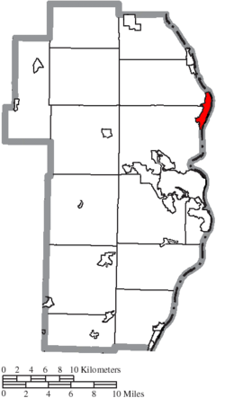 Location of Toronto in Jefferson County | |
| Coordinates: 40°27′44″N 80°36′16″W / 40.46222°N 80.60444°WCoordinates: 40°27′44″N 80°36′16″W / 40.46222°N 80.60444°W | |
| Country | United States |
| State | Ohio |
| County | Jefferson |
| Townships | Island Creek, Knox |
| Government | |
| • Mayor | John Parker |
| Area | |
| • Total | 2.44 sq mi (6.33 km2) |
| • Land | 2.09 sq mi (5.40 km2) |
| • Water | 0.36 sq mi (0.93 km2) |
| Elevation | 702 ft (214 m) |
| Population | |
| • Total | 5,091 |
| • Estimate (2019)[5] | 4,923 |
| • Density | 2,360.02/sq mi (911.24/km2) |
| Time zone | UTC−5 (Eastern (EST)) |
| • Summer (DST) | UTC−4 (EDT) |
| ZIP code | 43964 |
| Area code | 740 |
| FIPS code | 39-77112[4] |
| GNIS feature ID | 1061699[3] |
| Website | https://torontocity.weebly.com/ |

Toronto is the second-largest city in Jefferson County, Ohio, United States, along the Ohio River 6 miles northeast of Steubenville. The population was 5,091 at the 2010 census. It is part of the Weirton-Steubenville, WV-OH Metropolitan Statistical Area.
History[]
The area was first settled in the 19th century, when it was known as Newburg's Landing. When the railway was built, however, the area's name was changed to Sloanes Station.[6] In 1881, after a vote, the town was incorporated under its present name inspired by the Canadian city of the same name, which civic leader Thomas M. Daniels felt was a place worth emulating.
In the 20th century, the town became a center of heavy industry with a number of large factories in and around the town. In the 1980s and 1990s the city, along with the rest of the region, declined sharply as manufacturing jobs left. Today TIMET, the world's largest supplier of titanium metals, is the major employer in the city.
Geography[]
Toronto is located at 40°27′44″N 80°36′16″W / 40.46222°N 80.60444°W (40.462266, -80.604443),[7] and is about 45 minutes from Pittsburgh. According to the United States Census Bureau, the city has a total area of 2.14 square miles (5.54 km2), of which 1.86 square miles (4.82 km2) is land and 0.28 square miles (0.73 km2) is water.[8]
Demographics[]
| Historical population | |||
|---|---|---|---|
| Census | Pop. | %± | |
| 1890 | 2,536 | — | |
| 1900 | 3,526 | 39.0% | |
| 1910 | 4,271 | 21.1% | |
| 1920 | 4,684 | 9.7% | |
| 1930 | 7,044 | 50.4% | |
| 1940 | 7,426 | 5.4% | |
| 1950 | 7,253 | −2.3% | |
| 1960 | 7,780 | 7.3% | |
| 1970 | 7,705 | −1.0% | |
| 1980 | 6,934 | −10.0% | |
| 1990 | 6,127 | −11.6% | |
| 2000 | 5,676 | −7.4% | |
| 2010 | 5,091 | −10.3% | |
| 2019 (est.) | 4,923 | [5] | −3.3% |
| Sources:[4][9][10][11][12] | |||
2010 census[]
As of the census[2] of 2010, there were 5,091 people, 2,278 households, and 1,395 families living in the city. The population density was 2,737.1 inhabitants per square mile (1,056.8/km2). There were 2,516 housing units at an average density of 1,352.7 per square mile (522.3/km2). The racial makeup of the city was 97.1% White, 1.1% African American, 0.2% Native American, 0.2% Asian, 0.1% from other races, and 1.3% from two or more races. Hispanic or Latino of any race were 0.8% of the population.
There were 2,278 households, of which 26.2% had children under the age of 18 living with them, 42.5% were married couples living together, 14.0% had a female householder with no husband present, 4.7% had a male householder with no wife present, and 38.8% were non-families. 34.0% of all households were made up of individuals, and 15.8% had someone living alone who was 65 years of age or older. The average household size was 2.23 and the average family size was 2.84.
The median age in the city was 44 years. 20.7% of residents were under the age of 18; 7.5% were between the ages of 18 and 24; 23.1% were from 25 to 44; 30.5% were from 45 to 64; and 18.1% were 65 years of age or older. The gender makeup of the city was 46.9% male and 53.1% female.
2000 census[]
As of the census[4] of 2000, there were 5,676 people, 2,452 households, and 1,593 families living in the city. The population density was 3,014.6 people per square mile (1,165.7/km2). There were 2,627 housing units at an average density of 1,395.2 per square mile (539.5/km2). The racial makeup of the city was 97.60% White, 1.00% African American, 0.19% Native American, 0.21% Asian, 0.07% from other races, and 0.92% from two or more races. Hispanic or Latino of any race were 0.48% of the population.
There were 2,452 households, out of which 28.5% had children under the age of 18 living with them, 49.3% were married couples living together, 12.5% had a female householder with no husband present, and 35.0% were non-families. 31.3% of all households were made up of individuals, and 15.7% had someone living alone who was 65 years of age or older. The average household size was 2.31 and the average family size was 2.90.
In the city the age distribution of the population shows 22.8% under the age of 18, 8.0% from 18 to 24, 26.4% from 25 to 44, 24.9% from 45 to 64, and 17.9% who were 65 years of age or older. The median age was 41 years. For every 100 females, there were 85.0 males. For every 100 females age 18 and over, there were 80.9 males.
The median income for a household in the city was $30,905, and the median income for a family was $38,585. Males had a median income of $37,042 versus $19,405 for females. The per capita income for the city was $15,761. About 11.1% of families and 13.4% of the population were below the poverty line, including 22.2% of those under age 18 and 7.4% of those age 65 or over.
Education[]
Public education in the city is provided by the Toronto City School District. The district has two campuses and a new campus that has been recently built. – Karaffa Elementary School (Grades Pre. K – 5), Toronto High School [1][permanent dead link] (Grades 6-12). Toronto High School is a member of the Ohio Valley Athletic Conference.
Toronto has a public library, a branch of the Public Library of Steubenville and Jefferson County.[13]
Notable people[]
- John Comer – Football player for the Canton Bulldogs.
- Clarke Hinkle – Football player for the Green Bay Packers, and Pro Football Hall of Fame inductee.
- Gary A. Myers – U.S. House of Representatives member from Pennsylvania's 25th District.
- Bill Peterson – Head football coach for Florida State, Rice and the Houston Oilers.
- Robert Urich – Actor most known for television shows Vega$ and Spenser: For Hire.
- Bob Vogel – Football player for the Baltimore Colts.
See also[]
- List of cities and towns along the Ohio River
References[]
- ^ "2019 U.S. Gazetteer Files". United States Census Bureau. Retrieved July 28, 2020.
- ^ Jump up to: a b "U.S. Census website". United States Census Bureau. Retrieved 2013-01-06.
- ^ Jump up to: a b "US Board on Geographic Names". United States Geological Survey. 2007-10-25. Retrieved 2008-01-31.
- ^ Jump up to: a b c "U.S. Census website". United States Census Bureau. Retrieved 2008-01-31.
- ^ Jump up to: a b "Population and Housing Unit Estimates". Retrieved May 21, 2020.
- ^ Doyle, Joseph Beatty (1910). 20th Century History of Steubenville and Jefferson County, Ohio and Representative Citizens. Richmond-Arnold Publishing Company. pp. 446.
- ^ "US Gazetteer files: 2010, 2000, and 1990". United States Census Bureau. 2011-02-12. Retrieved 2011-04-23.
- ^ "US Gazetteer files 2010". United States Census Bureau. Archived from the original on 2012-01-25. Retrieved 2013-01-06.
- ^ "Population: Ohio" (PDF). 1910 U.S. Census. U.S. Census Bureau. Retrieved 28 November 2013.
- ^ "Population: Ohio" (PDF). 1930 US Census. U.S. Census Bureau. Retrieved 28 November 2013.
- ^ "Number of Inhabitants: Ohio" (PDF). 18th Census of the United States. U.S. Census Bureau. 1960. Retrieved 17 May 2020.
- ^ "Ohio: Population and Housing Unit Counts" (PDF). U.S. Census Bureau. Retrieved 22 November 2013.
- ^ "Branch Locations". The Public Library of Steubenville and Jefferson County. Retrieved 26 February 2018.
External links[]
- City website
- Toronto Chamber of Commerce
- Toronto Coalition for Revitalization "Building Our Future on the Strength of Our Past"
- Toronto In Focus City-based communications through the internet.
| show Municipalities and communities of Jefferson County, Ohio, United States |
|---|

| show Greater Pittsburgh Region |
|---|


| show Authority control |
|---|
- Toronto, Ohio
- Cities in Ohio
- Cities in Jefferson County, Ohio
- Ohio populated places on the Ohio River
- Canadian-American culture in Ohio
- Populated places established in 1881
- 1881 establishments in Ohio