Pulangi River
| Pulangi River Pulangui River | |
|---|---|
 The Pulangi River, winding through the in Valencia City, is one of the major tributaries of the Rio Grande de Mindanao | |
 | |
| Native name | Suba sa Pulangi |
| Location | |
| Country | |
| Region | |
| Province | |
| Physical characteristics | |
| Source | |
| • location | Brgy. Kalabugao, Impasugong, Bukidnon |
| • elevation | 6,400 ft (2,000 m) |
| Mouth | Mindanao River |
| Length | 374 km (232 mi) |
| Basin size | 9,940 km2 (3,840 sq mi) |
| Discharge | |
| • average | 980 m3/s (35,000 cu ft/s) |
| • maximum | 1,600 m3/s (57,000 cu ft/s) |
| Basin features | |
| Tributaries | |
| • left | |
| • right | |

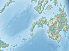
The Pulangi River or Pulangui flows entirely within the province of Bukidnon and Cotabato in the island of Mindanao in the Philippines. It is the greatest river source of the Rio Grande de Mindanao by volume of water. With a total length of 374 km (232 mi) it is the longest river in Bukidnon and the 5th longest river in the Philippines. It traverses through majority of the cities and municipalities of Bukidnon from its source in Barangay Kalabugao, Impasugong, Bukidnon.
History[]
Etymology[]
The name of the river could have come from the Manobo term “Empamulangi”, meaning "center of the island", referring to the location of the river within the island of Mindanao.
Watershed and hydroelectric plant[]
Pulangi has one reservoir type power plant, the Pulangi IV Hydroelectric Plant and watershed.[1] The Pulangi IV Hydroelectric Plant has a capacity of 255 megawatts and provides for 25% of Mindanao's power needs. It is owned and operated by the National Power Corporation (NAPOCOR). The reservoir and dam is also the main water source for the province of Bukidnon, both for drinking water and for irrigation through the National Irrigation Administration (NIA).[2]
The Pulangi IV Hydroelectric Plant watershed (also known as the Upper Pulangi Watershed) is the second largest watershed in the Philippines, covering an area of around 1.8 Million hectares.[2] It has ten catchments and covers the cities and municipalities of Impasugong, Cabanglasan, San Fernando, Lantapan, Maramag, Quezon, Valencia City, and Malaybalay City.

The artificial lake created by the reservoir proper is called the Pulangi Lake[3] or the Maramag Basin.[4] It has a surface area of about 1,985 hectares and a live storage of 67 million cubic meters.
Pulangi is also the site of the proposed Pulangi V Hydroelectric Dam. The project is expected to generate 300 megawatts of renewable energy for Mindanao in southern Philippines. The dam is 3,300 hectares covering portions, mostly highly sloping lands along the riverbank in 22 barangays in Kitaotao, Kibawe, Dangcagan and Damulog in Bukidnon and Roxas town in North Cotabato, including the Carmen Bridge Border Kabacan Carmen) North Cotabato. Of the total dam area, 40% is the present river itself and the inundated areas are stiff slopes along the river bank. An estimated of 1,060 households will be affected, all of whom will be relocated and compensated by the project.[5]
Opposition to the project have claimed that the project would submerge the burial site of Apo Mamalu, a revered ancestor of the Manobo indigenous people in Mindanao. There, however, are conflicting claims to this.[6][7]
The National Museum of the Philippines commissioned a team of experts to look into this claim, but as of February 6, 2011, the anthropologist asked to study the claim in response to a petition to declare Sitio Mikasili, Barangay Tangkulan, Damulog as a National Heritage Site said that there is not enough evidence to declare it as such. Dr. Antonio Montalvan, an anthropologist who earlier supported the petition to declare the site as a heritage site wrote the National Museum saying that after deeper scrutiny of the claims, a declaration of a National Heritage site is not feasible. Montalvan said: "Such an important declaration cannot be made when the assumptions lack unanimity and more so in material evidence. This may only lead to an obfuscation of the ethno-cultural importance and beautiful traditions of the ancient Manobo peoples."[8]
Geography[]

Sources[]
Barangay Kalabugao, Impasugong, Bukidnon,
Other Sources: Mount Dulang-dulang, Kitanglad Mountain Range, Mount Kalatungan, Mount Mangabon Misamis Oriental
Tributaries[]
The Manupali River, a major tributary of the Pulangi River, starts in the mountains of Lantapan, Bukidnon, picking up tributaries along the way from the Kalatungan and Kitanglad Mountain Ranges. It forms part of the natural boundary of Valencia City and Lantapan. It flows eastward towards Malaybalay City, eventually joining the Pulangi River in Valencia City.
The Muleta River is found in the southern portion of the province covering the municipalities of Pangantucan, Don Carlos, Kitaotao, Dangcagan, Kibawe, Kadingilan and Damulog. It is another important tributary of the Pulangi River and flows southward. It will join the Pulangi River in the boundary of Bukidnon and Cotabato province.
The Bobonawan River, found in the municipality of Cabanglasan, is another tributary of the Pulangi River. It covers most of the parts of the municipality, flowing southward towards Pulangi River.
Other tributaries are the Tigwa River of San Fernando, Bukidnon, the Maradugao River. Kalabugao River of Impasugong, of Malaybalay City. and of Managok, Malaybalay City. Kabacan River in Cotabato, Dampilasan River in Impasugong, of Valencia, of Valencia, and the Malitubog River in Cotabato.
Cultural diversity[]
Indigenous Higaonon communities that have settled around the headwater of Pulangi identify themselves as Pulangiyen.[9][10] Their Indigenous knowledge systems include environmental and biodiversity conservation.[10] The Pulangi watershed extends to the ancestral domain of Higaonon and Bukidnon Indigenous communities.[10][11] The watershed supplies water to rice paddies and agricultural areas in the barangays of Hagpa and Kalabugao.[12]
References[]
- ^ Pulangi 4 Hydroelectric Plant
- ^ Jump up to: a b Pulangi Watershed Area Team Archived 2010-07-04 at the Wayback Machine
- ^ Wikimapia: Pulangi Lake
- ^ Bukidnon
- ^ BenCyrus G. Ellorin (April 16, 2011). "More hydro plants to lower Mindanao power rates – FIBECO". MindaNews. Retrieved April 17, 2011.
- ^ Butch Enerio (February 6, 2011). "Manobo chieftains OK hydro plant in Bukidnon". Business Mirror. Retrieved April 17, 2011.
- ^ BenCyrus G. Ellorin (February 7, 2011). "Controversy over dam project heats up". UCA News. Retrieved April 17, 2011.
- ^ Bong D. Fabe (February 15, 2011). "Anthropologist opposes making Manobo burial site as national treasure". Business Mirror. Retrieved April 17, 2011.
- ^ Linantad, Lucy; Sagula, Rufino; Bruno, Eric; Walpole, Pedro (2010-04-26). "Assisting Forests: The Pulangiyen Approach in Bendum (2010)". Apu Palamguwan Cultural Education Center. Retrieved 2021-06-25.
- ^ Jump up to: a b c "PHI: Integrated Natural Resources and Environmental Management Project: Higaonon Ancestral Domain" (PDF). July 2019. Retrieved June 25, 2021.
- ^ "Foundation for the Philippine Environment". Foundation for the Philippine Environment. February 6, 2015. Retrieved 2021-06-25.
- ^ "The ICCA Registry". The ICCA Registry. Retrieved 2021-06-25.
External links[]
![]() Media related to Pulangi River at Wikimedia Commons
Media related to Pulangi River at Wikimedia Commons
| show Authority control |
|---|

- Landforms of Bukidnon
- Hydroelectric power plants in the Philippines
- Rivers of the Philippines