Qoʻrgʻontepa
Qoʻrgʻontepa | |
|---|---|
City | |
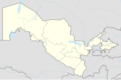 Qoʻrgʻontepa Location in Uzbekistan | |
| Coordinates: 40°44′01″N 72°45′30″E / 40.73361°N 72.75833°ECoordinates: 40°44′01″N 72°45′30″E / 40.73361°N 72.75833°E | |
| Country | |
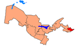
| Region | Andijan Region |
| District | Qoʻrgʻontepa District |
| City status | 1976 |
| Elevation | 693 m (2,274 ft) |
| Population (2010) | |
| • Total | 27,197 |
| Time zone | UTC+5 (UZT) |
| Postal code | 170700[1] |
| Area code(s) | (+998) 7631 |
| Vehicle registration | 60 |

Qoʻrgʻontepa (Uzbek: Qoʻrgʻontepa, Қўрғонтепа, Russian: Кургантепа) is a small city and seat of Qoʻrgʻontepa District, in Andijan Region in eastern Uzbekistan.[2] It is located roughly 30 kilometres (19 mi) north of Osh, near the border with Kyrgyzstan.[3] In 1989 it had a population of 19,565, and has an estimated population of 28,648 in 2012.[4][5] In 1976 Qo’rg’ontepa was granted city status. The city has a cotton factory, a tool factory and sewing factory.[6] The city is located on the Uzbek Railways .
References[]
- ^ "Pochta indekslari - Andijon filiali" (in Uzbek). pochta.uz. Archived from the original on 4 November 2013. Retrieved 12 May 2012.
- ^ "Classification system of territorial units of the Republic of Uzbekistan" (in Uzbek and Russian). The State Committee of the Republic of Uzbekistan on statistics. July 2020.
- ^ Maps (Map). Google Maps.
- ^ Всесоюзная перепись населения 1989 г. (in Russian). demoscope.ru. Retrieved 12 May 2012.
- ^ "Uzbekistan: largest cities and towns and statistics of their population". World Gazetteer. Archived from the original on 16 July 2012. Retrieved 12 May 2012.
- ^ КУРГАНТЕПА (in Russian). Энциклопедический словарь. 2009. Retrieved 12 May 2012.
Capital: Andijan | ||
| Districts and seats |
|  |
| Other towns and villages | ||
This Uzbekistan location article is a stub. You can help Wikipedia by . |
Categories:
- Populated places in Andijan Region
- Cities in Uzbekistan
- Uzbekistan geography stubs