Ontario Highway 8
 | |||||||
|---|---|---|---|---|---|---|---|
| Route information | |||||||
| Maintained by Ministry of Transportation of Ontario | |||||||
| Length | 159.7 km[1] (99.2 mi) | ||||||
| Existed | August 1918–present | ||||||
| Major junctions | |||||||
| West end | |||||||
| East end | Regional Road 8 (near Dundas) | ||||||
| Location | |||||||
| Major cities | Stratford, Kitchener, Cambridge, Hamilton | ||||||
| Towns | Goderich, Clinton | ||||||
| Highway system | |||||||
| |||||||
| |||||||
King's Highway 8, commonly referred to as Highway 8, is a provincially maintained highway in the Canadian province of Ontario. The 159.7 kilometres (99.2 mi) route travels from Highway 21 in Goderich, on the shores of Lake Huron, to Highway 5 in the outskirts of Hamilton near Lake Ontario. Prior to 1970s, it continued east through Hamilton and along the edge of the Niagara Escarpment to the American border at the Rainbow Bridge in Niagara Falls. However, the Queen Elizabeth Way (QEW) replaced the role of Highway 8 between those two cities, and the highway was subsequently transferred from province to the newly formed Regional Municipality of Niagara in 1970. In 1998, the remaining portion east of Peter's Corners was transferred to the city of Hamilton.
Between Stratford and Kitchener, Highway 8 is concurrent with Highway 7. The two highways widen into a four-lane freeway east of New Hamburg, eventually becoming the Conestoga Parkway within Kitchener, where it splits with Highway 7. It follows a short connector freeway – known as the Freeport Diversion, King Street Bypass, or Highway 8 expressway – south to Highway 401. The route continues as a locally maintained road through downtown Cambridge before resuming at Branchton Road and soon thereafter entering the city of Hamilton. Highway 8 ends east of Peter's Corners at an intersection with Hamilton Road 8.
Highway 8 was one of the first roads assumed when the provincial highway system was established, though it was not numbered as such until 1925. The routes that predate the highway, including the Huron Road, the Hamilton and Dundas Stone Road and the Queenston Stone Road, were established during the settlement of Southwestern Ontario between 1780 and 1830. These early trails served as the principal routes in the regions through which they passed, and eventually became part of the provincial highway system circa 1918.
Route description[]
Highway 8 begins at its western terminus in downtown Goderich, at the junction with Highway 21, within Huron County. It exits the town travelling southeast as a rural two-lane highway running roughly parallel and south of the Maitland River, passing through farmland outside of the many small communities it serves. At Holmesville, the river moves northwards while the highway continues southeast, now parallel to and north of the Goderich–Exeter Railway. Soon thereafter it passes through Clinton, where it intersects the northern terminus of Highway 4. Between Clinton and Stratford, Highway 8 is completely straight for approximately 50 kilometres (31 mi). After bisecting Seaforth, the highway enters Perth County and passes through the communities of Dublin, Mitchell (where it intersects Highway 23) and Sebringville.[2][3]
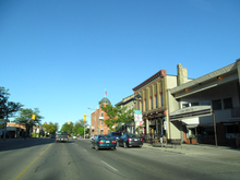
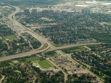
Entering Stratford as Huron Street, Highway 8 widens to four lanes. It crosses the Avon River then turns east onto Ontario Street before encountering Highway 7 at Erie Street.[3] The two routes become concurrent for the next 44.5 kilometres (27.7 mi), between Stratford and Kitchener. East of Stratford, the highway narrows back to two lanes and travels north of and parallel to the CN railway Guelph Subdivision. After passing through the village of Shakespeare, the route enters the Regional Municipality of Waterloo as it widens to four lanes and curves onto the New Hamburg Bypass. It travels south of New Hamburg and crosses the Nith River before becoming a divided four-lane freeway near Baden. At Trussler Road, the combined Highway 7/8 enters the city of Kitchener, where it is known as the Conestoga Parkway.[2][3]
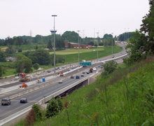
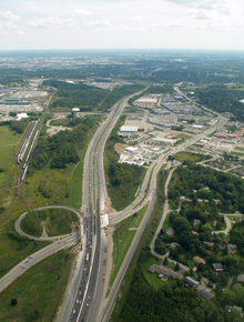
The Conestoga Parkway runs through Kitchener, widening to a six-lane freeway near Fischer Hallman Road. At King Street in the centre of the city, Highway 8 splits off southeastward at an interchange, while Highway 7 continues along the Conestoga Parkway. Traffic on Highway 8 heading northwest can continue under the Conestoga Parkway onto King Street into downtown Kitchener.[2][3] Between the Conestoga Parkway and Highway 401, Highway 8 follows an eight-lane freeway known as the Freeport Diversion or Highway 8 Expressway.[4][5] The expressway initially follows the former alignment of King Street, before swerving slightly south. At its midpoint it crosses over the Grand River, followed by a partial interchange with King Street East that provides access to Highway 401 westbound to London. The expressway narrows to six lanes, and later to four lanes at Sportsworld Drive. It merges to eastbound Highway 401 and from westbound 401.[2][3]

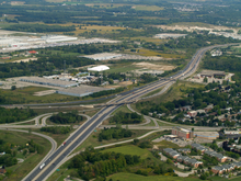
The MTO maintains approximately 670 metres (2,198.2 ft) of King Street and Shantz Hill Road at the Highway 401 interchange as an unsigned portion of Highway 8.[6] Within Cambridge, the route continues as Waterloo Regional Road 8 along Shantz Hill Road, Fountain Street, King Street, Coronation Boulevard, and Dundas Street.[7] Highway 8 resumes at Branchton Road, where it exits urban Cambridge into farmland travelling southeast. After approximately 3 kilometres (1.9 mi), the route enters Hamilton. It bypasses the communities of Sheffield and Rockton before eventually reaching Peters Corners, where it meets the western terminus of Highway 5 at a multilane roundabout. Highway 8 ends 200 metres (660 ft) to the east at an intersection with Hamilton Road 8.[1][3]
History[]
Predecessors (1780–1918)[]
While its history as a provincial highway dates back to 1918, significant portions of the roads that would be taken over by the province and eventually designated as Highway 8 had existed for nearly a century or longer. These include the Huron Road between Berlin (renamed Kitchener in 1916) and Goderich, begun in 1827;[8] the Dundas and the Hamilton Stone Road that were established in 1819 along a trail blazed between Hamilton and Berlin in 1798;[9][10][11] and the Queenston Road (later the Queenston and Grimsby Stone Road[12]), established along an aboriginal trail at the foot of the Niagara Escarpment in the 1780s.[10][13]
When settlers began arriving in the Niagara Peninsula following the American Revolution and the signing of the Treaty of Paris in 1783, natives were non-existent in the area, the local tribe having been ravaged over a century earlier. Trails criss-crossed the peninsula, with the dominant routes favouring an east–west orientation.[14] The most significant of these was known as the Iroquois Trail, and traversed along the foot of the Niagara Escarpment. In the east, Queenston provided an ideal crossing of the Niagara River. In the west, the escarpment breaks at Dundas, where the trail continued on towards the Grand River at present-day Brantford, thus providing a portage between Lake Ontario and Lake Erie. The Iroquois Trail was utilised by famous historical figures including John Graves Simcoe in 1793 on his voyage to Detroit, as well as Sir Isaac Brock and Tecumseh during the War of 1812.[13] It was widened to accommodate wagon traffic by 1785.[15]
Between approximately 1800 and 1820, large numbers of German and Dutch settlers from Pennsylvania travelled west across the Niagara Peninsula and onward to the Waterloo area, establishing many of the towns in that area named after European counterparts.[16] A trail cut from Hamilton to the Grand River, at Galt, in 1798[11] or 1799,[17] was gradually widened to be fit for wagons by 1819.[17] While Niagara-on-the-Lake served as the initial focal point of settlement into southwestern Ontario, Hamilton emerged in 1816 at the head of Lake Ontario, and immediately became the new hub for settlers.[18] The route between Hamilton and Waterloo was improved to a stone road circa 1836.[19] Over the years the route was known by various names, including the Waterloo Road, the Galt Road, the Old Dutch Road,[20] the Beverly Road,[17] and most often the Dundas and Hamilton Stone Road.[9]

Settlement beyond Waterloo was accomplished by the Canada Company, which acquired the Huron Tract in 1826.[21] In order to implement the grand settlement plan, a trail was surveyed by Mahlon Burwell and William Dunlop from Guelph to Lake Huron at the mouth of the Maitland River beginning in 1827.[8] After company commissioner Thomas Mercer Jones rode the muddy trail from Guelph to Goderich in June 1929, he recommended that it be widened to four rods (20 metres (66 ft)),[22] which was done by the end of that year by Colonel Anthony Van Egmond.[23] The trail was further improved to allow for the passage of wagons by 1832.[8] The Canada Company venture would ultimately fail, but not before establishing the present-day settlement patterns.[24]
Designation and paving (1918–1949)[]
Until 1918, the majority of the primary roads through southern Ontario formed part of the County Road System. The Department of Public Works and Highways paid up to 60% of the construction and maintenance costs for these roads, while the counties were responsible for the remaining 40%. The Ontario government passed an act in 1917 to permit the newly formed Department of Public Highways (DPHO) to take over (or assume) responsibility and upkeep of a provincial highway system. The initial system, between Windsor and Quebec, was bookended by branches to Niagara and Ottawa.[25] The branch to Niagara would become the first provincial highway connection to the United States, and later become the easternmost portion of Highway 8.[26] The Hamilton–Queenston Highway was assumed as part of "The Provincial Highway" in August 1918.[27]
In 1919, the federal government passed the Canada Highways Act, which provided C$20,000,000 to provinces under the condition that they establish an official highway network; up to 40% of construction costs would be subsidized. The first network plan was approved on February 26, 1920, and included the Queenston Road.[28] Most of the remainder of what would become Highway 8 – from Goderich to Hamilton – was assumed by the department throughout July 1920.[29] On October 13, several roads were taken over by the province between St. David's near Queenston and the Whirlpool Rapids Bridge in Niagara Falls.[29] The new route followed the present Four Mile Creek Road, St. Paul Avenue, and Portage Road south to Thorold Stone Road, which it followed east to Stanley Avenue, thence south to Bridge Street.[30] However, none of these roads would receive a route number until the summer of 1925.[31]
Initially Highway 8 was almost entirely unpaved, except within towns and portions between Stratford and Shakespeare as well as between Kitchener and Hamilton. During the initial few years of the existence of the highway network, which were spent rebuilding culverts, bridges, and ditches, paving took a low priority. The first sections of Highway 8 paved by the DPHO were in 1922 between Hamilton and Stoney Creek, as well as between Sebringville and Stratford.[32] The rest of the highway between Hamilton and Niagara Falls, as well as the remaining gaps between Kitchener and Hamilton, were paved the following year. Work was completed between Shakespeare and New Hamburg, as well as on the gaps between Petersburg and Kitchener in 1924. In 1925, paving between Mitchell and Sebringville was completed.[33] At this time, Highway 8 was paved from Mitchell to New Hamburg, and from Petersburg to Niagara Falls.[34] In 1926, paving was completed for 10 kilometres (6 mi) southeast of Goderich, as well as between Dublin and Mitchell. The following year, it was completed on the remaining gap between Goderich and Clinton, as well as between Seaforth and Dublin.[35] The final unpaved section of Highway 8, between Clinton and Seaforth,[36] was completed in 1928.[37]
Bypasses and the Conestoga Parkway (1949–1970)[]
Highway 8 would remain unchanged for approximately 20 years, until traffic congestion warranted the bypassing of several cities and towns along the route. The first such bypass was in Kitchener, where until 1949 the highway travelled into and out of the downtown core along King Street and Queen Street, before following Highland Road west towards Stratford.[38] By 1950, in an effort to divert truck traffic from the King and Queen Street intersection, it was redirected slightly along Ottawa Street and Courtland Avenue.[39] The New Hamburg Diversion opened in 1957, bypassing its namesake as well as the community of Baden. The original route – following Huron Street, Waterloo Street, and Snyder's Street West – met the new bypass at Gingerich Road east of Baden.[40][41][42] Farther east, two bypasses were constructed around the villages of Rockton and Sheffield beginning in 1958 that opened the following year.[42][43][44][45]
Within Hamilton, growing congestion in the 1950s led the city to hire American traffic engineer , whom had made a business of consulting for cities to develop one-way street plans.[46] Smith proposed a complete reorganisation of the downtown area, including converting Main Street – which Highway 8 followed through the city[47] – to an eastbound one-way. King Street served the opposing direction in the one-way pairing. The switch from two-way to one-way traffic took place on October 28, 1956. It immediately drew condemnation from local businesses, which saw a significant reduction in customers. A special council meeting to discuss the matter was held on July 15, 1957, which drew a large public audience. At it, Ramsey Evans, whom had first suggested the one-way conversion, sought to undo it. The motion was defeated, and Main Street and King Street remain one-way streets.[48]
In the fall of 1961, the Department of Highways began construction of the Freeport Diversion, providing a new divided highway crossing of the Grand River. The diversion, connecting with King Street south of the Grand River and at Fergus Street, was completed in 1963.[49][50][51] Although the concept of a ring road around Kitchener and Waterloo originated from the Kitchener-Waterloo and Suburban Planning Board in 1948,[52][53] actual consideration was not given to it until it was recommended by a 1961 traffic study.[54] By then, the opening of Highway 401 was attracting business away from the rapidly growing twin cities. Land was gradually purchased over the intervening years and picked up considerably when plans for the expressway system were first raised in late 1962.[52] The provincial government reached a funding arrangement with Kitchener and Waterloo to cover 75% of the expected C$22 million cost, and officially announced the Kitchener–Waterloo Expressway on May 21, 1964.[55] The province eventually took over authority for the entire project in August 1965.[56]
Construction of the Kitchener–Waterloo Expressway began in February 1966 with the awarding of a C$3 million contract to rebuild 2.7 kilometres (1.7 mi) of King Street into a four lane divided highway from Fairway Road (renamed from Block Line Road in 1965) to Doon Road,[57] including the half cloverleaf interchange that would serve the western and northern legs of the expressway system.[58] In anticipation of the long-term construction, Highway 8 was redirected along Fairway Road, Mill Street (now Vanier Drive) and a new road named Henry Sturm Boulevard that travelled east from Ottawa Street and Highland Road to Mill Street (now Vanier Drive).[59][60] The expressway was renamed the Conestoga Parkway in January 1967, after being chosen by a joint committee from a shortlist of 12 publicly-submitted names.[61] The reconstruction of King Street was completed and opened in November 1967.[62] Construction began several months later in October on a C$3.6 million contract to build a 2.9-kilometre (1.8 mi) segment of the parkway from King Street to west of Homer Watson Boulevard.[63] This section, which was built over the alignment of Henry Strum Boulevard, was opened to traffic in 1969,[63] at which point the Highway 8 designation was redirected along King Street and the Conestoga Parkway to Homer Watson Boulevard and onto Highland Road.[64]
Transfers and expressway extensions (1970–1997)[]

During the 1960s, the Department of Highways undertook several regional transportation studies to determine traffic patterns, which had changed significantly since the highway network was established in the 1920s. Among these was the Niagara Peninsula Planning Study, released in 1964. It indicated that several highways were no longer provincially significant, and responsibility for them should be transferred to local government. Having largely been supplanted by the Queen Elizabeth Way, opened in the 1940s, the winding route of Highway 8 east of Winona was transferred to the new Regional Municipality of Niagara on September 1, 1970.[65][66] The region designated the former highway as Regional Road 81.[67]
During the mid-1970s, proposals for a Highway 8 bypass of Cambridge were floated, but never gained traction.[68] Although the proposal was shelved in 1988,[69] the bypass idea was briefly revived as a result of recommendations in the Cambridge Area Transportation Study, released in June 1992. It recommended construction of a C$54.5 million bypass of Highway 8 around the west side of Cambridge, from Highway 401 to south of the city. The proposal faced public backlash due to the cost as well as environmental concerns of crossing the Grand River and five environmentally sensitive areas.[70]
Following the completion of an environmental assessment in 1984,[71] construction began by 1985 on a new freeway link between the Freeport Diversion and Highway 401, which was known as Highway 8 New during construction.[72] Highway 8 New was completed in 1987 and received the non-public designation Highway 7187.[citation needed] The existing cloverleaf interchange between Highway 401 and King Street East was modified, with high-speed ramps directly connecting the Highway 8 expressway extension to Highway 401 east of that interchange, however traffic on Highway 401 west of the interchange has to use King Street East for a short distance to reach the Freeport Diversion.[citation needed] In the late 2000s, Highway 7187 was absorbed into the rerouted Highway 8 which now includes the entire freeway between the Conestoga Parkway and Highway 401, as the Highway 8 designation along King Street East and Shantz Hill Road was decommissioned resulting in that former provincial route being renamed Regional Road 8.[citation needed]
The two lane segment of Highway 7/8 from Fischer-Hallman Road west to Baden was originally slated to be twinned to four lanes in the 1980s, but the project was put off for a decade. Early works tree clearing got underway in 1991 before the project was put on hold for archeological excavations.[73][74][75] Construction began to widen the route as far west as Queen Street, south of Petersburg, on July 6, 1992.[76]
Budget constraints brought on by a recession in the 1990s resulted in the Mike Harris provincial government forming the Who Does What? committee to determine cost-cutting measures in order to balance the budget after a deficit incurred by former premier Bob Rae.[77] It was determined that many Ontario highways no longer served long-distance traffic movement and should therefore be maintained by local or regional levels of government. The MTO consequently transferred many highways to lower levels of government in 1997 and 1998, which resulted in the removal of a significant percentage of the provincial highway network.[78][79] As a result of this, the portion of Highway 8 east of Highway 5 at Peter's Corners, through Dundas, Hamilton and Stoney Creek, was transferred to the Regional Municipality of Hamilton–Wentworth on April 1, 1997. A 2.3-kilometre (1.4 mi) section of King Street in Kitchener, from north of the Highway 401 interchange to the Freeport Diversion, was also transferred on that day to the Regional Municipality of Waterloo.[80][81]
Since 1997[]
In the early 1990s, the provincial government announced plans to widen the Conestoga Parkway and Highway 8, as well as to improve the interchange between the two.[82] The project was broken into several phases, and included rebuilding the Ottawa Street and Franklin Street overpasses.[83] Construction began in August or September 1998 to widen the Conestoga Parkway from four to six lanes between Courtland Avenue and King Street.[84] It was completed, along with widening of the parkway between King Street and Frederick Street, in July 2000.[85] The expansion of Highway 8 from four lanes to eight lanes between the Conestoga Parkway and Fergus Avenue was originally scheduled to begin in 2001, but was delayed as businesses along Weber Street fought expropriation.[86]
Construction instead began in April 2002. Included with this project was a reconstruction of the bottle-necked interchange of the Conestoga Parkway and Highway 8, including a new flyover ramp from westbound Conestoga Parkway to eastbound Highway 8 to replace one of the two loop ramps, and realignment of the northbound to eastbound ramp.[87] Both were completed and opened on June 11, 2004.[88] Work began on the next phase, widening Highway 8 from four to eight lanes from Fergus Avenue to northwest of the Grand River, in April 2006. This work included rebuilding the Fairway Road interchange.[89] Construction to twin Highway 8 over the Grand River and widen it northwest of the Sportsworld Drive interchange began in the summer of 2009, following the relocation of approximately 50 Wavy-rayed lampmussel, considered a species at risk in Canada.[90][91] Both projects were completed and opened, except for one westbound lane over the Grand River, in November 2011; the fourth westbound lane was opened the following year.[92]
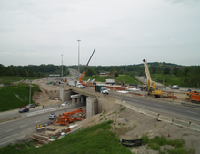
An operational and safety review of the three intersections at Peter's Corners near Hamilton was undertaken in February 2001. Studies, including an environmental assessment were conducted between 2004 and 2009, and settled upon a roundabout as the ideal replacement, with traffic signals at the two intersections with Westover Road.[93] Construction began in the spring of 2012,[93] and the C$6.3 million roundabout was opened on September 25, 2012.[94]
Future[]
The interchange between the Freeport Diversion and Highway 401 is incomplete, providing access only between eastbound Highway 8 and eastbound Highway 401, and between westbound Highway 401.[95] Although a detailed design for two additional ramps to provide access to and from the west to Highway 8 was prepared in 2010, there is no schedule or funding as of 2021 for this work.[96][97]
Exit list[]
The following table lists the major junctions along Highway 8, as noted by the Ministry of Transportation of Ontario. Highway 8 is maintained under a Connecting Link agreement within Goderich, Clinton, Seaforth, Mitchell, and Stratford.[98]
| Division | Location | km | mi | Destinations | Notes |
|---|---|---|---|---|---|
| Huron | Goderich | 0.0 | 0.0 | Beginning of Goderich Connecting Link agreement | |
| 2.1 | 1.3 | End of Goderich Connecting Link agreement | |||
| Clinton | 18.7 | 11.6 | Beginning of Clinton Connecting Link agreement | ||
| 19.9 | 12.4 | ||||
| 20.8 | 12.9 | End of Clinton Connecting Link agreement | |||
| Seaforth | 32.3– 33.7 | 20.1– 20.9 | Seaforth Connecting Link agreement | ||
| Perth | Dublin | 43.5 | 27.0 | County Road 180 / County Road 14 North | |
| Mitchell | 49.9 | 31.0 | Beginning of Mitchell Connecting Link agreement | ||
| 52.7 | 32.7 | End of Mitchell Connecting Link agreement | |||
| Sebringville | 63.9 | 39.7 | County Road 135 north | ||
| Stratford | 69.6 | 43.2 | Beginning of Stratford Connecting Link agreement | ||
| 75.4 | 46.9 | Beginning of Highway 7 concurrency | |||
| 78.4 | 48.7 | End of Stratford Connecting Link agreement | |||
| Perth–Waterloo boundary | Shakespeare | 87.1 | 54.1 | County Road 107 | Formerly |
| Waterloo | New Hamburg | 95.2 | 59.2 | Regional Road 1 | New Hamburg Bypass |
| 98.4 | 61.1 | Regional Road 4 west (Peel Street) | |||
| Wilmot | 99.2 | 61.6 | Regional Road 4 east (Bleams Road) | ||
| 100.7 | 62.6 | Regional Road 5 north (Nafziger Road) | |||
Controlled-access highway begins 1.4 km (0.87 mi) east of Nafziger Road | |||||
| Waterloo | Wilmot | 102.9 | 63.9 | Regional Road 51 (Foundry Street) – Wilmot Centre | |
| 107.7 | 66.9 | Regional Road 12 (Queen Street (south) / Notre Dame Drive (north)) – Petersburg | |||
| 111.6 | 69.3 | Regional Road 70 (Trussler Road) – Mannheim | |||
| Kitchener | |||||
| 114.5 | 71.1 | Regional Road 58 (Fischer Hallman Road) | |||
| 117.1 | 72.8 | Regional Road 28 (Homer Watson Boulevard) | Eastbound entrance via Ottawa Street South | ||
| 118.4 | 73.6 | Courtland Avenue | |||
| 119.8 | 74.4 | Highway 8 exits Conestoga Parkway onto Freeport Diversion; end of Highway 7 concurrency | |||
| 122.0 | 75.8 | Weber Street, Fairway Road | |||
| 124.5 | 77.4 | Regional Road 8 (King Street) – Cambridge, London | Eastbound exit and westbound entrance; former route of Highway 8 | ||
| 128.4 | 79.8 | Regional Road 38 (Sportsworld Drive, Maple Grove Road) | |||
| 130.5 | 81.1 | Eastbound exit and westbound entrance; Highway 8 is regionally maintained through Cambridge as Regional Road 8. | |||
| Cambridge | 141.5 | 87.9 | Regional Road 43 (Branchton Road) | Highway 8 resumes | |
| Hamilton | Rockton | 153.3 | 95.3 | Regional Road 552 (Kirkwall Road) – Kirkwall | Beginning of former Highway 52 concurrency |
| Peter's Corners | 159.5 | 99.1 | Westover Road | End of former Highway 52 concurrency | |
| 159.7 | 99.2 | ||||
1.000 mi = 1.609 km; 1.000 km = 0.621 mi
| |||||
References[]
Footnotes[]
- ^ a b Ministry of Transportation of Ontario, 2004 Annual Average Daily Traffic Archived 2017-12-17 at the Wayback Machine
- ^ a b c d Ontario Back Road Atlas (Map). Cartography by MapArt. Mapart Publishing. 2022. pp. 20–23. ISBN 1-55198-226-9.
- ^ a b c d e f Google (January 31, 2022). "Highway 8 – Length and Route" (Map). Google Maps. Google. Retrieved January 31, 2022.
- ^ Annual Report (Report) (1963 ed.). Department of Highways. March 31, 1963. p. 7. Retrieved February 7, 2022.
- ^ Swayze, Kevin (August 19, 2005). "Massive road work chugs along; Building tunnel under train tracks biggest project tackled by region". The Record. p. B1. ProQuest 358936288 (subscription required).
The $14.7- million job started in June and involves road widenings, a tunnel under CP Rail tracks serving Toyota and new access ramps to the Highway 8 expressway.
- ^ Ministry of Transportation of Ontario Geomatics Office; Land Information Ontario (December 10, 2020). "Ontario Road Network - Ontario Provincial Highways". ArcGIS.com. Retrieved February 8, 2022.
- ^ "Regional Roads By Name" (PDF). Region of Waterloo. October 19, 2016. pp. 2, 3, 5. Retrieved February 8, 2022.
- ^ a b c Belton, Betty Jo (June 4, 2021). "Reflections: Taking a trip down the Huron Road". The Stratford Beacon-Herald. Retrieved February 14, 2022.
- ^ a b Wells, Jon (September 18, 2010). "Take A Drive". Hamilton Spectator. Retrieved February 14, 2022.
- ^ a b Breithaupt 1919, p. 63.
- ^ a b Burghardt 1969, p. 428.
- ^ "Are we willing to roll the dice?". Stoney Creek News. February 16, 2000. p. 8. ProQuest 358936288 (subscription required).
- ^ a b Burghardt 1969, pp. 423–424.
- ^ Burghardt 1969, pp. 421–422.
- ^ Burghardt 1969, pp. 425–426.
- ^ Breithaupt 1919, p. 60.
- ^ a b c Breithaupt 1919, pp. 62–63.
- ^ Burghardt 1969, pp. 427–428.
- ^ "Crastor Scott Recalls Schooldays with the Late James E. Carter". Wellington County Museum. Retrieved February 14, 2022.
- ^ Burghardt 1969, pp. 428–429.
- ^ "About Our Heritage – The Founding of Goderich". Town of Goderich. Retrieved February 14, 2022.
- ^ Lee 2004, p. 110.
- ^ Lee 2004, p. 158.
- ^ Paterson, Donald G. (1975). "The Failure of British Business in Canada, 1980-1914". Proceedings of the Business History Conference. Cambridge University Press. 3: 14–31. JSTOR 44512540. Retrieved February 15, 2022.
- ^ "III. Provincial Highways". Annual Report (Report) (1918 ed.). Department of Public Highways. April 11, 1919. p. 13. Retrieved February 15, 2022 – via Internet Archive.
- ^ "Plan Showing Provincial Highways Assumed in the Province of Ontario in 1919". Annual Report (Report) (1920 ed.). Department of Public Highways. April 26, 1921. p. 41. Retrieved February 15, 2022 – via Internet Archive.
- ^ "Hamilton–Queenston Road". Annual Report (Report) (1919 ed.). Department of Public Highways. p. 16. Retrieved February 15, 2022 – via Internet Archive.
- ^ Shragge, John; Bagnato, Sharon (1984). From Footpaths to Freeways. Ontario Ministry of Transportation and Communications, Historical Committee. pp. 73–75. ISBN 0-7743-9388-2.
- ^ a b Annual Report (Report) (1920 ed.). Department of Public Highways. April 26, 1921. pp. 42–45. Retrieved February 17, 2022.
- ^ Niagara, Ontario. Map Sheet 30 M/03 (Map) (1930 ed.). 1:63,360. Cartography by General Staff, Geographical Section. Department of National Defence. 1906. Retrieved March 1, 2022 – via Scholars GeoPortal.
- ^ "Provincial Highways Now Being Numbered". The Canadian Engineer. Monetary Times Print. 49 (8): 246. August 25, 1925.
Numbering of the various provincial highways in Ontario has been commenced by the Department of Public Highways. Resident engineers are now receiving metal numbers to be placed on poles along the provincial highways. These numbers will also be placed on poles throughout cities, towns and villages, and motorists should then have no trouble in finding their way in and out of urban municipalities. Road designations from "2" to "17" have already been allotted...
- ^ Annual Report (Report) (1922 ed.). Department of Public Highways. May 28, 1923. pp. 12–14. Retrieved March 1, 2022.
- ^ Annual Report (Report) (1923, 1924 and 1925 ed.). Department of Public Highways. April 26, 1926. pp. 66–68. Retrieved March 2, 2022.
- ^ Ontario Road Map (Map) (1925 ed.). Department of Public Highways of Ontario. Retrieved February 17, 2022 – via Archives of Ontario.
- ^ Annual Report (Report) (1926 and 1927 ed.). Department of Public Highways. March 1, 1929. pp. 22–24. Retrieved February 23, 2022.
- ^ Ontario Road Map (Map) (1928 ed.). Cartography by D. Barclay. Department of Public Highways of Ontario. § D5. Retrieved February 17, 2022 – via Archives of Ontario.
- ^ "Provincial Highway Construction, 1928". Annual Report (Report) (1928 and 1929 ed.). Department of Public Highways. March 3, 1931. p. 21. Retrieved February 27, 2022.
- ^ Ontario Road Map (Map) (1949 ed.). Cartography by C. P. Robins. Department of Highways of Ontario. Waterloo / Kitchener inset. Retrieved February 27, 2022 – via Archives of Ontario.
- ^ Ontario Road Map (Map) (1950 ed.). Cartography by C. P. Robins. Department of Highways of Ontario. Waterloo / Kitchener inset. Retrieved February 27, 2022 – via Archives of Ontario.
- ^ Stratford, Ontario. Map Sheet 40 P/7 (Map) (1938 ed.). 1:63,360. Cartography by General Staff, Geographical Section. Department of National Defence. 1927. Retrieved March 1, 2022 – via Scholars GeoPortal.
- ^ "Provincial Highway Construction, 1928". Annual Report (Report). Department of Public Highways. March 31, 1957. p. 47. Retrieved March 1, 2022.
- ^ a b Ontario Road Map (Map) (1958 ed.). Cartography by C. P. Robins. Department of Highways of Ontario. § T31. Retrieved February 28, 2022 – via Archives of Ontario.
- ^ "Paving Near New Liskeard Among Highway Contracts". The North Bay Nugget. Vol. 50, no. 111. June 3, 1958. p. 14. Retrieved February 28, 2022 – via Newspapers.com.
- ^ Ontario Road Map (Map) (1959 ed.). Cartography by C. P. Robins. Department of Highways of Ontario. § T31–32. Retrieved February 28, 2022 – via Archives of Ontario.
- ^ Ontario Road Map (Map) (1960 ed.). Cartography by C. P. Robins. Department of Highways of Ontario. § T32. Retrieved February 28, 2022 – via Archives of Ontario.
- ^ McGreal, Ryan (September 20, 2013). "57 Years and Counting: Hamilton's Love Affair with One-Way Streets Needs to End Now". Raise the Hammer. Retrieved March 5, 2022.
- ^ Ontario Road Map (Map) (1957 ed.). Cartography by C. P. Robins. Department of Highways of Ontario. Hamilton inset. Retrieved March 5, 2022 – via Archives of Ontario.
- ^ Wilson, Paul (October 25, 2016). "WILSON: Wilbur's one-way streets take decades for Hamilton to defeat". Hamilton Spectator. Retrieved March 5, 2022.
- ^ Outhit, Jeff (March 8, 2002). "Freeport Bridge to get $1.6-million overhaul". The Record. p. B1. ProQuest 266974851 (subscription required).
- ^ Annual Report (Report). Ontario Department of Highway. March 31, 1962. p. 32. Retrieved March 6, 2022.
Work on the dual highway diversion of Highway 8 at Freeport, with structures, was begun in the fall of 1961.
- ^ Annual Report (Report). Ontario Department of Highway. March 31, 1963. p. 31. Retrieved March 6, 2022.
- ^ a b "Expect Expressway Opening Soon". Waterloo Chronicle. December 13, 1962. pp. 1, 4. Retrieved March 4, 2022 – via Waterloo Public Library.
- ^ "Expressway Objections Continue To Increase". Waterloo Chronicle. April 11, 1963. p. 1. Retrieved March 4, 2022 – via Waterloo Public Library.
- ^ "Expressway Has Top Priority". Waterloo Chronicle. February 14, 1963. p. 1. Retrieved March 4, 2022 – via Waterloo Public Library.
- ^ "Expressway Unveiled For Kitchener Region". The Globe and Mail. May 22, 1964. p. 4. ProQuest 1282688633 (subscription required).
- ^ "D Of H Take Over K-W Expressway". Waterloo Chronicle. August 11, 1965. p. 3. Retrieved March 4, 2022 – via Waterloo Public Library.
- ^ "Start Soon On Kitchener Expressway". The Brantford Expositor. February 15, 1966. p. 3. Retrieved March 4, 2022 – via Newspapers.com.
- ^ "'67 Parkway Construction Hits $11 Million". Waterloo Chronicle. December 27, 1967. p. 3. Retrieved March 4, 2022 – via Waterloo Public Library.
- ^ Kitchener - Breslau (Kitchener East), Ontario. Map Sheet 40P/08E (Map) (1 ed.). 1:25,000. Cartography by Surveys and Mapping Branch. Department of Energy, Mines and Resources. 1968. Retrieved March 4, 2022 – via Scholars GeoPortal.
- ^ Mills, Rych (October 22, 2016). "Flash From the Past". The Record. Retrieved March 4, 2022.
- ^ "Choose Name For Expressway". Waterloo Chronicle. January 25, 1967. p. 1. Retrieved March 4, 2022 – via Waterloo Public Library.
- ^ Annual Report (Report). Ontario Department of Highway. March 31, 1978. p. 10.
In November the first major contract for the Kitchener-Waterloo Expressway, a two-mile section of King Street in Kitchener, was completed.
- ^ a b "Kitchener–Waterloo Expressway Design: King street to west of Homer Watson blvd". Waterloo Chronicle. October 11, 1967. p. 9. Retrieved March 4, 2022 – via Waterloo Public Library.
- ^ Ontario Road Map (Map) (1970 ed.). Cartography by Photogrammetry Office. Department of Highways of Ontario. Waterloo / Kitchener inset. Retrieved March 5, 2022 – via Archives of Ontario.
- ^ Planning Branch (1964). Niagara Peninsula Planning Study (Report). Department of Highways.
- ^ "Appendix 17 – Schedule of Reversions and Transfers of Sections of the King's Highway and Secondary Highway Systems for the fiscal Year Ending March 31, 1971". Annual Report (Report). Department of Highways. March 31, 1971. p. 153.
- ^ Ontario Road Map (Map) (1980/81 ed.). Cartography by Cartography Section, Surveys and Plans Office. Ministry of Transportation and Communications. South-Central Ontario inset. Retrieved March 5, 2022 – via Archives of Ontario.
- ^ "Consistency the Key". Waterloo Chronicle. March 13, 1974. p. 4. Retrieved March 4, 2022 – via Waterloo Public Library.
- ^ Aagaard, Christian (May 12, 1999). "New roads overdue, residents complain". The Record. p. B01. ProQuest 275682678 (subscription required).
- ^ Danard, Susan (June 17, 1992). "Highway 8 bypass plan opposed in Cambridge". Kitchener - Waterloo Record. p. B3. ProQuest 275395985 (subscription required).
- ^ Highway 8 New From: Freeport Road South-easterly to Highway #401, 3.5 Km, Environmental Assessment Category "Aa", Regional Municipality of Waterloo, District #3 - Stratford, Grading, Drainage, Granular Base, Paving and Structures (Report). Ministry of Transportation and Communications. 1984. Retrieved March 6, 2022.
- ^ Annual Report (Report) (1985–1986 ed.). Ministry of Transportation and Communications. p. 16. Retrieved March 6, 2022.
- ^ "Finishing the job". Kitchener - Waterloo Record. January 7, 1991. p. A6. ProQuest 275155011 (subscription required).
- ^ "Archeologists scrape away time in Baden". Kitchener - Waterloo Record. May 30, 1991. p. B3. ProQuest 275240090 (subscription required).
- ^ "Highway 7-8 "bottleneck" annoys Wilmot councillor". Kitchener - Waterloo Record. October 15, 1991. p. A15. ProQuest 275245441 (subscription required).
- ^ "Highway widening to start on Monday". Kitchener - Waterloo Record. July 4, 1992. p. B1. ProQuest 275422550 (subscription required).
- ^ "The Age of Non-Planning". The Neptis Foundation. Retrieved May 26, 2015.
- ^ Association of Municipalities of ontario (Autumn 1999). "5.5 Highway Transfers". Local Services Realignment: A User's Guide (Report). Government of Ontario. p. 5.13. ISBN 0-7778-9068-2. Retrieved May 26, 2015.
- ^ Ibbitson, John (February 1, 1997). "Rough roads ahead under Tories: Experts fear Ontario's plan to turn over local highways to municipalities could lead to the demise of the road system". The Ottawa Citizen. p. E.10. ProQuest 240087831 (subscription required).
- ^ Highway Transfers List (Report). Ministry of Transportation of Ontario. April 1, 1997. pp. 2–3.
- ^ "Region forced to assume responsibility for highway". The Record. July 4, 1996. p. B3. (subscription required).
- ^ Crone, Greg (February 11, 1992). "Province must find alternative to road widening, Wagner says". The Record. p. B2. ProQuest 275282812 (subscription required).
- ^ Crowley, Kevin (February 13, 1998). "Parkway plans miff neighbors". The Record. p. B1. ProQuest 275522021 (subscription required).
- ^ "Parkway upgrade begins". The Record. July 9, 1998. p. B2. ProQuest 275553956 (subscription required).
- ^ Goodwin, Carol (July 21, 2000). "Overpass woes will blossom in spring". The Record. p. B01. ProQuest 266880910 (subscription required).
- ^ Burtt, Bob (October 12, 2001). "Highway 8 project on back burner". The Record. p. A01. ProQuest 266960877 (subscription required).
- ^ Caldwell, Brian (April 27, 2002). "Highway bottleneck surgery starts". The Record. p. A1. ProQuest 266981212 (subscription required).
- ^ "Enjoy the ride". The Record. June 10, 2004. p. A12. ProQuest 267094832 (subscription required).
It cost $29 million and took three years of construction work, but the most loathed and clearly one of the most dangerous interchanges in Waterloo Region is being closed and replaced by a new flyover. If the weather co-operates, this two-lane, 800-metre long engineering marvel which boasts its own automatic, de-icing system will open in time for tomorrow morning's rush hour.
- ^ "Highway 8 widening begins". Cambridge Times. April 13, 2006. p. 4. ProQuest 358639829 (subscription required).
- ^ Barrick, Frances (June 16, 2009). "Hwy 8 gets expansion funding". Waterloo Region Record. p. A.1. ProQuest 267297664 (subscription required).
- ^ Outhit, Jeff (May 23, 2009). "Mussels must be relocated before Hwy. 8 expansion finished". Waterloo Region Record. p. B.1. ProQuest 267284068 (subscription required).
- ^ Outhit, Jeff (November 5, 2011). "Better late than never as highways widen". The Record. Retrieved March 6, 2022.
- ^ a b "Gonna Go 'Round in Circles". Road Talk. Vol. 19, no. 2. Ministry of Transportation of Ontario. Retrieved March 6, 2022.
- ^ Nolan, Daniel (September 11, 2012). "Some doubt about new roundabout". Hamilton Spectator. Retrieved March 6, 2022.
- ^ Google (March 6, 2022). "Highway 401 and Highway 8 interchange" (Map). Google Maps. Google. Retrieved March 6, 2022.
- ^ "Highway 401 widening work starts Monday in Cambridge". The Record. June 5, 2015. Archived from the original on June 13, 2015. Retrieved March 6, 2022.
- ^ "Ontario's Highway Programs". Government of Ontario. July 21, 2021. Retrieved March 6, 2022.
- ^ Contract Management and Operations Branch (2011). Connecting Links (Report). Ministry of Transportation of Ontario. p. 3.
Bibliography[]
- Breithaupt, William Henry (1919). Seventh Annual Report (PDF) (Report). Waterloo Historical Society. Retrieved February 14, 2021.
- Burghardt, Andrew F. (1969). "The Origin and Development of the Road Network of the Niagara Peninsula, Ontario, 1770-1851. , 59(3), 417–440". Annals of the Association of American Geographers. 59 (3): 417–440. doi:10.1111/j.1467-8306.1969.tb00683.x. JSTOR 2561724. Retrieved February 13, 2021.
- Lee, Robert C. (2004). The Canada Company and the Huron Tract, 1826-1853 : personalities, profits and politics. Natural Heritage / Natural History. ISBN 1-896219-94-2. Retrieved February 14, 2022 – via Open Library.
External links[]
| Wikimedia Commons has media related to Ontario Highway 8. |
| |||||||||||
| |||||||||||
| |||||||||||


- Ontario provincial highways
- Roads in Hamilton, Ontario
- Roads in Kitchener, Ontario
- Transport in Stratford, Ontario
- Roads in the Regional Municipality of Waterloo