Quezon City
Quezon City
Lungsod Quezon | |
|---|---|
Highly urbanized city | |
       Clockwise from top: Quezon Memorial Circle, Quezon City Hall, Eastwood City, Batasang Pambansa Complex, Santo Domingo Church, Smart Araneta Coliseum, University of the Philippines Diliman | |
 Flag | |
| Nickname(s): | |
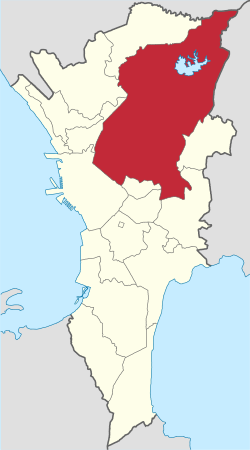 Quezon City in Metro Manila | |
show OpenStreetMap | |
 Quezon City Location within the Philippines | |
| Coordinates: 14°38′N 121°02′E / 14.63°N 121.03°ECoordinates: 14°38′N 121°02′E / 14.63°N 121.03°E | |
| Country | Philippines |
| Region | National Capital Region |
| Province | none |
| Districts | 1st to 6th districts |
| Incorporated (city) | 12 October 1939 |
| Highly Urbanized City | December 22, 1979 |
| Named for | Manuel L. Quezon |
| Barangays | 142 (see Barangays) |
| Government | |
| • Type | Sangguniang Panlungsod |
| • Mayor | Joy Belmonte |
| • Vice Mayor | Gian Sotto |
| • Representatives | show
List |
| • Council | show
Councilors |
| • Electorate | 1,330,118 voters (2019) |
| Area | |
| • Total | 161.11 km2 (62.20 sq mi) |
| Elevation | 67 m (220 ft) |
| Highest elevation | 796 m (2,612 ft) |
| Lowest elevation | −2 m (−7 ft) |
| Population (2020 census) [6] | |
| • Total | 2,960,048 |
| • Rank | 1st |
| • Density | 18,000/km2 (48,000/sq mi) |
| • Households | 660,249 |
| Demonym(s) | Taga-QC QCitizen |
| Economy | |
| • Income class | special city income class |
| • Poverty incidence | 2.45% (2018)[8] |
| • Revenue | ₱17,058,330,468.11 (2016) |
| Service provider | |
| • Electricity | Manila Electric Company (Meralco) |
| Time zone | UTC+8 (PST) |
| ZIP code | 1100 to 1138[7] |
| PSGC | |
| IDD : area code | +63 (0)2 |
| Climate type | tropical monsoon climate |
| Native languages | Tagalog |
| Website | www |


Quezon City (UK: /ˈkeɪzɒn/, US: /ˈkeɪsɒn, -sɔːn, -soʊn/;[9][10][11][12] Tagalog: Lungsod Quezon locally [luŋˈsod ˈkɛson]), also known as the City of Quezon and Q.C. (read in Filipino as Kyusi),[13][14][15] is the most populous city in the Philippines. According to the 2020 census, it has a population of 2,960,048 people. It was founded on October 12, 1939, and was named for Manuel L. Quezon, the second president of the Philippines. The city was intended to be the national capital of the Philippines that would replace Manila, as the latter was suffering from overcrowding, lack of housing, poor sanitation, and traffic congestion. To create Quezon City, several barrios were carved out from the towns of Caloocan, Marikina, San Juan and Pasig, in addition to the eight vast estates the Philippine government purchased for this purpose. It was officially proclaimed as the national capital on October 12, 1949, and several government departments and institutions moved out of Manila and settled into the new capital city. This necessitated the expansion of the city northwards, carving out Novaliches from Caloocan which divided it into two non-contiguous parts. Several barrios were also taken from San Mateo and parts of Montalban. However on June 24, 1976, Presidential Decree 940 was enacted, which reverted back to Manila the status of being the national capital while the whole of Metro Manila was designated as the seat of government.[16][17]
Quezon City is known for its culture, entertainment industry and media, and is aptly called the "City of Stars". Major broadcasting networks have their headquarters and studios in the city. It is also known for its commerce, education, research, technology, politics, tourism, art and sports. Several national government branches including the Batasang Pambansa Complex, the seat of House of Representatives of the Philippines, calls the city home.
Quezon City is a planned city. It covers a total area of 161.11 square kilometres (62.20 sq mi),[5] making it the largest city in Metro Manila in terms of land area. It is politically subdivided into Six Congressional Districts, which represents the city in the Lower House of the Congress of the Philippines. The city has 142 barangays under the City Government. National government departments and agencies are mostly situated at the National Government Center I (NGC I) in Diliman, and the National Government Center II (NGC II) in Batasan Hills, where the Lower House of the Philippine Congress is located. Most of the city's northern part lies at the foothills of the Sierra Madre mountain range, including the La Mesa Watershed Reservation, the largest watershed in Metro Manila and a designated protected area.
History[]
Initial plans for a new capital city[]

Before the creation of Quezon City, the land on where it will rise are part of several towns such as Caloocan, Marikina, Pasig and San Juan.
In the 1930s, Manila's urban problems were apparent and problematic.[18] It lacks public housing, where thousands of the city's residents live in congested informal settler communities, especially in the central districts of Binondo, Intramuros, Quiapo, San Nicolas and Tondo.[18] There are also problems in sanitation and traffic congestion.[18] The rise of slums in Manila gave rise to the development of its suburbs outside the city limits in the municipalities of Pasay, San Felipe Neri (renamed as Mandaluyong), San Francisco del Monte, San Pedro de Makati, and San Juan del Monte.[18] These towns became favorable to the upper and middle-class who wanted to escape the congested city but has economic links to it.[18]
President Manuel L. Quezon, aware of the problem besetting Manila, initiated housing projects called Barrio Obrero (Worker's Community).[18] These communities were established in various places in Manila such as Avenida Rizal, Sta. Cruz and Barrio Vitas, Tondo.[18] However, the project failed miserably and these communities became slum areas.[18]
Alejandro Roces, Sr., a prominent Filipino author, was said to be influential in Quezon's vision to establish a new city.[18] Quezon dreamt of a city where the common people can live and thrive.[18] Roces suggested that a sizeable tract of land be purchased for this purpose.[18] However, the government had no available fund except for 3 million in the hands of the National Development Company (NDC).[18]
In order to make Quezon's dream a reality and to mobilize funds for the land purchase, the People's Homesite Corporation (PHC) was created in October 14, 1938 as a subsidiary of NDC, with an initial capital of ₱2 million.[18] Roces was the Chairman of the Board of PHC, and they immediately acquired the vast Diliman Estate of the Tuason family at a cost of 5 centavos per square meter.[18] PHC conducted topographical and subdivision surveys, and then subdivided the lots and sell them to the target buyers at an affordable price.[18] Its target users and beneficiaries are obviously Manila's working class,[19] who are suffering from the shortage of affordable and decent housing in the capital.[18] The service of the Metropolitan Waterworks system was extended to site.[18] The Bureau of Public Works, then under Secretary Vicente Fragante, constructed the streets and highways within the property.[18] Quezon also tapped Architect Juan M. Arellano to draft a design of the city.[18]

Eight vast estates were acquired in order to create Quezon City: Diliman Estate 1,573.22 hectares (15.7322 km2), Santa Mesa Estate 861.79 hectares (8.6179 km2), Mandaluyong Estate 781.36 hectares (7.8136 km2), Magdalena Estate 764.48 hectares (7.6448 km2), Piedad Estate 743.84 hectares (7.4384 km2), Maysilo Estate 266.73 hectares (2.6673 km2) and the San Francisco Del Monte Estate 257.54 hectares (2.5754 km2).[18] Quezon's goal to create a place for the working class coincided with the planned transfer of the University of the Philippines campus in Manila to a more suitable location, which became the precedents for the creation of Quezon City.[18]
As early as 1928, the University of the Philippines (UP) plans to expand by adding more academic units and constructing new buildings.[18] The university experienced increase in enrollment and its planned expansion is hampered by its small campus in Manila.[20] The revised Burnham Plan of Manila envisioned the new campus to be located just outside Manila's city limits at 'the heights behind Manila'.[18] The UP Board of Regents informed Quezon of their desire to relocate the campus and he was supportive of the idea.[18] Furthermore, he wanted the facilities in the Manila campus to be used for government purposes.[18] In 1939, Quezon urged the National Assembly to enact UP's relocation and on June 8, 1939, Commonwealth Act 442 was passed, enacting the transfer of UP outside of Manila.[21] A portion of Mariquina Estate, which was adjacent to Magdalena Estate, was chosen as the new site with an approximate area of 600 hectares.[18] Additional land from the Diliman Estate were also added as part of the new university campus.[18]
Creation of Quezon City[]

With the development of the People's Homesite Corporation housing in the Diliman Estate and the creation of the new UP Campus, the creation of Quezon City was justified.[18] On October 12, 1939, Commonwealth Act No. 502, also known as the Charter of Quezon City, was passed by the National Assembly, which created Quezon City.[22] Surprisingly, Quezon allowed the bill to lapse into law because he did not sign it.[18] The city was originally to be known as Balintawak City according to the first bill filed by Ramon P. Mitra Sr., but Assemblymen Narciso Ramos and Eugenio Perez, both from Pangasinan, amended and successfully lobbied the assembly to name the city after the Quezon.[23][24][18] The creation of Quezon City halted the full implementation of the Burnham of Plan of Manila and funds were diverted for the establishment of the new capital.
Several barrios from different towns were carved out to correspond to the estates that PHC bought for the creation of Quezon City.[18] The new city has an area of 7,355 hectares (73.55 km2), and the barrios and sitios that were taken for its creation were the following: Bagubantay (Bago Bantay), Balingasa, Balintauac (Balintawak), Kaingin, Kangkong, Loma (La Loma), Malamig, Matalahib, Masambong, San Isidro, San Jose, Santol and Tatalon, were taken from Caloocan;[25] Cubao, Diliman, Kamuning, New Manila, Roxas, and San Francisco del Monte were taken from San Juan; Balara, Barranca (Barangka), Jesus de la Peña, Krus na Ligas, Tanong and the site of the new UP Campus were taken from Marikina; and, the barrios and sitios of Libis, and Ogong (Ugong Norte) from Pasig.[18] Commonwealth Act No. 659, enacted on June 21, 1941, changed the cities boundaries.[26] Under this law, the area of Wack Wack Golf and Country Club were to be reverted back to Mandaluyong, and the barrios of lower Barranca and Jesus de la Peña were reverted back to Marikina. However, Camp Crame was taken out of San Juan and was given to Quezon City.[26][18]
On 1939, in the year the city was established, it had a population of 39,103 people. The city in its early days was predominantly rural, but Quezon asked American Architect William Parsons to craft a master plan for the newly-created city.[18] Parsons was the one who advise Quezon to locate the National Government Center in Diliman instead of Wallace Field (now Rizal Park), due to the possibility of naval bombardment from Manila Bay.[18] Unfortunately, he died on December 1939 and his partner Harry T. Frost took over and become the lead planner.[18] Frost arrived on the Philippines on May 1, 1940 and became the architectural adviser of the Philippine Commonwealth government.[18] Together with Juan M. Arellano, Alpheus D. Williams, and Welton Becket, they created the Master Plan for Quezon City which was approved by the Philippine government in 1941.[18] The Frost Plan featured wide avenues, large open spaces and roundabouts at major intersections.[18] The plan for major thoroughfares made by Louis Croft for the Greater Manila Area served as the backbone for the Plan of Quezon City.[18] The center of the city was a 400-hectare quadrangle formed by four avenues — North, West, South and East — which was designed to be the location of the National Government of the Philippines.[18] At the northeast corner of the Quadrangle was a large roundabout, a 25-hectare elliptical site, were the proposed Capitol Building is envisioned to rise.[18]
To make the city accessible, Quezon ordered Luzon Bus Lines to ply from Kamuning towards Tutuban in Divisoria, Manila to provide transport for the city's residents. However, the fare was not affordable to minimum wage earners. Because of the city's unaffordable housing prices and lack of transportation for low income earners, the goal of creating mass housing for the working class was not met. Instead, those who opt to live in Quezon City were middle-class households such as in Kamuning, whose residents petitioned to rename it from Barrio Obrero (Worker's Community) to Kamuning (a type of tree that grows abundantly in the area) because its residents were not Obreros (Workers).[18]
Japanese occupation and World War II[]
The Philippine Exposition in 1941 was held on the newly established Quezon City, but participants were limited to locals because of the increasing turbulence at the beginning of the Second World War.[18] Eventually, parts of Manila were bombed by the Japanese Imperial Forces on December 1941, bringing the war to the Philippines. On January 1, 1942, President Quezon issued an executive order as an emergency measure to form the City of Greater Manila, with Jorge Vargas as its designated mayor.[27] It merge the cities of Manila and Quezon City with the towns of Caloocan, Las Piñas, Malabon, Mariquina, Muntinlupa, Navotas, San Pedro de Macati, San Felipe Neri, Parañaque, Pasay, Pasig, San Juan del Monte, and the Taguig–Pateros area. The mayors of these towns and cities serves as the vice mayor of their respective localities and were under Jorge Vargas. The City of Greater Manila will be the basis for the formation of Metro Manila in 1975.
When the Imperial Japanese forces occupied the Philippines in 1942 during World War II, the City of Greater Manila were reorganized by Japanese authorities into twelve districts, two of which were formed by dividing Quezon City: Balintawak which consisted of San Francisco del Monte, Galas, and La Loma; and Diliman which consisted of Diliman proper, Cubao, and the University District. In 1945, combined Filipino and American troops under the United States Army, Philippine Commonwealth Army, and Philippine Constabulary, with help from recognized guerril la units, liberated and recaptured Quezon City in a few months, expelling Imperial Japanese forces. Heavy fighting occurred near Novaliches, which at that time was in Caloocan, and New Manila which was a strongpoint. Smaller actions were fought at Barrio Talipapa and the University District. Toward the end of the Battle of Manila, President Sergio Osmeña dissolved the Greater Manila Complex, which included the Japanese-created districts of Balintawak and Diliman which had been formed from the prewar Quezon City.
Post-war years (1945-1965)[]

Existing territorial boundaries.
Detached by Commonwealth Act 502 (1939).
Novaliches area. Detached by Republic Act 392 (1949).
On July 17, 1948, President Elpidio Quirino signed Republic Act No. 333 into law, making Quezon City the capital of the Philippines.[28] The Act created the Capital City Planning Commission, which was tasked to develop and implement a masterplan for the city.[5] As the capital, the city was expanded northwards, and the barrios of Baesa, Bagbag, Banlat, Kabuyao, Novaliches Proper (Bayan/Poblacion), Pasong Putik, Pasong Tamo, Pugad Lawin, San Bartolome, and Talipapa in Novaliches were taken from Caloocan. This territorial changes caused the division of Caloocan into two non-contiguous parts.[5] Quezon City was formally inaugurated as the capital on October 12, 1949. President Quirino laid the cornerstone on the proposed Capitol Building at Constitution Hills.[5]
On June 16, 1950, the Quezon City Charter was revised by Republic Act No. 537, changing the city's boundaries to an area of 153.59 km2 (59 sq mi).[29] Exactly six years after on June 16, 1956, more revisions to the city's territory were made by Republic Act No. 1575, which defined its area as 151.06 km2 (58 sq mi).[30] However, according to the 1995 GIS graphical plot, the city's total area is 161.11 km2 (62.20 sq mi), making it the largest Local Government Unit in Metro Manila in terms of land area.[31][5]
The martial law era (1945–1986)[]

During the administration of Ferdinand Marcos, the region of Metro Manila was created as an integrated unit with the enactment of Presidential Decree No. 824 on November 7, 1975. The region encompassed four cities and thirteen adjoining towns, as a separate regional unit of government.[32][33] A year later, on June 24, 1976, Manila was reinstated by President Marcos as the capital of the Philippines for its historical significance as the seat of government since the Spanish Period. Presidential Decree No. 940 states that Manila has always been to the Filipino people and in the eyes of the world, the premier city of the Philippines being the center of trade, commerce, education and culture.[34][35] Concurrent with the reinstatement of Manila as the capital, Ferdinand Marcos designated his wife, Imelda Marcos, as the first governor of Metro Manila, who started the construction of massive government edifices with architectural significance as she re-branded Manila as the "City of Man".[36]
In March 31, 1978, President Marcos ordered the transfer of the remains of President Quezon from Manila North Cemetery to the newly-completed Quezon Memorial Shrine.[37][38] It now houses the mausoleum where President Quezon and his wife Aurora Aragon Quezon are interred. It also contains a museum dedicated to President Quezon and his life.

Quezon City became the venue of a lot of resistance activity against the Marcos dictatorship, as youth and student demonstrators repeatedly clashed with the police and military which were subservient to the Marcos regime. The Diliman Commune was the first of such uprising against the government, as the student, faculty members and residents of UP Diliman protested the three centavos increase in oil prices. It was followed by the First Quarter Storm, a period of civil unrest mostly organized by students. During the martial law era, a series of demonstrations, protests, and marches against the administration of President Ferdinand Marcos took place at various locations in the city. On 1986, the nonviolent People Power Revolution, led by Corazon Aquino and Cardinal Jaime Sin, occurred that ousted the Marcos from power. Thousands of people flocked EDSA between Camp Crame and Camp Aguinaldo in a series of popular demonstrations and civil resistance against the Marcos government that occurred between February 22–25, 1986.[39]
All of the three major monuments commemorating the Martial Law era are located in Quezon city.[40] The People Power Monument and the EDSA Shrine were built in the city to commemorate the event, with the latter being a symbol of the role that the Catholic Church played in the restoration of democracy in the Philippines. The Bantayog ng mga Bayani was constructed along Quezon Avenue to honor the heroes and martyrs that struggled under the 20-year the Marcos regime. The Wall of Remembrance at the Bantayog honors prominent figures during the martial law era.[41][42]
Contemporary period (1986-present)[]

On February 23, 1998, Republic Act. No. 8535 was signed by President Fidel Ramos, which paved the way for the creation of the City of Novaliches by carving out the 15 northernmost barangays of Quezon City.[43][44][45] The voting process only includes the affected barangays, but then-city mayor Ismael "Mel" Mathay Jr. lobbied to include the whole city. He also campaigned against the seccession of Novaliches. In the succeeding plebiscite that was held on October 23, 1999, an overwhelming majority of Quezon City residents rejected the secession of Novaliches. Mathay was succeeded by Feliciano Belmonte Jr., who served as the city mayor from 2001-2010.
In the 2010 local elections, Herbert "Bistek" Bautista was elected as the city mayor. During his term, the Quezon City Pride Council was established. It was the first LGBT council in the Philippines.[46] He also initiated numerous socialized housing projects called "Bistekville". Bautista was succeeded by Maria Josefina "Joy" Belmonte, who has served as the Vice Mayor under his term and the daughter of former Quezon City mayor Feliciano Belmonte Jr..
Since March 15, 2020, Quezon City has been under some form of quarantine, which were introduced due to the ongoing COVID-19 pandemic in the country. The strictest quarantine was from March 17,2020 – May 31, 2020, in response to the ongoing pandemic in the city, which has infected more than 100,000 of the city's residents with more than 1,200 deaths.
Geography[]

The geography of Quezon City is characterized by undulating terrain. The city is within the catchment area of five river systems – Marikina River, Pasig River, San Juan River, Tullahan River and Meycauayan River – along with their creeks and tributaries with a total length of almost 200 km (120 mi).[47] The city has an area of 161.11 km2 (62.20 sq mi), according to the 1995 GIS graphical plot, making it the largest Local Government Unit (LGU) in Metro Manila in terms of land area.[31] Since its creation in 1939, the city's boundary were revised four times; the final revision was made thru Republic Act No. 1575, which placed the city's territory at 151.06 square kilometres (58.32 sq mi).[5] Meanwhile, the Philippine Statistics Authority placed the city's land area at 171.71 square kilometres (66.30 sq mi), based on data provided by the Land Management Bureau. According to the Philippine Institute of Volcanology and Seismology and Geoscience Australia on their study earthquake impact and risk assessment on the Greater Metropolitan Manila Area, the total area of Quezon City is at 165.33 km2 (64 sq mi).[48][49]
Quezon City is bounded by San Jose del Monte to the north, Marikina, San Mateo and Rodriguez to the east, Pasig to the southeast, Mandaluyong and San Juan to the south, Manila to the southwest, and Caloocan and Valenzuela to the west and northwest. The city lies on the Guadalupe Plateau, a relatively high plateau at the northeast of the metropolis situated between the lowlands of Manila to the southwest and the Marikina River Valley to the east. The highest elevation in Quezon City is the northern tip of the La Mesa Watershed Reservation at 250 metres (820 ft) above sea level.[50] The West Valley Fault traverses the eastern border of the city.
Climate[]
| Quezon City | ||||||||||||||||||||||||||||||||||||||||||||||||
|---|---|---|---|---|---|---|---|---|---|---|---|---|---|---|---|---|---|---|---|---|---|---|---|---|---|---|---|---|---|---|---|---|---|---|---|---|---|---|---|---|---|---|---|---|---|---|---|---|
| Climate chart (explanation) | ||||||||||||||||||||||||||||||||||||||||||||||||
| ||||||||||||||||||||||||||||||||||||||||||||||||
| ||||||||||||||||||||||||||||||||||||||||||||||||
According to the Köppen climate classification, Quezon City has a tropical monsoon climate (Am). The city has a dry season from December to April, in which in turn, divided into cool and warm dry seasons, and a prolonged wet season from May to November that brings heavy rains in some areas.
The primary weather station of the city is located at the PAGASA Science Garden. It has been observed that extreme temperatures ranged from a record high of 38.5 °C (101.3 °F) to a record low of 14.9 °C (58.8 °F). The hot season was observed for 1.5 months, from April to May, with an average daily high temperature of 32.8 °C (91.0 °F). Meanwhile, the cool season lasts for 2.6 months, from November to February, with an average temperature of below 30.5 °C (86.9 °F).[51]
About 20 typhoons enter the Philippines every year, affecting Quezon City and the rest of Metro Manila. In recent years, heavy rainfalls from Habagat (south west monsoon) became as destructive as typhoons, triggering floods and landslides which endangers the city's residents living near the riverbanks.[47]
| hideClimate data for Science Garden, Quezon City (1981–2010, extremes 1961–2012) | |||||||||||||
|---|---|---|---|---|---|---|---|---|---|---|---|---|---|
| Month | Jan | Feb | Mar | Apr | May | Jun | Jul | Aug | Sep | Oct | Nov | Dec | Year |
| Record high °C (°F) | 34.7 (94.5) |
35.6 (96.1) |
36.8 (98.2) |
38.0 (100.4) |
38.5 (101.3) |
38.0 (100.4) |
36.2 (97.2) |
35.8 (96.4) |
35.4 (95.7) |
35.4 (95.7) |
35.0 (95.0) |
34.7 (94.5) |
38.5 (101.3) |
| Average high °C (°F) | 30.6 (87.1) |
31.7 (89.1) |
33.4 (92.1) |
35.0 (95.0) |
34.7 (94.5) |
33.1 (91.6) |
31.9 (89.4) |
31.3 (88.3) |
31.6 (88.9) |
31.6 (88.9) |
31.4 (88.5) |
30.5 (86.9) |
32.2 (90.0) |
| Daily mean °C (°F) | 25.7 (78.3) |
26.3 (79.3) |
27.8 (82.0) |
29.4 (84.9) |
29.7 (85.5) |
28.8 (83.8) |
28.0 (82.4) |
27.8 (82.0) |
27.8 (82.0) |
27.6 (81.7) |
27.1 (80.8) |
26.0 (78.8) |
27.7 (81.9) |
| Average low °C (°F) | 20.8 (69.4) |
20.9 (69.6) |
22.1 (71.8) |
23.7 (74.7) |
24.7 (76.5) |
24.6 (76.3) |
24.1 (75.4) |
24.2 (75.6) |
24.0 (75.2) |
23.5 (74.3) |
22.7 (72.9) |
21.6 (70.9) |
23.1 (73.6) |
| Record low °C (°F) | 15.5 (59.9) |
15.1 (59.2) |
14.9 (58.8) |
17.2 (63.0) |
17.8 (64.0) |
18.1 (64.6) |
17.7 (63.9) |
17.8 (64.0) |
20.0 (68.0) |
18.6 (65.5) |
15.6 (60.1) |
15.1 (59.2) |
14.9 (58.8) |
| Average rainfall mm (inches) | 18.5 (0.73) |
14.6 (0.57) |
24.8 (0.98) |
40.4 (1.59) |
186.7 (7.35) |
316.5 (12.46) |
493.3 (19.42) |
504.2 (19.85) |
451.2 (17.76) |
296.6 (11.68) |
148.8 (5.86) |
78.7 (3.10) |
2,574.4 (101.35) |
| Average rainy days (≥ 0.1 mm) | 4 | 3 | 4 | 5 | 12 | 18 | 22 | 23 | 22 | 18 | 14 | 8 | 153 |
| Average relative humidity (%) | 76 | 73 | 69 | 67 | 72 | 79 | 83 | 84 | 84 | 83 | 82 | 79 | 78 |
| Source: PAGASA[52][53] | |||||||||||||
City districts[]


- Cubao: Located at the southern part of the city, Cubao is the home of the 35-hectare Araneta City, a mixed-use township development that contains prominent shopping malls such as Ali Mall, Farmers Plaza and Gateway Mall and iconic landmarks such as the Smart Araneta Coliseum. The Cubao Cathedral is the seat of the Roman Catholic Diocese of Cubao.
- Diliman: Diliman is located at the center of Quezon City, the place where the city was originally established. Named for the Tagalog word for the medicinal fern species Stenochlaena palustris,[54][55] Diliman is where numerous national government offices are located, as well as prominent colleges and universities such as the University of the Philippines Diliman, FEU–FERN College, and New Era University. The Diliman Quadrangle, which is bounded by the North, West, South (Timog) and East Avenues is known for its massive hospitals and government edifices, bars, nightlife, and media. Several streets in South Triangle and Laging Handa were named in honor of the 22 Boy Scouts who died in the plane crash en route to joining the 11th World Scout Jamboree. A memorial stands in the center of the roundabout at the intersection of Timog and Tomas Morato Avenues. The place was known as the Scout Area. Major commercial broadcasting media and television networks such as ABS-CBN have their headquarters here. PTV, RPN, IBC, and PBS also hold headquarters in Diliman.
- La Loma: La Loma is located the southwestern portion of the city. It has five barangays along the vicinity of its main streets: N.S. Amoranto Avenue (Retiro) and A. Bonifacio Avenue. The district is famed as the birthplace of many popular Filipino culinary figures and establishments especially devoted to the lechon. The nearby La Loma Cemetery is named after this place.
- New Manila: New Manila is named after the City of Manila, since most of its residents are affluent families from the city who wished to escape the stress of living in the capital. It was formerly a part of San Juan before being carved out from its mother town to form Quezon City. Among its notable residents are the Hemady-Ysmael Family, the original landowner of New Manila, and Dona Narcisa de Leon, the matriarch of LVN Studios. It is also the birthplace of Eraño Manalo, the Second Executive Minister of Iglesia ni Cristo.[56] New Manila is also known for Balete Drive, which a haunted place according to Filipino folklore where the spirit of a white lady haunts the road seeking help from passing drivers.
- Novaliches: Novaliches is the largest district in Quezon City, which made up almost all the northern portion of the city after Batasan Hills. It contains the La Mesa Watershed Reservation and its Dam and Reservoir where most of Metro Manila's water supply came from. It was originally a part of Caloocan before being incorporated to Quezon City in 1948, when the latter was declared as the capital. Before the place was incorporated to Quezon City in 1948, Novaliches was already in the maps as early as 1864, having been organized by the Spanish as early as 1855, from the haciendas of Tala, Malinta, Piedad, and Maysilo. By 1856, it was its own municipality before being absorbed by Caloocan in 1901. Novaliches is still known by its historical boundaries. The whole of North Caloocan up to the banks of the Marilao River bordering Bulacan to the north, parts of the historic Polo section of Valenzuela to the west, and parts of San Jose del Monte, Bulacan to the upper reaches of Tungkung Mangga and the old Tala Leprosarium in the northeast and east, are still referred to as within the old enclave of Novaliches that many residents consider to this day.
- Project 1: Also known as Barangay Roxas or Roxas District.
- Project 2: Made up of barangays Quirino 2-A, Quirino 2-B and Quirino 2-C.
- Project 3: Made up of barangays Quirino 3-A, Amihan, Claro and Duyan-Duyan.
- Project 4: Located within the eastern area beside Cubao.
- Project 5: Also known as Barangay E. Rodriguez.
- Project 6: Project 6 in Diliman is an affluent barangay which is known for hospitals such as the Philippine Children's Medical Center (PCMC) and the Veterans Memorial Medical Center (VMMC), as well as the home of Philippine Science High School Main Campus. The Office of the Ombudsman and the Ninoy Aquino Parks and Wildlife Center are located here.
- Project 7: Project 7 is made up of barangays Bungad and Veterans Village.
- Project 8: Project 8 is made up of barangays Bahay Toro, Baesa and Sangandaan.
- San Francisco del Monte: San Francisco del Monte was founded as a pueblo by Saint Pedro Bautista in 1590, is considered as Quezon City's oldest district. The original land area of the old town was approximately 2.5 square kilometers (1.0 sq mi), including parts of Project 7 and 8 and Timog Avenue. It is bounded by West Avenue on the east, Epifanio De Los Santos Avenue on the north, Quezon Avenue on the south, and Araneta Avenue on the west. It was originally a part of San Juan, before it was carved out of its mother town to form Quezon City. The district is made up of barangays San Antonio, Paraiso, Paltok, Mariblo, Masambong, Manresa, Damayan and Del Monte. SFDM featured a hilly topography with lush vegetation and mineral springs, in the midst of which the old Santuario de San Pedro Bautista was built as a retreat and monastery for Franciscan friars. The headquarters of IBC is located here.
- Santa Mesa Heights: Santa Mesa Heights is an affluent neighborhood where many middle-class and upper-middle-class families reside. It is mostly residential. It is the home to the National Shrine of Our Lady of Lourdes and the National Shrine of Our Lady of La Naval. Prominent Catholic educational institutions such as the Angelicum College, Lourdes School of Quezon City, and St. Theresa's College of Quezon City are located here. During the Commonwealth Period, Santa Mesa Heights was considered as the ideal site for universities, located just outside the suburban city limits of Manila.
Cityscape[]
Architecture[]

The architecture of Quezon City varies greatly. It features wide variety of architectural styles such as art deco, brutalist, international modern, postmodern and the contemporary style.[citation needed] The city also has numerous monuments and museums. When the city was created in 1939, Art Deco was the prevailing architectural style, moving forward from the colonial designs of Bahay na bato by the Spanish, and the neoclassical style by the Americans. The choice of designing buildings in contemporary international style was intentional to show that the Philippines was moving forward since it was anticipating independence in 1945.[citation needed]
The Quezon Memorial Shrine, which was built from 1952-1978, was designed in Art Deco style. It became the city's symbol and at its base was a museum and mausoleum dedicated to the late Manuel L. Quezon and his wife Aurora. When the city became the capital in 1948, a lot of government buildings transferred from Manila to Quezon City. Numerous government buildings were built during the terms of President Elpidio Quirino, Ramon Magsaysay, Carlos P. Garcia, Diosdado Macapagal and Ferdinand Marcos. However, it was only during the term of Marcos that began the filipinization of architecture.[citation needed] Numerous government hospitals in the city such as the Lung Center of the Philippines, Philippine Heart Center, and the Kidney Center of the Philippines were built and regarded as "designer" hospitals. Traditional Filipino design motifs were incorporated in government buildings such as the Batasang Pambansa, which drew inspiration from the Bahay Kubo and the Bahay na bato.[citation needed] Most of the government buildings and structures built during the time of Marcos were associated with the "edifice complex" of the Marcoses.[57]
Master Plans[]
In 1938, President Manuel L. Quezon made a decision to push for a new capital city. Manila was getting crowded, and his military advisors reportedly told him that Manila, being by the bay, was an easy target for bombing by naval guns in case of attack.[43][44] The new city will be located at least 15 km (9 mi) away from Manila Bay, which is beyond the reach of naval guns. Quezon contacted William E. Parsons, an American architect and planner, who had been the consulting architect for the islands early in the American colonial period. Parsons came over in the summer of 1939 and helped select the Diliman (Tuason) estate as the site for the new city. Unfortunately, he died later that year, leaving his partner Harry Frost to take over. Frost collaborated with Juan Arellano, engineer A.D. Williams, and landscape architect and planner Louis Croft to craft a grand master plan for the new capital. The plan was approved by the Philippine authorities in 1941.[43][44]
The core of the new city was to be a 400-hectare (990-acre) Central Park, about the size of New York's Central Park, and defined by the North, South (Timog), East and West Avenues. On one corner of the proposed Diliman Quadrangle was delineated a 25-hectare (62-acre) elliptical site, the focal point of the grand quadrangle. This was the planned location of a large Capitol Building to house the Philippine Legislature and ancillary structures for the offices of representatives.[43][44] On either side of the giant ellipse were supposed to have been the new Malacañang Palace on North Avenue (site of the present-day Veterans Memorial Hospital), and the Supreme Court Complex along East Avenue (now the site of East Avenue Medical Center). The three branches of government were to be finally and efficiently located in close proximity to each other.[43][44]
Demographics[]
| Year | Pop. | ±% p.a. |
|---|---|---|
| 1939 | 39,013 | — |
| 1948 | 107,977 | +11.98% |
| 1960 | 397,990 | +11.48% |
| 1970 | 754,452 | +6.60% |
| 1975 | 956,864 | +4.88% |
| 1980 | 1,165,865 | +4.03% |
| 1990 | 1,669,776 | +3.66% |
| 1995 | 1,989,419 | +3.34% |
| 2000 | 2,173,831 | +1.92% |
| 2007 | 2,679,450 | +2.93% |
| 2010 | 2,761,720 | +1.11% |
| 2015 | 2,936,116 | +1.17% |
| 2020 | 2,960,048 | +0.16% |
| Source: Philippine Statistics Authority [6] [58] [59] [60][61] | ||
According to the 2020 Census, the population of the city was 2,960,048, making it the most populous city in the Philippines.[62] As of the 2015 Census, the population of Quezon City comprises 22.80% or ¼ of Metro Manila's population.[62] From a population of 39,013 people when the city was established in 1939, it tremendously grew and reached the one million mark in 1980 with a population of 1,165,865.[62] It reached another milestone when the population reached the two million mark in 2000 with a population of 2,173,931.[62] The city's population density is at 18,222 person per km2, lower than Metro Manila's population density at 20,247 person per km2.[62] As of 2020, the city's most populous barangay is Commonwealth with 198,285 people, while the least populous was Quirino 3-A with 1,140 people.[62]
As of 2015, the average size of a household in Quezon City is 4.3 members.[62] It has a generally young population with an average of 28 years.[62] Females comprise 50.71% (1,488,765) while males comprise 49.29% (1,447,351). The child and youth alone (0-30 years old) constituted more than half (58.78% or 1,725,832) of the city's total population.[62]
Tagalog is the most spoken language in Quezon City which is spoken by 46.78% of the city's population.[62] It was followed by Bisaya/Binisaya (13.47%), Bicolanos (9.03%), Ilocanos (8.13%), Hiligaynon/Ilonggo (4.34%), Pangasinan/Panggalatok (2.64%), Cebuano (2.55%), Kapampangan (1.72%), Masbateño/Masbateñon (0.57%), Boholano (0.51%) and other languages (10.23%).[62]
Religion[]
Religion in Quezon City[62]
Quezon City is predominantly Roman Catholic city, which made up about 86.25% of its population.[62] It was followed by various Protestant faiths, which have seen a significant increase in membership over recent decades and are well represented in Quezon City.[62][63][64] The third largest religion is Iglesia ni Cristo, whose Central Temple and main office is located along Commonwealth Avenue in New Era.[62] A significant population of Quezon City belongs to the Islamic faith, the fourth largest religion in the city.[62]
Protestantism has strong presence in the Quezon City. Several Evangelical, Protestant and Charismatic churches has their main headquarters, churches, and seminaries in the city. The main headquarters of the National Council of Churches in the Philippines (NCCP), Philippine Council of Evangelical Churches (PCEC) and the United Church of Christ in the Philippines (UCCP) are located in the city. The Episcopal Church in the Philippines has its national office in Cathedral Heights, New Manila including the National Cathedral of Saints Mary and John.
Jesus Is Lord Church Worldwide (JIL) has many branches in the city. The church is currently building the JIL Cornerstone Central, a 12-storey, 5,000 seating worship center located in Balintawak.[65] Jesus Miracle Crusade held its weekly service on Amoranto Sports Complex, with thousands of attendance. The Church of Jesus Christ of Latter-day Saints (LDS Church) has the Manila Philippines Temple and the Missionary Training Center located at Temple Drive, Green Meadows Subdivision in Ugong Norte. The Iglesia Filipina Independiente (Aglipayan Church) has three parishes located in the city: the Parish of the Crucified Lord in Apolonio Samson, Parish of the Holy Cross inside the UP Diliman Campus, and the Parish of the Resurrection in Balingasa. The Philippine Branch office of the Jehovah's Witnesses is located along Roosevelt Avenue. The headquarters of the UCKG HelpCenter (Universal Church of the Kingdom of God) is located at the former Quezon Theater in Araneta City, Cubao. There are also numerous Members Church of God International (Ang Dating Daan) churches in the city.
Other churches that has their main churches in the city include the Bread of Life Ministries International, The Church So Blessed, People of Grace Fellowship, Tabernacle of Faith International and the Word of Hope Christian Family Church.
Other faiths in the city include the Nichiren Buddhists, with many thousands of adherents attending worship services at Soka Gakkai International (SGI) Philippines headquarters at Quezon Memorial Circle. The headquarters of Tzu Chi Philippines is located in the city.
Poverty, housing and urban slums[]
As of 2013, there are 196,818 informal settler families in Quezon City living in 151,890 structures. 48,927 of these families live along waterways, danger areas, or right of ways.[73]
The Quezon Task Force on Socialized Housing and Development of Blighted Areas (Task Force Housing) is the lead agency of the city government to address the needs of socialized housing within the city.[62] It shall direct and coordinate various city departments to develop housing projects and for other community development related activities.[62] The goal of the city's socialized housing program is to provide a safe, decent and sustainable home for the city's informal settlers and slum dwellers. The program involves the collaboration between different national and local government agencies, including the private sector.[74] The flagship housing program of the city is the Bistekville communities, which started during the term of Mayor Herbert "Bistek" Bautista, a former actor who served as the city's mayor from 2010-2019. The housing projects were named after him.[75] The naming was controversial to an extent as it was considered a form of political epal because his name was affixed on a public works project. As of 2018, Quezon City has 37 Bistekville projects with 7,184 beneficiaries.[76] Additionally, there are 960 housing units built by the National Housing Authority (NHA) in barangay Holy Spirit.[77]
Economy[]

Quezon City is a hub for business and commerce, as a center for banking and finance, retailing, transportation, tourism, real estate, entertainment, new media, traditional media, telecommunications, advertising, legal services, accountancy, healthcare, insurance, theater, fashion, and the arts in the Philippines. The National Competitiveness Council of the Philippines which annually publishes the Cities and Municipalities Competitiveness Index (CMCI), ranks the cities, municipalities and provinces of the country according to their economic dynamism, government efficiency and infrastructure. Quezon City was the Most Competitive City in the country from 2015 to 2019 assuring that the city is consistently one of the best place to live in and do business. It earned the Hall of Fame Award in 2020 for its consecutive top performance.[78] There are about 86,000 registered business in the city.[79] As of 2019, Quezon City is the second richest city in the Philippines after Makati. The city's total asset stood at ₱96.4 billion,[80][81] while it has the biggest liability at ₱21.624 billion.[81]
Information and communications technology[]

Quezon City bills itself as the ICT capital of the Philippines.[82] Quezon City was the first Local Government Unit (LGU) in the Philippines with a computerized real estate assessment and payment system, which was developed in 2015 that contains around 400,000 property units with capability to record payments.[43][44] The city has 33 ICT parks according to PEZA, which includes the Eastwood City Cyberpark in Bagumbayan, the first and largest IT Park in the country.[83]
The Department of Information and Communications Technology of the Philippines has its headquarters in the city.
Media and entertainment[]

Quezon City is known as the " Entertainment Capital of the Philippines"[82] and the "City of Stars", since it is where major studios located and most Filipino actors and actresses reside.[83] To support the film industry, the city established the Quezon City Film Development Commission (QCFDC). The city also holds its own film festival, the QCinema International Film Festival, every October or November and showcases local and international films, documentaries, and short films, and gives grants to their creators.[84][85][86]
Quezon City is home to the Philippines' major broadcasting networks. There are 11 local television networks, 6 cable TV, 7 AM radio stations, and 4 FM radio stations in the city.[5] Major commercial broadcast network in the Philippines such as ABS-CBN and GMA Network have their headquarters in the city. From 1992 to 2013, TV5 had its headquarters in the city. It moved to Mandaluyong in 2013 although TV5's former Novaliches headquarters still serves as its alternate studios. Its transmitter in Novaliches is still being used and operated by the network.[87] State-owned media and television network such as RPN, IBC and PTV also have their headquarters in the city.
Religious broadcasting companies in the city include CEBSI (formerly CBS), DZCE-TV and EBC (Net 25), which are all affiliated with Iglesia ni Cristo. UNTV is another religious broadcasting network affiliated with Members Church of God International. Major broadcasting facilities in the city include the Net 25 Tower, the tallest communications tower in the Philippines standing at 907 feet (276 m), GMA's Tower of Power (777 ft (236.8 m)), ABS-CBN's Millennium Transmitter (720 ft (219.5 m)), the ABS-CBN's ELJ Communications Center, GMA Network Center, and the UNTV Broadcast Center. Formerly, the Broadcast City in Matandang Balara was once home to Banahaw Broadcasting Corporation (BBC), Radio Philippines Network (RPN) and Intercontinental Broadcasting Corporation (IBC).
Government[]

Quezon City is classified as a Special City (according to its income)[88][89] and a Highly Urbanized City (HUC). The mayor is the chief executive, and is a member of the Metro Manila Council. The mayor is assisted by the vice mayor, who serves as the presiding officer of the 24-member Quezon City Council. The members of the City Council are elected as representatives of the four councilor districts within the city, and the municipal presidents of the Liga ng mga Barangay and Sangguniang Kabataan.
The current mayor is Maria Josefina "Joy" Belmonte, who previously served as the city's vice mayor. The vice mayor is Gian Sotto, the son of Senate President Tito Sotto and actress Helen Gamboa. The mayor and the vice mayor are term-limited by up to 3 terms, with each term lasting for 3 years. The mayor serves as the executive head that leads all the city's department in executing city ordinances and improving public services. The vice mayor, who serves a concurrent position as the presiding officer of the City Council, oversees the formulation and enactment passed by the council.
From its creation in 1939 up until 1959, the mayors of Quezon City were appointed by the President. Norberto S. Amoranto was the first elected mayor, and was the city's longest-serving mayor, having served that position for 22 years.[24]
The city observes regular and non-working holidays of the Philippines. The Quezon City Day, which was celebrated annually on August 19 by both Quezon City and Quezon Province to commemorate the birth of Manuel L. Quezon, is a special non-working holiday.[90]
Barangays and congressional districts[]


Right: The six legislative districts of Quezon City.
Quezon City is politically subdivided into 142 barangays. These barangays are grouped into six congressional districts, with each district being represented by a congressman in the House of Representatives. Each congressional district has six City Councilors. The number of barangays per district is: District I, 37; District II, 5; District III, 37; District IV, 38; District V, 14; and District VI, 11; Although District II has the fewest barangays, it is the biggest in land area, including the Novaliches Reservoir.
- District I (2015 population: 409,962)[91] covers barangays Alicia, Bagong Pag-asa, Bahay Toro, Balingasa, Bungad, Damar, Damayan, Del Monte, Katipunan, Mariblo, Masambong, N.S. Amoranto (Gintong Silahis), Nayong Kanluran, Paang Bundok, Pag-ibig sa Nayon, Paltok, Paraiso, Phil-Am, Ramon Magsaysay, Salvacion, San Antonio, San Isidro Labrador, San Jose, Santa Cruz, Santa Teresita, Santo Cristo, Talayan, Veterans Village and West Triangle. It has an area of 19.59 km2 (7.56 sq mi).[92]
- District II (2015 population: 688,773)[91] covers barangays Bagong Silangan, Batasan Hills, Commonwealth, Holy Spirit and Payatas. It is the most populous district in the country from 1987-2013, before it was partitioned and its northern part became the 5th District and its western part became the 6th District.
- District III (2015 population: 324,669)[91] covers barangays Amihan, Bagumbuhay, Bagumbayan, Bayanihan, Blue Ridge A, Blue Ridge B, Camp Aguinaldo, Claro, Dioquino Zobel, Duyan-Duyan, E. Rodriguez, East Kamias, Escopa I, Escopa II, Escopa III, Escopa IV, Libis, Loyola Heights, Mangga, Marilag, Masagana, Matandang Balara, Milagrosa, Pansol, Quirino 2-A, Quirino 2-B, Quirino 2-C, Quirino 3-A, Saint Ignatius, San Roque, Silangan, Socorro, Tagumpay, Ugong Norte, Villa Maria Clara, West Kamias and White Plains.
- District IV (2015 population: 446,122)[91] covers barangays Bagong Lipunan ng Crame, Botocan, Central, Kristong Hari, Damayang Lagi, Doña Aurora, Doña Imelda, Doña Josefa, Don Manuel, East Triangle, Horseshoe, Immaculate Conception, Kalusugan, Kamuning, Kaunlaran, Krus na Ligas, Laging Handa, Malaya, Mariana, Obrero, Old Capitol Site, Paligsahan, Pinyahan, Pinagkaisahan, Roxas, Sacred Heart, San Isidro Galas, San Martin de Porres, San Vicente, Santo Niño, Santol, Sikatuna Village, South Triangle, Tatalon, Teachers Village East, Teachers Village West, U.P. Campus, U.P. Village and Valencia.
- District V (2015 population: 535,798)[91] covers barangays Bagbag, Capri, Fairview, Greater Lagro, Gulod, Kaligayahan, Nagkaisang Nayon, North Fairview, Novaliches Proper, Pasong Putik Proper, San Agustin, San Bartolome, Santa Lucia and Santa Monica. It is more commonly known as Novaliches.
- District VI (2015 population: 531,592)[91] covers barangays Apolonio Samson, Baesa, Balon-Bato, Culiat, New Era, Pasong Tamo, Sangandaan, Sauyo, Talipapa, Tandang Sora and Unang Sigaw.
National government[]

As the former capital, the city is the home to numerous government departments, agencies and institutions. The House of Representatives of the Philippines (Lower House), as well as the Departments of Agrarian Reform, Agriculture, Environment and Natural Resources, Human Settlements and Urban Development, Information and Communications Technology, Interior and Local Government, National Defense and Social Welfare and Development calls the city home. Independent constitutional bodies such as the Commission on Audit and the Office of the Ombudsman, as well as special courts such as the Court of Tax Appeals and the Sandiganbayan are located in the city.


There are two National Government Centers (NGC) in the city. National Government Center I (NGC I) is located at Diliman Quadrangle, which is bounded by the North, South, East and West Avenues. The proposed Capitol Building of the Philippines is supposed to rise at the site of the Quezon Memorial Circle, while the Executive Mansion was planned to be constructed at the present-day Veterans Memorial Medical Center (VMMC) and the Supreme Court was supposed to rise at the present-day East Avenue Medical Center (EAMC). This is where the main offices of the Departments of Agrarian Reform, Agriculture, Environment and Natural Resources, Human Settlements and Urban Development (including the National Housing Authority) and the Interior and Local Government are located. Other government agencies located at NGC I are the Bureau of Internal Revenue, BSP Security Plan Complex, Land Registration Authority, Land Transportation Office, National Power Corporation, Philippine Atmospheric, Geophysical and Astronomical Services Administration (PAGASA), Philippine Statistics Authority (PSA) and the Social Security System (SSS).
National Government Center II is located along Commonwealth Avenue, Batasan Hills. It is where the Batasang Pambansa Complex is located, whose site is supposed to be the national civic center and the focal point of the 1949 Master Plan. The Commission on Audit (COA), Public Attorney's Office (PAO) and the Sandiganbayan are located here.
Sports[]

Sports in Quezon City have a long and distinguished history. Quezon City is the home to notable sporting and recreational venues such as the Amoranto Sports Complex, Quezon City Sports Club and the Smart Araneta Coliseum. The prominent boxing fight between Muhammad Ali and Joe Frazier, which was known as Thrilla in Manila" was held at the Araneta Coliseum. It was renamed as the "Philippine Coliseum" for the event and the match was watched by over 1 billion viewers worldwide.
The city's, and in general the country's main sport is basketball, and most barangays have a basketball court or at least a makeshift basketball court, with court markings drawn on the streets. Larger barangays have covered courts where inter-barangay leagues are held every summer (April to May).
Quezon City is notable for its golf courses, such as the Veterans Memorial Golf Club and Camp Aguinaldo Golf Club, which operates on golf-courses owned by the national government. The Capitol Hills Golf & Country Club in Matandang Balara is a privately-owned exclusive 18 hole golf course situated at the hills overlooking Marikina Valley. In the early days after the creation of the city, Greenhills was considered as part of it along with Wack Wack Golf and Country Club, but the golf course was reverted back to Mandaluyong.
The city is the home of the Philippine Basketball Association.
The Quezon City Capitals, the city's professional men's basketball team, plays at the Maharlika Pilipinas Basketball League.
Quezon City will host some matches in the 2023 FIBA Basketball World Cup at the Smart Araneta Coliseum.
Healthcare[]
The Quezon City Health Department is responsible for the public health of the city. Its headquarters is located at the Batasan Social Hygiene Clinic Building along IBP Road, Batasan Hills. There are 60 government and privately-owned hospitals in the city.[82] At present, there are three city-owned and controlled hospitals: the Quezon City General Hospital in Bahay Toro (Project 8), Novaliches District Hospital in San Bartolome, Novaliches and the Rosario Maclang Bautista General Hospital in Batasan Hills. Another city-owned hospital, the Visayas Avenue Medical Center is currently under-construction.[93]

There are several hospitals operated by the national government such as the East Avenue Medical Center (EAMC), Quirino Memorial Medical Center and the 55 ha (140 acres) Veterans Memorial Medical Center (VMMC), which is operated by the Department of National Defense. The national government also operates several specialty hospitals in the city such as the Lung Center of the Philippines, National Kidney and Transplant Institute (NKTI), Philippine Heart Center and the Philippine Orthopedic Center. There are two government-owned children's hospital in the city: the Philippine Children's Medical Center along Quezon Avenue, and the National Children's Hospital in E. Rodriguez Sr. Avenue. The Armed Forces of the Philippines operates the V. Luna General Hospital (AFP Medical Center).
The city's healthcare is also provided by non-profit corporations, such as the Quezon Institute. There are numerous privately-owned hospitals in the city, such as the Ace Medical Center, Bernardino General Hospital, Capitol Medical Center, Commonwealth Hospital and Medical Center, De Los Santos Medical Center, Diliman Doctor's Hospital, the Far Eastern University – Nicanor Reyes Medical Foundation Medical Center, J. P. Sioson General Hospital, St. Luke's Medical Center – Quezon City, UERM Memorial Hospital, United Doctors Medical Center, Villarosa Hospital and the World Citi Medical Center.
Education[]

The Schools Divisions Office of Quezon City (SDO) oversees the 97 public elementary schools and 46 public high schools within the city. The number of students enrolled in public schools across the city has increased overtime from an initial population of 20,593 elementary pupils and 310 high school students in 1950, it has grown to 258,201 elementary pupils and 143,462 high school students in the School Year 2013-14.[94] With its large student population, Quezon City has the most number of public schools in the Philippines.[95] As of 2015, five of the city's elementary schools and four of its high schools are among the 15 most populous public schools in the Philippines.[96] The Quezon City Science High School (QueSci) was designated as the Regional Science High School for the National Capital Region since 1998. The city is the home of the Philippine Science High School, the top science school in the Philippines operated by the Department of Science and Technology.
The Quezon City Science Interactive Center is regarded as the first of its kind science interactive center in the Philippines. The Quezon City Public Library (QCPL) operates 20 branches throughout the city, with its Main Library located within the Quezon City Hall Complex.
Higher education[]

Quezon City, along with Manila, is the center for education in the Philippines. There are two state universities within the city limits: the University of the Philippines Diliman (UPD) and the Polytechnic University of the Philippines Quezon City (PUPQC). The city-run Quezon City University (QCU) has established three campuses around the city: San Bartolome, San Francisco and Batasan Hills.
Private universities include the AMA Computer University, Central Colleges of the Philippines (CCP), Far Eastern University – FERN College, Kalayaan College, National College of Business and Arts (NCBA), the Technological Institute of the Philippines (TIP).
Quezon City hosts prestigious Catholic educational institutions such as the Ateneo de Manila University (AdMU), Immaculate Heart of Mary College, St. Paul University Quezon City, Saint Pedro Poveda College, Siena College of Quezon City and the UST Angelicum College. It is also the home to other sectarian colleges and universities such as the Evanglical Grace Christian College, Episcopalian-run Trinity University of Asia, and the Iglesia ni Cristo founded New Era University (NEU).
The presence of medical schools has made Quezon City a center of healthcare and medical education. These include Our Lady of Fátima University, FEU Nicanor Reyes Medical Foundation, St. Luke's College of Medicine, Capitol Medical Center Colleges, De Los Santos - STI College, and the University of the East Ramon Magsaysay Memorial Medical Center (UERMMMC).
Infrastructure[]
Transportation[]

Transportation in the city are purely-land based. As of 2006, the MMDA Traffic Operation Center revealed that private transport dominates with 82.49% of the total volume while public transport such as buses, and jeepneys and taxis made up 13.72%, followed by industrial/commercial vehicles (such as trucks and vans) at 3.79%.[97] Skyway is the only elevated expressway passing through Quezon City, serving as a tolled connector between the North and South Luzon Expressways. The upcoming Southeast Metro Manila Expressway (C-6 Expressway) will parts of Quezon City and will have its northern terminus at Batasan Hills.
Famous modes of transportation in the city to get around are the jeepney, city buses and the UV Express, which followed fixed routes for a set price. All types of public road transport plying Quezon City are privately owned and operated under government-issued franchises. As of September 2020, the city has distributed 276 e-trikes in selected barangays in hopes of promoting energy efficiency and clean technologies in the transport sector.[98]
Railway systems[]

Quezon City is served by LRT Line 1 (LRT-1), LRT Line 2 (LRT-2), and the MRT Line 3 (MRT-3). LRT-1 runs along the northern portion of EDSA (AH26/C-4), and ending at the North Triangle Common Station where it connects to Lines 1, 7 and the Subway. LRT-2 runs through Aurora Boulevard (R-6/N59/N180), connecting Quezon City to Manila, San Juan, Marikina, Pasig, Cainta and Antipolo. MRT-3 runs through EDSA (AH26/C-4), linking Quezon City to the cities of Mandaluyong, Makati and Pasay. Railway lines that are under-construction within the city are the MRT Line 4 (MRT-4), MRT Line 7 (MRT-7) and the Metro Manila Subway (MMS). The North Triangle Common Station, which will link Lines 1, 3, and the Subway, is currently under-construction at the intersection of EDSA and North Avenue.
Air[]
The city is served by the Ninoy Aquino International Airport and Clark International Airport. In the future, it will also be served by the upcoming New Manila International Airport. All are located outside the city limits.
Utilities[]
Water supply, power and telecommunications[]

Water services is provided by Maynilad Water Services for the west and northern part of the city and Manila Water for the southeastern part. The Novaliches-Balara Aqueduct 4 (NBAQ4), constructed by Manila Water, is the largest water supply infrastructure project in Metro Manila.[99] NBAQ4 measures 7.30-km long and 3.10-m in diameter, and the aqueduct has a capacity of 1,000 MLD (millions of liter per day).[100] The La Mesa Dam and Reservoir is situated at the northernmost part of the city, covering an area of more than 27 square kilometers (10 sq mi). The reservoir contains the La Mesa Watershed and Ecopark.
Electric services are provided by Meralco, the sole electric power distributor in Metro Manila. As of December 2009, Meralco has a total of 512,255 customers within the city: 461,645 (90.1%) residential, 49,082 (9.6%) commercial, and 1,110 (0.2%) industrial. Street lights have 418 accounts.[5][101] As of October 2019, the city has LED 26,776 streetlights.[98]
With the liberalization of the telecommunications industry, the city benefitted by having more firms that offer telephone and internet services. At present, there are five telecommunication companies operating in the city: PLDT, Bayantel, Digitel, Multimedia and Eastern Telecommunications Services, Inc.[5]
Domestic solid waste[]

The Payatas dumpsite was the largest landfill in Metro Manila. It was established in the 1970s on the barangay of the same, located at the northeast part of Quezon City. The area where the landfill is situated used to be a ravine surrounded by farming villages and rice paddies.[102] When the Smokey Mountain in Tondo, Manila was closed in 1995, people who resided and worked as scavengers there migrated to the Payatas dumpsite, establishing a squatter colony around the dumpsite. On July 10, 2000, the deadly Payatas landslide occurred, when large heaps of garbage dump collapsed on a nearby informal settlers community and burned, killing 218-700 people.[103] Following the tragic collapse, Republic Act No. 9003 or the Ecological Solid Waste Management Act of 2000 was passed, which mandates the closure of open dumpsites in the Philippines by 2004 and controlled dumpsites by 2006.[104] In 2004, the Payatas dumpsite was reconfigured as a controlled disposal facility but it was closed down in December 2010.[105] A separate dumpsite was established near the old open dumpsite in January 2011.[106][105] The newer dumpsite closed in December 2017.[104]
Sister cities[]
Asia[]
 Alicia, Philippines[107]
- Banaybanay, Philippines[107]
- Cagayan de Oro, Philippines[108]
 Chiba, Japan[109]
- Cotabato City, Philippines[107]
- Davao City, Philippines[107][110]
- General Santos, Philippines[107][111]
 Hagåtña, Guam[109]
- Iloilo City, Philippines[107][112]
- La Trinidad, Philippines[107]
- Puerto Princesa, Philippines[107]
- Pura, Philippines[107]
- Roxas, Philippines[113]
- Sadanga, Philippines[107]
 Shenyang, People's Republic of China[114]
 Taipei, Taiwan[115]
- Wao, Philippines[107]
 Yangon, Myanmar[116]
- Yuci District, People's Republic of China[109]
Americas[]
International relations[]
Affiliates[]
Consulates[]
| Country | Type | Ref. |
|---|---|---|
| Cyprus | Consular agency | [119] |
See also[]
- Capital of the Philippines
- Manila
- Manuel L. Quezon
- Quezon Province
References[]
Citations[]
- ^ San Diego, Bayani, Jr. (July 21, 2012). "QC, 'City of Stars,' goes indie". Philippine Daily Inquirer. Archived from the original on April 19, 2019. Retrieved April 19, 2019.
- ^ Villamente, Jing (August 5, 2018). "Quezon City to host festival of Filipino films". The Manila Times. Archived from the original on April 19, 2019. Retrieved April 19, 2019.
...a float parade and Grand Fans Day will be held in Quezon City which had been tagged the "City of Stars."
- ^ [1] | (DILG)
- ^ "2015 Census of Population, Report No. 3 – Population, Land Area, and Population Density" (PDF). Philippine Statistics Authority. Quezon City, Philippines. August 2016. ISSN 0117-1453. Archived (PDF) from the original on May 25, 2021. Retrieved July 16, 2021.
- ^ Jump up to: a b c d e f g h i j "Quezon City History". Quezon City Government. Retrieved July 25, 2021.
- ^ Jump up to: a b Census of Population (2020). "National Capital Region (NCR)". Total Population by Province, City, Municipality and Barangay. PSA. Retrieved July 8, 2021.
- ^ "Quezon City ZIP Code", Philippine ZIP Codes Directory
- ^ https://psa.gov.ph/sites/default/files/Table%202a.%20Updated%20Annual%20Per%20Capita%20Poverty%20Threshold%2C%20Poverty%20Incidence%20and%20Magnitude%20of%20Poor%20Population%20with%20Measures%20of%20Precision%2C%20%20by%20Region%2C%20Province%20and%20HUC_2018.xlsx; publication date: 4 June 2020; publisher: Philippine Statistics Authority.
- ^ "Quezon City". The American Heritage Dictionary of the English Language (5th ed.). Boston: Houghton Mifflin Harcourt. Retrieved April 18, 2019.
- ^ "Quezon City". Collins English Dictionary. HarperCollins. Retrieved April 18, 2019.
- ^ "Quezon City" (US) and "Quezon City". Oxford Dictionaries UK Dictionary. Oxford University Press. Retrieved April 18, 2019.
- ^ "Quezon City". Merriam-Webster Dictionary. Retrieved April 18, 2019.
- ^ "House BIll No. 3930: Tandang Sora Holiday Act of 2019" (PDF). House of Representatives of the Philippines. Retrieved February 17, 2021.
January 6 of every year is hereby declared as a special non-working holiday in the entire City of Quezon...
- ^ "Resolution 956 s. 2017: Approving the Comprehensive Land Use Plan of Quezon City, 2011-2025" (PDF). Housing and Land Use Regulatory Board. September 14, 2017. Retrieved February 17, 2021.
WHEREAS, the City of Quezon has mainstreamed...
- ^ "Part II". Quezon City at 75 Resurgent & Resilient. Erehwon Artworld Corporation for the Local Government of Quezon City through the Communications Coordination Center. 2014. pp. 131–133. ISBN 9789719566632.
- ^ "History of Quezon City Public Library" (PDF). November 21, 2006. Archived from the original (PDF) on September 24, 2015. Retrieved July 25, 2014.
- ^ "Presidential Decree No 940, s. 1976". Official Gazette of the Republic of the Philippines. Archived from the original on April 5, 2019. Retrieved March 12, 2019.
- ^ Jump up to: a b c d e f g h i j k l m n o p q r s t u v w x y z aa ab ac ad ae af ag ah ai aj ak al am an ao ap aq ar Pante, Michael D. (February 2017). "Quezon's City: Corruption and contradiction in Manila's prewar suburbia, 1935–1941" (PDF). Cambridge.org. Retrieved July 24, 2021.
- ^ Pante, Michael. A Capital City at the Margins: Quezon City and Urbanization in the Twentieth-Century Philippines. Academia. Retrieved August 7, 2021.
- ^ "University of the Philippines Diliman History". University of the Philippines Diliman. Retrieved July 24, 2021.
- ^ "C. A. No 442 • An Act to Direct the Transfer of the University of the Philippines to a Site Outside the City of Manila, Appropriating Funds Therefor". The Corpus Juris. June 3, 1939. Retrieved August 7, 2021.
- ^ "Commonwealth Act No. 502". Official Gazette of the Republic of the Philippines. Retrieved August 7, 2021.
- ^ "The Envisioned City of Quezon". Quezon City Government. Retrieved July 24, 2021.
- ^ Jump up to: a b Bueza, Michael (October 12, 2013). "FAST FACTS: Quezon City". Rappler. Retrieved August 7, 2021.
- ^ "Caloocan City History". Caloocan City Government. Retrieved July 24, 2021.
- ^ Jump up to: a b "Commonwealth Act No. 659". Chan Robles Virtual Law Library. Retrieved August 7, 2021.
- ^ "Executive Order No. 400, s. 1942". Official Gazette of the Republic of the Philippines. January 1, 1942. Retrieved April 20, 2020.
- ^ "Republic Act No. 333". Official Gazette of the Republic of the Philippines. July 17, 1948. Retrieved July 31, 2021.
- ^ [hhttps://www.chanrobles.com/republicacts/republicactno537.html#.YQ6bTRQzbIU/ "Republic Act No. 537"]. Chan Robles Virtual Law Library. Retrieved August 7, 2021.
- ^ "Republic Act No. 1575". Arellano Law Foundation. Retrieved August 7, 2021.
- ^ Jump up to: a b "About the City". Quezon City Government. Retrieved July 25, 2021.
- ^ "Presidential Decree No. 824 November 7, 1975". The LawPhil Project. Retrieved April 22, 2013.
- ^ "Presidential Decree No. 824, s. 1975". Official Gazette of the Republic of the Philippines. November 7, 1975. Retrieved April 21, 2020.
- ^ "Presidential Decree No. 940 June 24, 1976". Chan C. Robles Virtual Law Library. Retrieved April 22, 2013.
- ^ "Presidential Decree No. 940, s. 1976". Official Gazette of the Republic of the Philippines. May 29, 1976. Retrieved April 21, 2020.
- ^ Lico, Gerard. Edifice Complex: Power, Myth, and Marcos State Architecture. Quezon City: Ateneo de Manila University Press, 2003.
- ^ "Official Week in Review: July 30 – August 5, 1979". Official Gazette of the Republic of the Philippines. August 6, 1979. Retrieved April 21, 2020.
- ^ "Museo ni Manuel Quezon". National Historical Commission of the Philippines. Retrieved April 21, 2020.
- ^ "Edsa people Power 1 Philippines". Angela Stuart-Santiago. Retrieved December 3, 2007.
- ^ Claudio, Lisandro E. (2013) Taming People's Power: The EDSA Revolutions and Their Contradictions. Ateneo de Manila University Press. ISBN 9789715506557
- ^ Layug, Margaret Claire (November 30, 2018). "7 more 'heroes' added to 'Bantayog ng mga Bayani' wall". GMA News Online. Retrieved December 1, 2018.
- ^ Cabato, Regine D.; Sayson, Frances P. (September 11, 2014). "Braving the storm". The Guidon. Ateneo de Manila University. Archived from the original on December 20, 2016. Retrieved June 6, 2019.
- ^ Jump up to: a b c d e f Web Admin. "Milestones in History". Archived from the original on April 26, 2014. Retrieved September 14, 2015.
- ^ Jump up to: a b c d e f "Quezon City Brief History, Philippines (Official Website of PhilTravelcenter.com – Quezon City Metro Manila, Philippines)". Archived from the original on October 6, 2015. Retrieved September 14, 2015.
- ^ "REPUBLIC ACT NO. 8535". Chan Robles Virtual Law Library. February 23, 1998. Retrieved April 21, 2020.
- ^ "1st sa 'Pinas 'Pride' council, itatatag sa QC" (in Tagalog). Abante. March 23, 2013. Retrieved October 22, 2014.
- ^ Jump up to: a b "Chapter 7: Risk Profile" (PDF). Quezon City Government. Retrieved May 16, 2016.
- ^ "An Update on the Earthquake Hazards and Risk Assessment of Greater Metropolitan Manila Area" (PDF). Philippine Institute of Volcanology and Seismology. November 14, 2013. Archived from the original (PDF) on June 24, 2016. Retrieved May 16, 2016.
- ^ "Enhancing Risk Analysis Capacities for Flood, Tropical Cyclone Severe Wind and Earthquake for the Greater Metro Manila Area Component 5 – Earthquake Risk Analysis" (PDF). Philippine Institute of Volcanology and Seismology and Geoscience Australia. Retrieved May 16, 2016.
- ^ "Safe cities – Quezon City, Philippines" (PDF). World Bank. Retrieved July 26, 2015.
- ^ "Quezon City Climate". Weather Spark. Retrieved August 31, 2021.
- ^ "Science Garden Quezon City Climatological Normal Values". Philippine Atmospheric, Geophysical and Astronomical Services Administration. Archived from the original on September 23, 2018. Retrieved September 23, 2018.
- ^ "Science Garden Quezon City Climatological Extremes". Philippine Atmospheric, Geophysical and Astronomical Services Administration. Archived from the original on September 23, 2018. Retrieved September 23, 2018.
- ^ "Non-Timber Forest Products Exchange Programme". Retrieved September 14, 2015.
- ^ "Update Magazine Sept-Dec 2014". Retrieved September 14, 2015.
- ^ Reyes, Isidra. "The ghosts of New Manila's Millionaire's Row and the spirits of 42 Broadway Avenue". ABS-CBN News.
- ^ Afinidad-Bernardo, Deni Rose M. "Edifice complex | 31 years of amnesia". The Philippine Star. Retrieved May 3, 2018.
- ^ Census of Population (2015). "National Capital Region (NCR)". Total Population by Province, City, Municipality and Barangay. PSA. Retrieved June 20, 2016.
- ^ Census of Population and Housing (2010). "National Capital Region (NCR)". Total Population by Province, City, Municipality and Barangay. NSO. Retrieved June 29, 2016.
- ^ Censuses of Population (1903–2007). "National Capital Region (NCR)". Table 1. Population Enumerated in Various Censuses by Province/Highly Urbanized City: 1903 to 2007. NSO.
- ^ "Province of Metro Manila, 2nd (Not a Province)". Municipality Population Data. Local Water Utilities Administration Research Division. Retrieved December 17, 2016.
- ^ Jump up to: a b c d e f g h i j k l m n o p q r "Chapter 3: Demographic Profile and Social Development" (PDF). Quezon City Government. Retrieved July 30, 2021.
- ^ Central Intelligence Agency. "The World Factbook". Philippines – People and Society. Retrieved January 27, 2014.
- ^ Manila : Republic of the Philippines, Philippine Statistics Authority (2010). "The Philippines in figures". WorldCat.
- ^ Central Intelligence Agency (January 28, 2013). "JIL Church Worldwide Groundbreaking Ceremony". Jesus Is Lord Church Worldwide. Retrieved August 8, 2021.
- ^ "Poverty incidence (PI):". Philippine Statistics Authority. Retrieved December 28, 2020.
- ^ https://psa.gov.ph/sites/default/files/NSCB_LocalPovertyPhilippines_0.pdf; publication date: 29 November 2005; publisher: Philippine Statistics Authority.
- ^ https://psa.gov.ph/sites/default/files/2003%20SAE%20of%20poverty%20%28Full%20Report%29_1.pdf; publication date: 23 March 2009; publisher: Philippine Statistics Authority.
- ^ https://psa.gov.ph/sites/default/files/2006%20and%202009%20City%20and%20Municipal%20Level%20Poverty%20Estimates_0_1.pdf; publication date: 3 August 2012; publisher: Philippine Statistics Authority.
- ^ https://psa.gov.ph/sites/default/files/2012%20Municipal%20and%20City%20Level%20Poverty%20Estima7tes%20Publication%20%281%29.pdf; publication date: 31 May 2016; publisher: Philippine Statistics Authority.
- ^ https://psa.gov.ph/sites/default/files/City%20and%20Municipal-level%20Small%20Area%20Poverty%20Estimates_%202009%2C%202012%20and%202015_0.xlsx; publication date: 10 July 2019; publisher: Philippine Statistics Authority.
- ^ https://psa.gov.ph/sites/default/files/Table%202a.%20Updated%20Annual%20Per%20Capita%20Poverty%20Threshold%2C%20Poverty%20Incidence%20and%20Magnitude%20of%20Poor%20Population%20with%20Measures%20of%20Precision%2C%20%20by%20Region%2C%20Province%20and%20HUC_2018.xlsx; publication date: 4 June 2020; publisher: Philippine Statistics Authority.
- ^ "Quezon City Socialized Housing Program" (PDF). League of Cities of the Philippines. Retrieved August 2, 2021.
- ^ "Cities100: In Quezon City, resilient communities are replacing vulnerable, informal settlements". C40 Knowledge Hub. October 2019. Retrieved August 8, 2021.
- ^ Araja, Rio N. (October 12, 2016). "Bistekville: Home sweet home for QC's homeless". ManilaStandard.net. Retrieved August 8, 2021.
- ^ Araja, Rio N. (September 23, 2018). "Herbert opens 2 new buildings for QC's poor". ManilaStandard.net. Retrieved August 2, 2021.
- ^ de Villa, Kathleen; Generalao, Minerva; Antonio, Rafael L. (June 23, 2018). "Home for the masses". Inquirer.net. Retrieved August 2, 2021.
- ^ "2020 Rankings". Cities and Municipalities Competitive Index. Retrieved June 24, 2021.
- ^ Calalo, Arlie O. (October 3, 2020). "Quezon City automates business registration process". The Manila Times. Retrieved July 30, 2021.
- ^ "Makati is richest city for third straight year — COA report". CNN Philippines. January 14, 2021. Retrieved August 2, 2021.
- ^ Jump up to: a b Arcalas, Jasper (January 14, 2021). "Makati still PHL's richest city". BusinessMirror. Retrieved August 2, 2021.
- ^ Jump up to: a b c "Economy". Quezon City Government. Retrieved June 24, 2021.
- ^ Jump up to: a b Medina, Marielle (July 6, 2019). "A fair view of the city". Inquirer.net. Retrieved June 24, 2021.
- ^ "Quezon City forms Film Development Commission". Manila Standard.
- ^ Agting, Ira. "Quezon City launches QCinema Film Fest". Rappler. Archived from the original on December 9, 2018. Retrieved December 8, 2018.
- ^ San Diego, Jr., Bayani (July 21, 2012). "QC, 'City of Stars,' goes indie". Inquirer.net. Retrieved July 31, 2021.
- ^ "Kapatid network's new home | Entertainment, News, The Philippine Star | philstar.com". The Philippine Star. Retrieved July 25, 2014.
- ^ "Income Classification Per DOF Order No. 23-08, dated July 29, 2008" (PDF). Bureau of Local Government Finance. Archived from the original (PDF) on December 31, 2016. Retrieved December 31, 2016.
- ^ "Position Classification and Compensation Scheme in Local Government Units" (PDF). Department of Budget and Management.
- ^ "Proclamation No. 137, Series of 1949". The LawPhil Project. Retrieved August 2, 2021.
- ^ Jump up to: a b c d e f "Population of Legislative Districts by Region, Province, and Selected Highly Urbanized / Component City : 2015". Philippine Statistics Authority. 2015. Retrieved August 1, 2021.
- ^ "QC-TOD" (PDF). League of Cities of the Philippines. Quezon City Department of Public Order and Safety / Quezon City Planning and Development Office. pp. 3–8. Retrieved January 23, 2018.
- ^ Ferrer, Ray (February 1, 2021). "Konstruksyon ng bagong ospital sa QC, pasisimulan na" (in Tagalog). Radyo Pilipinas Uno. Retrieved July 31, 2021.
- ^ "Schools Division Office Quezon City". Quezon City Government. Retrieved July 14, 2021.
- ^ "A Short Primer on How the Quezon City Public Education System is Organized". Step Forward Foundation. Retrieved June 19, 2021.
- ^ "LIST: Top 15 public schools with biggest population". ABS-CBN News. June 1, 2015. Retrieved August 1, 2021.
- ^ "History". Quezon City Government. Retrieved June 18, 2021.
- ^ Jump up to: a b "Quezon City (Philippines) Sustainable Procurement Profile" (PDF). Global Lead City Network on Sustainable Development. Retrieved August 6, 2021.
- ^ "Novaliches-Balara Aqueduct 4 (NBAQ4) project: Connecting Vision, People and Experience". Metropolitan Waterworks and Sewerage System. Retrieved July 8, 2021.
- ^ "Novaliches-Balara Aqueduct 4 (NBAQ4) Project". Cmc. Retrieved July 8, 2021.
- ^ "CLUP 2011-2025 Final Version" (PDF). Quezon City Government. Retrieved July 8, 2021.
- ^ Donohoe, Martin (2012). Public Health and Social Justice Volume 31 of Public Health/Vulnerable Populations. John Wiley & Sons. p. 41. ISBN 9781118223093.
- ^ (Habitat), United Nations Centre for Human Settlements (2001). Cities in a globalizing world (1. publ. in the UK and USA. ed.). London [u.a.]: Earthscan. p. xxvi. ISBN 1853838063.
- ^ Jump up to: a b Roxas, Pathricia Ann (August 6, 2017). "Environmentalists hail closure of Payatas dumpsite". Philippine Daily Inquirer. Retrieved September 23, 2019.
- ^ Jump up to: a b "Quezon City Local Government - Background (Domestic Solid Waste)". Quezon City Official Website. Quezon City Government. Retrieved September 23, 2019.
- ^ Ranada, Pia (March 6, 2014). "Time ticking for Payatas landfill". Rappler. Retrieved September 23, 2019.
- ^ Jump up to: a b c d e f g h i j k "QC eyes sister city ties with Naga City". Manila Standard. February 15, 2017. Retrieved July 29, 2021.
- ^ "8 Sister Cities of Cagayan de Oro – International and Local Cities". Project LUPAD. Retrieved July 29, 2021.
- ^ Jump up to: a b c d e f g h i "Quezon City eyes ties with five cities". Manila Standard. January 30, 2017. Retrieved July 8, 2021.
- ^ Raymundo, Perfecto, Jr. (July 24, 2018). "Quezon City, Davao City renew sisterhood ties". Philippine News Agency. Retrieved July 8, 2021.
- ^ Estabillo, Allen (October 6, 2020). "GenSan to continue rollout of priority tourism projects". Philippine News Agency. Retrieved July 8, 2021.
- ^ Lena, Perla (June 29, 2018). "Iloilo City invites sister cities for Charter Day anniversary". Philippine News Agency. Retrieved July 8, 2021.
- ^ Villamente, Jing (March 18, 2013). "QC, Roxas City Now Sister Cities". The Manila Times. Retrieved July 29, 2021.
- ^ "Quezon City renews sister-cities ties with Shenyang". The Manila Times. May 28, 2019. Retrieved July 8, 2021.
- ^ "Taipei City Council-International Sister Cities". Taipei City Council. Retrieved July 29, 2021.
- ^ "Quezon City and Yangon Region Ink Sister City Agreement". Department of Foreign Affairs. February 6, 2017. Retrieved July 8, 2021.
- ^ "The City of Osaka's International Network". Osaka City Government Economic Strategy Bureau. Retrieved August 6, 2021.
- ^ "Memorandum of Understanding (MOU)". Quezon City Government. Retrieved August 8, 2021.
- ^ "Consulate General of Cyprus in Manila, Philippines". EmbassyPages. Retrieved July 8, 2021.
Bibliography[]
- Quezon City Government, Milestones in History, 2014.
- Encyclopædia Britannica – Quezon City Topic
External links[]
| Wikisource has original works written by or about: Quezon City |
| Wikiquote has quotations related to: Quezon City |
- Official website
- Quezon City General Information
- Philippine Standard Geographic Code
 Geographic data related to Quezon City at OpenStreetMap
| show Places adjacent to Quezon City |
|---|


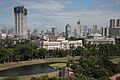
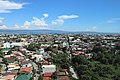
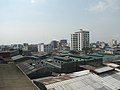

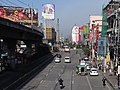

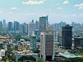

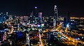
| show Authority control |
|---|
- Quezon City
- Former national capitals
- Cities in Metro Manila
- 1939 establishments in the Philippines
- Populated places established in 1939
- Planned cities in the Philippines
- Populated places on the Marikina River
- Highly urbanized cities in the Philippines