Commonwealth Avenue, Quezon City
 R-7 | |
|---|---|
| Don Mariano Marcos Avenue Killer Highway[1] | |
 Map of Commonwealth Avenue in Metro Manila | |
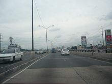
 Commonwealth Avenue southbound near University of the Philippines Diliman | |
| Route information | |
| Length | 12.712 km (7.899 mi) |
| Existed | 1960s–present |
| Component highways | |
| Major junctions | |
| South end | |
| |
| North end | |
| Location | |
| Major cities | Quezon City |
| Highway system | |
| |
Commonwealth Avenue, formerly known as Don Mariano Marcos Avenue,[a] is a 12.4-kilometer (7.7 mi) highway located in Quezon City, Philippines, which spans from six to eighteen lanes and is the widest in the Philippines.[3] It is one of the major roads in Metro Manila and is designated as part of Radial Road 7 (R-7) of the older Manila arterial road system and National Route 170 (N170) of the Philippine highway network.
Commonwealth Avenue starts from the Quezon Memorial Circle inside the Elliptical Road, and it passes through the areas of Philcoa, Tandang Sora, Balara, Batasan Hills and ends at Quirino Highway in the Novaliches area.
The avenue, being located on Quezon City, which is listed as one of several cities in Metro Manila with high incidence of road accidents, has a high rate of accidents, especially related to overspeeding, and has gained the nickname "Killer Highway".[1] A 60-kilometer-per-hour (37 mph) speed limit is being enforced to reduce the high rate of accidents on the avenue.[4]
Route description[]
Commonwealth Avenue follows a curving route from Elliptical Road to Quirino Highway, which includes the section named Fairview Avenue. The main segment, south of the roundabout with Doña Carmen Street, is characterized by partial control of access, where at-grade intersections are replaced with interchanges and U-turn slots, and pedestrian crossings placed on overpasses (or footbridges). The segment has 18 lanes, with 9 lanes per direction, excluding lanes allocated for buses and jeepneys. Fairview Avenue has 6 to 8 lanes, with 3 to 4 lanes per direction, but intersections are mostly at-grade, usually with traffic lights.
Being located in Quezon City, which has a high number of road accidents, Commonwealth Avenue has a high incidence of accidents along with Quezon Avenue.[5] The number of accidents in the avenue have lend its known nickname, the "Killer Highway".[6]
MRT Line 7[]
The Mass Rapid Transit Line 7 (MRT 7), which will connect with the Metro Rail Transit Line 3 at North Avenue Common Station, began construction in 2016.[7] Most of the alignment of the MRT 7 will follow the Center island of Commonwealth Avenue up to Regalado Highway.
History[]
Commonwealth Avenue is divided into two portions, the six-to eight-lane Fairview Avenue and the eighteen-lane Don Mariano Marcos Avenue. Don Mariano Marcos Avenue, named after Mariano Marcos, the father of President Ferdinand Marcos, was constructed in the late-1960s as a two-lane highway to offer a route towards the Batasang Pambansa Complex. Quezon City was then the capital of the Philippines and embassies were to be put up on the stretch of highway. Because the country's capital was moved back to Manila in 1976, other establishments were put up instead. Don Mariano Marcos Avenue was later extended from the Elliptical Road to Calle España (now known as España Boulevard). Don Mariano Marcos Avenue was later renamed into two parts, Commonwealth Avenue and Quezon Avenue. Later, Commonwealth Avenue regained the eight-lane Fairview Avenue, which ends in the Jordan Plains Subdivision in Novaliches.
In the 1980s, the road was widened into a six-lane highway. During the late 1990s and early 2000s, the avenue was prone to heavy traffic and accidents due to the increase in number of public transportation vehicles plying the highway, and sidewalk vendors crowding onto the road. In the late 2000s, the Metropolitan Manila Development Authority (MMDA) cleared the sidewalk vendors, especially in the Tandang Sora area, which was prone to heavy rush hour traffic. Fairview Avenue uses stoplights and center island splittings at its intersections, while Don Mariano Marcos Avenue uses interchanges at its intersections.
The avenue is 18 lanes at its widest, and is the widest road in the Philippines, beating the old record set by EDSA.[3]
Linking to Quirino Highway[]
On October 1, 2009, Quezon City Mayor Feliciano Belmonte Jr. announced his 15-year-old plan to link Commonwealth Avenue and Quirino Highway at the cost of ₱20 million to ₱140 million, which would be adjacent to the Zabarte Road.[8] The project was completed in May 2011 and is already operational.[when?]
Speed limit implementation[]
From May 2011, a 60-kilometer-per-hour (37 mph) speed limit is enforced on Commonwealth Avenue, following the death of Lourdes Estella-Simbulan, a journalist, on a road accident in the avenue. In the first week of the speed limit implementation, 120 violators were apprehended after speeds of over 60 kilometers per hour (37 mph) were recorded through speed guns.[9]
Intersections[]
The entire route will be located in Quezon City. The list includes the section of the avenue named "Fairview Avenue". Kilometers are measured from Rizal Park, the Kilometer Zero.
| km[10][11] | mi | Destinations | Notes | ||
|---|---|---|---|---|---|
| 12.491 | 7.762 | Roundabout. Continues to Manila as | |||
| Masaya Street | Accessible from southbound lanes via U-turn slot. Access to U.P. Village, Teachers Village and Kalayaan Avenue. | ||||
| 12.879– 13.051 | 8.003– 8.110 | Accessible from southbound lanes via U-turn slot. Access to University of the Philippines Diliman. | |||
| Central Avenue | Accessible from northbound lanes via U-turn slot. Access to New Era University and Iglesia Ni Cristo Central Temple | ||||
| Tandang Sora Avenue | Right turns only. Flyover closed due to MRT Line 7 construction. | ||||
| Zuzuarregui Street | Southern segment has access to Broadcast City | ||||
| Holy Spirit Street, Capitol Homes Drive | Holy Spirit Street intersection accessible from northbound lanes via U-turn slot. Capitol Homes Drive intersection accessible from southbound lanes via U-turn slot. Access to Ever Gotesco Commonwealth. | ||||
| IBP Road | Accessible from southbound lanes via U-turn slot. Access to Batasang Pambansa on both ends. Access to Payatas Road and the municipality of Rodriguez (Montalban) at the northern end. | ||||
| 20.382– 20.682 | 12.665– 12.851 | Doña Carmen Street | Roundabout. Access to Don Jose Heights. Name change from Commonwealth Avenue to Fairview Avenue. Change from 18-lane road to 6-lane road. | ||
| 22.041 | 13.696 | Regalado Avenue | Traffic light intersection | ||
| 23.242 | 14.442 | Regalado Highway | Traffic light intersection. No left turns from southbound lanes. Access to SM City Fairview. | ||
| Mindanao Avenue | Traffic light intersection | ||||
| 25.203 | 15.660 | Northern terminus. | |||
1.000 mi = 1.609 km; 1.000 km = 0.621 mi
| |||||
Notes[]
- ^ Named after the father of President Ferdinand Marcos, Mariano Marcos.[2]
References[]
- ^ a b Cayabyab, Marc Jayson (February 21, 2020). "C-5 Metro Manila's deadliest road – MMDA". The Philippine Star. Retrieved January 27, 2021.
Commonwealth Avenue in Quezon city, tagged as "killer highway," came in second with 23 fatal road crashes, up from 10 deaths in 2018 and 17 in 2017.
- ^ "Should Commonwealth be renamed Eraño Manalo Ave?".
- ^ a b Rey, Aika (December 23, 2015). "5 iconic roads in the Philippines". Rappler. Retrieved January 27, 2021.
- ^ "MMDA Expands Coverage of 60-kph Speed Limit on Commonwealth Avenue". Metropolitan Manila Development Authority. February 26, 2013. Retrieved January 27, 2021.
- ^ "QC, Manila, Makati record most road crashes - MMDA". Rappler. February 7, 2017. Retrieved May 16, 2017.
- ^ Abelgas, Gus (December 20, 2010). "Commonwealth Avenue a 'killer highway': police". ABS-CBN News. Retrieved May 16, 2017.
- ^ "Construction of the MRT Line 7 begins". Official Gazette. Government of the Republic of the Philippines. April 20, 2016.
- ^ Manila Bulletin Online
- ^ "Task group apprehends 120 speedsters in 6 days". Philippine Daily Inquirer. May 23, 2011. Retrieved May 16, 2017.
- ^ "Quezon City 1st". 2016 DPWH Road Data. Department of Public Works and Highways. Archived from the original on November 30, 2017. Retrieved May 16, 2017.
- ^ "Quezon City 2nd". 2016 DPWH Road Data. Department of Public Works and Highways. Archived from the original on December 2, 2017. Retrieved May 16, 2017.
External links[]
| Wikimedia Commons has media related to Commonwealth Avenue (Quezon City). |
Coordinates: 14°39′22″N 121°3′22″E / 14.65611°N 121.05611°E

- Streets in Quezon City