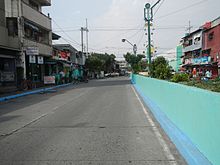
Zobel Roxas Street
 The street along the San Andres–Makati boundary | |||
| Namesake |
| ||
|---|---|---|---|
| Type | Tertiary road (northeast of Arellano Avenue)[1] | ||
| Maintained by | Department of Public Works and Highways - South Manila District Engineering Office[1] | ||
| Length | 2.2 km (1.4 mi) | ||
| West end | Tramo Street along the Malate–Pasay boundary | ||
| Major junctions |
| ||
| East end | Tejeron Street and J.P. Rizal Avenue along the San Andres–Santa Ana–Makati boundary | ||
Zobel Roxas Street is an east-west street that forms the southeastern limit of the City of Manila, the northwestern city limit of Makati, and the northern city limit of Pasay, all in Metro Manila, Philippines. It stretches across western Metro Manila from Tramo Street in the Singalong area of Malate to Tejeron Street at the district boundary of San Andres Bukid and Santa Ana. It has a short extension northeast of the Tejeron Street–J.P. Rizal Avenue junction as Del Pan Street.
Zobel Roxas and other streets in the area (e.g., Alfonso, Consuelo, Enrique, Fernando, Jacobo, Don Pedro, C. Ayala and T. Ayala Streets) were named after members of the Róxas de Ayala and Zóbel de Ayala families, whose company, Ayala y Compañía, developed portions of Singalong and San Andres into residential areas in the 1930s.[2] These areas formed part of the vast Hacienda San Pedro de Macati which José Bonifacio Róxas purchased in 1851 and later developed into commercial and residential areas.
Zobel Roxas was historically known as Casal Street.[3]
Landmarks[]
- Francisco Benitez Elementary School
- La Paz Elementary School
- Puregold Makati
- Rafael Palma Elementary School
References[]
- ^ a b "South Manila". Department of Public Works and Highways. Retrieved November 2, 2020.
- ^ "Ayala Land Group of Companies". RealEstateCagayan.com. Retrieved October 28, 2013.
- ^ Manila, Philippines map (Map). American Red Cross Service Bureau. August 1945. Retrieved April 25, 2021.
Coordinates: 14°34′5″N 121°0′19″E / 14.56806°N 121.00528°E

- Streets in Manila
- San Andres, Manila
- Santa Ana, Manila
- Malate, Manila
- Zobel de Ayala family