Macapagal Boulevard
This article relies largely or entirely on a single source. (December 2020) |
| President Diosdado Macapagal Boulevard Macapagal Avenue | |
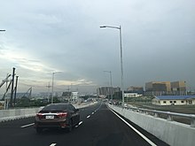
 Macapagal Boulevard near Entertainment City | |
| Namesake | Diosdado Macapagal |
|---|---|
| Type | Tertiary road[1] |
| Maintained by | Philippine Reclamation Authority[a] |
| Length | 22.3 km (13.9 mi) |
| Location | Pasay and Parañaque |
| North end | Jose Diokno Boulevard in CCP Complex, Pasay |
| Major junctions | Epifanio de los Santos Avenue Bradco Drive Asean Avenue (Solaire Boulevard) NAIA Expressway Seaside Drive |
| South end | Pacific Avenue in Asia World City, Don Galo, Parañaque |
Macapagal Boulevard, also known as President Diosdado Macapagal Boulevard and Macapagal Avenue,[2] is a modern eight-lane road in Metro Manila, Philippines, running parallel to Roxas Boulevard from the Cultural Center of the Philippines Complex in Pasay to Asia World City in Parañaque. It was named after former President Diosdado Macapagal. This road has three major bridges, crossing the 'channels', of which the largest is the Libertad Channel, where the Libertad Water Pumping Station is situated. Thanks to intersection reconfiguring around EDSA to relieve traffic, Macapagal Boulevard is now often used to access the SM Mall of Asia to the north and Cavite to the south. It is also the main major road in Metro Manila's reclamation area called Bay City.
History[]
Macapagal Boulevard construction started in 1984 and ended in 1998,[citation needed] the year after Diosdado Macapagal's death in 1997.
Route description[]
Macapagal Boulevard commences at the intersection with Jose Diokno Boulevard, an extension of Gil Puyat Avenue in the Cultural Center of the Philippines Complex in Pasay, where World Trade Center Metro Manila is located. It heads south across Financial Center consisting of the Philippine National Bank headquarters and the Government Service Insurance System complex, which houses the Philippine Senate. South of the Libertad channel, the boulevard enters Metropolitan Park and the SM Central Business Park, intersecting with Epifanio de los Santos Avenue (EDSA) before entering the Aseana City development, home of the Department of Foreign Affairs–Office of Consular Affairs Building and Ayala Malls Manila Bay. At Asean Avenue, Macapagal traverses the Entertainment City gaming complex with Solaire Resort & Casino and City of Dreams Manila (formerly Belle Grande Manila) dominating this stretch up to Seaside Boulevard, an extension of NAIA Road. Near the Seaside Boulevard junction are the NAIA Expressway ramps that provide access to the Ninoy Aquino International Airport and connect it to the Metro Manila Skyway. The Manila Southwest Integrated Bus Terminal is housed within the Uniwide Coastal Mall grounds at Seaside Boulevard, while the Parañaque Integrated Terminal Exchange is located few meters south. Macapagal's current southern terminus is Pacific Avenue in Marina Baytown East village in Parañaque, where most traffic turns left towards the Manila–Cavite Expressway.
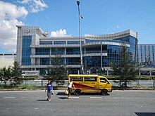
Landmarks[]
- Ayala Malls Manila Bay
- Blue Bay Walk
- City of Dreams Manila
- Dampa Seafood Market
- Department of Foreign Affairs–Office of Consular Affairs Building
- DoubleDragon Plaza
- HK Sun Plaza
- Hobbies of Asia
- Icon Hotel
- Manila Tytana Colleges
- Marina Bay Village
- Met Live Mall
- Philippine National Bank Financial Center
- Sentosia Condominiums
- Solaire Resort & Casino
- Uniwide Coastal Mall
- W Mall
- World Trade Center Metro Manila
Notes[]
References[]
- ^ "South Manila". Department of Public Works and Highways. Retrieved November 7, 2020.
- ^ Jump up to: a b "PRA, DPWH COMPLETE ROAD REPAIR WORKS IN PARAÑAQUE CITY" (PDF). Philippine Reclamation Authority. January 29, 2021. Retrieved May 14, 2021.
Coordinates: 14°31′44″N 120°59′23″E / 14.52889°N 120.98972°E

| Wikimedia Commons has media related to Macapagal Boulevard. |
| show Major roads in Metro Manila |
|---|

This article about a location in Metropolitan Manila (NCR) is a stub. You can help Wikipedia by . |
This article about transportation in Philippines is a stub. You can help Wikipedia by . |
- Streets in Metro Manila
- Metro Manila geography stubs
- Philippines transportation stubs