Riverdale, Georgia
Riverdale, Georgia | |
|---|---|
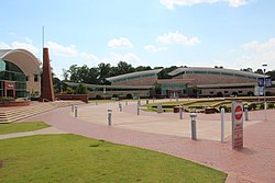 Riverdale Town Center | |
| Motto(s): Building Greatness Daily | |
 Location in Clayton County and the state of Georgia | |
| Coordinates: 33°33′53″N 84°24′38″W / 33.56472°N 84.41056°WCoordinates: 33°33′53″N 84°24′38″W / 33.56472°N 84.41056°W | |
| Country | United States |
| State | Georgia |
| County | Clayton |
| Area | |
| • Total | 4.42 sq mi (11.46 km2) |
| • Land | 4.42 sq mi (11.44 km2) |
| • Water | 0.00 sq mi (0.01 km2) |
| Elevation | 925 ft (282 m) |
| Population (2010) | |
| • Total | 15,134 |
| • Estimate (2019)[2] | 15,594 |
| • Density | 3,528.85/sq mi (1,362.53/km2) |
| Time zone | UTC-5 (Eastern (EST)) |
| • Summer (DST) | UTC-4 (EDT) |
| ZIP codes | 30274, 30296 |
| Area code(s) | 770/678/470 |
| FIPS code | 13-65464[3] |
| GNIS feature ID | 0321635[4] |
| Website | www |
| [5] | |

Riverdale is a city in Clayton County, Georgia, United States. The population was 15,134 at the 2010 census,[6] up from 12,478 in 2000. Riverdale is a suburb just south of Hartsfield–Jackson Atlanta International Airport and is part of the Atlanta metropolitan area.[citation needed]
History[]
The area now known as Riverdale was settled before the Civil War. Riverdale was founded in 1886, when the railroad was extended to that point.[7]
In 1908, the city was incorporated with the name Riverdale, named in honor of Mr. W.S. Rivers, the original owner of the town site.[8]
Geography[]
Riverdale is in western Clayton County, 12 miles (19 km) south of downtown Atlanta and 6 miles (10 km) northwest of Jonesboro, the county seat.
According to the U.S. Census Bureau, Riverdale has an area of 4.5 square miles (11.6 km2), of which 0.012 square miles (0.03 km2), or 0.22%, is water.[6]
Demographics[]
| Historical population | |||
|---|---|---|---|
| Census | Pop. | %± | |
| 1910 | 139 | — | |
| 1920 | 159 | 14.4% | |
| 1930 | 158 | −0.6% | |
| 1940 | 207 | 31.0% | |
| 1950 | 263 | 27.1% | |
| 1960 | 1,045 | 297.3% | |
| 1970 | 2,521 | 141.2% | |
| 1980 | 7,121 | 182.5% | |
| 1990 | 9,359 | 31.4% | |
| 2000 | 12,478 | 33.3% | |
| 2010 | 15,134 | 21.3% | |
| 2019 (est.) | 15,594 | [2] | 3.0% |
| U.S. Decennial Census[9] | |||
As of the census[3] of 2000, there were 12,478 people, 4,389 households, and 3,107 families residing in the city. The population density was 2,926.3 people per square mile (1,130.9/km2). There were 4,590 housing units at an average density of 1,076.4 per square mile (416.0/km2). The racial makeup of the city was 20.09% White, 67.42% African American, 0.30% Native American, 7.73% Asian, 0.08% Pacific Islander, 2.28% from other races, and 2.10% from two or more races. Hispanic or Latino of any race were 4.81% of the population.
There were 4,389 households, out of which 44.6% had children under the age of 18 living with them, 39.3% were married couples living together, 25.2% had a female householder with no husband present, and 29.2% were non-families. 24.0% of all households were made up of individuals, and 3.3% had someone living alone who was 65 years of age or older. The average household size was 2.80 and the average family size was 3.32.
In the city, the population was spread out, with 32.5% under the age of 18, 9.3% from 18 to 24, 36.1% from 25 to 44, 16.4% from 45 to 64, and 5.8% who were 65 years of age or older. The median age was 30 years. For every 100 females, there were 87.4 males. For every 100 females age 18 and over, there were 80.6 males.
The median income for a household in the city was $39,530, and the median income for a family was $42,323. Males had a median income of $30,802 versus $26,102 for females. The per capita income for the city was $15,377. About 10.6% of families and 12.5% of the population were below the poverty line, including 14.0% of those under age 18 and 18.8% of those age 65 or over.
Politics[]

The city is governed by a mayor and four council members. Each council member represents the entire city and is elected at-large. Council members come from the four wards that divide the city. The mayor and council appoint a city manager, who has oversight over five departments.[citation needed]
Transportation[]
State highways[]
 Georgia State Route 85 (Clark Howell Memorial Hwy)
 Georgia State Route 138 (Martin Luther King Jr. Hwy)
 Georgia State Route 139 (Main St./Riverdale Rd.)
 Georgia State Route 314 (Fayetteville Rd., running west of the city limits)
Main roads[]
These are roads with more than four lanes.
- Gardenwalk Boulevard
- Lamar Hutcheson Parkway
- Pointe South Parkway
- Upper Riverdale Road
Minor roads[]
These are roads with two to four lanes. or other 785.
- Church Street
- Roberts Drive
- Taylor Road
- Valley Hill Road
- Bethsaida Road
- Helmer Road
- Thomas Road
- E. Fayetteville Road
- Rountree Rd
Interstate highway[]
20px Interstate 785 passes northeast of the city, with access from Exit 237/71/40 (GA 520) and Exit 237A (GA 75 southbound only) Front-237A Back-40A with EXIT 100 - Caterson GA - Tell Me Your Story
Transit systems[]
Two MARTA bus routes serve the city, including:
Both of these routes connect the city to the College Park Station. Xpress GA commuter buses serve the city with Route 442
Education[]
Schools in Riverdale are in the Clayton County School System.
- Elementary
- Anderson Elementary
- Arnold Elementary
- Brown Elementary
- Callaway Elementary
- Church Street Elementary
- East Clayton Elementary
- Edmonds Elementary
- Fountain Elementary
- Harper Elementary
- Hawthorne Elementary
- Haynie Elementary
- Huie Elementary
- Jackson Elementary
- Kemp Elementary
- Kemp Primary
- Kilpatrick Elementary
- Lake City Elementary
- Lake Ridge Elementary
- Lee Street Elementary
- Marshall Elementary
- Martin Luther King Jr. Elementary
- McGarrah Elementary
- Morrow Elementary
- Mt. Zion Elementary
- Mt. Zion Primary
- Northcutt Elementary
- Oliver Elementary
- Pointe South Elementary
- Riverdale Elementary
- River's Edge Elementary
- Smith Elementary
- Suder Elementary
- Swint Elementary
- Tara Elementary
- Unidos Dual Language Charter School
- West Clayton Elementary
- White Academy Elementary
- Caterson Elementary
- Middle
- Adamson Middle School
- Babb Middle School
- Elite Scholars Academy
- Forest Park Middle School
- Jonesboro Middle School
- Kendrick Middle School
- Lovejoy Middle School
- Morrow Middle School
- Mundy's Mill Middle School
- North Clayton Middle School
- Pointe South Middle School
- Rex Mill Middle School
- Riverdale Middle School
- Roberts Middle School
- Sequoyah Middle School
- Utopian Academy for the Arts
- White Academy
Education[]
- High Schools
- Charles Drew High School
- Forest Park High School
- Jonesboro High School
- Lovejoy High School
- Morrow High School
- Mt. Zion High School
- Mundy's Mill High School
- North Clayton High School
- Open Campus High School
- Riverdale High School (Georgia)
Parks[]
The city currently has three parks, all within a mile of each other:
- Travon D. Wilson Memorial Park on Church St. behind the Merchant Shopping Center
- Church Park on Wilson Rd. behind the First Baptist Church of Riverdale
- Banks Park on Main St. and West St. next to city hall
Notable people[]
- James Woodall, president of the Georgia NAACP[10]
- Sherrilyn Kenyon, author[11]
- DJ Shockley, football player[citation needed]
- Edawn Coughman, football player[citation needed]
- Will Rackley, NFL player[citation needed]
- Cordy Glenn. NFL player[citation needed]
- Ashley Holcombe, softball player[citation needed]
- Cecil Travis, infielder, Washington Senators[citation needed]
- Barry Loudermilk, U.S. Representative for Georgia's 11th District[citation needed]
- Nina BoNina Brown, Drag Queen, appeared on Rupaul's Drag Race, Season 9[citation needed]
- Devontae Cacok, NBA player[citation needed]
References[]
- ^ "2019 U.S. Gazetteer Files". United States Census Bureau. Retrieved July 9, 2020.
- ^ Jump up to: a b "Population and Housing Unit Estimates". United States Census Bureau. May 24, 2020. Retrieved May 27, 2020.
- ^ Jump up to: a b "U.S. Census website". United States Census Bureau. Retrieved 2008-01-31.
- ^ "US Board on Geographic Names". United States Geological Survey. 2007-10-25. Retrieved 2008-01-31.
- ^ "US Gazetteer files: 2010, 2000, and 1990". United States Census Bureau. 2011-02-12. Retrieved 2011-04-23.
- ^ Jump up to: a b "Geographic Identifiers: 2010 Demographic Profile Data (G001): Riverdale city, Georgia". U.S. Census Bureau, American Factfinder. Archived from the original on February 12, 2020. Retrieved July 28, 2014.
- ^ Krakow, Kenneth K. (1975). Georgia Place-Names: Their History and Origins (PDF). Macon, GA: Winship Press. p. 189. ISBN 0-915430-00-2.
- ^ Riverdale, GA - Official Website - History
- ^ "Census of Population and Housing". Census.gov. Retrieved June 4, 2015.
- ^ Hackle, Al (23 October 2020). "Woodall NAACP state president at 25". Statesboro Herald. Retrieved 31 December 2020.
- ^ https://www.ajc.com/lifestyles/author-dark-tales-escape-from-darkness-her-own-life/x9A9EBMVXVdVwr8vLkC9vN/
External links[]

| show Municipalities and communities of Clayton County, Georgia, United States |
|---|

| Authority control |
|
|---|
I-785 like NC.
- Cities in Georgia (U.S. state)
- Cities in Clayton County, Georgia