Walton County, Georgia
Walton County | |
|---|---|
U.S. county | |
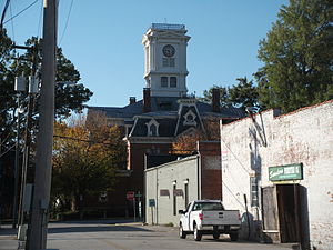 Walton County courthouse in Monroe | |
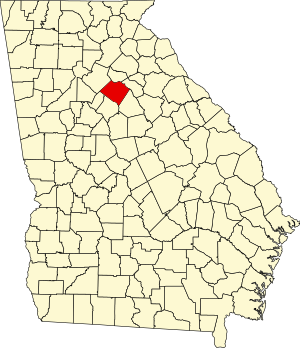 Location within the U.S. state of Georgia | |
 Georgia's location within the U.S. | |
| Coordinates: 33°47′N 83°44′W / 33.78°N 83.74°W | |
| Country | |
| State | |
| Founded | December 22, 1818 |
| Named for | George Walton |
| Seat | Monroe |
| Largest city | Monroe |
| Area | |
| • Total | 330 sq mi (900 km2) |
| • Land | 326 sq mi (840 km2) |
| • Water | 4.3 sq mi (11 km2) 1.3%% |
| Population | |
| • Estimate (2018) | 93,503 |
| • Density | 257/sq mi (99/km2) |
| Time zone | UTC−5 (Eastern) |
| • Summer (DST) | UTC−4 (EDT) |
| Congressional district | 10th |
| Website | www |

Walton County is a county located in the north central portion of the U.S. state of Georgia. As of the 2010 census, the population was 83,768.[1] It is located about 30 miles east of the state capital, the city of Atlanta. Monroe is the county seat; Loganville is another major city.[2]
Walton County is part of the Atlanta-Sandy Springs-Roswell, GA Metropolitan Statistical Area.
History[]
This section may lend undue weight to lynchings in the county at the expense of all other history. Please help to create a more balanced presentation. Discuss and resolve this issue before removing this message. (March 2021) |
Walton County was created on December 15, 1818. It is named for George Walton, one of the three men from Georgia who signed the United States Declaration of Independence.[3] The other two were Button Gwinnett and Lyman Hall.
Developed by planters for cotton plantations in the antebellum era, the county depended on the labor of thousands of enslaved African Americans. After the Civil War and emancipation of the slaves, there was considerable violence as local whites attempted to maintain social dominance.
Particularly after Reconstruction, lynchings of blacks by whites, and other attacks helped them to re-establish white supremacy and maintain social control. The county had a total of nine documented lynchings of African Americans from 1880 to 1950. Although most lynchings in the South took place during the decades around the turn of the 20th century, when the states passed laws to disenfranchise most blacks by making voter registration more difficult, and to impose Jim Crow racial segregation, Walton County was the site of a notorious mass lynching of four African Americans in 1946, soon after World War II.[4]
A Supreme Court ruling in April 1946 had ruled that white primaries were unconstitutional, enabling some black citizens in Georgia to cast ballots for the first time during the primary race later that summer.[5] This increased social tensions in many areas, as whites continued to oppose voting by blacks. In addition, many whites resisted black veterans' efforts to gain expanded freedoms following their service during World War II.
Moore's Ford lynchings (1946)[]
In July 1946, the county was the site of one of the last mass lynchings of the pre-Civil Rights Era, when four African Americans, two young married couples, were murdered here. African American Roger Malcom had had an argument with a local white farmer, "ostensibly over a woman".[5] He and his pregnant wife, and her cousin and her husband, were beaten and lynched on July 25.
A historical highway marker erected by the state in the 21st century reads:
2.4 miles east, at Moore’s Ford Bridge on the Apalachee River, four African-Americans - George and Mae Murray Dorsey and Roger and Dorothy Dorsey Malcom (reportedly 7 months pregnant) - were brutally beaten and shot by an unmasked mob on the afternoon of July 25, 1946. The lynching followed an argument between Roger Malcom and a local white farmer. These unsolved murders played a crucial role in both President Truman’s commitment to civil rights legislation and the ensuing modern civil rights movement.
The sign is at 33° 51.417′ N, 83° 36.733′ W. Marker is near Monroe, Georgia, in Walton County. This is at the intersection of U.S. 78 and Locklin Road, on the right when traveling east on U.S. 78.[6][7]
In 1998, local people arranged a biracial memorial service honoring the victims, which was held at Moore's Ford Bridge.[8][9] Since then a local interracial committee organized to rekindle attention to the case, in hopes of bringing justice to the victims. They also gained state support to erect the historical highway marker noted above to mark the unsolved murders and commemorate the victims.[5]
In the 21st century, commemoration has included an on-site reenactment, held annually since 2005 as part of the education effort.[5][10]
Fire in a Canebrake: The Last Mass Lynching in America (2003), by author Laura Wexler, is among the books to explore the case and social context, and related evidence, including reference to contemporary FBI reports in the investigation ordered under President Truman.[5][11][12]
In the early 21st century, the US Department of Justice reopened an investigation into the cold case, but they were unable to gain sufficient evidence to prosecute any survivors among the more than 50 suspects that FBI files from 1946 had suggested had been involved in the lynching.[5][13] A local multi-ethnic committee continues to press for the case to be reviewed again in hopes of bringing justice to the victims. In February 2014 they presented a video to the Walton Board of Commissioners about the case.[14]
Geography[]
According to the U.S. Census Bureau, the county has a total area of 330 square miles (850 km2), of which 326 square miles (840 km2) is land and 4.3 square miles (11 km2) (1.3%) is water.[15] The county is located in the Piedmont region of the state.
The western half of Walton County, in a half circle from Social Circle through Monroe to northeast of Loganville, is located in the Upper Ocmulgee River sub-basin of the Altamaha River basin. The eastern part of the county, east of that curve, is located in the Upper Oconee River sub-basin of the same Altamaha River basin.[16]
Adjacent counties[]
- Barrow County – north
- Oconee County – northeast
- Morgan County – southeast
- Newton County – south
- Rockdale County – southwest
- Gwinnett County – northwest
Transportation[]
Major highways[]
 Interstate 20
 U.S. Route 78
 U.S. Route 278
 State Route 10
 State Route 10 Business
 State Route 11
 State Route 12
 State Route 20
 State Route 81
 State Route 83
 State Route 138
 State Route 186
 State Route 402 (unsigned designation for I-20)
Walton County doesn't have any pedestrian trails. However, there are trails in neighboring Gwinnett and Rockdale county such as the Arabia Mountain Path, Conyers Trail and Cedar Creek Trail Loop.
Demographics[]
There was a noted decline in population from 1900 to 1960, as thousands of African Americans left the rural area in the Great Migration, moving to the North, Midwest and West Coast to escape social oppression and to gain better jobs and opportunities.
With dramatic new growth related to the rise of Atlanta as a corporate city, the demographics have changed and the county is majority white in the 21st century. The area has been developed for suburban housing and retail.
| Historical population | |||
|---|---|---|---|
| Census | Pop. | %± | |
| 1810 | 1,026 | — | |
| 1820 | 4,192 | 308.6% | |
| 1830 | 10,929 | 160.7% | |
| 1840 | 10,209 | −6.6% | |
| 1850 | 10,821 | 6.0% | |
| 1860 | 11,074 | 2.3% | |
| 1870 | 11,038 | −0.3% | |
| 1880 | 15,622 | 41.5% | |
| 1890 | 17,467 | 11.8% | |
| 1900 | 20,942 | 19.9% | |
| 1910 | 25,393 | 21.3% | |
| 1920 | 24,216 | −4.6% | |
| 1930 | 21,118 | −12.8% | |
| 1940 | 20,777 | −1.6% | |
| 1950 | 20,230 | −2.6% | |
| 1960 | 20,481 | 1.2% | |
| 1970 | 23,404 | 14.3% | |
| 1980 | 31,211 | 33.4% | |
| 1990 | 38,586 | 23.6% | |
| 2000 | 60,687 | 57.3% | |
| 2010 | 83,768 | 38.0% | |
| 2018 (est.) | 93,503 | [17] | 11.6% |
| U.S. Decennial Census[18] 1790-1960[19] 1900-1990[20] 1990-2000[21] 2010-2013[1] | |||
2000 census[]
As of the census[22] of 2000, there were 60,687 people, 21,307 households, and 17,002 families living in the county. The population density was 184 people per square mile (71/km2). There were 22,500 housing units at an average density of 68 per square mile (26/km2). The racial makeup of the county was 83.03% White, 14.42% Black or African American, 0.25% Native American, 0.70% Asian, 0.02% Pacific Islander, 0.64% from other races, and 0.95% from two or more races. 1.92% of the population were Hispanic or Latino of any race.
There were 21,307 households, out of which 39.20% had children under the age of 18 living with them, 62.70% were married couples living together, 12.80% had a female householder with no husband present, and 20.20% were non-families. 16.60% of all households were made up of individuals, and 6.20% had someone living alone who was 65 years of age or older. The average household size was 2.82 and the average family size was 3.16.
In the county, the population was spread out, with 28.40% under the age of 18, 8.10% from 18 to 24, 32.20% from 25 to 44, 21.70% from 45 to 64, and 9.60% who were 65 years of age or older. The median age was 34 years. For every 100 females, there were 94.90 males. For every 100 females age 18 and over, there were 93.00 males.
The median income for a household in the county was $46,479 and the median income for a family was $52,386. Males had a median income of $37,482 versus $25,840 for females. The per capita income for the county was $19,470. About 8.00% of families and 9.70% of the population were below the poverty line, including 12.30% of those under age 18 and 10.60% of those age 65 or over.
2010 census[]
As of the 2010 United States Census, there were 83,768 people, 29,583 households, and 22,921 families living in the county.[23] The population density was 257.2 inhabitants per square mile (99.3/km2). There were 32,435 housing units at an average density of 99.6 per square mile (38.5/km2).[24] The racial makeup of the county was 80.1% white, 15.6% black or African American, 1.1% Asian, 0.3% American Indian, 0.1% Pacific islander, 1.4% from other races, and 1.5% from two or more races. Those of Hispanic or Latino origin made up 3.2% of the population.[23] In terms of ancestry, 20.2% identified as American, 15.6% as African-American, 12.2% as Irish, 10.9% as English, and 8.9% as German.[25]
Of the 29,583 households, 40.7% had children under the age of 18 living with them, 58.5% were married couples living together, 13.9% had a female householder with no husband present, 22.5% were non-families, and 18.7% of all households were made up of individuals. The average household size was 2.81 and the average family size was 3.19. The median age was 37.4 years.[23]
The median income for a household in the county was $51,721 and the median income for a family was $58,750. Males had a median income of $45,669 versus $32,064 for females. The per capita income for the county was $22,521. About 10.5% of families and 12.5% of the population were below the poverty line, including 17.6% of those under age 18 and 9.1% of those age 65 or over.[26]
Government[]
Walton County has a 6-member commission elected from single-member districts. This legislative body can pass laws for the county and tax bills. The county chairman is elected at-large to serve as the leader. If a seat becomes vacant during the term, the governor can appoint someone to fill the seat, based on recommendations. In 2015, two of the six positions were filled by appointees.
Politics[]
Communities[]
Cities[]
Towns[]
Unincorporated communities[]
- Bold Springs
- Campton
- Gratis
- Mt. Vernon
- Pannell
- Windsor
- Youth
- Split Silk
See also[]
- National Register of Historic Places listings in Walton County, Georgia
- Hard Labor Creek Regional Reservoir
References[]
- Camp, Lynn Robinson, and Jennifer E. Cheek-Collins. Walton County, Georgia (Black America Series; Charleston, S.C., 2003) (ISBN 0-7385-1528-0).
- Sams, Anita B. Wayfarers in Walton: A History of Walton County, Georgia, 1818–1967 (Monroe, Ga., 1967).
- ^ Jump up to: a b "State & County QuickFacts". United States Census Bureau. Retrieved June 27, 2014.
- ^ "Find a County". National Association of Counties. Retrieved June 7, 2011.
- ^ Krakow, Kenneth K. (1975). Georgia Place-Names: Their History and Origins (PDF). Macon, GA: Winship Press. p. 245. ISBN 0-915430-00-2.
- ^ "Lynching in America, "Supplement: Lynchings by County," 2015, 3rd edition, Equal Justice Institute" (PDF). Archived from the original (PDF) on October 23, 2017. Retrieved March 30, 2018.
- ^ Jump up to: a b c d e f Chelsea Bailey, "Moore's Ford Massacre: Activists Reenact Racist Lynching as a Call for Justice", 02 August 2017; accessed 11 June 2018
- ^ "Moore's Ford Lynching Historical Marker". www.hmdb.org.
- ^ "Historical Marker Database Map". www.hmdb.org.
- ^ "Lynching in the South; Marking Murder". The Economist. February 21, 2015.
- ^ GeorgiaInfo - Moore's Ford Lynching GHS Historical Marker Archived November 14, 2007, at the Wayback Machine, Carl Vinson Institute of Government, Last accessed July 4, 2008.
- ^ Auslander, Mark. “Touching the Past: Materializing Time in Traumatic ‘Living History” Reenactments.” Signs and Society Vol. 1 (2013): 161-183
- ^ "Fire in a Canebrake: The Last Mass Lynching in America". amazon.com. Scribner. 2003.
- ^ Asim, Jabari (January 2003). "The Moore's Ford Incident". The Washington Post. washingtonpost.com. Retrieved September 3, 2019.
- ^ "New evidence collected in 1946 lynching case - CNN.com". www.cnn.com.
- ^ Joeff Davis, "New information to be presented in unsolved Georgia lynching case", Creative Loafing (Atlanta), 1 March 2014
- ^ "US Gazetteer files: 2010, 2000, and 1990". United States Census Bureau. February 12, 2011. Retrieved April 23, 2011.
- ^ "Georgia Soil and Water Conservation Commission Interactive Mapping Experience". Georgia Soil and Water Conservation Commission. Retrieved November 18, 2015.
- ^ "Population and Housing Unit Estimates". Retrieved July 31, 2019.
- ^ "U.S. Decennial Census". United States Census Bureau. Retrieved June 27, 2014.
- ^ "Historical Census Browser". University of Virginia Library. Retrieved June 27, 2014.
- ^ "Population of Counties by Decennial Census: 1900 to 1990". United States Census Bureau. Retrieved June 27, 2014.
- ^ "Census 2000 PHC-T-4. Ranking Tables for Counties: 1990 and 2000" (PDF). United States Census Bureau. Retrieved June 27, 2014.
- ^ "U.S. Census website". United States Census Bureau. Retrieved January 31, 2008.
- ^ Jump up to: a b c "DP-1 Profile of General Population and Housing Characteristics: 2010 Demographic Profile Data". United States Census Bureau. Archived from the original on February 13, 2020. Retrieved December 30, 2015.
- ^ "Population, Housing Units, Area, and Density: 2010 - County". United States Census Bureau. Archived from the original on February 13, 2020. Retrieved December 30, 2015.
- ^ "DP02 SELECTED SOCIAL CHARACTERISTICS IN THE UNITED STATES – 2006-2010 American Community Survey 5-Year Estimates". United States Census Bureau. Archived from the original on February 13, 2020. Retrieved December 30, 2015.
- ^ "DP03 SELECTED ECONOMIC CHARACTERISTICS – 2006-2010 American Community Survey 5-Year Estimates". United States Census Bureau. Archived from the original on February 13, 2020. Retrieved December 30, 2015.
- ^ Leip, David. "Dave Leip's Atlas of U.S. Presidential Elections". uselectionatlas.org. Retrieved March 22, 2018.
External links[]
- Georgia.gov on Walton County
- https://web.archive.org/web/20070704131617/http://www.negrdc.org/counties/walton/default.asp
- "Holding on to Those Who Can't be Held": Reenacting a Lynching at Moore's Ford, Georgia" Southern Spaces, November 8, 2010.
| show Places adjacent to Walton County, Georgia |
|---|
| show Municipalities and communities of Walton County, Georgia, United States |
|---|


| show Authority control |
|---|
- Georgia (U.S. state) counties
- Walton County, Georgia
- 1818 establishments in Georgia (U.S. state)
- Populated places established in 1818
- Counties in the Atlanta metropolitan area