Park name
County or counties
Size
Location
Water body(s)
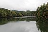
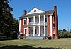
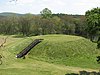
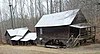
Image
acres
ha
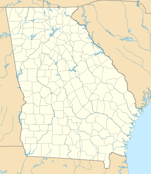
A.H. Stephens State Park Taliaferro 1,177
476
33°33′44.16″N 82°53′44.56″W / 33.5622667°N 82.8957111°W / 33.5622667; -82.8957111 Alexander Stevens State Park Lake
Amicalola Falls State Park & Lodge Dawson 829
335
34°34′34.11″N 84°14′10.5″W / 34.5761417°N 84.236250°W / 34.5761417; -84.236250 Amicalola Falls
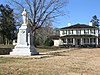
Black Rock Mountain State Park Rabun 1,743
705
34°54′34″N 83°24′55″W / 34.90944°N 83.41528°W / 34.90944; -83.41528 Black Rock Lake
[3] Coweta 2,910
1,180
33°25′58.05″N 84°59′10.13″W / 33.4327917°N 84.9861472°W / 33.4327917; -84.9861472 Chattahoochee River
Cloudland Canyon State Park Dade 3,488
1,412
34°48′57.96″N 85°29′21.12″W / 34.8161000°N 85.4892000°W / 34.8161000; -85.4892000 Hemlock Falls
Crooked River State Park Camden 500
200
30°50′35″N 81°33′29″W / 30.84306°N 81.55806°W / 30.84306; -81.55806 Intracoastal Waterway
[1] Hall 1,316
533
34°23′5.44″N 83°44′35.68″W / 34.3848444°N 83.7432444°W / 34.3848444; -83.7432444 Lake Lanier
Elijah Clark State Park Lincoln 447
181
33°51′16.2″N 82°25′10.54″W / 33.854500°N 82.4195944°W / 33.854500; -82.4195944 Clarks Hill Lake
F. D. Roosevelt State Park Harris , Meriwether 9,049
3,662
32°49′55″N 84°48′29″W / 32.83194°N 84.80806°W / 32.83194; -84.80806
Florence Marina State Park Stewart 173
70
32°5′26.88″N 85°2′35.99″W / 32.0908000°N 85.0433306°W / 32.0908000; -85.0433306 Walter F. George Lake
Fort McAllister State Park Bryan 1,725
698
31°53′28″N 81°11′46″W / 31.89111°N 81.19611°W / 31.89111; -81.19611 Ogeechee River & Atlantic Ocean
Fort Mountain State Park Murray 3,712
1,502
34°45′39.3″N 84°42′25.8″W / 34.760917°N 84.707167°W / 34.760917; -84.707167 Fort Mountain Lake
Fort Yargo State Park Barrow 1,816
735
33°58′10.64″N 83°43′46.6″W / 33.9696222°N 83.729611°W / 33.9696222; -83.729611 Fort Yargo Lake
General Coffee State Park Coffee 1,511
611
31°31′26.4″N 82°46′1.2″W / 31.524000°N 82.767000°W / 31.524000; -82.767000
George L. Smith State Park Emanuel 1,634
661
32°33′43.2″N 82°6′46.8″W / 32.562000°N 82.113000°W / 32.562000; -82.113000 Parish Pond
George T. Bagby State Park Clay 700
280
31°39′57.6″N 85°3′25.2″W / 31.666000°N 85.057000°W / 31.666000; -85.057000 Walter F. George Lake
Georgia Veterans State Park Crisp 1,308
529
31°57′23″N 83°54′58″W / 31.95639°N 83.91611°W / 31.95639; -83.91611 Lake Blackshear
Gordonia-Alatamaha State Park Tattnall 662
268
32°5′31.51″N 82°8′9.61″W / 32.0920861°N 82.1360028°W / 32.0920861; -82.1360028 Altamaha River
Hamburg State Park Warren 741
300
33°12′28.37″N 82°47′20.05″W / 33.2078806°N 82.7889028°W / 33.2078806; -82.7889028 Hamburg Mill Pond
Hard Labor Creek State Park Morgan 5,804
2,349
33°39′49.88″N 83°36′22.15″W / 33.6638556°N 83.6061528°W / 33.6638556; -83.6061528 Hard Labor Creek
Hart State Outdoor Recreation Area Hart 147
59
34°22′35.16″N 82°54′38.4″W / 34.3764333°N 82.910667°W / 34.3764333; -82.910667 Lake Hartwell
High Falls State Park Monroe 1,050
420
33°10′44.31″N 84°1′10.73″W / 33.1789750°N 84.0196472°W / 33.1789750; -84.0196472 Towaliga River
Indian Springs State Park Butts 528
214
33°14′38″N 83°55′52″W / 33.24389°N 83.93111°W / 33.24389; -83.93111 Sandy Creek
James H. Floyd State Park Chattooga 561
227
34°26′13.83″N 85°20′22.47″W / 34.4371750°N 85.3395750°W / 34.4371750; -85.3395750 Sloppy Floyd Lake
Kolomoki Mounds State Park Early 1,293
523
31°28′17.28″N 84°55′45.72″W / 31.4714667°N 84.9293667°W / 31.4714667; -84.9293667 Yahola & Kolomoki Lakes
Laura S. Walker State Park Ware 626
253
31°8′10.67″N 82°12′36.3″W / 31.1362972°N 82.210083°W / 31.1362972; -82.210083 Laura S. Walker Lake
Little Ocmulgee State Park & Lodge Telfair 1,360
550
32°5′32.17″N 82°53′49.11″W / 32.0922694°N 82.8969750°W / 32.0922694; -82.8969750 Little Ocmulgee Lake
Magnolia Springs State Park Jenkins 1,070
430
32°53′12″N 81°57′20″W / 32.88667°N 81.95556°W / 32.88667; -81.95556 Magnolia Springs State Park Lake
Mistletoe State Park Columbia 1,920
780
33°38′37.56″N 82°23′2.7″W / 33.6437667°N 82.384083°W / 33.6437667; -82.384083 Clarks Hill Lake
Moccasin Creek State Park Rabun 32
13
34°49′36.84″N 83°33′18.36″W / 34.8269000°N 83.5551000°W / 34.8269000; -83.5551000 Lake Burton
Panola Mountain State Park Henry 1,635
662
33°38′7″N 84°10′13″W / 33.63528°N 84.17028°W / 33.63528; -84.17028 Alexander Lake & South River
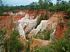
Providence Canyon State Outdoor Recreation Area Stewart 1,003
406
32°3′47.44″N 84°55′11.58″W / 32.0631778°N 84.9198833°W / 32.0631778; -84.9198833
Red Top Mountain State Park Bartow 1,776
719
34°9′5.4″N 84°42′55.8″W / 34.151500°N 84.715500°W / 34.151500; -84.715500 Lake Allatoona
Reed Bingham State Park Colquitt 1,613
653
31°10′14.49″N 83°33′16.98″W / 31.1706917°N 83.5547167°W / 31.1706917; -83.5547167 Reed Bingham Lake
Richard B. Russell State Park Elbert 2,508
1,015
34°10′41.09″N 82°45′40.89″W / 34.1780806°N 82.7613583°W / 34.1780806; -82.7613583 Russell Lake
Seminole State Park Seminole 604
244
30°48′18.61″N 84°52′44.2″W / 30.8051694°N 84.878944°W / 30.8051694; -84.878944 Lake Seminole
Skidaway Island State Park Chatham 588
238
31°56′13.41″N 81°3′7.98″W / 31.9370583°N 81.0522167°W / 31.9370583; -81.0522167 Intracoastal Waterway
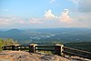
Smithgall Woods State Park White 5,664
2,292
34°41′30.57″N 83°46′4.71″W / 34.6918250°N 83.7679750°W / 34.6918250; -83.7679750 Dukes Creek
Stephen C. Foster State Park Charlton 80
32
30°49′35.86″N 82°22′45.9″W / 30.8266278°N 82.379417°W / 30.8266278; -82.379417 Suwannee River
Sweetwater Creek State Park Douglas 2,549
1,032
33°45′30″N 84°38′10″W / 33.75833°N 84.63611°W / 33.75833; -84.63611 Sweetwater Creek
Tallulah Gorge State Park Rabun , Habersham 2,739
1,108
34°43′30″N 83°22′13″W / 34.72500°N 83.37028°W / 34.72500; -83.37028 Tallulah River
Tugaloo State Park Franklin 393
159
34°29′41.37″N 83°4′4.54″W / 34.4948250°N 83.0679278°W / 34.4948250; -83.0679278 Lake Hartwell
Unicoi State Park & Lodge White 1,050
420
34°43′22.92″N 83°43′20.28″W / 34.7230333°N 83.7223000°W / 34.7230333; -83.7223000 Unicoi Lake
Victoria Bryant State Park Franklin 502
203
34°18′4.23″N 83°9′35.52″W / 34.3011750°N 83.1598667°W / 34.3011750; -83.1598667 North Fork of the Broad River
Vogel State Park Union 233
94
34°45′46″N 83°55′40″W / 34.76278°N 83.92778°W / 34.76278; -83.92778 Lake Trahlyta
Watson Mill Bridge State Park Madison 1,118
452
34°1′34″N 83°4′23″W / 34.02611°N 83.07306°W / 34.02611; -83.07306 South Fork of the Broad River