Union City, Georgia
Union City, Georgia | |
|---|---|
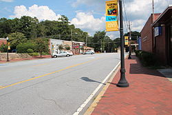 Downtown Union City | |
 Location in Fulton County and the state of Georgia | |
 Union City, Georgia Location in the United States | |
| Coordinates: 33°34′42″N 84°32′36″W / 33.57833°N 84.54333°WCoordinates: 33°34′42″N 84°32′36″W / 33.57833°N 84.54333°W | |
| Country | United States |
| State | Georgia |
| County | Fulton |
| Government | |
| • Mayor | Vince Williams |
| Area | |
| • Total | 19.83 sq mi (51.37 km2) |
| • Land | 19.66 sq mi (50.93 km2) |
| • Water | 0.17 sq mi (0.44 km2) |
| Elevation | 968 ft (295 m) |
| Population (2010) | |
| • Total | 19,456 |
| • Estimate (2019)[4] | 22,399 |
| • Density | 1,139.14/sq mi (439.83/km2) |
| Time zone | UTC-5 (Eastern (EST)) |
| • Summer (DST) | UTC-4 (EDT) |
| ZIP code | 30291 |
| Area code(s) | 770 |
| FIPS code | 13-78324[2] |
| GNIS feature ID | 0333305[3] |
| Website | Union City, GA |

Union City is a city in Fulton County, Georgia, United States. The population was 19,456 at the 2010 census.[5]
History[]
The Georgia General Assembly incorporated Union City in 1908.[6] One source claims that the town was named for the union of rails at a railroad junction,[7] while another version states the name commemorates a "Farmer's Union" which once was headquartered here.[6]
Geography[]
Union City is located at 33°34′42″N 84°32′36″W / 33.57833°N 84.54333°W (33.578470, -84.543354).[8]
According to the United States Census Bureau, the city has a total area of 19.3 square miles (50.0 km2), of which 19.1 square miles (49.5 km2) is land and 0.2 square miles (0.5 km2), or 0.83%, is water.
Demographics[]
| Historical population | |||
|---|---|---|---|
| Census | Pop. | %± | |
| 1910 | 534 | — | |
| 1920 | 620 | 16.1% | |
| 1930 | 776 | 25.2% | |
| 1940 | 884 | 13.9% | |
| 1950 | 1,490 | 68.6% | |
| 1960 | 2,118 | 42.1% | |
| 1970 | 3,031 | 43.1% | |
| 1980 | 4,780 | 57.7% | |
| 1990 | 8,375 | 75.2% | |
| 2000 | 11,621 | 38.8% | |
| 2010 | 19,456 | 67.4% | |
| 2019 (est.) | 22,399 | [4] | 15.1% |
| U.S. Decennial Census[9] | |||
At the 2010 census, there were 19,456 people living in the city. The racial makeup of the city was 81.5% Black, 8.6% White, 0.2% Native American, 0.8% Asian, 0.0% Pacific Islander, 0.3% from some other race and 1.6% from two or more races. 7.0% were Hispanic or Latino of any race.
At the 2000 census there were 11,622 people, 4,974 households, and 2,750 families living in the city. The population density was 1,353.2 people per square mile (522.3/km2). There were 5,332 housing units at an average density of 620.9 per square mile (239.7/km2). The racial makeup of the city was 69.33% African American, 25.36% White, 0.26% Native American, 1.26% Asian, 0.03% Pacific Islander, 2.04% from other races, and 1.72% from two or more races. Hispanic or Latino of any race were 5.22%.[2]
Of the 4,974 households 30.7% had children under the age of 18 living with them, 26.4% were married couples living together, 23.6% had a female householder with no husband present, and 44.7% were non-families. 38.5% of households were one person and 15.5% were one person aged 65 or older. The average household size was 2.29 and the average family size was 3.05.
The age distribution was 27.2% under the age of 18, 9.0% from 18 to 24, 33.6% from 25 to 44, 16.7% from 45 to 64, and 13.5% 65 or older. The median age was 32 years. For every 100 females, there were 79.1 males. For every 100 females age 18 and over, there were 71.3 males.
The median household income was $35,322 and the median family income was $39,697. Males had a median income of $30,421 versus $28,111 for females. The per capita income for the city was $17,208. About 9.9% of families and 12.1% of the population were below the poverty line, including 14.0% of those under age 18 and 14.3% of those age 65 or over.
Education[]
Elementary schools[]
- C.H. Gullatt Elementary
- Liberty Point Elementary
- Oakley Elementary School
Middle schools[]
- Bear Creek Middle (serves students in Palmetto and Fairburn)
- Camp Creek Middle School
High School[]
- Creekside High School (serves students in Palmetto and Fairburn)
- Langston Hughes High School
- Benjamin E. Banneker High School
Charter schools[]
- Hapeville Charter Career Academy
Colleges and universities[]
- Adams International University
- Georgia Military College
References[]
- ^ "2019 U.S. Gazetteer Files". United States Census Bureau. Retrieved July 9, 2020.
- ^ Jump up to: a b "U.S. Census website". United States Census Bureau. Retrieved 2008-01-31.
- ^ "US Board on Geographic Names". United States Geological Survey. 2007-10-25. Retrieved 2008-01-31.
- ^ Jump up to: a b "Population and Housing Unit Estimates". United States Census Bureau. May 24, 2020. Retrieved May 27, 2020.
- ^ "Race, Hispanic or Latino, Age, and Housing Occupancy: 2010 Census Redistricting Data (Public Law 94-171) Summary File (QT-PL), Union City city, Georgia". United States Census Bureau. Retrieved October 28, 2011.
- ^ Jump up to: a b "Union City". GeorgiaGov. Retrieved 24 June 2019.
- ^ Krakow, Kenneth K. (1975). Georgia Place-Names: Their History and Origins (PDF). Macon, GA: Winship Press. p. 237. ISBN 0-915430-00-2.
- ^ "US Gazetteer files: 2010, 2000, and 1990". United States Census Bureau. 2011-02-12. Retrieved 2011-04-23.
- ^ "Census of Population and Housing". Census.gov. Retrieved June 4, 2015.
External links[]
- Official website
- Shadnor Baptist Church historical marker
| show Municipalities and communities of Fulton County, Georgia, United States |
|---|


| show Authority control |
|---|
- Cities in Georgia (U.S. state)
- Cities in Fulton County, Georgia