Romanija
| Romanija | |
|---|---|
| Романија | |
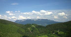
 Landscape in the Romanija mountain | |
| Highest point | |
| Elevation | 1,652 m (5,420 ft) |
| Coordinates | 43°51′36″N 18°40′12″E / 43.86000°N 18.67000°E |
| Geography | |
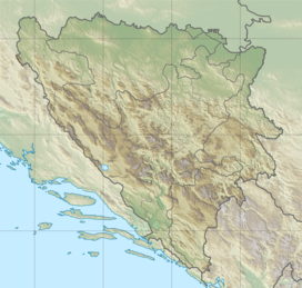
 Romanija Location of Romanija | |
| Location | Republika Srpska, Bosnia and Herzegovina |
| Parent range | Dinaric Alps |
Romanija (Serbian Cyrillic: Романија) is a mountain, karst plateau, and geographical region in eastern Bosnia and Herzegovina, including numerous villages and towns, such as Pale, Sokolac, Rogatica and Han Pijesak. Its highest point is Veliki Lupoglav (1,652 m).[citation needed]
A football club from the neighbouring town of Pale bears its name, FK Romanija.
History[]

The region is north of Sarajevo and local features include the "Romanija Mountains" and "Romanija Planina".
The name comes from the "Romanized" populations called Vlachs (modern-day Romanians), who have used the mountains for pasturage since the Middle Ages.[1]
Only at the end of the 19th century were assimilated the last of these romanised Vlachs, who are connected and related to the population of Serbia's Stari Vlah (meaning: 'historical Vlach') region.
The area is famous for the local music, which was originally created by the Vlach shepherds.[2] Its geographical extent lies within Republika Srpska. Its highest point is Veliki Lupoglav (1,652 m).
Administratively the region was part of the Republika Srpska's region called: [3] (formerly SAO Romanija).[4]
See also[]
References[]
| Wikimedia Commons has media related to Romanija. |
- Regions of Republika Srpska
- Mountains of Republika Srpska
- Romanija plateau
- Mountains of Bosnia and Herzegovina
- Bosnia and Herzegovina stubs

