Saint-Augustin-de-Woburn
Saint-Augustin-de-Woburn | |
|---|---|
Parish municipality | |
 | |
 Location within Le Granit RCM | |
 Saint-Augustin-de-Woburn Location in southern Quebec | |
| Coordinates: 45°23′N 70°51′W / 45.38°N 70.85°WCoordinates: 45°23′N 70°51′W / 45.38°N 70.85°W[1] | |
| Country | |
| Province | |
| Region | Estrie |
| RCM | Le Granit |
| Constituted | January 13, 1900 |
| Government | |
| • Mayor | Steve Charrier |
| • Federal riding | Mégantic—L'Érable |
| • Prov. riding | Mégantic |
| Area | |
| • Total | 284.10 km2 (109.69 sq mi) |
| • Land | 280.63 km2 (108.35 sq mi) |
| Population | |
| • Total | 695 |
| • Density | 2.5/km2 (6/sq mi) |
| • Pop 2006-2011 | |
| • Dwellings | 328 |
| Time zone | UTC−5 (EST) |
| • Summer (DST) | UTC−4 (EDT) |
| Postal code(s) | G0Y 1R0 |
| Area code(s) | 819 |
| Highways | |

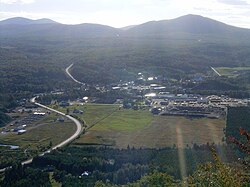
Saint-Augustin-de-Woburn, known locally as Woburn, is a parish municipality in Le Granit Regional County Municipality in the Estrie region of Quebec, Canada. The population is 695 as of the Canada 2011 Census. A parish municipality is the territory of a parish established as a municipality.
Settlement began around 1880.[4]
It is 5km from Canada–United States border and the Coburn Gore-Woburn Border Crossing. Mount Gosford lies entirely within the parish, making Woburn one of the highest towns in Quebec, at an altitude of 1,193 metres (3,914 ft).
References[]
- ^ Reference number 55699 of the Commission de toponymie du Québec (in French)
- ^ Jump up to: a b Geographic code 30005 in the official Répertoire des municipalités (in French)
- ^ Jump up to: a b "(Code 2430005) Census Profile". 2011 census. Statistics Canada. 2012.
- ^ "Saint-Augustin-de-Woburn". MRC du Granit. Retrieved 1 June 2020.
See also[]
Types of municipalities in Quebec
External links[]
 Media related to Saint-Augustin-de-Woburn at Wikimedia Commons
| show Places adjacent to Saint-Augustin-de-Woburn |
|---|
| show |
|---|
| Authority control |
|
|---|
Categories:
- Parish municipalities in Quebec
- Incorporated places in Estrie
- Le Granit Regional County Municipality