Saint-François-Xavier (Paris Métro)
Saint-François-Xavier | |||||||||||
|---|---|---|---|---|---|---|---|---|---|---|---|
| Paris Métro station | |||||||||||
 | |||||||||||
| Location | 7th arrondissement of Paris Île-de-France France | ||||||||||
| Coordinates | 48°51′07″N 2°18′52″E / 48.851951°N 2.314475°ECoordinates: 48°51′07″N 2°18′52″E / 48.851951°N 2.314475°E | ||||||||||
| Owned by | RATP | ||||||||||
| Operated by | RATP | ||||||||||
| Other information | |||||||||||
| Fare zone | 1 | ||||||||||
| History | |||||||||||
| Opened | 30 December 1923 | ||||||||||
| Services | |||||||||||
| |||||||||||
| Location | |||||||||||
 Saint-François-Xavier Location within Paris | |||||||||||

Saint-François-Xavier (French pronunciation: [sɛ̃ fʁɑ̃swa ɡzavje]) is a station on line 13 of the Paris Métro in the 7th arrondissement.
The station was opened on 20 December 1923 as part of the original section of line 10 between Invalides and Croix Rouge (a station east of Sèvres - Babylone, which was closed during World War II). On 27 July 1937 the section of line 10 between Invalides and Duroc was transferred to become the first section of old line 14, which was connected under the Seine and incorporated into line 13 on 9 November 1976. It is named after the church of Saint-François-Xavier, dedicated to Saint Francis Xavier (1506–1562), co-founder of the Society of Jesus.
Station layout[]
| G | Street Level | Exit/Entrance |
| B1 | Mezzanine | Fare control |
| B2 | Side platform, doors will open on the right | |
| Northbound | ← | |
| Southbound | | |
| Side platform, doors will open on the right | ||
Gallery[]
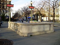
Street-level entrance at Saint-François-Xavier
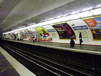
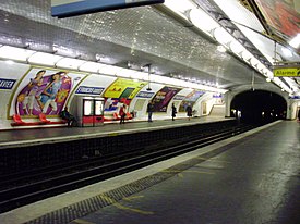
Line 13 platforms at Saint-François-Xavier


| Wikimedia Commons has media related to Saint-François-Xavier (Paris Metro). |
References[]
- Roland, Gérard (2003). Stations de métro. D’Abbesses à Wagram. Éditions Bonneton.
| Stations |
| ||||||
|---|---|---|---|---|---|---|---|
- Paris Métro line 13
- Paris Métro stations in the 7th arrondissement of Paris
- Railway stations in France opened in 1923
- Paris Métro stubs