Saint-Quentin-du-Dropt
Saint-Quentin-du-Dropt | |
|---|---|
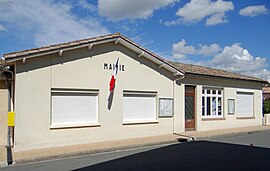 The town hall in Saint-Quentin-du-Dropt | |
show Location of Saint-Quentin-du-Dropt | |
 Saint-Quentin-du-Dropt | |
| Coordinates: 44°41′07″N 0°36′03″E / 44.6853°N 0.6008°ECoordinates: 44°41′07″N 0°36′03″E / 44.6853°N 0.6008°E | |
| Country | France |
| Region | Nouvelle-Aquitaine |
| Department | Lot-et-Garonne |
| Arrondissement | Villeneuve-sur-Lot |
| Canton | Le Val du Dropt |
| Government | |
| • Mayor (2020–2026) | Frédéric Perletti[1] |
| Area 1 | 11.9 km2 (4.6 sq mi) |
| Population (Jan. 2018)[2] | 196 |
| • Density | 16/km2 (43/sq mi) |
| Time zone | UTC+01:00 (CET) |
| • Summer (DST) | UTC+02:00 (CEST) |
| INSEE/Postal code | 47272 /47330 |
| Elevation | 61–127 m (200–417 ft) (avg. 120 m or 390 ft) |
| 1 French Land Register data, which excludes lakes, ponds, glaciers > 1 km2 (0.386 sq mi or 247 acres) and river estuaries. | |


Saint-Quentin-du-Dropt (French pronunciation: [sɛ̃ kɑ̃tɛ̃ dy dʁo], literally Saint-Quentin of Dropt; Languedocien: Sent Quentin de Dròt) is a commune in the Lot-et-Garonne department in south-western France.
See also[]
References[]
- ^ Maires au 17-06-2020, data.gouv.fr, accessed 1 December 2020
- ^ "Populations légales 2018". INSEE. 28 December 2020.
| Wikimedia Commons has media related to Saint-Quentin-du-Dropt. |
This Lot-et-Garonne geographical article is a stub. You can help Wikipedia by . |
Categories:
- Communes of Lot-et-Garonne
- Lot-et-Garonne geography stubs