Sainte-Marie, Cantal
show This article may be expanded with text translated from the corresponding article in French. (December 2008) Click [show] for important translation instructions. |
Sainte-Marie | |
|---|---|
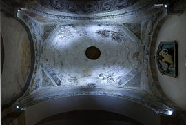 The interior of the dome of the church of Sainte-Agathe | |
show Location of Sainte-Marie | |
 Sainte-Marie | |
| Coordinates: 44°52′42″N 2°53′10″E / 44.8783°N 2.8861°ECoordinates: 44°52′42″N 2°53′10″E / 44.8783°N 2.8861°E | |
| Country | France |
| Region | Auvergne-Rhône-Alpes |
| Department | Cantal |
| Arrondissement | Saint-Flour |
| Canton | Saint-Flour-2 |
| Intercommunality | Saint-Flour Communauté |
| Government | |
| • Mayor (2020–2026) | Pierre-Jean Seguis |
| Area 1 | 17.87 km2 (6.90 sq mi) |
| Population (Jan. 2018)[1] | 107 |
| • Density | 6.0/km2 (16/sq mi) |
| Time zone | UTC+01:00 (CET) |
| • Summer (DST) | UTC+02:00 (CEST) |
| INSEE/Postal code | 15198 /15230 |
| Elevation | 620–1,055 m (2,034–3,461 ft) (avg. 840 m or 2,760 ft) |
| 1 French Land Register data, which excludes lakes, ponds, glaciers > 1 km2 (0.386 sq mi or 247 acres) and river estuaries. | |


Sainte-Marie (French pronunciation: [sɛ̃t maʁi] (![]() listen); Auvergnat: Senta Mària) is a commune in the Cantal department in south-central France.
listen); Auvergnat: Senta Mària) is a commune in the Cantal department in south-central France.
Population[]
| Year | Pop. | ±% |
|---|---|---|
| 1962 | 156 | — |
| 1968 | 185 | +18.6% |
| 1975 | 152 | −17.8% |
| 1982 | 133 | −12.5% |
| 1990 | 125 | −6.0% |
| 1999 | 107 | −14.4% |
| 2008 | 112 | +4.7% |
| 2016 | 110 | −1.8% |
See also[]
References[]
- ^ "Populations légales 2018". INSEE. 28 December 2020.
| Wikimedia Commons has media related to Sainte-Marie (Cantal). |
This Cantal geographical article is a stub. You can help Wikipedia by . |
Categories:
- Communes of Cantal
- Cantal geography stubs