Sambreville
Sambreville
Sambveye (Walloon) | |
|---|---|
 Auvelais | |
 Flag  Coat of arms | |
 Sambreville Location in Belgium
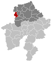
show Location of Sambreville in Namur Province | |
| Coordinates: 50°27′N 04°36′E / 50.450°N 4.600°ECoordinates: 50°27′N 04°36′E / 50.450°N 4.600°E | |
| Country | Belgium |
| Community | French Community |
| Region | |
| Province | Namur |
| Arrondissement | Namur |
| Government | |
| • Mayor | .[1] Denis Lisélélé (acting mayor)[2] |
| • Governing party/ies | PS |
| Area | |
| • Total | 34.20 km2 (13.20 sq mi) |
| Population (2018-01-01)[3] | |
| • Total | 28,211 |
| • Density | 820/km2 (2,100/sq mi) |
| Postal codes | 5060 |
| Area codes | 071 |
| Website | www.sambreville.be |

Sambreville (French pronunciation: [sɑ̃bʁəvil]; Walloon: Sambveye) is a municipality of Wallonia located in the province of Namur, Belgium.
On January 1, 2006, Sambreville had a total population of 26,949. The total area is 34.20 km2 (13.20 sq mi) which gives a population density of 788 inhabitants per square kilometre (2,040/sq mi).
Villages and towns[]
The municipality was created in 1977, as part of the post-1974 fusion of the Belgian municipalities, bringing together the ancienne communes (now towns and villages) of:
Tamines is associated with the Rape of Belgium during World War I. At least 384 townspeople were massacred, including women and children.
Twin towns[]
 Gessopalena, Italy
See also[]
References[]
- ^ "Luperto stapt op als parlementsvoorzitter maar ontkent openbare zedenschennis". vandaag.be (in Dutch).
- ^ "Philippe Courard en Denis Lisélélé nemen activiteiten Luperto over". HLN (in Dutch).
- ^ "Wettelijke Bevolking per gemeente op 1 januari 2018". Statbel. Retrieved 9 March 2019.
External links[]
 Media related to Sambreville at Wikimedia Commons
- Official website
| show Places adjacent to Sambreville |
|---|
| show Municipalities in the province of Namur, Wallonia |
|---|

| Authority control |
|
|---|
This Namur Province location article is a stub. You can help Wikipedia by . |
Categories:
- Municipalities of Namur (province)
- Namur geography stubs