Viroinval
Viroinval
Virwinvå (Walloon) | |
|---|---|
 | |
 Flag  Coat of arms | |
 Viroinval Location in Belgium
show Location of Viroinval in the province of Namur | |
| Coordinates: 50°05′N 04°33′E / 50.083°N 4.550°ECoordinates: 50°05′N 04°33′E / 50.083°N 4.550°E | |
| Country | Belgium |
| Community | French Community |
| Region | |
| Province | Namur |
| Arrondissement | Philippeville |
| Government | |
| • Mayor | Freddy Cabaraux (PS) |
| • Governing party/ies | PS, CDH |
| Area | |
| • Total | 120.90 km2 (46.68 sq mi) |
| Population (2018-01-01)[1] | |
| • Total | 5,731 |
| • Density | 47/km2 (120/sq mi) |
| Postal codes | 5670 |
| Area codes | 060 |
| Website | www.viroinval.be |


Viroinval (French pronunciation: [viʁwɛ̃val]; Walloon: Virwinvå) is a municipality of Wallonia located in the province of Namur, Belgium.
On January 1, 2006, Viroinval had a total population of 5,680. The total area is 120.90 km2 which gives a population density of 47 inhabitants per km2.
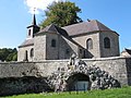
Villages in Viroinval[]
The name Viroinval, Viroin (River) Valley, was chosen for the municipality that was formed by fusing eight villages, in 1977: , , , Nismes, , , , Vierves-sur-Viroin.[2]
Dourbes

Nismes

Olloy-sur-Viroin

Treignes

Vierves-sur-Viroin


Attractions[]

Monument for the geographical centre of the EU until its May 2004 expansion
- From 1995 to 2004, Viroinval was the location of the geographical centre of the European Union, at coordinates 50°00′33″N 4°39′59″E / 50.00917°N 4.66639°E in Oignies-en-Thiérache, and a monument there records that finding. On May 1, 2004, the EU expanded from fifteen states to twenty-five, and the geographical centre of the union moved eastwards to the village of Kleinmaischeid, Rhineland-Palatinate, Germany. On 1 January 2007 it shifted even further south-eastwards.
- The tourist steam train line Mariembourg–Treignes has most of its stations in villages of Viroinval: Nismes, Olloy-sur-Viroin, Vierves-sur-Viroin, and Treignes.[3] The latter village has a relevant museum.[4]
References[]
- ^ "Wettelijke Bevolking per gemeente op 1 januari 2018". Statbel. Retrieved 9 March 2019.
- ^ "Viroinval" (in French). Viroinval municipality. Retrieved 2011-09-24.
- ^ "Trois Vallées – Chemin de fer touristique" (in French). Viroinval municipality. Retrieved 2011-09-24.
- ^ "Musée du Chemin de Fer à Vapeur des Trois Vallées" (in French). Viroinval municipality. Retrieved 2011-09-24.
External links[]
| Wikimedia Commons has media related to Viroinval. |
- Official Website of the municipality
- The former Centre of the European Union
- Awarded "EDEN - European Destinations of Excellence" non traditional tourist destination 2009
| show Places adjacent to Viroinval |
|---|
| show Municipalities in the province of Namur, Wallonia |
|---|

| show Authority control |
|---|
This Namur Province location article is a stub. You can help Wikipedia by . |
Categories:
- Municipalities of Namur (province)
- Namur geography stubs