Sombreffe
Sombreffe
Sombrefe (Walloon) | |
|---|---|
 | |
 Coat of arms | |
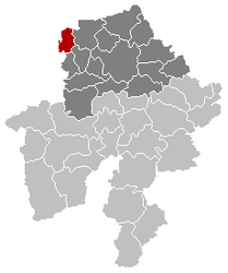
 Sombreffe Location in Belgium
show Location of Sombreffe in Namur Province | |
| Coordinates: 50°31′53″N 4°35′49″E / 50.53145°N 4.59700°ECoordinates: 50°31′53″N 4°35′49″E / 50.53145°N 4.59700°E | |
| Country | Belgium |
| Community | French Community |
| Region | |
| Province | Namur |
| Arrondissement | Namur |
| Government | |
| • Mayor | Philippe Leconte (MR -IC) |
| • Governing party/ies | MR-IC, PS, Ecolo |
| Area | |
| • Total | 35.78 km2 (13.81 sq mi) |
| Population (2018-01-01)[1] | |
| • Total | 8,420 |
| • Density | 240/km2 (610/sq mi) |
| Postal codes | 5140 |
| Area codes | 071 |
| Website | www.sombreffe.be |

Sombreffe (Walloon: Sombrefe; French pronunciation: [sɔ̃.bʁɛf]) is a municipality of Wallonia located in the province of Namur, Belgium.
On 1 January 2014 the municipality had 8,226 inhabitants.[2] The total area is 35.78 km², giving a population density of 230 inhabitants per km².
The municipality is composed of the following districts: Boignée, Ligny, Sombreffe and Tongrinne.

See also[]
References[]
- ^ "Wettelijke Bevolking per gemeente op 1 januari 2018". Statbel. Retrieved 9 March 2019.
- ^ http://statbel.fgov.be/fr/statistiques/webinterface/beSTAT_home/#4
External links[]
 Media related to Sombreffe at Wikimedia Commons
- Official website (in French)
| show Places adjacent to Sombreffe |
|---|
| show Municipalities in the province of Namur, Wallonia |
|---|

| Authority control |
|
|---|
This Namur Province location article is a stub. You can help Wikipedia by . |
Categories:
- Municipalities of Namur (province)
- Battle of Ligny locations
- Namur geography stubs