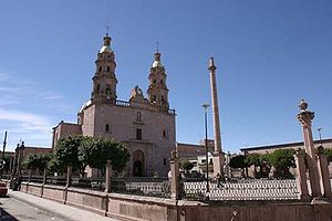
San Miguel el Alto
San Miguel el Alto, Jalisco México | |
|---|---|
Municipality and City | |
 | |
 Location of the municipality in Jalisco | |
 San Miguel el Alto, Jalisco México Location in Mexico | |
| Coordinates: 21°1′25″N 102°24′21″W / 21.02361°N 102.40583°WCoordinates: 21°1′25″N 102°24′21″W / 21.02361°N 102.40583°W | |
| Country | |
| State | Jalisco |
| Government | |
| • Presidente | Alonso Vazquez Jimenez |
| Area | |
| • Total | 580 km2 (220 sq mi) |
| Population (2015) | |
| • Total | 32,960 |
| Time zone | UTC-6 (Central Standard Time) |
| • Summer (DST) | UTC-5 (Central Daylight Time) |

San Miguel el Alto is a town and municipality, in Jalisco in central-western Mexico. The municipality covers an area of 580 km².
As of 2005, the municipality had a total population of 40,000.[1]
The municipality includes the town of San José de los Reynoso.
It was the setting and filming location for the 1957 film, Los chiflados del rock and roll, starring Luis Aguilar.
Fiestas[]
San Miguel is known for its beautiful patronal festival that lasts from 19 September to 29 September. The celebration is in honor of Saint Michael the Arch Angel. Many events like horse races, artist performance, fireworks, and the coronation of the fiesta queen take place.
Sister cities[]
 Big Spring, Texas, United States
References[]
- ^ "San Miguel El Alto". Enciclopedia de los Municipios de México. Instituto Nacional para el Federalismo y el Desarrollo Municipal. Retrieved 16 April 2009.
External links[]
| Wikimedia Commons has media related to San Miguel el Alto Municipality. |
- "La belleza eterna de San Miguel el Alto", Informador, retrieved 26 June 2017

| Authority control |
|
|---|
Categories:
- Municipalities of Jalisco
- Jalisco geography stubs