Saskatoon metropolitan area
Saskatoon metropolitan area | |
|---|---|
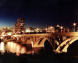 Downtown Saskatoon skyline | |
| Country | Canada |
| Province | Saskatchewan |
| Communities | List of communities |
| Area | |
| • Total | 5,890.71 km2 (2,274.42 sq mi) |
| Population (2019 Q4)[1] | |
| • Total | 325,806 |
| • Density | 50.1/km2 (130/sq mi) |
| Canadian CD rank: 17th | |
| Time zone | UTC-6 (CST) |
| Postal Code | S |
| Area code(s) | ,639 |
The Saskatoon region is the greater metropolitan area of Saskatoon, Saskatchewan. As of 2019 the city estimates the regions population to be 325,806 people.[1]
The area is served by the Saskatoon John G. Diefenbaker International Airport, the 22nd busiest airport in the country.
Unlike many major North American urbanized areas, yet similarly to other prairie centres in Canada, Saskatoon has absorbed numerous of its neighbouring communities in its history. In the past, when the city limits reached the borders of neighbouring municipalities, such as Sutherland and Nutana, they were simply annexed into Saskatoon's jurisdiction. The vast majority of the region's inhabitants reside within the City of Saskatoon, which now has a population in excess of 270,000.[2]
Saskatoon CMA[]
Census metropolitan area (CMA) is the term Statistics Canada uses to determine the demographics of greater Saskatoon (as well as other large Canadian cities). The Saskatoon CMA includes the City of Saskatoon, Rural Municipality of Corman Park No. 344, the cities of Martensville and Warman, and other smaller communities within the region.
According to Canada's 2016 census, the Saskatoon CMA has surpassed a quarter of a million people and is the 17th largest metropolitan area in the country with an estimated population of 295,095.[1] It is also the largest CMA in Saskatchewan and has a land area of 5,214 square kilometres (2,013 sq mi).
Demographics[]
| Ethnic groups in Metro Saskatoon (2016) Source: [1] |
Population | % | |
|---|---|---|---|
| Ethnic group | European | 208,575 | 72.2% |
| Aboriginal | 32,430 | 11.2% | |
| South Asian | 13,670 | 4.7% | |
| Filipino | 11,345 | 3.9% | |
| Chinese | 7,815 | 2.7% | |
| Black | 5,580 | 1.9% | |
| Arab | 2,345 | 0.8% | |
| Southeast Asian | 2,305 | 0.8% | |
| Latin American | 2,065 | 0.7% | |
| West Asian | 1,185 | 0.4% | |
| Korean | 585 | 0.2% | |
| Japanese | 420 | 0.1% | |
| Multiple minorities | 1,490 | 0.5% | |
| Visible minority, n.i.e. | 490 | 0.2% | |
| Total population | 295,095 | 100% | |
List of municipalities[]


| Municipality[3] | 2016 Population[4] | 2011 Population |
|---|---|---|
| Cities | ||
| Martensville | 9,645 | 7,716 |
| Saskatoon | 246,376 | 222,246 |
| Warman | 11,020 | 7,104 |
| Towns | ||
| Aberdeen | 622 | 599 |
| Allan | 644 | 648 |
| Asquith | 639 | 603 |
| Colonsay | 451 | 475 |
| Dalmeny | 1,826 | 1,702 |
| Delisle | 1,038 | 975 |
| Dundurn | 611 | 693 |
| Langham | 1,290 | 1,290 |
| Osler | 1,237 | 1,088 |
| Villages | ||
| Borden | 287 | 245 |
| Bradwell | 166 | 230 |
| Clavet | 410 | 386 |
| Meacham | 99 | 84 |
| Vanscoy | 462 | 377 |
| Resort villages | ||
| Shields | 288 | 220 |
| Thode | 148 | 157 |
| Rural municipalities | ||
| Aberdeen No. 373 | 1,379 | 1,016 |
| Blucher No. 343 | 2,006 | 1,876 |
| Colonsay No. 342 | 269 | 240 |
| Corman Park No. 344 | 8,568 | 8,277 |
| Dundurn No. 314 | 2,404 | 1,148 |
| Vanscoy No. 345 | 2,840 | 2,714 |
| Indian reserves | ||
| Whitecap | 451 | 351 |
References[]
- ^ a b c d Statistics Canada (2016). "Saskatoon, Saskatchewan (Census metropolitan area)". Retrieved February 18, 2016.
- ^ City Of Saskatoon. "City Of Saskatoon Quick Facts". Retrieved February 9, 2012.
- ^ Canada, Government of Canada, Statistics. "Geographic hierarchies, Census Profile, 2016 Census – Saskatoon [Census metropolitan area], Saskatchewan and Saskatchewan [Province]". www12.statcan.gc.ca. Retrieved February 18, 2017.
- ^ Statistics Canada. "Census Profile". Retrieved February 18, 2016.
External links[]
- Statistics Canada
- The City of Saskatoon
- Saskatoon Regional Economic Development Authority
- R.M. Of Corman Park
- City Of Martensville
Subdivisions of Saskatchewan | |
|---|---|
| Subdivisions | |
| Communities | |
| Cities | |
| Topics |
|
| |

- Metropolitan areas of Saskatchewan