Shaki, Armenia
Shaki
Շաքի | |
|---|---|
 | |
 Shaki | |
| Coordinates: 39°33′51″N 45°59′51″E / 39.56417°N 45.99750°ECoordinates: 39°33′51″N 45°59′51″E / 39.56417°N 45.99750°E | |
| Country | |
| Province | Syunik |
| Municipality | Sisian |
| Area | |
| • Total | 60.67 km2 (23.42 sq mi) |
| Population | |
| • Total | 1,197 |
| • Density | 20/km2 (51/sq mi) |
| Time zone | UTC+4 (AMT) |
| Shaki, Armenia at GEOnet Names Server | |

Shaki (Armenian: Շաքի) is a village in the Sisian Municipality of the Syunik Province in Armenia, located to the north of Sisian. The village's Holy Mother of God Church was opened in 2003. The Shaki Waterfall is located near the village.
Demographics[]
Population[]
The 2011 Armenia census reported its population was 1,197,[3] down from 1,390 at the 2001 census.[4]
Gallery[]
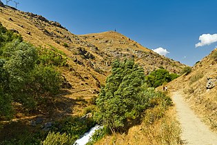
Scenery around Shaki river

Shaki waterfall

Scenery around Shaki river


References[]
- ^ "Syunik regional e-Governance System" (in Armenian). Syunik Province provincial government. Click on link entitled "Համայնքներ" (community) and search for the place by Armenian name.
- ^ Statistical Committee of Armenia. "The results of the 2011 Population Census of the Republic of Armenia" (PDF).
- ^ "Marzes of Armenia and Yerevan City in Figures, 2010" (PDF). Statistical Committee of Armenia.
- ^ Report of the results of the 2001 Armenian Census, Statistical Committee of Armenia

This article about a location in Syunik Province, Armenia is a stub. You can help Wikipedia by . |
Categories:
- Populated places in Syunik Province
- Syunik geography stubs