Slavětice
Slavětice | |
|---|---|
Municipality | |
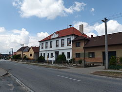 Former school in the village | |
 Slavětice | |
| Coordinates: 49°6′22″N 16°6′38″E / 49.10611°N 16.11056°ECoordinates: 49°6′22″N 16°6′38″E / 49.10611°N 16.11056°E | |
| Country | |
| Region | Vysočina |
| District | Třebíč |
| Area | |
| • Total | 9.49 km2 (3.66 sq mi) |
| Elevation | 384 m (1,260 ft) |
| Population (2006) | |
| • Total | 249 |
| • Density | 26/km2 (68/sq mi) |
| Postal code | 675 55 |
| Website | http://www.slavetice.eu |

Slavětice is a village and municipality (obec) in Třebíč District in the Vysočina Region of the Czech Republic.
The municipality covers an area of 9.49 square kilometres (3.66 sq mi), and has a population of 249 (as at 3 July 2006).
Slavětice lies approximately 22 kilometres (14 mi) south-east of Třebíč, 50 km (31 mi) south-east of Jihlava, and 164 km (102 mi) south-east of Prague.
References[]
| Wikimedia Commons has media related to Slavětice (Třebíč District). |
| Authority control: National libraries |
|---|
This Vysočina Region location article is a stub. You can help Wikipedia by . |
Categories:
- Villages in Třebíč District
- Vysočina Region geography stubs