Spring Park, Minnesota
Spring Park | |
|---|---|
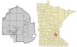 Location of Spring Park within Hennepin County, Minnesota | |
| Country | United States |
| State | Minnesota |
| County | Hennepin |
| Incorporated | 1951 |
| Government | |
| • Mayor | Jerome P. "Jerry" Rockvam |
| Area | |
| • Total | 0.60 sq mi (1.57 km2) |
| • Land | 0.35 sq mi (0.91 km2) |
| • Water | 0.25 sq mi (0.65 km2) |
| Population | |
| • Total | 1,669 |
| • Estimate (2019)[3] | 1,784 |
| • Density | 5,053.82/sq mi (1,951.02/km2) |
| Time zone | UTC-6 (Central (CST)) |
| • Summer (DST) | UTC-5 (CDT) |
| FIPS code | 27-62014 |
| Website | springpark |
Spring Park is a city on Lake Minnetonka in Hennepin County, Minnesota, United States. The population was 1,669 at the 2010 census.[4] It is located on Lake Minnetonka and has over 4 miles (6.4 km) of shoreline while being less than 0.5 square miles (1 km2) in area. It was incorporated in 1951 and at that time had a population of a little over 200.
Geography[]

According to the United States Census Bureau, the city has a total area of 0.62 square miles (1.61 km2), of which 0.36 square miles (0.93 km2) is land and 0.26 square miles (0.67 km2) is water.[5] County 15 and County 51 are two of the main routes.
Demographics[]
| Historical population | |||
|---|---|---|---|
| Census | Pop. | %± | |
| 1960 | 668 | — | |
| 1970 | 1,087 | 62.7% | |
| 1980 | 1,465 | 34.8% | |
| 1990 | 1,571 | 7.2% | |
| 2000 | 1,717 | 9.3% | |
| 2010 | 1,669 | −2.8% | |
| 2020 | 1,734 | 3.9% | |
| U.S. Decennial Census | |||
2010 census[]
As of the census[2] of 2010, there were 1,669 people, 897 households, and 314 families living in the city. The population density was 4,636.1 inhabitants per square mile (1,790.0/km2). There were 1,072 housing units at an average density of 2,977.8 per square mile (1,149.7/km2). The racial makeup of the city was 94.1% White, 2.0% African American, 0.1% Native American, 2.6% Asian, 0.2% from other races, and 1.0% from two or more races. Hispanic or Latino of any race were 1.4% of the population.
There were 897 households, of which 15.3% had children under the age of 18 living with them, 24.7% were married couples living together, 6.6% had a female householder with no husband present, 3.7% had a male householder with no wife present, and 65.0% were non-families. 55.0% of all households were made up of individuals, and 22.9% had someone living alone who was 65 years of age or older. The average household size was 1.67 and the average family size was 2.52.
The median age in the city was 49.2 years. 13.1% of residents were under the age of 18; 5.1% were between the ages of 18 and 24; 25.8% were from 25 to 44; 25.8% were from 45 to 64; and 30.1% were 65 years of age or older. The gender makeup of the city was 46.4% male and 53.6% female.
2000 census[]
As of the census[6] of 2000, there were 1,717 people, 930 households, and 321 families living in the city. The population density was 4,724.3 people per square mile (1,841.5/km2). There were 983 housing units at an average density of 2,704.7 per square mile (1,054.3/km2). The racial makeup of the city was 96.51% White, 1.40% African American, 0.35% Native American, 0.70% Asian, 0.23% from other races, and 0.82% from two or more races. Hispanic or Latino of any race were 0.82% of the population.
There were 930 households, out of which 11.3% had children under the age of 18 living with them, 26.3% were married couples living together, 4.6% had a female householder with no husband present, and 65.4% were non-families. 55.1% of all households were made up of individuals, and 22.5% had someone living alone who was 65 years of age or older. The average household size was 1.63 and the average family size was 2.43.
In the city, the population was spread out, with 9.3% under the age of 18, 8.3% from 18 to 24, 30.3% from 25 to 44, 20.2% from 45 to 64, and 31.9% who were 65 years of age or older. The median age was 47 years. For every 100 females, there were 87.9 males. For every 100 females age 18 and over, there were 85.0 males.
The median income for a household in the city was $36,071, and the median income for a family was $42,969. Males had a median income of $40,750 versus $33,750 for females. The per capita income for the city was $30,290. About 8.0% of families and 8.8% of the population were below the poverty line, including 17.9% of those under age 18 and 6.5% of those age 65 or over.
Economy[]
Tonka Toys was headquartered in Spring Park between 1946 and 1991.
References[]
- ^ "2019 U.S. Gazetteer Files". United States Census Bureau. Retrieved July 26, 2020.
- ^ Jump up to: a b "U.S. Census website". United States Census Bureau. Retrieved 2012-11-13.
- ^ "Population and Housing Unit Estimates". United States Census Bureau. May 24, 2020. Retrieved May 27, 2020.
- ^ "2010 Census Redistricting Data (Public Law 94-171) Summary File". American FactFinder. U.S. Census Bureau, 2010 Census. Retrieved 23 April 2011.[dead link]
- ^ "US Gazetteer files 2010". United States Census Bureau. Archived from the original on 2012-01-25. Retrieved 2012-11-13.
- ^ "U.S. Census website". United States Census Bureau. Retrieved 2008-01-31.
External links[]
| show Municipalities and communities of Hennepin County, Minnesota, United States |
|---|

| show Authority control |
|---|
Coordinates: 44°56′07″N 93°37′56″W / 44.93528°N 93.63222°W

- Cities in Hennepin County, Minnesota
- Cities in Minnesota
- Populated places established in 1951
- 1951 establishments in Minnesota