Starke, Florida
Starke, Florida | |
|---|---|
 From top, left to right: Bradford County Courthouse, Starke water tower, Old Bradford County Bank, Old Bradford County Courthouse, Florida Twin Theatre, Railroad tracks running through Call Street Historic District | |
 Location in Bradford County and the state of Florida | |
| Coordinates: 29°56′39″N 82°06′35″W / 29.94417°N 82.10972°WCoordinates: 29°56′39″N 82°06′35″W / 29.94417°N 82.10972°W | |
| Country | |
| State | |
| County | Bradford |
| Area | |
| • Total | 7.18 sq mi (18.59 km2) |
| • Land | 7.18 sq mi (18.59 km2) |
| • Water | 0.00 sq mi (0.00 km2) |
| Elevation | 167 ft (51 m) |
| Population (2010) | |
| • Total | 5,449 |
| • Estimate (2019)[4] | 5,422 |
| • Density | 755.36/sq mi (291.63/km2) |
| Time zone | UTC-5 (Eastern (EST)) |
| • Summer (DST) | UTC-4 (EDT) |
| ZIP code | 32091 |
| Area code(s) | 904 |
| FIPS code | 12-68525[3] |
| GNIS feature ID | 0291634[2] |
| Website | www |

Starke is a city in and the county seat of Bradford County, Florida, United States.[5] The population was 5,449 at the 2010 census.[6]
Starke may have been named in honor of developer George W. Cole's fiancée or in honor of Madison Starke Perry, fourth governor of Florida and a Confederate States Army colonel.[7] The Florida Department of State, Division of Historical Resources, adds that the city may have been named after "Thomas Starke, a slaveholder who once owned much land around the area."[8]
Geography[]
Starke is located in east-central Bradford County. U.S. Route 301 passes through the center of the city, leading north 26 miles (42 km) to Baldwin and Interstate 10 and southwest (via State Road 24) 25 miles (40 km) to Gainesville.
According to the United States Census Bureau, the city has a total area of 7.2 square miles (18.7 km2), all land.[6]
Starke is located approximately 8 miles (13 km) west of Florida's National Guard base, Camp Blanding, and is approximately 10 miles (16 km) southeast of Florida State Prison, Union Correctional Institution, and New River East Correctional Institution.
Climate[]
| hideClimate data for Starke, Florida, 1991-2020 normals | |||||||||||||
|---|---|---|---|---|---|---|---|---|---|---|---|---|---|
| Month | Jan | Feb | Mar | Apr | May | Jun | Jul | Aug | Sep | Oct | Nov | Dec | Year |
| Average high °F (°C) | 68.3 (20.2) |
71.1 (21.7) |
76.3 (24.6) |
81.9 (27.7) |
87.4 (30.8) |
91.8 (33.2) |
92.4 (33.6) |
92.0 (33.3) |
89.1 (31.7) |
83.0 (28.3) |
76.3 (24.6) |
70.9 (21.6) |
81.7 (27.6) |
| Daily mean °F (°C) | 56.8 (13.8) |
59.2 (15.1) |
64.2 (17.9) |
69.9 (21.1) |
76.5 (24.7) |
82.1 (27.8) |
83.3 (28.5) |
82.9 (28.3) |
80.2 (26.8) |
72.7 (22.6) |
64.5 (18.1) |
59.0 (15.0) |
70.9 (21.6) |
| Average low °F (°C) | 45.3 (7.4) |
47.4 (8.6) |
52.1 (11.2) |
58.0 (14.4) |
65.6 (18.7) |
72.5 (22.5) |
74.2 (23.4) |
73.7 (23.2) |
71.3 (21.8) |
62.4 (16.9) |
52.7 (11.5) |
47.1 (8.4) |
60.2 (15.7) |
| Average precipitation inches (mm) | 3.96 (101) |
3.02 (77) |
3.14 (80) |
2.60 (66) |
3.70 (94) |
8.17 (208) |
7.13 (181) |
6.42 (163) |
5.90 (150) |
4.34 (110) |
2.27 (58) |
2.70 (69) |
53.35 (1,355) |
| Average precipitation days (≥ 0.01 in) | 6.7 | 6.8 | 6.6 | 5.5 | 5.8 | 11.3 | 13.6 | 13.8 | 10.8 | 5.9 | 4.5 | 6.2 | 97.5 |
| Source: NOAA[9][10] | |||||||||||||
Demographics[]
| Historical population | |||
|---|---|---|---|
| Census | Pop. | %± | |
| 1880 | 292 | — | |
| 1890 | 669 | 129.1% | |
| 1900 | 972 | 45.3% | |
| 1910 | 1,135 | 16.8% | |
| 1920 | 1,023 | −9.9% | |
| 1930 | 1,339 | 30.9% | |
| 1940 | 1,480 | 10.5% | |
| 1950 | 2,944 | 98.9% | |
| 1960 | 4,806 | 63.2% | |
| 1970 | 4,848 | 0.9% | |
| 1980 | 5,306 | 9.4% | |
| 1990 | 5,226 | −1.5% | |
| 2000 | 5,593 | 7.0% | |
| 2010 | 5,449 | −2.6% | |
| 2019 (est.) | 5,422 | [4] | −0.5% |
| U.S. Decennial Census[11] | |||
As of the census[3] of 2000, there were 5,593 people, 2,003 households, and 1,350 families residing in the city. The population density was 839.3 people per square mile (324.2/km2). There were 2,273 housing units at an average density of 341.1 per square mile (131.8/km2). The racial makeup of the city was 67.05% White, 29.54% African American, 0.21% Native American, 1.25% Asian, 0.16% Pacific Islander, 0.64% from other races, and 1.14% from two or more races. Hispanic or Latino of any race were 2.23% of the population.
There were 2,003 households, out of which 32.7% had children under the age of 18 living with them, 43.3% were married couples living together, 20.0% had a female householder with no husband present, and 32.6% were non-families. 28.0% of all households were made up of individuals, and 13.6% had someone living alone who was 65 years of age or older. The average household size was 2.57 and the average family size was 3.14.
In the city, the population was spread out, with 26.7% under the age of 18, 9.7% from 18 to 24, 25.1% from 25 to 44, 20.3% from 45 to 64, and 18.1% who were 65 years of age or older. The median age was 36 years. For every 100 females, there were 86.2 males. For every 100 females age 18 and over, there were 81.1 males.
The median income for a household in the city was $27,021, and the median income for a family was $35,093. Males had a median income of $27,176 versus $17,986 for females. The per capita income for the city was $13,507. About 19.2% of families and 23.9% of the population were below the poverty line, including 34.9% of those under age 18 and 23.2% of those age 65 or over.
Education[]

Bradford County School District operates public schools.
- Bradford High School
- Bradford Middle School
- Starke Elementary School
- Southside Elementary School
North Florida Technical College (Bradford-Union Technical Center), a tertiary institution managed by the school district, is in Starke. Santa Fe Community College's Andrews Center campus is located in the historic Old Bradford County Courthouse. The Romanesque style brick courthouse, with its restored yet original clock tower was constructed in 1902 and added to the U.S. National Register of Historic Places on December 27, 1974. The courthouse lies within the Call Street Historic District and is considered the center of downtown Starke.
Bradford County Public Library is in Starke. It is a part of the New River Public Library Cooperative.[12]
Bradford Middle School

Starke Elementary School
Southside Elementary School

Bradford-Union Technical Center

Bradford County Public Library


Point of interest[]
The Starke post office contains a mural, Reforestation, painted in 1940 by Elizabeth Terell. Murals were produced from 1934 to 1943 in the United States through the Section of Painting and Sculpture, later called the Section of Fine Arts, of the Treasury Department. The WPA was the largest and most ambitious American New Deal agency, employing individuals to carry out public works projects.[13]
Film and television locations[]
Starke has been the location of several Hollywood films, including:
- G.I. Jane, which starred Demi Moore and was filmed east of Starke on the Camp Blanding Joint Training Center.[14]
- Joel Schumacher's film Tigerland, starring Colin Farrell was filmed at Camp Blanding.[15]
- Basic starring Samuel L. Jackson and John Travolta was filmed at Camp Blanding.[16]
- Why Do Fools Fall in Love starring Halle Berry and Vivica A. Fox.[16]
Starke has been the location of the following television series:
- The Fox Broadcasting Company's reality TV show Boot Camp.[17]
- The BBC's mini-series The State Within.
Musicals[]
The Great American Trailer Park Musical is set in Starke.
Notable people[]
- Judy Canova, film actress and entertainer, was born in Starke.
- Doyle Edward Conner Sr, Florida politician, was born in Starke.
- Charley Eugene Johns, 32nd Governor of Florida
Gallery[]
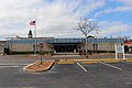
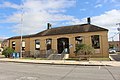
City Hall
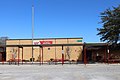
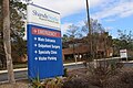
Starke Fire Department
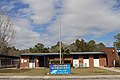
Shands Starke Regional Medical Center
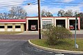
Post Office


References[]
- ^ "2019 U.S. Gazetteer Files". United States Census Bureau. Retrieved July 2, 2020.
- ^ Jump up to: a b U.S. Geological Survey Geographic Names Information System: Starke, Florida
- ^ Jump up to: a b "U.S. Census website". United States Census Bureau. Retrieved January 31, 2008.
- ^ Jump up to: a b "Population and Housing Unit Estimates". United States Census Bureau. May 24, 2020. Retrieved May 27, 2020.
- ^ "Find a County". National Association of Counties. Retrieved June 7, 2011.
- ^ Jump up to: a b "Geographic Identifiers: 2010 Demographic Profile Data (G001): Starke city, Florida". U.S. Census Bureau, American Factfinder. Archived from the original on February 12, 2020. Retrieved October 21, 2013.
- ^ The official web site of the City of Starke, Florida states: "George W. Cole, a land speculator and developer, attracted here by the prospects of growth following arrival of the railroad, obtained title to a 40-acre tract on both sides of the railroad for a reputed $100. This section of land is still known in legal description as 'The Original Town of Starke.'...One legend has it that the post office was given the name of Starke in honor of Mr. Cole's fiancée, whose family name was Starke. Another account has it that the town was named in honor of Madison Starke Perry, Governor of Florida from 1857 to 1861. No one actually knows which version of the naming is correct." "Archived copy". Archived from the original on December 4, 2011. Retrieved December 4, 2011.CS1 maint: archived copy as title (link)
- ^ http://www.flheritage.com/facts/reports/names/city3.cfm#S
- ^ "NOWData - NOAA Online Weather Data". National Oceanic and Atmospheric Administration. Retrieved June 24, 2021.
- ^ "Summary of Monthly Normals 1991-2020". National Oceanic and Atmospheric Administration. Retrieved June 24, 2021.
- ^ "Census of Population and Housing". Census.gov. Retrieved June 4, 2015.
- ^ Home. Bradford County Public Library. Retrieved on March 12, 2018. "Address: 456 W Pratt St, Starke, FL 32091"
- ^ Arnesen, Eric (2007). Encyclopedia of U.S. Labor and Working-Class History. 1. New York: Routledge. p. 1540. ISBN 9780415968263.
- ^ "G.I. Jane Filming Locations". IMDB, An Amazon Company. Retrieved March 21, 2014.
- ^ "Tigerland Filming Locations". IMDB, An Amazon Company. Retrieved March 21, 2014.
- ^ Jump up to: a b "FDOT Bradford County Freight & Logistics Overview" (PDF). Florida Department of Transportation. Retrieved March 21, 2014.
- ^ "Boot Camp Filming Locations". IMDB, An Amazon Company. Retrieved March 21, 2014.
External links[]
| show Municipalities and communities of Bradford County, Florida, United States |
|---|

| show Authority control |
|---|
- Cities in Bradford County, Florida
- County seats in Florida
- Cities in Florida