Swanton, Ohio
Swanton, Ohio | |
|---|---|
  Top: Aerial view Bottom: Downtown Swanton. | |
| Motto(s): "Honoring the past - Committed to the future!" | |
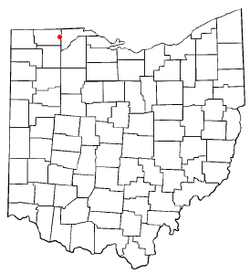 Location of Swanton, Ohio | |
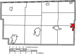 Location of Swanton in Fulton County | |
| Coordinates: 41°35′14″N 83°53′29″W / 41.58722°N 83.89139°WCoordinates: 41°35′14″N 83°53′29″W / 41.58722°N 83.89139°W | |
| Country | United States |
| State | Ohio |
| Counties | Fulton, Lucas |
| Townships | Fulton, Swan Creek, Swanton |
| Government | |
| • Mayor | Neil Toeppe[1] |
| Area | |
| • Total | 3.42 sq mi (8.85 km2) |
| • Land | 3.38 sq mi (8.75 km2) |
| • Water | 0.04 sq mi (0.10 km2) |
| Elevation | 682 ft (208 m) |
| Population | |
| • Total | 3,690 |
| • Estimate (2019)[6] | 3,858 |
| • Density | 1,142.43/sq mi (441.11/km2) |
| Time zone | UTC-5 (Eastern (EST)) |
| • Summer (DST) | UTC-4 (EDT) |
| ZIP code | 43558 |
| Area code(s) | 419 Exchanges: 826, 825 |
| FIPS code | 39-75896[5] |
| GNIS feature ID | 1061667[4] |
| Website | www |

Swanton is a town in Fulton and Lucas counties in the U.S. state of Ohio. The population was 3,690 at the 2010 census.
History[]

A post office called Swanton has been in operation since 1827.[7] The village takes its name from nearby Swan Creek.[8]
In the heyday of steam power, Swanton was home to the A. D. Baker Company, a manufacturer of steam powered traction engines and road contractors' equipment. It was at the Baker Company that an improved valve gear for steam engines was developed. A Baker employee named Gifford is credited with the initial idea, which was subsequently developed into the Baker valve gear and patented in 1903. Baker valve gear was eventually manufactured by The Pilliod Company, another Swanton business. Baker valve gear from Pilliod saw widespread use on U.S. steam locomotives for railroads in the first half of the 20th century.
On February 15, 1992, Air Transport International Flight 805 crashed in Swanton, killing all four people on board.[9]
On June 6, 2019, a vehicle left parked on the tracks next to the Main Street railroad crossing resulted in a derailment that knocked out power to the town and much of the surrounding area, and hampered traffic on one of the main rail lines linking the Midwest to the East Coast.[10]
Geography[]
Swanton is located at 41°35′14″N 83°53′29″W / 41.587194°N 83.891259°W (41.587194, -83.891259).[11]
According to the United States Census Bureau, the village has a total area of 3.13 square miles (8.11 km2), of which 3.09 square miles (8.00 km2) is land and 0.04 square miles (0.10 km2) is water.[12]
Demographics[]
| Historical population | |||
|---|---|---|---|
| Census | Pop. | %± | |
| 1880 | 335 | — | |
| 1890 | 508 | 51.6% | |
| 1900 | 887 | 74.6% | |
| 1910 | 1,058 | 19.3% | |
| 1920 | 1,248 | 18.0% | |
| 1930 | 1,505 | 20.6% | |
| 1940 | 1,594 | 5.9% | |
| 1950 | 1,740 | 9.2% | |
| 1960 | 2,306 | 32.5% | |
| 1970 | 2,927 | 26.9% | |
| 1980 | 3,424 | 17.0% | |
| 1990 | 3,557 | 3.9% | |
| 2000 | 3,307 | −7.0% | |
| 2010 | 3,690 | 11.6% | |
| 2019 (est.) | 3,858 | [6] | 4.6% |
| U.S. Decennial Census[13] | |||
2010 census[]
As of the census[3] of 2010, there were 3,690 people, 1,409 households, and 1,018 families living in the village. The population density was 1,194.2 inhabitants per square mile (461.1/km2). There were 1,498 housing units at an average density of 484.8 per square mile (187.2/km2). The racial makeup of the village was 97.1% White, 0.9% African American, 0.2% Native American, 0.1% Asian, 0.3% from other races, and 1.3% from two or more races. Hispanic or Latino of any race were 3.5% of the population.
There were 1,409 households, of which 34.8% had children under the age of 18 living with them, 54.3% were married couples living together, 12.3% had a female householder with no husband present, 5.7% had a male householder with no wife present, and 27.8% were non-families. 22.9% of all households were made up of individuals, and 8.6% had someone living alone who was 65 years of age or older. The average household size was 2.56 and the average family size was 2.99.
The median age in the village was 38 years. 26% of residents were under the age of 18; 7.3% were between the ages of 18 and 24; 25.9% were from 25 to 44; 26.9% were from 45 to 64; and 13.9% were 65 years of age or older. The gender makeup of the village was 48.8% male and 51.2% female.
2000 census[]
As of the census[5] of 2000, there were 3,307 people, 1,241 households, and 903 families living in the village. The population density was 1,388.0 people per square mile (536.5/km2). There were 1,292 housing units at an average density of 542.3 per square mile (209.6/km2). The racial makeup of the village was 98.43% White, 0.18% African American, 0.18% Native American, 0.18% Asian, 0.60% from other races, and 0.42% from two or more races. Hispanic or Latino of any race were 1.39% of the population.
There were 1,241 households, out of which 35.4% had children under the age of 18 living with them, 59.3% were married couples living together, 9.7% had a female householder with no husband present, and 27.2% were non-families. 23.9% of all households were made up of individuals, and 11.1% had someone living alone who was 65 years of age or older. The average household size was 2.57 and the average family size was 3.05.
In the village, the population was spread out, with 26.0% under the age of 18, 7.3% from 18 to 24, 29.0% from 25 to 44, 22.8% from 45 to 64, and 14.8% who were 65 years of age or older. The median age was 37 years. For every 100 females there were 90.6 males. For every 100 females age 18 and over, there were 90.6 males.
The median income for a household in the village was $44,127, and the median income for a family was $55,313. Males had a median income of $40,746 versus $32,207 for females. The per capita income for the village was $20,160. About 1.5% of families and 4.6% of the population were below the poverty line, including 1.4% of those under age 18 and 6.4% of those age 65 or over.
Parks and recreation[]
- Swanton Memorial Park is home to one of E. M. Viquesney's "Spirit of the American Doughboy" statues. The sculpture was one of several donated as a gift by France to U.S. cities that had lost many soldiers during World War I. It is described as a "Figure of a World War I infantryman advancing through the stumps and barbed wire of No Man's Land. He holds a grenade in his raised proper right hand and a rifle in his proper left hand."[14] The Smithsonian Institution Research Information System lists the statue as being installed in 1926, "administered by City of Swanton, Parks Division, Swanton, Ohio."[15]
- Memorial Park is home to recreation facilities including several baseball diamonds. A Creek runs through the park. It also has a few soccer fields. land was donated for use by the McNeill family.
- Pilliod Park is located next to Swanton Public Library and is home to Swanton's red caboose, several gazebos, and a paved walkway. During the winter holiday it is home to Swanton's festive light display.
- Rotary Park is an offshoot of Pilliod Park.
Education[]
Public education in Swanton is administered by .[16] St. Richard Catholic School is a private institution.[17] Swanton Public Library is the village's lending library.[18]
Arts and culture[]
Swanton is home to an annual Corn Festival, occurring in late August. The festival has a parade, volleyball competition, singing contest, car show, a resident caricaturist, much food and other festivities, along with the annual All Class high school reunion.
The Swanton Fine Art Exhibit is held each year at Valleywood Golf Club.
Notable people[]
- Roy Beecher, MLB pitcher
- Emerson Cole, NFL fullback and wide receiver
- Karl Koepfer, NFL player
- Richard B. McQuade Jr., attorney and federal judge
- Paul Schudel, NFL player and coach
References[]
- ^ "Village Reporter Article".
- ^ "2019 U.S. Gazetteer Files". United States Census Bureau. Retrieved July 28, 2020.
- ^ Jump up to: a b "U.S. Census website". United States Census Bureau. Retrieved 2013-01-06.
- ^ Jump up to: a b "US Board on Geographic Names". United States Geological Survey. 2007-10-25. Retrieved 2008-01-31.
- ^ Jump up to: a b "U.S. Census website". United States Census Bureau. Retrieved 2008-01-31.
- ^ Jump up to: a b "Population and Housing Unit Estimates". United States Census Bureau. May 24, 2020. Retrieved May 27, 2020.
- ^ "Fulton County". Jim Forte Postal History. Retrieved 25 January 2016.
- ^ Reighard, Frank H. (1920). A Standard History of Fulton County, Ohio (Volume 1). Lewis Publishing Company. p. 459.
- ^ "AIRCRAFT ACCIDENT REPORT AIR TRANSPORT INTERNATIONAL, INC., FLIGHT 805 DOUGLAS DC-8-63, N794AL LOSS OF CONTROL AND CRASH SWANTON, OHIO FEBRUARY 15, 1992" (PDF). National Transportation Safety Board. November 19, 1992. NTSB/AAR-92/05. Retrieved June 19, 2019.
- ^ Train Derailment In Northwest Ohio Snarls Main Route Between Chicago And East Coast
- ^ "US Gazetteer files: 2010, 2000, and 1990". United States Census Bureau. 2011-02-12. Retrieved 2011-04-23.
- ^ "US Gazetteer files 2010". United States Census Bureau. Archived from the original on 2012-01-25. Retrieved 2013-01-06.
- ^ "Census of Population and Housing". Census.gov. Retrieved June 4, 2015.
- ^ Viquesney, E. M. (19 April 2018). "The Spirit of the American Doughboy". Retrieved 19 April 2018 – via siris-artinventories.si.edu Library Catalog.
- ^ "SIRIS - Smithsonian Institution Research Information System". siris-artinventories.si.edu. Retrieved 19 April 2018.
- ^ http://www.swantonschools.org
- ^ http://www.saintrichard.org/school
- ^ "Homepage". Swanton Public Library. Retrieved 25 February 2018.
External links[]
- Village website
- Swanton Public Library
- Swanton Local School District
- Swanton Chamber of Commerce
- Tourism Website
| show Municipalities and communities of Fulton County, Ohio, United States |
|---|

| show Municipalities and communities of Lucas County, Ohio, United States |
|---|

| show Authority control |
|---|
- Villages in Fulton County, Ohio
- Villages in Lucas County, Ohio
- Villages in Ohio