Tanay, Rizal
This article needs additional citations for verification. (March 2013) |
Tanay | |
|---|---|
| Municipality of Tanay | |
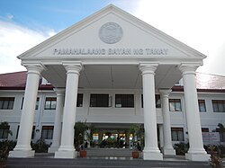 Tanay Municipal Hall | |
 Seal | |
| Nickname(s): Tourism Capital of Rizal | |
 Map of Rizal with Tanay highlighted | |
show OpenStreetMap | |
 Tanay Location within the Philippines | |
| Coordinates: 14°29′50″N 121°17′11″E / 14.49722°N 121.28639°ECoordinates: 14°29′50″N 121°17′11″E / 14.49722°N 121.28639°E | |
| Country | Philippines |
| Region | Calabarzon |
| Province | Rizal |
| District | 2nd district |
| Founded | November 12, 1606[1] |
| Named for | "Monte de Tan-ay" |
| Barangays | 20 (see Barangays) |
| Government | |
| • Type | Sangguniang Bayan |
| • Mayor | Rex Manuel C. Tanjuatco |
| • Vice Mayor | Rafael A. Tanjuatco |
| • Representative | Juan Fidel Felipe F. Nograles |
| • Municipal Council | show
Members |
| • Electorate | 69,466 voters (2019) |
| Area | |
| • Total | 200.00 km2 (77.22 sq mi) |
| Elevation | 37 m (121 ft) |
| Highest elevation | 331 m (1,086 ft) |
| Lowest elevation | 1 m (3 ft) |
| Population (2020 census) [4] | |
| • Total | 139,420 |
| • Density | 700/km2 (1,800/sq mi) |
| • Households | 25,463 |
| Economy | |
| • Income class | 1st municipal income class |
| • Poverty incidence | 11.61% (2015)[5] |
| • Revenue | ₱312,045,746.77 (2016) |
| Service provider | |
| • Electricity | Manila Electric Company (Meralco) |
| Time zone | UTC+8 (PST) |
| ZIP code | 1980 |
| PSGC | |
| IDD : area code | +63 (0)2 |
| Climate type | tropical monsoon climate |
| Native languages | Sinauna Tagalog |
| Major religions | Roman Catholicism |
| Feast date | January 22–24 |
| Catholic diocese | Roman Catholic Diocese of Antipolo |
| Patron saint | Ildephonsus of Toledo
Our Lady of Guadalupe - (Town Proper), Holy Cross - (Barangay Tandang Kutyo) and Jude the Apostle - (Barangay Sampaloc) |
| Website | www |


Tanay, officially the Municipality of Tanay (Tagalog: Bayan ng Tanay IPA: [tɐˈnaɪ]), is a 1st class municipality in the province of Rizal, Philippines. According to the 2020 census, it has a population of 139,420 people. [4]
It is located 57 kilometres (35 mi) east of Manila, although a typical commute between Manila and Tanay will take between one and three hours depending upon traffic conditions. It contains portions of the Sierra Madre Mountains and is bordered by Antipolo in the north-west, Baras, Morong and Teresa in the west, General Nakar (Quezon Province) in the east, and Pililla, Santa Maria (Laguna province) as well as the lake Laguna de Bay in the south.
It is the epicenter of the Tanay Tagalog dialect, which has the deepest modern Tagalog words in the Tagalog language and is the only endangered Tagalog dialect.
History[]

Tanay was settled by early Austronesian people. Shortly after the conquest and subjugation of Manila by the Spaniards and the surrounding lake areas by Juan de Salcedo in 1570–1574, Franciscan missionaries arrived to Christianize the inhabitants of what is now the Morong-Pililla area. In 1583, both Morong and Pililla were created as separate towns with Tanay forming part of Pililla.
Tanay was founded as a separate pueblo (town) in 1606 under the name "Monte de Tan-ay". In 1620, administration was moved to San Antonio (now called Inalsan or Pantay) and Tandang Kutyo. In 1638, the town was burned during an uprising of Chinese living in the area, and the town was rebuilt in 1640 at the present day location.[6]
In 1747, the town of Tanay consisted of only eight barangays, namely Nuestra Senora del Rosario, Sa Josep, San Ildefonso de Tanay, San Francisco de Maytubig, San Pedro de Alcantara, San Lucas y San Antonio, San Apostol, and San Agustin de Balugbog.
In 1853, a new political subdivision was formed. The town of Tanay together with Morong, Baras, Pililla, Angono, Binangonan and Jalajala form the Province of La Laguna, with the capital at Morong. This district was later changed to Distrito Politico-Militar de Morong after four years.
Tanay became a Municipality in 1894 as an effect of the Spanish Maura Law. The first election of Public Office took place in 1895–1898 and 1898–1900 under the Revolutionary Government of the Philippines.
Tanay members of the Katipunan fought valiantly during the Revolution against Spain. The town was the headquarters of the second military area of the Philippine Revolutionary Government under General Emilio Aguinaldo. And for a brief period between 1899 and 1900, Tanay served as the capital of the then Morong Province after Philippine–American War broke out and the American forces invaded the lake towns and captured Antipolo.[7]
In 1900–1901, Tanay as was under the Government appointed by the American Military under Taft Commission. From 1903 to 1934 the town leadership was under the American rule then in 1934 Tanay was under the Commonwealth of the Philippines as the Tydings–McDuffie Act was approved on March 24, 1934, until the Philippines fell to the hands of the Japanese during the Second World War in 1942.
In 1942–1945 the Mountains of Tanay served as the Guerrilla base for 'Marking's Fil-American Guerrillas, beginning the Liberation of Tanay in March 1945 a very decorated by the Filipino soldiers of the 4th and 42nd Division of the Philippine Commonwealth Army, 4th Constabulary Regiment of the Philippine Constabulary and the recognized guerrillas against the Japanese occupation forces during World War II. General Agustin Marking is buried in a private cemetery by the road overlooking his son's farm in Sampaloc.
On June 19, 1959, Republic Act No. 2336, also known as "An Act Establishing a Summer Resort in Sampaloc, Municipality of Tanay, Province of Rizal" was approved whereas there is hereby established a summer resort in Sampaloc. The Commission on Parks and Wildlife shall issue such rules and regulations for the establishment of such resort is taken place.
In October 2003, deposed Philippine president Joseph Estrada was transferred to a rest home in Sampaloc, a mountain barangay. He remained under house arrest until he was given executive clemency by President Gloria Macapagal Arroyo.
During the Typhoon Ketsana (Ondoy) on September 26, 2009, Tanay was one of the hardest hit towns due to the rising of Laguna Lake and the flooding of Tanay River.
Barangays[]

Tanay is politically subdivided into 20 barangays (10 urban, 10 rural). [8]
- Cayabu
- Cuyambay
- Daraitan
- Katipunan-Bayani (Pob.)
- Kay Buto (Poblacion)
- Laiban
- Mag-Ampon (Poblacion)
- Mamuyao
- Madilay-dilay[9]
- Pinagkamaligan (Poblacion)
- Plaza Aldea (Poblacion)
- Sampaloc
- San Andres[10][11]
- San Isidro (Poblacion)
- Santa Inez
- Santo Niño
- Tabing Ilog (Poblacion)
- Tandang Kutyo (Poblacion)
- Tinucan
- Wawa (Poblacion)
Climate[]
| hideClimate data for Tanay, Rizal (1999–2012, extremes 2000–2012) | |||||||||||||
|---|---|---|---|---|---|---|---|---|---|---|---|---|---|
| Month | Jan | Feb | Mar | Apr | May | Jun | Jul | Aug | Sep | Oct | Nov | Dec | Year |
| Record high °C (°F) | 28.1 (82.6) |
29.5 (85.1) |
31.0 (87.8) |
32.2 (90.0) |
33.0 (91.4) |
31.0 (87.8) |
30.8 (87.4) |
29.5 (85.1) |
29.5 (85.1) |
30.1 (86.2) |
29.0 (84.2) |
28.5 (83.3) |
33.0 (91.4) |
| Average high °C (°F) | 24.2 (75.6) |
24.9 (76.8) |
26.4 (79.5) |
28.2 (82.8) |
28.3 (82.9) |
27.4 (81.3) |
26.4 (79.5) |
25.8 (78.4) |
26.2 (79.2) |
26.2 (79.2) |
25.6 (78.1) |
24.3 (75.7) |
26.2 (79.2) |
| Daily mean °C (°F) | 21.4 (70.5) |
21.9 (71.4) |
22.9 (73.2) |
24.4 (75.9) |
24.7 (76.5) |
24.3 (75.7) |
23.6 (74.5) |
23.2 (73.8) |
23.3 (73.9) |
23.3 (73.9) |
22.8 (73.0) |
21.7 (71.1) |
23.1 (73.6) |
| Average low °C (°F) | 18.6 (65.5) |
18.8 (65.8) |
19.4 (66.9) |
20.5 (68.9) |
21.0 (69.8) |
21.1 (70.0) |
20.7 (69.3) |
20.5 (68.9) |
20.4 (68.7) |
20.4 (68.7) |
19.9 (67.8) |
19.1 (66.4) |
20.0 (68.0) |
| Record low °C (°F) | 14.8 (58.6) |
13.0 (55.4) |
13.0 (55.4) |
16.0 (60.8) |
15.5 (59.9) |
15.0 (59.0) |
16.0 (60.8) |
13.5 (56.3) |
15.0 (59.0) |
15.0 (59.0) |
13.0 (55.4) |
13.5 (56.3) |
13.0 (55.4) |
| Average rainfall mm (inches) | 70.7 (2.78) |
63.0 (2.48) |
59.0 (2.32) |
50.6 (1.99) |
196.3 (7.73) |
257.6 (10.14) |
534.2 (21.03) |
474.1 (18.67) |
482.8 (19.01) |
276.5 (10.89) |
264.8 (10.43) |
202.3 (7.96) |
2,931.9 (115.43) |
| Average rainy days (≥ 0.1 mm) | 10 | 9 | 8 | 6 | 14 | 18 | 22 | 23 | 21 | 18 | 18 | 16 | 183 |
| Average relative humidity (%) | 89 | 89 | 87 | 85 | 87 | 90 | 92 | 93 | 92 | 91 | 91 | 90 | 89 |
| Source: PAGASA[12][13] | |||||||||||||
Demographics[]
| Year | Pop. | ±% p.a. |
|---|---|---|
| 1903 | 4,124 | — |
| 1918 | 6,704 | +3.29% |
| 1939 | 8,228 | +0.98% |
| 1948 | 8,627 | +0.53% |
| 1960 | 13,955 | +4.09% |
| 1970 | 23,247 | +5.23% |
| 1975 | 33,382 | +7.53% |
| 1980 | 40,443 | +3.91% |
| 1990 | 58,410 | +3.75% |
| 1995 | 69,181 | +3.22% |
| 2000 | 78,223 | +2.67% |
| 2007 | 94,460 | +2.64% |
| 2010 | 98,879 | +1.68% |
| 2015 | 117,830 | +3.40% |
| 2020 | 139,420 | +3.36% |
| Source: Philippine Statistics Authority [14] [15] [16][17] | ||
In the 2020 census, the population of Tanay, Rizal, was 139,420 people, [4] with a density of 700 inhabitants per square kilometre or 1,800 inhabitants per square mile.
The majority of the population consists of Tagalogs who live near Laguna de Bay, though there is also a significant percentage of mountain-dwelling people living in the northern portions of the municipality. The town's major trades consist of fishing, agriculture and regional commerce.
The roots of the Sambalic languages can be traced back to Tanay, where the etymologically similar Sinuana or Remontado Dumagat is still spoken in villages in the Sierra Madre mountains between Sampaloc and General Nakar, Quezon.[18]
Economy[]
| Poverty Incidence of Tanay | |
| Source: Philippine Statistics Authority[19][20][21][22][23][24] | |
Local government[]
| Position | Name | Political Party | Gather Votes |
|---|---|---|---|
| Mayor | Rex Manuel C. Tanjuatco | LIBERAL PARTY | 30 921 |
| Vice Mayor | Jaime "Jimmy" Vista | LAKAS/KAMPI/LP | 24 989 |
| Councilor | Allan Sacramento | NPC | 26, 665 |
| Councilor | Ricardo"Boboy" Bernados | LAKAS | 22, 488 |
| Councilor | Rommel "Ram" Magwili | LP | 23, 526 |
| Councilor | Luis "GO GO GO" Catolos | NPC | 19 385 |
| Councilor | Ivan Tongohan | UNA | 19, 312 |
| Councilor | Santos"Boy" Pagalunan-Santos | LP | 18 439 |
| Councilor | Rading Juco | LP | 16, 579 |
| Councilor | Rafael Reyes | LP | 15 772 |
| ABC Chairman | TBF | TBF | TBF |
| SK President | TBF | TBF | TBF |
The Municipal Council approved the P80+ million budget for the construction of the new municipal building of Tanay. The lending company will be the Landbank of the Philippines, Tanay Branch. Certain issues and debates from different sectors and influential names about the construction arose, and still now under public consultation and hearing.
Tanay Rodeo Festival[]
To promote and market the town's cattle and agri-eco tourism not only within the municipality but also in the Calabarzon region, the Municipal Government of Tanay holds Tanay Rodeo every third week of January each year. The festival is also in line with the celebration of Tanay Town Fiesta. It is participated by professionals and rodeo enthusiasts, and veterinary/animal science students from renowned universities in the country.[25]
References[]
- ^ "Tanay Hane Festival - Municipality of Tanay, Rizal". Tanay.gov.ph. 2015-07-10. Retrieved 2019-10-26.
- ^ Municipality of Tanay | (DILG)
- ^ "2015 Census of Population, Report No. 3 – Population, Land Area, and Population Density" (PDF). Philippine Statistics Authority. Quezon City, Philippines. August 2016. ISSN 0117-1453. Archived (PDF) from the original on May 25, 2021. Retrieved July 16, 2021.
- ^ Jump up to: a b c Census of Population (2020). "Region IV-A (Calabarzon)". Total Population by Province, City, Municipality and Barangay. PSA. Retrieved 8 July 2021.
- ^ https://psa.gov.ph/sites/default/files/City%20and%20Municipal-level%20Small%20Area%20Poverty%20Estimates_%202009%2C%202012%20and%202015_0.xlsx; publication date: 10 July 2019; publisher: Philippine Statistics Authority.
- ^ "Municipality of Tanay, Its Profile". Archived from the original on 2007-03-22. Retrieved 2007-06-20.
- ^ "Municipality of Tanay, Its Profile". Archived from the original on 2007-03-22. Retrieved 2007-06-20.
- ^ "Province: Rizal". PSGC Interactive. Quezon City, Philippines: Philippine Statistics Authority. Retrieved 12 November 2016.
- ^ "Tanay now has 20 barangays". Manila Bulletin. Retrieved 2019-10-26.
- ^ "Archived copy". Archived from the original on 2010-10-09. Retrieved 2010-10-11.CS1 maint: archived copy as title (link)
- ^ "Archived copy". Archived from the original on 2010-10-11. Retrieved 2010-10-11.CS1 maint: archived copy as title (link)
- ^ "Tanay, Rizal Climatological Normal Values". Philippine Atmospheric, Geophysical and Astronomical Services Administration. Archived from the original on 18 October 2018. Retrieved 18 October 2018.
- ^ "Tanay, Rizal Climatological Extremes". Philippine Atmospheric, Geophysical and Astronomical Services Administration. Archived from the original on 18 October 2018. Retrieved 18 October 2018.
- ^ Census of Population (2015). "Region IV-A (Calabarzon)". Total Population by Province, City, Municipality and Barangay. PSA. Retrieved 20 June 2016.
- ^ Census of Population and Housing (2010). "Region IV-A (Calabarzon)". Total Population by Province, City, Municipality and Barangay. NSO. Retrieved 29 June 2016.
- ^ Censuses of Population (1903–2007). "Region IV-A (Calabarzon)". Table 1. Population Enumerated in Various Censuses by Province/Highly Urbanized City: 1903 to 2007. NSO.
- ^ "Province of Rizal". Municipality Population Data. Local Water Utilities Administration Research Division. Retrieved 17 December 2016.
- ^ About Culture and Arts
- ^ "Poverty incidence (PI):". Philippine Statistics Authority. Retrieved 28 December 2020.
- ^ https://psa.gov.ph/sites/default/files/NSCB_LocalPovertyPhilippines_0.pdf; publication date: 29 November 2005; publisher: Philippine Statistics Authority.
- ^ https://psa.gov.ph/sites/default/files/2003%20SAE%20of%20poverty%20%28Full%20Report%29_1.pdf; publication date: 23 March 2009; publisher: Philippine Statistics Authority.
- ^ https://psa.gov.ph/sites/default/files/2006%20and%202009%20City%20and%20Municipal%20Level%20Poverty%20Estimates_0_1.pdf; publication date: 3 August 2012; publisher: Philippine Statistics Authority.
- ^ https://psa.gov.ph/sites/default/files/2012%20Municipal%20and%20City%20Level%20Poverty%20Estima7tes%20Publication%20%281%29.pdf; publication date: 31 May 2016; publisher: Philippine Statistics Authority.
- ^ https://psa.gov.ph/sites/default/files/City%20and%20Municipal-level%20Small%20Area%20Poverty%20Estimates_%202009%2C%202012%20and%202015_0.xlsx; publication date: 10 July 2019; publisher: Philippine Statistics Authority.
- ^ Tourism, Tanay. "Tanay Rodeo Festival". Municipal Government of Tanay, Rizal. Retrieved 2016-02-12.
External links[]
| Wikimedia Commons has media related to Tanay, Rizal. |
- Official website
- Tanay Profile at PhilAtlas.com
- TanayGeographic.com: Contains images of Tanay, a phone directory, and other information
- Philippine Standard Geographic Code
- Philippine Census Information
- Local Governance Performance Management System
| show Places adjacent to Tanay, Rizal |
|---|
| show Authority control |
|---|
- Municipalities of Rizal
- Populated places on Laguna de Bay