Thionne
show This article may be expanded with text translated from the corresponding article in French. (December 2008) Click [show] for important translation instructions. |
Thionne | |
|---|---|
Commune | |
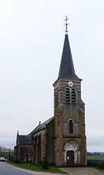 The church in Thionne | |
show Location of Thionne | |
 Thionne | |
| Coordinates: 46°24′21″N 3°34′36″E / 46.4058°N 3.5767°ECoordinates: 46°24′21″N 3°34′36″E / 46.4058°N 3.5767°E | |
| Country | France |
| Region | Auvergne-Rhône-Alpes |
| Department | Allier |
| Arrondissement | Vichy |
| Canton | Moulins-2 |
| Intercommunality | Entr'Allier Besbre et Loire |
| Government | |
| • Mayor (2020–2026) | Monique Bouillot[1] |
| Area 1 | 26.96 km2 (10.41 sq mi) |
| Population (Jan. 2018)[2] | 302 |
| • Density | 11/km2 (29/sq mi) |
| Time zone | UTC+01:00 (CET) |
| • Summer (DST) | UTC+02:00 (CEST) |
| INSEE/Postal code | 03284 /03220 |
| Elevation | 237–305 m (778–1,001 ft) (avg. 260 m or 850 ft) |
| 1 French Land Register data, which excludes lakes, ponds, glaciers > 1 km2 (0.386 sq mi or 247 acres) and river estuaries. | |


Thionne (French pronunciation: [tjɔn]) is a commune in the Allier department in Auvergne-Rhône-Alpes in central France.
Population[]
| Year | Pop. | ±% |
|---|---|---|
| 1962 | 461 | — |
| 1968 | 489 | +6.1% |
| 1975 | 427 | −12.7% |
| 1982 | 374 | −12.4% |
| 1990 | 337 | −9.9% |
| 1999 | 306 | −9.2% |
| 2008 | 317 | +3.6% |
| 2013 | 321 | +1.3% |
| Source: INSEE (1968–2013) | ||
See also[]
- Communes of the Allier department
References[]
- ^ "Liste nominative des communes de l'Allier" [Nominative list of communes of Allier] (PDF) (in French). Association of Mayors and Presidents of Communities of Allier. 8 July 2020. Retrieved 22 November 2020.
- ^ "Populations légales 2018". INSEE. 28 December 2020.
| Wikimedia Commons has media related to Thionne. |
| show Communes of the Allier department |
|---|
| Authority control |
|
|---|
This Allier geographical article is a stub. You can help Wikipedia by . |
Categories:
- Communes of Allier
- Allier geography stubs