Tonggu County
Tonggu County
铜鼓县 Tungku | |
|---|---|
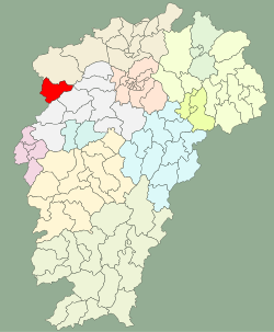 Location in Jiangxi | |
| Coordinates: 28°31′16″N 114°22′16″E / 28.521°N 114.371°ECoordinates: 28°31′16″N 114°22′16″E / 28.521°N 114.371°E | |
| Country | People's Republic of China |
| Province | Jiangxi |
| Prefecture-level city | Yichun |
| Area | |
| • Total | 1,547.7 km2 (597.6 sq mi) |
| Population (2018) | |
| • Total | 138,616 |
| • Density | 90/km2 (230/sq mi) |
| Time zone | UTC+8 (China Standard) |
| Postal Code | 336200 |

Tonggu County (simplified Chinese: 铜鼓县; traditional Chinese: 銅鼓縣; pinyin: Tónggǔ Xiàn) is a county of Jiangxi province, People's Republic of China, bordering Hunan province to the west. It is under the jurisdiction of the prefecture-level city of Yichun.
Administrative divisions[]
In the present, Tonggu County has 6 towns and 3 townships.[1]
- 6 towns
|
|
- 3 townships
- (高桥乡)
- (港口乡)
- (带溪乡)
Demographics[]
The population of the district was 135,924 in 1999.[2]
Climate[]
| Climate data for Tonggu (1981–2010) | |||||||||||||
|---|---|---|---|---|---|---|---|---|---|---|---|---|---|
| Month | Jan | Feb | Mar | Apr | May | Jun | Jul | Aug | Sep | Oct | Nov | Dec | Year |
| Record high °C (°F) | 24.4 (75.9) |
28.5 (83.3) |
33.2 (91.8) |
34.0 (93.2) |
35.3 (95.5) |
37.1 (98.8) |
39.4 (102.9) |
40.1 (104.2) |
37.4 (99.3) |
34.5 (94.1) |
30.9 (87.6) |
25.4 (77.7) |
40.1 (104.2) |
| Average high °C (°F) | 9.7 (49.5) |
11.8 (53.2) |
15.7 (60.3) |
22.2 (72.0) |
26.9 (80.4) |
29.6 (85.3) |
32.8 (91.0) |
32.5 (90.5) |
28.8 (83.8) |
24.0 (75.2) |
18.3 (64.9) |
13.1 (55.6) |
22.1 (71.8) |
| Daily mean °C (°F) | 4.8 (40.6) |
7.0 (44.6) |
10.6 (51.1) |
16.6 (61.9) |
21.2 (70.2) |
24.5 (76.1) |
27.3 (81.1) |
26.5 (79.7) |
22.9 (73.2) |
17.7 (63.9) |
11.8 (53.2) |
6.6 (43.9) |
16.5 (61.6) |
| Average low °C (°F) | 1.8 (35.2) |
3.9 (39.0) |
7.3 (45.1) |
12.8 (55.0) |
17.2 (63.0) |
21.0 (69.8) |
23.3 (73.9) |
22.8 (73.0) |
19.2 (66.6) |
13.7 (56.7) |
7.8 (46.0) |
2.6 (36.7) |
12.8 (55.0) |
| Record low °C (°F) | −7.0 (19.4) |
−5.6 (21.9) |
−4.9 (23.2) |
−0.9 (30.4) |
7.3 (45.1) |
12.1 (53.8) |
15.6 (60.1) |
16.3 (61.3) |
10.6 (51.1) |
0.0 (32.0) |
−4.1 (24.6) |
−10.4 (13.3) |
−10.4 (13.3) |
| Average precipitation mm (inches) | 78.7 (3.10) |
103.2 (4.06) |
164.4 (6.47) |
228.2 (8.98) |
237.7 (9.36) |
320.4 (12.61) |
202.3 (7.96) |
160.5 (6.32) |
105.6 (4.16) |
76.8 (3.02) |
87.3 (3.44) |
49.6 (1.95) |
1,814.7 (71.43) |
| Average relative humidity (%) | 84 | 84 | 85 | 83 | 83 | 84 | 81 | 83 | 84 | 82 | 83 | 81 | 83 |
| Source: China Meteorological Data Service Center[3] | |||||||||||||
Notes and references[]
- ^ "南京市-行政区划网 www.xzqh.org" (in Chinese). XZQH. Retrieved 2012-05-24.
- ^ (in English) National Population Statistics Materials by County and City - 1999 Period, in China County & City Population 1999, Harvard China Historical GIS
- ^ 中国地面气候标准值月值(1981-2010) (in Simplified Chinese). China Meteorological Data Service Center. Retrieved 20 October 2018.
External links[]
- (in Chinese) Government site - Google translation
This Jiangxi location article is a stub. You can help Wikipedia by . |
Categories:
- Tonggu County
- County-level divisions of Jiangxi
- Jiangxi geography stubs