Uranium mining in the Bancroft area

Volcanic eruptions during the Precambrian era created very unusual geological conditions around Bancroft, Ontario, leaving it as one of only two uranium producing areas in Ontario.[1] In the context of minerals and mining, the "Bancroft area" includes Haliburton, Hastings, and Renfrew counties, and all areas between Minden and Lake Clear.[2]
After the discovery of atomic energy in 1942, the Canadian government encouraged prospecting for uranium. Uranium was found in small quantities in many parts of Canada, and was found in concentrated places south of the Canadian Shield. The discovery of uranium near Bancroft resulted in what was described by engineer A. S. Bayne in a 1977 report as the "greatest uranium prospecting rush in the world".[3] In Ontario, other than the Bancroft area, uranium is also found in mineable quantities around Elliot Lake and Agnew Lake.[4][5]
As a result of the uranium mining at four mine sites throughout the 1950s, Bancroft experienced rapid population and economic growth.[1] By 1958, Canada had become one of the world's leading producers of uranium; the $274 million of uranium exports that year represented Canada's most significant mineral export.[6]: 1 By 1962 and 1963 the government was buying more than $1,500 million of uranium from Canadian producers for export, but soon thereafter the global supply of uranium increased, prices fell and the government cancelled all contracts to buy.[6]
Bancroft today is known for gems and mineralogy,[2] and has three abandoned mines and one that is being rehabilitated.[7][8] Former miners have exhibited a twofold increase in lung cancer development likelihood and mortality rate.[9]: iii
Geology and mineralogy[]


During the most recent ice age, in the area of what is now Bancroft, Ontario, ancient glaciers removed soil and rock, exposing the Precambrian granite that had been the heart of volcanic mountains on an ancient sea bed. Volcanic eruptions had spouted through sediments, recrystallizing them into layers of banded gneisses including limestone, graphite, gabbro and diorite, rich in iron and other dark minerals.[1] Uranium ores in these structures are about 1,000 million years old.[10]
In Canada, 99% of known uranium occurrences and 93% of properties producing uranium are on the Canadian Shield, almost all on the western and southern edges of it.[11]
Bancroft, known as the "Mineral Capital of Canada"[12] and is only of only five major locations in the world where uranium is extracted from intrusive rocks, the others being Rössing uranium mine, Trekkopje mine, Utah, Twin Buttes, Ilimaussaq deposit and Palabora.[13][14] Of the seven global locations where uranium is mined rom intrusive rock, Bancroft is the only one where it is mined from intrusive rocks of the pegmatite type.[13]: 11
The key geological features in the Bancroft area relevant to uranium mining are three circular granitic complexes, each about 10 kilometres (6.2 mi) across. They are (from southwest to northeast):
- The Cheddar complex is a circular double dome of granitic rock surrounded by paragneiss, para-amphibolite, and pyroxene granulite. All these rocks contain younger granitic and syenitic intrusions.[6]: 177–78
- The Cardiff plutonic complex consists mainly of three southeast-dipping cylindrical sheet intrusions: the Centre Lake granite, the Monck Lake granite, and the Deer Lake syenite. They intrude metasedimentary rocks.[6]
- The Faraday granite is a sheet of granite covered by gneisses and metagabbro. The Faraday granite sheet dips to the south and it is the southern edge of the Hastings Highland gneiss complex.[6]
Gems and other resources[]

Prior to the 1922 discovery of uranium, mica, feldspar, and other minerals were mined on a small scale in the Bancroft area.[6]: 175 Inspired by finds of gold in nearby Eldorado (now known as Madoc) in 1886–87 and onwards, many hoped also to find gold around Bancroft. More than 1,600 identifiable minerals and non-metallic collectibles can be found in the area.[1]
Finds of gold in nearby Madoc, Ontario, (then known as Eldorado) from 1886 to 1887, inspired many to seek gold around Bancroft. Surface gold was found in October 1897 by R. Bradshaw, 32 km (20 mi) southwest of Bancroft (towards Bobcaygeon). This triggered a rush of prospectors to the area. Iron and magnetic ores were mined from 1882, gold, copper and mica from the late 1890s, and marble from 1911. More than 1,600 identifiable minerals and non-metallic collectibles can be found in the area,[1] including 175 species of gemstones.[2]
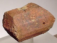
Aside from uranium, Bancroft area and its mines produced sought-after gemstones of 175 species, most notably calcite, clinohumite, corundum, diopside, dravite, edenite, euxenite-(Y), ferri-fluoro-katophorite, fluorapatite, fluorite, fluoro-richterite, ilmenite, kainosite-(Y), molybdenite, nepheline, phlogopite, crystals of the pyrochlore supergroup, thorite, titanite, tremolite, uraninite, uranophane, and zircon. Madawaska Mine produced samples of the very rare kainosite-(Y), globally renowned samples of the common calcite and flourite, "superb" samples of ilmenite, "fine" samples of molybdenite, and the best known samples of molybdenite.[2]
| Resource | Locations mined | From |
|---|---|---|
| Gold | Bancroft | 1897 |
| Copper | Dungannon, Cardiff, Maynooth | 1899 |
| Mica | Cardiff, Paudash Lake | 1899 |
| Iron | Coe Hill, Mayo (now Carlow/Mayo), Egan Creek (now Bancroft) | 1882 |
| Magnetic ore, arsenical pyrites and quartz | Bradshaw | 1882 |
| Corundum | Carlow, Raglan | 1898 |
| Marble | Faraday, Dungannon | 1911 |
| Sodalite | Bancroft, Dungannon | 1905 |
Marble mined in Bancroft was used to make the floor of the Whitney Block and the Royal Ontario Museum.[12]
Gem gallery[]
- Mineral samples collected from Bancroft mines

Betafite, Zircon collected from Silver Crater Mine (the old name of Bicroft Mine) near Bancroft

Uranpyrochlore, zircon sample collected from the MacDonald mine in Bancroft

Fluorite sample collected in 1974 near Bancroft collected by Bob Whitmore


Uranium mining[]

Uranium was first discovered in the area of Cardiff, Ontario, in 1922 by prospector W. M. Richardson[1] at a location first called "the Richardson deposit" and later known as "the Fission property".[6]: 175 Between 1929 and 1931,[6]: 175 attempts were made to extract radon from the uranium ore.[11]
In 1943,[6] during World War II, global interest in mining uranium escalated.[11] The government sent geologists to Bancroft, who concluded at the time that all known uranium deposits were unviable due to accessibility, size and uranium concentration.[6]: 175
1948 saw an increase in private staking of claims for uranium, but due to the difficulties in extracting uranium from lower grade ore, none developed into mines.[6]: 176–77
Between 1953 and 1956, 100 claims were staked around Bancroft[1] and at approximately the same time, another ten mines were started in the Elliot Lake area.[15]
In 1953 "intelligent prospecting and excellent preliminary exploration" by G. W. Burns and R. J. Steele discovered the Central Lake deposits (which later were developed into Bicroft Mine) and Arthur H. Shore (whose prospect became the Faraday Mine) led the way successful prospecting.[6]: 176–77
Uranium mining operations in the Bancroft area were conducted at four sites, beginning in the early 1950s and concluding by 1982.[6] Each of these used underground hard-rock mining methods to access and collect uranium ores from the surrounding granite and gneiss.[6] The mines were:
| Mine (years active) | Geological feature | Ore milled | Uranium-oxide produced |
|---|---|---|---|
| Bicroft Mine (1957–1963) | Cardiff Complex | 2,470,000 tonnes (2,720,000 short tons)[16] | 1957–1960: 49,904 kg (133,693 lb)[17]
1961–1962: 127,659 kg (342,000 lb)[17] 1062–1963: 430,000 kg (950,000 lb)[17] |
| Faraday Mine (1954–1964) Madawaska Mine (1975–1982) |
Faraday Granite | 3,572,826 tonnes (3,938,366 short tons)[18] | 3,322,500 kg (7,324,858 lb)[18] |
| Dyno Mine (1958–1960) | Cheddar Granite | 598,200 tonnes (659,403 short tons)[19] | 368,943 kg (813,381 lb)[19] |
| Greyhawk Mine (1957–1959, 1976–1982) | Faraday Granite | 1957–1959: 72,799 tonnes (80,247 short tons)[17][20] | 50,407 kg (111,128 lb)[18] |
Bicroft Mine[]
Bicroft mining operations[]


In 1952 G. W. Burns, a well-studied amateur prospector from Peterborough, found deposits 16 kilometres (10 mi) southwest of Bancroft, near Cardiff township and Paudash Lake. In an 18 December 1955 letter to the Geological Survey of Canada (GSC), Burns wrote of his interest in minerals and rocks, his purchase of property in Cardiff, his research in Peterborough Public Library, superficially a book Prospecting for Uranium and Thorium in Canada published by the Geological Survey of Canada. Another book prompted him to inspect a property near Centre Lake and while there he observed purple rocks which he knew to be fluorspar, an indicator of radioactive geology. After borrowing a Geiger counter from Robbert Steele, he confirmed radioactivity and immediately started staking land claims. Their slow careful staking disadvantaged them as others rushed to the area and staked their own claims, nonetheless, their work paid off and he started mining what the Geological Survey of Canada confirmed to be uraninite.[6]
In late 1952, Burns sold his property to a Toronto syndicate that formed into the Centre Lake Uranium Mines Limited, lead by C. C. Huston. The company worked on the surface, opened an adit and started diamond drilling, mostly every 30 metres (100 ft), sometimes 15 m (50 ft) between the holes. A shaft was created in 1954. Simultaneous to this, Croft Uranium Mines Limited, a subsidiary of Macassa Mines Limited, formed in 1953 and discovered uranium north of the original site. In 1955 the two sites were merged under the ownership of Bicroft Uranium Mines Limited, with work focused on the Centre Lake part of the property. A shaft was sunk to 400 metres (1,300 ft) and ten levels created. A treatment plant capable of processing 1,000 tonnes (1,100 short tons) of ore per day was built and operations started in late 1956. Production in 1957 was 183,828 kg (405,271 lb) of U3O8 from ore with a grade of 0.0859%. Production increased to 1,200 tonnes (1,300 short tons) per day in 1958 and exploration started to the south of the site.[6]
Mining continued until 1963, producing a total 2,470,000 tonnes (2,430,000 long tons; 2,720,000 short tons) of uranium ore,[21] employing up to 619 people at its peak.[22]
2,284,421 tonnes (2,248,342 long tons; 2,518,143 short tons) of tailings remain on site in two impoundments.[23] Repairs to the decommissioned site, including the addition of vegetation over the tailings, were completed in 1980. Subsequent upgrades of the dams were completed in the 1990s.[24][7][25] The site is now a wetlands.[23]
Bicroft mine geology[]
The uranium deposits of Bicroft mine occur in a set of eastward-dipping en-echelon lenticular dykes of syenite and granite, up to 24 m (80 ft) wide and 120 m (400 ft) long, which extend over an area of about 4.5 square kilometres (1.75 sq mi) within a north–south oriented belt of amphibolite and paragneiss (the eastern part of the Centre Lake granite). The ore minerals are uranothorite and uraninite. The uranium-to-thorium ratio is variable. Pyroxene-rich granite of this area is richer in thorium.[6]
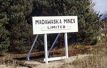
Faraday Mine/Madawaska Mine[]


Mining operations as Faraday Mine (1948 to 1964)[]
Arthur H. Shore, an independent prospector, first found uranium at his lot on Faraday township in 1949.[18] He founded Faraday Uranium Mines Limited in 1949, but injured himself shortly afterwards. Newkirk Mining Corporation lead work in 1952, including diamond drilling in December 1952 which helped identify seven main zones of uranium ore. Further drilling the following year identified additional deposits to a depth of 150 metres (500 ft). 1954 drilling found more uranium and adits were created. By 1955 it was established that there were 1,506,820 tonnes (1,660,980 short tons) of ore that was 0.112% U3O8 (uranium oxide). A sale price was agreed in January 1956. A 263-metre-deep (863 ft) shaft was sunk from an adit, from which five levels were established. A treatment plant with a 680-tonne-per-day (750-short-ton) capacity was built and operations started in April 1957. In 1958, the treatment capacity was increased to 1,220 tonnes (1,350 short tons) per day in order to support processing of ore from Greyhawk Mine. Production in 1957 was 183,828 kg (405,271 lb) from ore with a grade of 0.0859% U3O8.[6] Between 1948 and 1964 Faraday Mine had produced $54 million of ore.[1]


Mining operations as Madawaska Mine (1975 to 1982)[]
After $7 million of investment to rehabilitate the mine,[1] it reopened as the Madawaska Mine in 1975 and production continued to 1982. The shaft into the uranium-bearing pegmatite reached a depth of 473 metres (1,552 ft).[26] During this period, the mine was producing 1,400 tonnes (1,500 short tons) of ore per day.[1]
Decommissioning of Madawaska Mine (1982 to present)[]
In 2015, inspections found improper surface protection of the tailings and the site has been undergoing rehabilitation.[7]
Faraday and Madawaska Mine geology[]
At the Faraday and Madawaska mines, lens-shaped bodies of ore occur in granitic pegmatite dykes within an area of steeply-dipping amphibolite and metagabbro at the southern edge of the Faraday granite. Uraninite and uranothorite are the principal ore minerals at Faraday and Madawaska. Other radioactive minerals found at this locality include allanite, cyrtolite (a uranium-thorium rich variety of zircon),[27] uranophane-α and uranophane-β. The uranium-to-thorium ratio is about 2-to-1. Uranium ore concentrations range from 0.07 to 0.4 per cent U3O8 (uranium-oxide.)[6]
Dyno Mine[]
Dyno mining operations[]
Prospector Paul Mullette discovered radioactive occurrences in November 1953 that were sold to Dyno Mines Limited (later Canadian Dyno Mines Limited). The company undertook diamond drilling that same month simultaneous to geological mapping. This identified three zones, resulting in drilling, which discovered two additional zones. Surface diamond drilling of 124 holes at 61-metre (200 ft) intervals occurred through 1954 and 1955. A 300-metre (1,000 ft) shaft, in the "B" zone, was sunk creating five levels. A price to sell uranium was agreed, and an ore treatment plant with 910-tonne-per-day (1,000-short-ton) capacity was started in 1956. Production started in May 1958.[6]
Dyno mine geology[]
At Dyno mine, at the eastern edge of the Cheddar granite, five zones of ore occur as uranothorite and uraninite in a set of steeply-dipping lens-shaped dykes of pegmatitic granite 0.9 to 20 m (3 to 60 ft) wide, which intrude into gneisses. Ore occurs across the full width of narrower dykes (up to about 3.7 m [12 ft] wide); in wider dykes, ore is usually restricted to only parts of the dyke. The ores are closely associated with a set of north–south trending fractures. Ore concentrations vary from 0.05 to more than 1.00 per cent U3O8, averaging 0.093 per cent. The ore often contains magnetite, particularly where the ore is of higher grade. Cyrtolite and allanite also occur.[6]
Greyhawk Mine[]
Greyhawk mining operations (1955 to 1959)[]
Radioactive materials were first discovered in Faraday Township in 1955 by K. D. Thompson and M. Card, two employees of Goldhawk Porcupine Mines Limited who were surveying with Geiger counters. They found exposed rock to be radioactive across a 18-by-91-metre (60 by 300 ft) area. Ownership subsequently shifted to Greyhawk Uranium Mines Limited.[6] Diamond drilling followed at 15 to 122 metres (50 to 400 ft) intervals at 140-metre (450 ft) depth. An exploration shaft was begun in 1956 and three levels created.[6] Operations uncovered no high-grade ore deposits, leaving the average grade below that of other Bancroft mines.[6]
Ore was transferred for processing at the Faraday Mine site, starting August 1957 at a rate of about 180 tonnes (200 short tons) per day. By the end of 1957, 17,752 tonnes (19,568 short tons) at a value of $12.6 per tonne ($11.4/short ton) had been shipped. Through 1958, production was 140 tonnes (150 short tons) per day averaging at 0.082% U3O8.[6] The tonnage of ore was 30% less than feasibility estimates.[6]
Mining operations stopped in 1959.[1][7]
Greyhawk mining operations (1962 to 1982)[]

Faraday Uranium Mines Limited purchased the site in 1962.[28][8] Madawaska Mines Limited was formed in 1975 and purchased the mine, as well as the Faraday Mine. Mining operations restarted in 1976 and continued until 1982.[28][11]: 12
After mining, the uranium ore was treated in acid leaching plants located at the mines. The leaching process produced yellowcake high-grade uranium compounds which were either processed further at the Port Hope refinery or sold to the US government for processing in that country.[17] Processing uranium ore in Bancroft cost $3.00 per ton[6]
Greyhawk mine geology[]
In the Greyhawk area, metagabbro is intruded by east–west trending pegmatitic granite dykes up to 18 m (60 ft) wide. Ore bodies of uranothorite and uraninite with an average length of 30 m (100 ft) and average width of 1.8 m (6 ft) occur within these pegmatitic dykes, often at the contact with metagabbro. Radioactive minerals are concentrated in the more mafic parts of the host rock. Ores of 0.095 per cent U3O8 have been reported from this area.[6]
Other mines[]
Kemp Uranium Mine[]
Located at latitude 44° 59′ 53.22″, longitude −78° 9′ 42.15″, the Kemp Uranium Mine, sometimes called the Kemp Property or Kemp Prospect, produced uranium and a world-class specimen of thorite between 1954 and 1955.[29]
Old Smokey Occurrence[]
Nu-Age Uranium Mines Limited owned the Old Smokey Occurrence, also known as the Tripp property and also known as the Montgomery property.[30][6] Surveying was done by Nu-Age Uranium Mines in 1955 and by Imperial Oil Limited in 1975.[30] Although a 50-ton-per-day concentrator was known to be on site in the 1950s, the production quantities are unknown.[6]
Blue Rock Cerium Mines[]
Blue Rock Cerium Mines Limited started exploratory work for a mine at a location in Monmouth township (now known as Highlands East, Ontario) during 1954.[31][32]
Economic and political influence[]
Economic growth[]
Eldorado Mining and Refining Limited was the crown company that purchased all uranium oxide in Canada; it entered into contracts with mine owners at fixed prices.[33] Faraday Mine alone produced $54 million of uranium ore, creating a rapid economic boom.[1] The mine succeeded due to a combination of economic factors, including Bancroft's geographical proximity to industrial centers (Port Hope) and a good road and rail network.[17]
Employment of miners in Bancroft started in 1955 and peaked in 1958 at around 1,600 jobs.[33]: 34 chart Mine workers unionized in 1957, forming Local 1006 Bancroft Mine and Mill Worker's Union.[1] Housing for miners was quickly established around the mines and in nearby Bancroft village, which extended to cover ten square kilometres (4 sq mi). Other construction quickly followed, including two single-men's bunkhouses, a canteen, an eleven-room school, an ice-curling rink, and a recreation center. In 1957, a swimming pool was started.[34]
Decline in demand[]

Mining in Bancroft initially stopped in 1964 due to global reductions in demand of uranium.[35] Local Catholic priest (brother of former Ontario Ombudsman Arthur Maloney and Minster of Mines James Anthony Maloney) rallied the community to demand support from the provincial and federal government. Canadian Prime Minister John Diefenbaker, relying on an old agreement with the United Kingdom to buy uranium from Canada, was able to prolong the life of the mine.[1]
However, by the 1980s, uranium demand was again down, with global energy consumption growing at 2%, much less than the expected 7%.[35] The price of uranium dropped from around US$44 per pound in 1979 to US$23.50 per pound in March 1982.[35][36]
Combined with environmental concerns about the nuclear industry following the Three Mile Island accident and increasing costs of building nuclear power plants, circumstances lead to the cancellation of a contract to buy uranium by Italian energy company Agip.[37][35] While the uranium mining at Elliot Lake continued to grow, the remaining uranium mining in Bancroft ended in 1982, closing the mines and jeopardizing the local economy.[1][35]
Regulatory environment[]
The Atomic Energy Control Board (AECB) issued licenses for uranium mines and mills in Canada, and began regulating uranium mines in 1977. As a result of this, mines that closed prior to 1977 (i.e. Bicroft and Dyno Mines) were able to abandon their sites without any regulatory oversight. Faraday Mine/Madawaska Mine and Greyhawk Mine both resumed mining from 1976 until 1982, so their operation and closure had AECB oversight.[11] Greyhawk Mine's tailings were processed at the mill located at Madawaska Mine, leaving no tailings on site. As a consequence of this, the primary hazards that are regulated are present only at Faraday/Madawaska Mine, and resulted in ongoing environmental monitoring by AECB's successor organization, the Canadian Nuclear Safety Commission (CNSC).[38]
Legacies[]

Mineral legacy[]
After the closure of the mines, the various tailing sites attracted mineral collectors, especially to an annual "gemboree" in which tourists travelled to Bancroft in search of gems and minerals.[1][39]
180,000 tonnes (200,000 short tons) of ore, averaging 0.065% U3O8, remain in the ground at Greyhawk Mine.[28] Dyno Mine ran out of uranium ore in 1960.[34]
In 2007, The Globe and Mail newspaper reported on a $3 million uranium development project in nearby Haliburton.[40]
Corporate environmental liability[]
1978 and 1980, studies found that the natural weathering of the granite and gabbro rocks left at Greyhawk Mine had caused uranium leaching into the aquifer at concentrations ranging between 1.2 and 380 parts per billion, with higher concentrations measured deeper in the water table and in sediments.[41][42]
Tailings remain at Bicroft, Madawaska and Dyno sites where water sampling by the CNSC is ongoing.[15] 2019 sampling found radioactive and hazardous contamination in two of several water samples.[7] Subsequent inspections in 2020 from nearby locations reported water quality to be within provincial standards.[43]
Dyno, Greyhawk, and Madawaska Mines are now managed by EWL Management Limited.[7] Bicroft Mine is owned by Barrick Gold; the owners of all legacy tailing sites at former mines are responsible for the ongoing management of the sites.[7]
Health legacy for miners[]


Silicosis[]
In the 1970s, the scientific community was making connections between uranium mining and silicosis in miners. Uranium mining produces silica-laden dust and the health risk to miners is correlated to the amount of free silica in the uranium ore. The mines around Bancroft had a free silica rate of 5–15%, presenting some risk but much less than at the uranium mines around Elliot Lake which produced ore with 60–70% free silica. In 1974, the Ontario Workmen's Compensation Board studied 15,094 people who worked in uranium mines in Bancroft and around Elliot Lake for at least one month, between 1955 and 1974. Of those 15,094 people, 94 silicosis cases were found in 1974, of which one was attributed to working a Bancroft mine, i.e. the other 93 were attributed to working in an Elliot Lake mine.[33]: 43, 62, 108
Exposure to ionizing radiation and lung cancer[]

Mines produce radon gas which can increase lung cancer risks. Miners' exposure to radiation was not measured before 1958 and exposure limits were not enacted until 1968. Risks to miners at Bancroft and Elliot Lake mines were investigated and the official report of that investigation quotes a miner:[33]
"We have been led to believe through the years that the working environment in these mines was safe for us to work in. We have been deceived."[33]: 77
The aforementioned 1974 study of 15,094 Ontario uranium miners found 81 former miners who died of lung cancer. Factoring in predicted lung cancer rate for men in Ontario, led to the conclusion that by 1974 there were 36 more deaths than expected attributable to both Bancroft and Elliot Lake mines, with the additional risk being twice as high for Bancroft miners compared to Elliot Lake miners.[33]
A study report for the CNSC undertaken by the Occupational Cancer Research Centre at Cancer Care Ontario tracked the health of 28,959 former uranium miners over 21 years and found a two-fold increase in lung cancer mortality and incidence.[9]: 35 table 4 The BMJ (journal of the British Medical Association) reported an increase of lung cancer risk; miners who have worked at least 100 months in uranium mines have a twofold increased risk of developing lung cancer.[44] The study is to be updated in 2023.[45]
See also[]
- Royal Commission on the Health and Safety of Workers in Mines
- Uranium ore deposits
- List of uranium mines
- List of mines in Ontario
- 1974 Elliot Lake miners strike
References[]
- ^ a b c d e f g h i j k l m n o p Reynolds, Nila (1979). Bancroft. A Bonanza of Memories. The Bancroft Centennial Committee. pp. 184–193, 223.
- ^ a b c d McDougall, Raymond (3 September 2019). "Mineral Highlights from the Bancroft Area, Ontario, Canada". Rocks & Minerals. 94 (5): 408–419. doi:10.1080/00357529.2019.1619134. ISSN 0035-7529. S2CID 201298402.
- ^ Bayne, A. S. (31 December 1977). "Report on Wilson Uranium Property, Cardiff & Faraday Townships, Eastern Ontario Mining Division, Haliburton & Hastings Counties, Ontario, Canada" (PDF). Ontario: A. S. Bayne & Company, Consulting Engineers. p. 3. Archived (PDF) from the original on 5 January 2022. Retrieved 29 December 2021.
- ^ "Ontario Mineral Inventory Record MDI41I05NE00009: Agnew Lake Mine, Canadian Thorium Corporation Ltd. Property". www.geologyontario.mndm.gov.on.ca. Retrieved 24 January 2022.
- ^ Mulligan, Carol (25 March 2014). "Elliot Lake wildcat strike led to key law". The Sudbury Star. Retrieved 24 January 2022.
- ^ a b c d e f g h i j k l m n o p q r s t u v w x y z aa ab ac ad Lang, A. H.; Griffith, J. W.; Steacy, H. R. (1962). Canadian Deposits of Uranium and Thorium (PDF). Yukon University: Geological Survey of Canada - Department of Mines and Technical Surveys. Archived (PDF) from the original on 25 November 2021. Retrieved 25 November 2021.
- ^ a b c d e f g "Independent Environmental Monitoring Program: Dyno, Bicroft, and Madawaska Mines". Canadian Nuclear Safety Commission. 21 September 2020. Retrieved 22 November 2021.
{{cite web}}: CS1 maint: url-status (link) - ^ a b "Greyhawk Mine, Faraday Township, Hastings County, Ontario, Canada". Mindat.org. Retrieved 25 November 2021.
- ^ a b Navaranjan, Garthika; Berriault, Colin; Demers, Paul A.; Do, Minh; Villeneuve, Paul (February 2015). "Ontario Uranium Miners Cohort Study Report" (PDF). Occupational Cancer Research Centre, Cancer Care Ontario – via University of Toronto Library.
{{cite journal}}: Cite journal requires|journal=(help) - ^ Wakefield, J. Richard. "Geology of the Canadian Sites". California State University. Retrieved 27 November 2021.
- ^ a b c d e "Radioactive and toxic wastes from the Bancroft Uranium Mines. Where are we going and who is in charge?" (PDF). Toronto, Ontario: Canadian Institute for Radiation Safety (CAIRS). 1 May 1987. p. 12. Archived (PDF) from the original on 25 November 2021. Retrieved 25 November 2021.
- ^ a b Eyles, Nick (2002). Ontario Rocks: Three Billion Years of Environmental Change. Markham, Ontario: Fitzhenry & Whiteside. p. 64. ISBN 9781550416190.
- ^ a b "World Distribution of Uranium Deposits (UDEPO) with Uranium Deposit Classification" (PDF). International Atomic Energy Agency. 2009.
- ^ "Geology of Uranium Deposits - World Nuclear Association". www.world-nuclear.org. Retrieved 24 January 2022.
- ^ a b "Uranium mines and mills waste". Canadian Nuclear Safety Commission. 3 February 2014. Retrieved 25 November 2021.
{{cite web}}: CS1 maint: url-status (link) - ^ Government of Canada, Natural Resources Canada (7 December 2015). "GEOSCAN Search Results: Fastlink". geoscan.nrcan.gc.ca. Retrieved 23 January 2022.
- ^ a b c d e f Michèle Proulx, Michèle (1997). "The Uranium Mining industry of the Bancroft Area: an Environmental History and Heritage Assessment" (PDF). pp. 56–57. Archived (PDF) from the original on 5 January 2022. Retrieved 27 November 2021.
- ^ a b c d Masson, S. L.; Gordon, J. B. (1981). Radioactive Mineral Deposits of the Pembroke-Renfrew Area (PDF). Ontario Ministry of Natural Resources. p. 63. ISBN 0774349204.
- ^ a b "Ontario Mineral Inventory Record MDI31D16NE00032: Canadian Dyno, Dyno Mine, International Mogul". www.geologyontario.mndm.gov.on.ca. Retrieved 24 January 2022.
- ^ "Ontario Mineral Inventory Record MDI31F04SW00036: Greyhawk Mine, Greyhawk". www.geologyontario.mndm.gov.on.ca. Retrieved 24 January 2022.
- ^ Parsons, Michael B.; Friske, Peter W. B.; Laidlow, Allison M.; Jamieson, Heather E. (2014). "Abstract: Controls on Uranium, Rare Earth Element, and Radionuclide Mobility at the Decommissioned Bicroft Uranium Mine, Ontario". Atlantic Geology. Archived from the original on 22 November 2021. Retrieved 25 November 2021.
- ^ Ontario Department of Mines Annual Report, 1958
- ^ a b Laidlow, Allison Marie. "Characterization of uranium and rare earth element mobility and attenuation downstream of decommissioned tailings impoundments at the Bicroft Uranium Mine near Bancroft, Ontario - ProQuest". www.proquest.com. Archived from the original on 22 November 2021. Retrieved 25 November 2021.
- ^ Watt, Jenn (6 October 2020). "Sampling near old mine sites finds 'no expected health impacts'". Haliburton Echo. Retrieved 22 November 2021.
- ^ Golder Associates Ltd, Consulting Engineers (February 1990). "Subsurface Investigations and Condition of Dams: Bicroft Mine Site Bancroft, Ontario · U-Links Centre For Community Based Research". database.ulinks.ca. Archived from the original on 22 November 2021. Retrieved 22 November 2021.
- ^ "Madawaska Mine (Faraday Mine)". Mindat.org. Archived from the original on 19 October 2008. Retrieved 25 November 2021.
- ^ "Cyrtolite: Mineral information, data and localities". Mindat.org. Archived from the original on 26 December 2021. Retrieved 26 December 2021.
- ^ a b c "Mineral Deposit Inventory Record MDI31F04SW00036: Greyhawk Mine, Greyhawk". www.geologyontario.mndm.gov.on.ca. Ministry of Northern Development, Mines, Natural Resources and Forestry. Retrieved 25 November 2021.
- ^ "Ontario Mineral Inventory Record MDI31D16NE00166: Kemp". Ontario Ministry of Natural Resources. Archived from the original on 20 December 2021. Retrieved 20 December 2021.
- ^ a b "Ontario Mineral Inventory Record MDI31D16NW00199: Nu-Age Uranium Mines Ltd., Old Smokey Occurrence". www.geologyontario.mndm.gov.on.ca. Retrieved 25 January 2022.
- ^ Satterly, J.; Hewitt, D. F. (1955). "Some Radioactive Mineral Occurrences in the Bancroft Area" (PDF). Government of Ontario.
- ^ "Ontario Mineral Inventory Record MDI31D16NE00143: Blue Rock, Amalgamated Rare Earth # 2 Prospect". www.geologyontario.mndm.gov.on.ca. Retrieved 25 January 2022.
- ^ a b c d e f Ham, James M. (1976). Report of the Royal Commission on the Health and Safety of Workers in Mines (Report). Ministry of the Attorney General.
- ^ a b Voisin, Stella (28 July 2007). "Report on The Caring for Kids in Cardiff Research Project" (PDF). Fay And Associates. Archived (PDF) from the original on 24 November 2021. Retrieved 25 November 2021.
- ^ a b c d e Theilheimer, Ish (22 March 1982). "Area's future uncertain without mine". Ottawa Citizen. p. 7.
- ^ "Consolidated Canadian Faraday Limited 1980 Annual Report" (PDF). McGill University. p. 4.
- ^ "Mineral Deposit Inventory Record MDI31F04SW00037: Faraday, Madawaska". www.geologyontario.mndm.gov.on.ca. Archived from the original on 22 November 2021. Retrieved 27 November 2021.
- ^ "Record of Proceedings. Request for Exemption from Licensing the Greyhawk and Agnew Lake Closed Uranium Mines without Tailings" (PDF). Canadian Nuclear Safety Commission. 11 May 2012. Archived (PDF) from the original on 16 November 2021. Retrieved 25 November 2021.
- ^ "Rockhound Gemboree". Bancroft Township. Archived from the original on 26 November 2021. Retrieved 26 November 2021.
- ^ Wallace, Kenyon; Ebner, David (27 December 2007). "Uranium exploration plan stirs health fears". The Globe and Mail. Toronto, Ontario. Archived from the original on 27 November 2021. Retrieved 27 November 2021.
- ^ Bin Daud, Mohamad (June 1980). "A Study of Uranium in Ground Water Around Greyhawk Mine, Bancroft, Ontario". McMaster University.
- ^ Veska, E.; Cherry, J. A.; Sharma, H. D. (October 1983). Origin and subsurface migration of radionuclides from waste rock at an abandoned uranium mine near Bancroft, Ontario (PDF) (Report). Ottawa, Ontario, Canada: Atomic Energy Control Board. Retrieved 25 November 2021 – via University of Waterloo.
{{cite report}}: CS1 maint: url-status (link) - ^ Davis, Greg (29 September 2020). "3 decommissioned uranium mines near Bancroft, Ont. deemed protected, no health impacts: study". Global News. Vancouver, British Columbia. Retrieved 11 October 2021.
- ^ Navaranjan, Garthika; Berriault, Colin; Do, Minh; Villeneuve, Paul J.; Demers, Paul A. (1 December 2016). "Cancer incidence and mortality from exposure to radon progeny among Ontario uranium miners". Occupational and Environmental Medicine. 73 (12): 838–845. doi:10.1136/oemed-2016-103836. ISSN 1351-0711. PMID 27651479. S2CID 422365. Archived from the original on 27 November 2021. Retrieved 27 November 2021.
- ^ Mandel, Charles (22 July 2021). "Are Canadian uranium workers still more likely to die from lung cancer?". Canada's National Observer. Archived from the original on 27 November 2021. Retrieved 27 November 2021.
| Year list (Timeline) |
|
|---|---|
| Topics |
|
| Provinces and territories |
|
| Cities |
|
| Research | |
| |
Geography of the provinces and territories of Canada | |
|---|---|
| National | |
| Provinces |
|
| Territories |
|
| See also | |
| |
- Uranium mining
- Uranium mines in Ontario
- Mining in Ontario
- Former mines in Canada
- History of mining
- Mining and the environment
- History of Canada (1945–1960)
- History of Canada (1960–1981)
- History of Canada (1982–1992)
- Mineralogy
- History of Ontario
- Geology
- Economy of Canada
- Environmental impact of nuclear power
- Lung cancer
- Nuclear power
- Nuclear energy