Villahermosa
This article may require cleanup to meet Wikipedia's quality standards. The specific problem is: New content is a mess with lots of bad refs etc, this is a machine translation from Spanish. (September 2019) |
Villahermosa | |
|---|---|
State capital | |
 | |
 Coat of arms | |
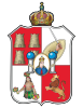
| Nickname(s): The Emerald of the Southeast Spanish: La Esmeralda del Sureste | |
 Location of Villahermosa | |
| Coordinates: 17°59′21″N 92°55′41″W / 17.98917°N 92.92806°W | |
| Country | Mexico |
| State | Tabasco |
| Founded | 24 June 1564 |
| Government | |
| • Mayor | |
| Area | |
| • State capital | 61.177 km2 (23.62 sq mi) |
| • Urban | 63.2 km2 (24.4 sq mi) |
| • Metro | 1,612 km2 (622.4 sq mi) |
| Elevation | 20 m (70 ft) |
| Population (2010 census) | |
| • State capital | 640,359 |
| • Urban | 353,577 |
| Time zone | UTC−6 (CST) |
| • Summer (DST) | UTC−5 (CDT) |
| Federal Routes | |
| Website | www.villahermosa.gob.mx |

Villahermosa (/ˌviː(j)əɛərˈmoʊsə/ VEE-(y)ə-air-MOH-sə, Spanish: [ˌbiʝaeɾˈmosa] (![]() listen); "Beautiful Village") is the capital and largest city of the Mexican state of Tabasco, and the municipal seat of the Centro municipality. Villahermosa, the locality (urban settlement), reported a population of 353,577 in the 2010 census, whereas its Centro municipality had 640,359 inhabitants, a modest increase from the previous censuses. The municipality covers an area of 1,612 km2 (622.4 sq mi), while the city (locality) covers 63.2 km2 as of 2010.[1] The city is situated 863 kilometres (536 mi) southeast from Mexico City.
listen); "Beautiful Village") is the capital and largest city of the Mexican state of Tabasco, and the municipal seat of the Centro municipality. Villahermosa, the locality (urban settlement), reported a population of 353,577 in the 2010 census, whereas its Centro municipality had 640,359 inhabitants, a modest increase from the previous censuses. The municipality covers an area of 1,612 km2 (622.4 sq mi), while the city (locality) covers 63.2 km2 as of 2010.[1] The city is situated 863 kilometres (536 mi) southeast from Mexico City.
The city[]

It is the capital of the Free and Sovereign State of Tabasco, its main city, and is home to the state's largest population. The city is an important business center for the Mexican oil industry. In 2008, the city consisted of 33 colonias and fraccionamientos. Also known as La Esmeralda del Sureste (The Emerald of the Southeast), Villahermosa is a modern city rich in natural resources, in terms of both agriculture and farming. Commercially, the city is served by major merchants, such as Liverpool, Fábricas de Fráncia, Palacio de Hierro, Walmart, City Club, Soriana, Comercial Mexicana and Home Depot. All the major national banks are present in the city as well.
Etymology[]
The city takes the name of Villahermosa, from the title that King Philip II gave it when in 1598, he titled it: "Villa Hermosa of San Juan Bautista", and granted it the use of a that still identifies Tabasco. With the passage of time, the city changed its name several times, until in 1916 the then governor decreed to eliminate the name of "San Juan Bautista", leaving only the name of "Villahermosa" which, according to a decree of the H. State Congress[which?], must be written together and not separated.
Various names that the city of Villahermosa has had[]
Throughout history, the city of Villahermosa has had several names, among which the following stand out:
- 'Villa Carmona' (1564) name given by when founding the city.[2]
- 'San Juan Bautista' (1565) in honor of the city's Patron Saint.
- 'Villa Felipe II' (in honor of the Spanish Monarch).
- 'Villa Hermosa de San Juan Bautista' (1598) Title granted by King Felipe II of Spain.[3][4]
- 'San Juan de Villahermosa' (1604) the Viceroy Marquis de Montesclaros authorizes the name in honor of Juan de Grijalva discoverer of Tabasco.[3]
- 'Villahermosa del Puerto' (1792) When Villahermosa is declared a "minor port". Torruco Saravia (1987), p. 36
- 'San Juan Bautista De Villahermosa' (1811) Torruco Saravia (1987), p. 41
- 'San Juan Bautista de Tabasco' (as of November 4, 1826) by decree of the State Congress. Torruco Saravia (1987), p. 54
- 'Villahermosa' (officially instituted since February 3 of 1916) by decree of the state governor Francisco J. Múgica. In the official newspaper "Tabasco" on February 17 of that year, it is indicated that the name "Villahermosa" must be written together and not separated. Torruco Saravia (1987), p. 316
The extreme geographical coordinates of the municipality are: to the north 18-20', south of 17-43' north latitude; 92-35', west 93-15' west.
Symbols of the City[]
Coat of Arms[]
AAP Tabasco's Coat of Arms
On July 24, 1598, the King Philip II of Spain granted the village of San Juan Bautista the title of Villa Hermosa' of San Juan Bautista, and a Coat of Arms, which since 1892 by decree of the State Congress, was adopted as representative of the state of Tabasco.
The shield has a bull's skin structure or shape with a rounded end and protruding tip in the center, quartered in a sabre-free cross.
In the First Quarter, in the field of gules, four towers plaqued in or and freemasons in sable, clarified in sabre, set two and two, representing the Kingdom of Castile.
In the Second Quarter, in the field of argent, sinister arm in adarga, high two-edged sword wielded; gules, which represent Spanish power over the province.
In the Third Quarter, in Silver Field, Nascent Woman in Carnation, Naked Torso, Sealed, Slashed, Feather Skirt in Shaded Gules of sinople, ribbons on forearms of gules and bouquets of flowers in gules, carved and sylladed on both hands, which represents the indigenous culture of the region.
In the fourth, in the field of gules, rampant lion, crowned, tongued and disarmed, in gold representing the ancient Kingdom of León.
In the oval silver spit, bust of the Virgin Santa Maria in carnation, crowned in gold, dressed in gules and tabled in azure. Smooth embroidery in gold. It is flanked right and sinister by the columns of Hercules with base, shaft and capital in silver shaded in sabre; the die-hand with a band loaded with synople lyrics that says "NEC PLUS" and the sinister bar loaded with synople lyrics that reads: "ULTRA". Peaks each with balloon in azur with meridians and parallels in sabre, summed with sabre crosses, which is interpreted as "Beyond the columns of Hercules". At the bell, closed royal crown which is a gold circle set of interpolated rubies and emeralds of its color.
Location[]
Located 904 km southeast of Mexico City, the city is located in the municipality of Centro, Tabasco, which adjoins the north with the municipalities of Nacajuca and Centla, to the south with the municipalities of and Teapa and with the State of Chiapas, to the east with the municipalities of Centla, and Macuspana and to the west with the state of Chiapas and with the municipalities of Cunduacan and Nacajuca.
- Population of the (2010): 756,065 inhabitants.
- Foundation: Although the first inhabitants settled on site in 1557, the official foundation occurred on June 24, 1564.
The urban area of the city of Villahermosa occupies an area of 61,177 km2, while the territorial extension of the municipality of is 1,612 km2, which correspond to 6.9% of the total state, occupying 7th place on the municipal extension scale.
The territorial division of the consists of a city, 7 villas, 1 village, 132 rancheries, 117 colonies and fractions. The municipality contains 13 regional development centers (CORs) where most economic and social activities are carried out, these are: , Villa Macultepec, , Villa Subteniente García, , Villa , Poblado , Los Boquerones, , and Villa .
History[]

Founded officially on 24 June 1564 by the Spanish on the banks of the Grijalva River under the name of Villa Hermosa, in 1826 the village was raised to the rank of city under the name of San Juan Bautista de la Villa Hermosa (Saint John the Baptist). During the French intervention in Mexico, French troops occupied the city in 1863. In 1916, the governor of Tabasco, Francisco J. Múgica, ordered the restoration of the city's name to Villahermosa.[5]
Today, Villahermosa is a modern city and one of the most important commercial points in the long stretch of territory between Mexico City and Cancún—perhaps second only to Mérida in Yucatán.
"Colonial Age"[]
The Villa Carmona was later christened San Juan Bautista, and was divided into neighborhoods. The oldest of them was the neighborhood of Esquipulas, on the ridge of the hill of Esquipulas and around the Church of Our Lord of Esquipulas, with his image of Christ black, which had been brought from Esquipulas, [Guatemala].
By 1596 he was Mayor of Tabasco who continued to dispatch in Santa Maria de la Victoria as the capital, and because the pirates had been attacking much the coasts of Tabasqueñas, it commands to build in San Juan Bautista (today Villahermosa) the Fort House or Royal Warehouse, in order to defend the population and safeguard the flows Real. The Royal Warehouse was located in what are the current streets of Juárez, Reforma, Madero and Lerdo.[3]
On July 24, 1598, the King granted the city of San Juan Bautista the title of Villa Hermosa de San Juan Bautista" as well as a royal shield (which currently identifies the state of Tabasco) and which is one of the oldest in America.
In 1604, the Mayor of Tabasco requested the Viceroy to authorize the powers to be changed from Santa Maria de la Victoria to St. John the Baptist (now Villahermosa) in addition to requesting that the name of the city be changed to San Juan de Villahermosa, authorizing the change of name of the city, not so the transfer of powers.
The King Philip II of Spain gave the city the title of Villa Hermosa as well as a .
As the pirate attacks did not cease, and they continually destroyed and ranted the village of Santa María de la Victoria, in the year 1619, the change of the powers of the province to San Juan Bautista before the Marquis de Guadalcázar Diego Fernández de Córdoba, authorizing it on December 3 of that same year, however, was re-established. , the move was not made because many neighbors did not want to leave Saint Mary of Victory.[6]
Tabasco Capital for the first time[]
In 1640 due to the continuous pirate attacks on the village of Santa María de la Victoria, the authorities of the Province request the Viceroy to change the capital of the Province to San Juan de Villahermosa, which the Viceroy authorizes on 3 February 1641. The transfer of powers takes effect on June 24 of that same year, making Villahermosa the new capital of the Province of Tabasco. The "Fortín de la Encarnación" is immediately built in what is now the park of "the birds" on the corner that form the current streets of May 5 and Zaragoza at the foot of the hill of "La Encarnación".[7]
In 1677 as Mayor , the privateers fiercely attacked the capital Villahermosa de San Juan Bautista, forcing the authorities to leave the city and transfer the powers to the village of Tacotalpa, which was the capital of the province by 118 Years. On June 21 of that year, the Mayor of Tabasco informed the Viceroy that the fear of pirate invasions had caused the depopulation of entire villages such as Cunduacán, and that Villahermosa, which was the capital, was had depopulated too."'
In 1688 they were built in Villahermosa, lookouts, trenches and fortifications, to protect the desolate city from pirate attacks. However, in 1711 Villahermosa is again fiercely attacked by the English pirates, who set fire to the Royal Warehouse that was the Government House, the defenders had to take refuge in the "Fortín de la Encarnación", which withstood the attack, but the pirates burned down many houses leaving the town in ruins.

It was until July 16, 1717, when the then Mayor of Tabasco , at the head of an army of Tobaccoandos and Veracruz forces, attacks the pirates on the Island of Tris (now the island of Carmen) that at that time belonged to Tabasco . Despite the death of [Alonso Felipe Andrade], the Tabaqueña forces expel the pirates and founded that same day the military post of Nuesra Señora del Carmen (today [City of Carmen]). However, in 1757 the English pirates counterattacked the military post of Nuestra Señora del Carmen, setting it on fire and destroying it, and then re-attacking the Tabasque coasts.
Finally, in 1785, the Tabasco militias, commanded by Captain and Lieutenant Francisco Interiano, defeated and permanently evicted the English from Carmen Island.[8] Tabasco Capital for the Second Time In January 1795 the Viceroy authorized the change of the powers of the Province of Tabasco from Tacotalpa to Villa Hermosa de San Juan Bautista, taking effect on Monday, August 15 of that year. Thus, after 118 years, Villahermosa is again the capital of Tabasco.
The neighborhood of La Punta or La Concepción was the next growth step of San Juan that transcended the first natural boundaries of the site. Developed around the church of the Immaculate Conception - "La Conchita"-, the neighborhood was also known as La Punta for being at the southern end of the city, on a hillside of the hill of La Eminence, between the Grijalva River, the lagoon of La Pólvora and the primary trace. The last district dating from the late colonial era, from the early years of the nineteenth century, was the neighborhood of La Santa Cruz, with its center in the church of the same name. This neighborhood was developed on marshy and grassland land north of the city center.
The city lived peacefully during the last years of the Colony, being an important river port. The 19th century The Installation of the First Town Hall In November 1808, the Viceroy of the [New Spain] don Pedro de Garibay arranged for elections to be made for the first Town Hall of Villa Hermosa (at that time it was written separately), verifying the solemn installation of this first Town Hall on 1 January 1809.[9]
The Libertarian Struggle[]
During the struggle for Independence, few libertarian movements aroused in the state capital, due to the fierce control exercised by the colonial authorities of the province. It was until [1814] that [José María Jiménez Garrido] launched the cry of insurrection, however he was imprisoned by the governor and sent to [San Juan de Ulúa].
On July 5, 1821, Villahermosa was taken by the independentists headed by and [10] and at 2 p.m. in the , proclaims independence[11] and unveils the 'Glorious Independent System, however the governor managed to stifle the rebellion and the royalists recapture the city.[12] The Proclamation of Independence On September 7, 1821, The Colonel , who came from Veracruz, fought a slight battle in the village of Tamulté (now a colony of Villahermosa), defeating the Spanish army and planting himself in the vicinity of San John the Baptist, which led to the escape of the last colonial governor of Tabasco , and triumphantly entered the city proclaiming The National Independence.
paraded with the troop by the royal road to Atasta and Tamulté (today Av. 27 de Febrero), to Cruz Verde (today Av. Francisco Javier Mina), folded on Yerbabuena street (today Iguala), to the hill and street of the "Encarnación" (today 5 may), occupying the new barracks on Today's Independence Street, the Old Barracks, the Town Hall and the where I proclaim Tabasco's independence from the Spanish crown.[13] Completing 302 years and six months of Spanish rule in the state.
The next day September 8, at 9 a.m. in the , the local authorities swear the Iguala Plan and sign the annexation to the new nation, thus remainingTabasco attached to Mexico The festivities culminated in a mass and a "Te Deum" in the hermitage of the Conception.[14]
First Constitutional Town Hall[]
Shortly after the consummate of the Independence movement, in November 1821, the first Constitutional Council was elected in accordance with the Constitution of 1812, being elected as the first Don Mayor. Taking office on 1 January 1822.[15] •'Change's name and rank's. In solemn meeting, held on October 27, 1826, the Congress of the State, decreed the renaming of the capital city, determining that from November 4, 1826, the city of Villahermosa would be called San Juan Bautista de Tabasco, granting it in addition to the rank of "city".[16]
Cholera Epidemic[]
On November 26, 1833, the epidemic of was declared in St. John the Baptist, and can be controlled until September 1834. A total of 2,500 people died in the state capital and according to the report of the "Ministry of Justice and Ecclesiastical Business", which appeared in the official newspaper of August 25, 1849, 4,020 people died statewide.[17]
On December 16 i arrived at St. John the Baptist, and the cholera epidemic was in all its might, and another calamity no less terrible, the civil war, was on the eve of the outbreak..." Juan Federico Maximilian. Baron of Waldeck."[18]
The Civil War and the Separation of Tabasco VT Tabasco Separation Federalist Revolution (Tabasco) The succession of violent events began in 1833, when the civil war began in the state, between centralists and federalists with the victory of the centralists in 1834. Later in 1839, the which culminated in November 1840, with the takeover of the city and the victory of the Tabasque federalists led by the Cuban , the jalisciense and the Tabasqueño . After the federalist revolution, the Texan navy that had supported demanded payment for collaborating in the victory, and in the end of achieving it, began a bombardment of the city of San Juan Bautista. The bombing was halted two days later thanks to negotiations by the governor . The triumph of the Tabasque federalists would annoy the president Anastasio Bustamante, who on February 11, 1841, ordered heavy economic sanctions for the state, taking the State Congress and the governor the decision to decreeing the from Mexico on 13 February 1841.[19] Granting the local Congress to the governor the functions of President.[20] creating two departments: the Treasury department and the War and Navy department. The various revolts and seasoned military stakes between 1833 and 1841 left the city heavily destroyed.
U.S. Invasion[]
On October 23, 1846, U.S. forces invaded Tabasco, and on the 25 thresemonious day they arrived at the capital San Juan Bautista, which was defended by the Governor of the state and Military Commander , who was in command of the Tabaquean militias and the Acayucan Battalion. The commander demanded the surrender of the square, to which the governor replied that the square would defend it with life, so they could initiate the attack, the bombing was not expected, it was 14:15.[21] developed between 25 and 26 October, which is known as the [First Battle of Tabasco].
Due to the resilience of the city, they indiscriminately bombed St. John the Baptist, destroying their main buildings such as neighborhood churches, public prison, theater and room houses of the three neighborhoods but due to the fierce defense of the authorities and villagers, fail to take the city. This would be the only battle won by Mexican forces over the Americans, and was achieved thanks to the expertise of Colonel and to the value of the Tobacco military volunteering, headed among others by: Miguel Bruno, Manuel Escofié, José Julián Dueñas, Juan Duque de Estrada, [Simón Sarlat García], Manuel Plascencia, and many more.[22] The Americans retreated to the port of where they set up an eight-month blockade, to prevent food and bastimento from reaching St. John the Baptist.
Faced with this, the governor asked the federal government for help in the purchase of war equipment and materials, in order to protect the square from a second invasion, however, in the face of the federal government's refusal, Traconis declares Tabasco separated from the Mexican nation. However his proposal was unresonated, and Traconis was removed from the office of governor, assuming the functions .
On June 16, 1847, the Americans returned to St. John the Baptist, staging the [Second Battle of Tabasco], in which the Americans re-bomb the city, which without bastimentos or food, falls into the hands of the invaders on June 15, having to flee the authorities to the village of Tacotalpa which is named state capital. The Americans take the city and appoint Commander Van Brunt governor of the state.
However, on July 22, the Tobacco guerrillas led by Miguel Bruno, which gave them no truce or respite, began performing in the city.[23] On the 26th arrived in St. John the Baptist, Commander Bigelow who replaced Van Brunt in government, and tried more reinforcements to defeat the Tobacco forces. Due to the strong Tobacco guerrillas, and the reckless courage of the Tabasqueños organized by the Colonel first, and the governor afterwards, were the causes that gave the national weapons in [Tabasco] the triumph about the Americans, on July 22, 1847.[24] Defeated, the Americans vacated the city in which they stayed for 35 days, after which they withdrew not without first setting fire and raving much of the city, leaving it completely destroyed and burned.
French Invasion[]
Also, in 1863 and 1864, both French interventionist forces and Mexican pro-imperialist forces again destroyed much of the buildings of San Juan. On 18 June 1863, the French army under the command of Eduardo González Arévalo, dawned before the capital of the state San Juan Bautista, initiating a heavy bombardment and landing with 150 men.[25] A line of defense was established from the square of Ruiz to the stream El Jícaro, the bombardment was so intense that forced the retreat of the defenders to the outskirts of the city, taking control of the invaders of the city and establishing its barracks in the building called "The Principal" which had been the Royal Warehouse during the colony. From the capital, the French invaders would begin the struggle to control the entire state of Tabasco. However, the Tobacco forces would gradually go back to ground.
Six months later, on December 2, 1863, the Tabasque Republican forces under the Colonel begin bombing the city of San Juan Bautista.[26] The prelude to the final assault began with the harassment of the capital, and was attacked from different flanks by , , , and Pedro Fuentes who by the end of 1863 had closed the fence over the state capital.[27]
The final assault on the capital began on 13 January 1864,[28] and as the enemy became closer, various battles and skirmishes took place, in what is known as the [St. John the Baptist's Take] in a street-by-street fight. Republican forces gradually gained ground and by January 18 were in the center of the capital, causing French troops to retreat, entrenching themselves in the Royal Warehouse known as "The Principal". It was fought until February 25, when the Strong House or The Principal began to gun down, and on February 27, when the dawn broke, the French invaders undertook the retreat leaving the state capital,[26] this glorious date for national weapons since this was the first region from which the French invaders were expelled from the national territory. Churches and buildings rebuilt after the French bombing had to be rebuilt after this new aggression.
The Twentieth and Twentyfirst Century[]
Mexican Revolution in Tabasco[]
The 1890s and 1900s witnessed the first notable expansions of this colonial city. However, during the [Mexican Revolution in Tabasco', the political and social instability that characterized Mexico, was also reflected in the state capital, where in that period, there were 13 governors and in 1918 there were two governors and two state congresses at the same time. On June 28, 1911, he made his triumphant entrance to St. John the Baptist, the revolutionary contingent of the Chontalpa under .
During the Revolution, on August 28, 1914 at the head of the Usumacinta Brigade, he entered the capital San Juan Bautista, taking office of the government on 31 August, which stunned the struggle between the defatuent factions Revolutionary. On September 2, the generals , , [Ramón Sosa Torres], and [José Domingo Ramírez Garrido], entered the state capital, with the arrival of the chontalpa revolutionaries, there were suffoals and terrors in the city. The general took office in government, however, the Donetists attacked the state capital, causing the authorities to leave St. John the Baptist because they protested for "electoral fraud" formed their Congress and settled in Amatitan, recognizing Luis Felipe Domínguez as constitutional governor and brought before the Senate of the Republic, a case of conflict of powers, since there are two governors and two Congresses at the same time. In 1919 with the help of [Tomás Garrido Canabal" Tomás Garrido] defeats the Donetists and will recapture the state capital.
He had just finished the revolutionary movement, then there was a strong and transcendent re-arrangement of the socio-political and reorganization classes of the Mexican state. The war known as "Christian" spread throughout the country, and in [Tabasco] it had its own manifestations. By government decree of February 3, 1916, the city was renamed "Villahermosa", stating that the name should be written together and not separated as it was in place.
Delahuertista rebellion in Tabasco[]
In 1923 the general Adolfo de la Huerta protested against the imposition of the presidential candidacy of [Plutarco Elías Calles], which caused the landowners to rise up in arms in various parts of the country. In Tabasco, in mid-December the homeless men rose in arms in the port of against the governor Tomás Garrido Canabal and Alvaro Obregón, while the general joined the movement, rising in arms in the Chontalpa.
On January 10, 1924, at the head of 2,500 men, the generals and Fernando Segovia besieged and took Villahermosa the capital of the state, without being contained by forces loyal to the President , commanded by Generals Vicente González and Miguel Henríquez Guzmán,[29] leading to the escape of the governor Tomás Garrido Canabal, who had to hide for a few days and then left the city at night in a cayuco. The delauertists appointed as governor who occupied the governorship from January 21 to June 7, 1924, when the rebellion ended when the state was attacked by federal forces and defeated the deserters.[30]
Garridism[]
This time began in 1928 with the arrival of Tomás Garrido Canabal in the state government. Several times Governor of Tabasco, he created the organization "red shirts" which, in addition to his political activity of support, deployed a paramilitary battle against the Catholic Church in the state. As authority he expelled the bishop, the priests and decreed several prohibitions concerning worship, religious feasts, Catholic funeral rites, including domestic worship and even the mere mention of God. He closed the temples and gave them a new use, turning them into "rationalist" schools, military barracks or libraries. Later, the temples, the center of the old quarters, were demolished. The images were burned, but the Christians hid several of them in the "mountain", including the black Christ of Esquipulas and also the image of the Virgin Mary brought by . Life linked to worship and other religious celebrations virtually disappeared in Garrido's years of authority, whose influence he left feeling even after his last governorship in 1934.
Contemporary Time[]
In the 1940s and 1950s, the expansion of Villahermosa was made up of developments by state governments and landowners who prepared and fractionated land that had previously had agricultural, grassland or grassland use forest, thus creating the first colonies. On the other hand, the installation of drains, stormwater ducts, etc. began to change also the physiognomy of some old streets. Juan Perez Arrollave Infantry Lieutenant who participated in the Mexican Revolution, was as municipal president from 1946 to 1950, personal friend of Plutarco Elias Calles
The old St. John the Baptist, now became the "center" of a larger city. The babbling of a new urban phenomenon began to manifest itself: metropolization.
When [Tabasco] entered the "age of capital", that is, it fully integrated into the country's economic development through oil exploitation and the construction of road, hydro-agricultural and hydroelectric infrastructure in the 1950s-1960s, Villahermosa began an important commercial development, towns such as Tamulté, Atasta and Tierra Colorada, became populous colonies of the new city.
By 1970 the city was also revealed as a modern and modern city, due to a process of architectural dynamism that began in the last century, when the state of Tabasco became one of the main oil regions of the country, which changed the urban geography of Villahermosa.
Buildings and large recreation centers changed the physiognomy of the state capital, being the area called Tabasco 2000, the main area of progress, the best example of the rejuvenated city. In Tabasco 2000 reside the Municipal Powers, the Administrative Center of Government, office buildings, banks, hotels, restaurants, shopping squares and residential areas.
Main sights[]
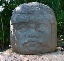

La Venta Museum-Park, which includes a small zoo, has the most important collection of Olmec artifacts.
Other sights include:
- Esperanza Iris Theatre.
- Plaza de Armas (main square)
- Zona Luz (city centre)
- Catedral del Señor de Tabasco (Cathedral of the Lord of Tabasco).
- Tomás Garrido Canabal Park
- La Venta (site museum)
- Yumká (zoo where animals roam freely).
- La Choca Park.
- Tabasco Park - a 'must see' during the Feria festivities.
- Papagayo Children's Museum.
- Musevi
Geography and natural resources[]
Villahermosa is located in the southeast of Mexico between the rivers Grijalva and Carrizal. The average elevation of the city is 10 meters above sea level. The city also has several lagoons, the largest and most important of them being La Laguna de las Ilusiones (Illusions Lagoon).
The most important city thoroughfares are Paseo Tabasco, Gregorio Méndez Avenue, the Periférico, Ruiz Cortines Avenue, and Pino Suárez Avenue.
Climate[]
Like most of Tabasco, Villahermosa has a tropical monsoon climate. Temperatures during spring and summer seasons can reach upwards of 40°C (104 °F), with humidity levels hovering around 30% during the same period (for total humidity-adjusted temperatures in the high forties). During its short "winter", Villahermosa's climate is very humid but daytime temperatures decrease to around 28°C (82 °F).
The most stunning season of the year is spring, as the flamboyán, guayacán, macuilis, and other tropical vegetation bloom and dress the city with a beautiful sense of joy along its major thoroughfares.
In October 2007, Villahermosa suffered its worst flood in recorded history. Several hundred thousand people were displaced because of flooded homes.
| hideClimate data for Villahermosa (1951–2010) | |||||||||||||
|---|---|---|---|---|---|---|---|---|---|---|---|---|---|
| Month | Jan | Feb | Mar | Apr | May | Jun | Jul | Aug | Sep | Oct | Nov | Dec | Year |
| Record high °C (°F) | 38.0 (100.4) |
38.0 (100.4) |
41.5 (106.7) |
43.1 (109.6) |
43.5 (110.3) |
41.7 (107.1) |
40.0 (104.0) |
40.0 (104.0) |
38.5 (101.3) |
37.5 (99.5) |
38.0 (100.4) |
35.5 (95.9) |
43.5 (110.3) |
| Average high °C (°F) | 27.9 (82.2) |
29.2 (84.6) |
31.9 (89.4) |
33.9 (93.0) |
35.1 (95.2) |
34.4 (93.9) |
33.9 (93.0) |
34.0 (93.2) |
33.0 (91.4) |
31.2 (88.2) |
29.8 (85.6) |
28.3 (82.9) |
31.9 (89.4) |
| Daily mean °C (°F) | 23.6 (74.5) |
24.5 (76.1) |
26.6 (79.9) |
28.5 (83.3) |
29.6 (85.3) |
29.3 (84.7) |
28.9 (84.0) |
28.9 (84.0) |
28.4 (83.1) |
27.1 (80.8) |
25.7 (78.3) |
24.1 (75.4) |
27.1 (80.8) |
| Average low °C (°F) | 19.3 (66.7) |
19.7 (67.5) |
21.3 (70.3) |
23.1 (73.6) |
24.2 (75.6) |
24.2 (75.6) |
23.8 (74.8) |
23.8 (74.8) |
23.8 (74.8) |
23.0 (73.4) |
21.5 (70.7) |
19.9 (67.8) |
22.3 (72.1) |
| Record low °C (°F) | 10.5 (50.9) |
12.4 (54.3) |
13.0 (55.4) |
15.0 (59.0) |
13.0 (55.4) |
19.0 (66.2) |
20.0 (68.0) |
20.0 (68.0) |
19.5 (67.1) |
17.0 (62.6) |
14.0 (57.2) |
10.9 (51.6) |
10.5 (50.9) |
| Average rainfall mm (inches) | 125.6 (4.94) |
79.0 (3.11) |
50.1 (1.97) |
44.6 (1.76) |
95.9 (3.78) |
208.5 (8.21) |
178.9 (7.04) |
216.8 (8.54) |
328.2 (12.92) |
299.9 (11.81) |
187.2 (7.37) |
145.0 (5.71) |
1,959.7 (77.15) |
| Average rainy days (≥ 0.1 mm) | 11.1 | 8.5 | 5.8 | 4.2 | 5.9 | 13.9 | 14.5 | 15.7 | 18.3 | 16.2 | 11.3 | 11.0 | 136.4 |
| Average relative humidity (%) | 76 | 75 | 73 | 73 | 71 | 72 | 72 | 75 | 77 | 79 | 81 | 81 | 75 |
| Mean monthly sunshine hours | 168 | 185 | 252 | 215 | 278 | 217 | 252 | 245 | 167 | 150 | 170 | 144 | 2,443 |
| Source 1: Servicio Meteorológico National (humidity 1981–2000)[31][32][33] | |||||||||||||
| Source 2: Deutscher Wetterdienst (sun, 1961–1990)[34][a] | |||||||||||||
Transportation[]

The city is served by several national air carriers. Its airport, the Carlos Rovirosa Pérez International Airport, is operated by Aeropuertos del Sureste de Mexico (ASUR) and has recently seen a significant expansion. This airport was the destination for the 1929 Mexicana inaugural flight. The city is the closest destination to the ancient Mayan ruins at Palenque. Airlines providing flights to/from the airport are: Aeromexico, Interjet, United, VivaAerobus, and previously by the defunct Mexicana de Aviación.
Education[]


The city has an extensive network of elementary, secondary, and college-preparatory educational centers.
It is also home to the most important universities of the state of Tabasco, among them:
- Universidad Juárez Autónoma de Tabasco (UJAT)
- Instituto Tecnológico de Villahermosa
- Universidad Tecnológica de Tabasco
- Universidad del Valle de México
- Universidad Mundo Maya[35]
- Universidad Olmeca
- Universidad Autónoma de Guadalajara Campus Tabasco
Religion[]
Like the rest of the Mexico there is no official religion. Tabasco's population is mostly Catholic, with many Protestant denominations also represented.
Infrastructure[]
Urbanism[]
VT Villahermosa's Old Town

Despite being a very old city, Villahermosa has a modern physiognomy. The guards the old colonial center of the city. It is an area of approximately 143 hectares[36] containing the oldest buildings in the city, including the first painting where the or Main Park, where the [[Tabasco Government Palace] is located Government Palace]], the headquarters of the executive branch of the State; the Legislative Palace, the headquarters of the H. Congress of the State; the High Court of Justice, the headquarters of the Judiciary, and the Church of the Conception, opened on 8 December 1800 but destroyed by the American bombing sprees in 1846 and 1847 and by the French in 1863 and 1864.[37] There are other buildings of historical value in the area, such as the House of Tiles (now the Museum of History), the ancient Juarez Institute (now house of culture of the ), the museum house of the poet and others buildings that are now art galleries or businesses.
The heart of the is the so-called Light Zone', formed by Juarez, Lerdo, Aldama, and Sáenz streets, Reforma, which are the oldest in the city and which have been transformed into pedestrian streets, where there are cafes, restaurants, neverías, clothing stores, etc., and they constitute the commercial heart of the city. Also within the are located the Park of the Corregidora, the Juarez Park, the Square of the Eagle and the Square Bicentennial, with a metallic of 30 meters high.
Outside the historic center, the city features modern architecture. Its rapid development since the 1970s caused it to overflow into areas that were formerly formed by lagoons, grasslands and swamps, and to absorb other communities, such as , and , now populous colonies. Its most important roads that link the city of Villahermosa between different points are: Av.: from the Gaviotas Bridge to the Peripheral Arco Noreste, crossing sites such as the Main Cemetery, the , crosses the , the tourist complex , [[Gregorio[Gregorio Mendez Magaña Av. Gregorio Mendez]], [[27 February] Av. 27 De Febrero]], Av. , [Av. Francisco J. Mina], El and the communicate to the different points of importance of the city.

In the west of the city is located the most important commercial and financial area called Tabasco 2000, urban complex built in the 1980s as a result of the strong oil activity, there are located important commercial squares, banks, restaurants, hotels and high-class residential developments. Tall and modern office buildings, they account for the important economic development of the city.
To the north is the Industrial City with its two stages, and housing areas of social interest and middle class. To the south, the mountains and higher areas have led to the proliferation of shopping centers and housing and residential developments.
Over the past 10 years, the lack of suitable land for the construction of housing and the new reordering that prohibits construction in low and flood areas of the city, has led to the growth of housing developments to the outskirts of the city, promoting the growth of the urban spot towards nearby towns, now integrated into the so-called , promoting the development of populations such as Villa Parrilla, Macultepec, Ocuiltzapotlán, Playas del Rosario, Río Viejo, Buenavista, Ixtacomitán and Boquerón where most housing fractions currently take place.
Major urban planning projects[]
The most important urban projects that are planned or currently under construction in the city of Villahermosa, are:
- Emerald City', (Project) Includes State Government offices, as well as medium-interest housing, hospitals and shopping plazas
- New Convention Center' (Project) A huge complex of halls for top-level exhibitions.
- Extension of the Internal Circuit Carlos Pellicer, is an extension of 4 to 8 lanes of what was once the Peripheral of the city since due to its growth this was absorbed by the urban spot, now called "Circuit Interiór"
- Libramiento de Villahermosa, 4-lane road, 12 steps at uneven and 39 km long, which will serve to de-skid the heavy traffic that daily runs through the streets of the city. This route will be quota, and is expected to be completed in 2013.
- Road Distributor 'Tabscoob'' (Already built)Modern road distributor located at the confluence of Adolfo Ruíz Cortines, Luis Donaldo Colosio and Circuit Interior "Carlos Pellicer" in the east of the city, and will speed up the intense traffic existing vehicle in the Tabscoob roundabout.
- Road Distributor 'La Pigua'' (construction completed): This road distributor projected for the confluence of University Avenue and the "Carlos Pellicer" Indoor Circuit, which will serve to speed up the intense vehicular traffic that exists in the currently in the roundabout "Carlos A. Madrazo" in the north of the city. It envisages the expansion of two bridges over the Carrizal River as well as the extension of 4 to 8 lanes of industrial boulevard. Mexican and two steps at unevenness.
- Villa Brisa (Land Preparation) This is a mixed-use development located on the side of the Shopping Center , will have an artificial lake and several towers of apartments and shops.
- Tabasco Diamante' (In Construction): Located in front of the Shopping Center On the peripheral Carlos Pellicer Camara
This project started in 2015.... The exact date of completion of the works is not yet known... This place will have numerous buildings and possibly shops of the chains Best Buy and Costco. It will occupy a 43-hectare plot of land
Tourism[]
Villahermosa gives tourists a wealth of attractions, including zoos, history museums, ecological parks, interactive museums and huge green areas. Villahermosa is culture and tradition. From Tomás Garrido Canabal Park with its multiple spaces to modern technological museums such as the Tabasco 2000 Planetarium, galleries, theaters, parks, museums; a true universe of possibilities for those who want to come on holiday to Villahermosa and relax or fill with culture. Delight in the huge natural spaces where you can let the wind caress you or lie under a tree to admire the scenery. Spend interesting afternoons touring museums, art galleries and squares imbued with Tabasco culture.

In addition to this, Villahermosa is one of the main congress and convention destinations in the country. In 2010 alone, 61 congresses and conventions were held with a total of 40,933 attendees,[38] highlighting that the city is the permanent seat of the "Mexico's International Petroleum Congress and Conference"' which is held each year and brings together just over 3,000 attendees from all over the world.
The city has more than 4,000 hotel rooms,[39] large shopping, entertainment, dining and infrastructure with world-class services, making it the ideal place to conduct everything from small conventions to size conferences International.
Excellent air communications, as it has an international airport, which has flights to and from the main cities of the country; by land, modern highways and wide roads link it to the center and south of the country; and by sea, the commercial port of (80 km from the city), has the capacity to receive cargo ships and cruise ships up to 10 m in line, in addition to having top-notch port infrastructure.
Health[]
The city is served by a large number of both private and public healthcare institutions, hospitals, and clinics. Both ambulatory (same-day) centers as well as extended stay centers serve the city. General as well as specialized hospitals provide care in the city. Amongst its specialized health care institutions are a Women's Hospital, a Children's Hospital, and an Oncology Hospital. There are also various government healthcare institutions located here, including the and the IMSS Medical Centers. The Seventh-day Adventist Church has a hospital here as well, Hospital del Sureste. There is also the well-respected Hospital Los Angeles.
Twin towns[]
Villahermosa has two sister cities. They are:
See also[]
References[]
- ^ "Tabasco (Mexico): Municipalities & Localities - Population Statistics, Charts and Map".
- ^ Torruco Saravia 1987, p. 30
- ^ Jump up to: a b c Torruco Saravia 1987, p. 31
- ^ Gil and Sáez Manuel. Historical and Statistical Compedium of Tabasco. Government of the state of Tabasco. 1979. p = 115
- ^ Enciclopedia de Municipios de México, [Tabasco - Centro]
- ^ Torruco Saravia, Geney (1987). H. Ayuntamiento Constitucional del Municipio de Centro (ed.). Villahermosa Nuestra Ciudad. p. 34. OCLC 253403147.
- ^ Torruco Saravia, Geney (1987). H. Ayuntamiento Constitucional del Municipio de Centro (ed.). Villahermosa Nuestra Ciudad. p. 32. OCLC 253403147.
- ^ Carlos Ruiz Abreu. Trade and Militias of Tabasco in the Colony. Government of the State of Tabasco. 1989. p-117
- ^ Torruco Saravia, Geney (1987). H. Ayuntamiento Constitucional del Municipio de Centro (ed.). Villahermosa Nuestra Ciudad. p. 40. OCLC 253403147.
- ^ 'CitaTed Harvard' Martínez Assad-2006-p-60-sp-yes-
- ^ 'Cita Harvard' Abdo Francis 2011-p-83-sp-yes-
- ^ 'CitaHarvard' Martínez Assad-2006-p-60-sp-yes-
- ^ Torruco Saravia, Geney (1987). H. Ayuntamiento Constitucional del Municipio de Centro (ed.). Villahermosa Nuestra Ciudad. p. 48. OCLC 253403147.
- ^ Torruco Saravia, Geney (1987). H. Ayuntamiento Constitucional del Municipio de Centro (ed.). Villahermosa Nuestra Ciudad. p. 49. OCLC 253403147.
- ^ Torruco Saravia, Geney (1987). H. Ayuntamiento Constitucional del Municipio de Centro (ed.). Villahermosa Nuestra Ciudad. p. 51. OCLC 253403147.
- ^ Torruco Saravia, Geney (1987). H. Ayuntamiento Constitucional del Municipio de Centro (ed.). Villahermosa Nuestra Ciudad. p. 54. OCLC 253403147.
- ^ Torruco Saravia, Geney (1987). H. Ayuntamiento Constitucional del Municipio de Centro (ed.). Villahermosa Nuestra Ciudad. p. 58. OCLC 253403147.
- ^ Torruco Saravia, Geney (1987). H. Ayuntamiento Constitucional del Municipio de Centro (ed.). Villahermosa Nuestra Ciudad. p. 59. OCLC 253403147.
- ^ Torruco Saravia, Geney (1987). H. Ayuntamiento Constitucional del Municipio de Centro (ed.). Villahermosa Nuestra Ciudad. p. 71. OCLC 253403147.
- ^ Torruco Saravia, Geney (1987). H. Ayuntamiento Constitucional del Municipio de Centro (ed.). Villahermosa Nuestra Ciudad. p. 72. OCLC 253403147.
- ^ Torruco Saravia, Geney (1987). H. Ayuntamiento Constitucional del Municipio de Centro (ed.). Villahermosa Nuestra Ciudad. p. 83. OCLC 253403147.
- ^ Torruco Saravia, Geney (1987). H. Ayuntamiento Constitucional del Municipio de Centro (ed.). Villahermosa Nuestra Ciudad. p. 85. OCLC 253403147.
- ^ Torruco Saravia, Geney (1987). H. Ayuntamiento Constitucional del Municipio de Centro (ed.). Villahermosa Nuestra Ciudad. p. 87. OCLC 253403147.
- ^ Torruco Saravia, Geney (1987). H. Ayuntamiento Constitucional del Municipio de Centro (ed.). Villahermosa Nuestra Ciudad. p. 88. OCLC 253403147.
- ^ "Harvnp" Torruco Saravia-1987-p-100-sp-yes-
- ^ Jump up to: a b Torruco Saravia, Geney (1987). H. Ayuntamiento Constitucional del Municipio de Centro (ed.). Villahermosa Nuestra Ciudad. p. 102. OCLC 253403147.
- ^ Torruco Saravia, Geney (1987). H. Ayuntamiento Constitucional del Municipio de Centro (ed.). Villahermosa Nuestra Ciudad. p. 242. OCLC 253403147.
- ^ 'harvnp' Arias Gómez-1987-p-242-sp-yes-
- ^ 'Cita Harvard' Martínez Assad-2006-p-164-sp-yes-
- ^ 'Citation Harvard' Martínez Assad-2006-p-166-sp-yes-
- ^ "Estado de Tabasco–Estacion: Villahermosa (DGE)". NORMALES CLIMATOLÓGICAS 1951–2010 (in Spanish). Servicio Meteorológico National. Archived from the original on 18 May 2015. Retrieved 7 May 2015.
- ^ "Extreme Temperatures and Precipitation for Villahermosa (DGE) 1949–2011" (in Spanish). Servicio Meteorológico Nacional. Retrieved 7 May 2015.
- ^ "NORMALES CLIMATOLÓGICAS 1981–2000" (PDF) (in Spanish). Servicio Meteorológico Nacional. Retrieved 7 May 2015.
- ^ "Station 76743 Villahermosa, TAB". Global station data 1961–1990—Sunshine Duration. Deutscher Wetterdienst. Retrieved 7 May 2015.
- ^ Maya, TI Universidad Mundo. "Universidad Mundo Maya". www.umma.com.mx. Retrieved 2017-02-23.
- ^ Guide to the Historic Center of Villahermosa. National Institute of Anthropology and History. 2001
- ^ Torruco Saravia, Geney (1987). H. Ayuntamiento Constitucional del Municipio de Centro (ed.). Villahermosa Nuestra Ciudad. p. 47. OCLC 253403147.
- ^ ,'Web Quote', 'Title', 'Visit Tabasco', 'author', Office of Congresses and Visitors of Tabasco. Tabasco State Government .url.http://www.visitetabasco.com/eventos.html .26 November 2010 .urlfile.org/web/2009091702751/http://www.visitetabasco.com/eventos.html .html .17 September 2009
- ^ -web quote, title, visit Tabasco, author, Tabasco Congress and Visitors Office. Tabasco State Government .url.http://www.visitetabasco.com/tab_rutas_paths_villahermosa.html .22 November 2010 .urlfile.https://web.archive.org/web/20100411231312/http://www.visitetabasco.com/tab_rutas_villahermosa.html "April 11, 2010" Archivedate,
Notes[]
- ^ Station ID for Villahermosa, TAB. is 76743 Use this station ID to locate the sunshine duration
Further reading[]
External links[]
| Wikimedia Commons has media related to Villahermosa, Tabasco. |
| Wikivoyage has a travel guide for Villahermosa. |
- Ayuntamiento del Centro (Municipality of Centro)
- Diario Tabasco Hoy (state and regional news)
- Gobierno del Estado de Tabasco (Tabasco state government)
| show |
|---|

| show Authority control |
|---|
- Villahermosa