Wentworth, Quebec
Wentworth | |
|---|---|
Township municipality | |
 | |
 Location within Argenteuil RCM | |
 Wentworth Location in central Quebec | |
| Coordinates: 45°48′N 74°22′W / 45.8°N 74.37°WCoordinates: 45°48′N 74°22′W / 45.8°N 74.37°W[1] | |
| Country | |
| Province | |
| Region | Laurentides |
| RCM | Argenteuil |
| Settled | 1830s |
| Constituted | July 1, 1855 |
| Government | |
| • Mayor | Jason Morrison |
| • Federal riding | Argenteuil—Papineau—Mirabel |
| • Prov. riding | Argenteuil |
| Area | |
| • Total | 94.40 km2 (36.45 sq mi) |
| • Land | 87.69 km2 (33.86 sq mi) |
| Population (2016)[3] | |
| • Total | 533 |
| • Density | 6.1/km2 (16/sq mi) |
| • Pop 2011-2016 | |
| • Dwellings | 788 |
| Time zone | UTC−5 (EST) |
| • Summer (DST) | UTC−4 (EDT) |
| Postal code(s) | J8H 0C7 |
| Area code(s) | 450 and 579 |
| Highways | No major routes |
| Website | www |

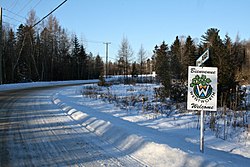
Wentworth is a township municipality in the Laurentides region of Quebec, Canada, part of the Argenteuil Regional County Municipality, north-west of Lachute.
Its population centres are Louisa and Dunany.
Geography[]

The township is in the foothills of the Laurentian Mountains, not exceeding 487 meters (1,598 ft) above sea level, with a rocky, sandy, gravelly soil that is not conducive to agriculture. However, much of the land was cleared by early Irish settlers for farming and there remains small pockets of pastures along the Dalesville River, especially in the Glen and around the town center. It is dotted with many lakes, such as Curran, Black, McDougall, Rainbow, and most notably Lake Louisa - the largest lake in the Regional County. These lakes attract many cottage vacationers and fishing enthusiasts.[4][5]
The headwater of the Dalesville River, the largest river in Wentworth, begins at the outlet of Barrows Lake on the western edge of the municipality and meanders for approximately 12 km through the municipality.
History[]
The Gale and Duberger map of 1795 already shows the Wentworth Township, but it was not officially established until 1809.[4] It is unclear if it is named after a village in York County, England, or that it is a tribute to Sir John Wentworth (1737-1820), Lieutenant Governor of Nova Scotia from 1792 to 1808.[5]
Around 1830, a group of settlers composed of Irish and French Canadians, began clearing the rough land with difficulty. In 1845, the Gore Municipality was established, which included the Gore and Wentworth Townships, but it was abolished two years later. In 1855, the Wentworth Township Municipality was formed.[5]
In 1914, a small portion of the Wentworth and Montcalm Townships separated and formed the Municipality of Lac-des-Seize-Îles,[6] and in 1958, Wentworth lost a large chunk of its territory when the Municipality of Wentworth-Nord separated.[7]
Demographics[]
| hideCanada census – Wentworth, Quebec community profile | |||
|---|---|---|---|
| 2016 | 2011 | ||
| Population: | 533 (6.2% from 2011) | 502 (3.9% from 2006) | |
| Land area: | 87.69 km2 (33.86 sq mi) | 87.16 km2 (33.65 sq mi) | |
| Population density: | 6.1/km2 (16/sq mi) | 5.8/km2 (15/sq mi) | |
| Median age: | 56.9 (M: 57.4, F: 56.2) | 53.5 (M: 53.9, F: 53.2) | |
| Total private dwellings: | 788 | 754 | |
| Median household income: | $66,816 | ||
| References: 2016[8] 2011[9] earlier[10] | |||
| Year | Pop. | ±% |
|---|---|---|
| 1986 | 273 | — |
| 1991 | 329 | +20.5% |
| 1996 | 379 | +15.2% |
| 2001 | 434 | +14.5% |
| 2006 | 483 | +11.3% |
| 2011 | 502 | +3.9% |
| 2016 | 533 | +6.2% |
| Source: Statistics Canada | ||
Mother tongue:[3]
- English as first language: 47.7%
- French as first language: 47.7%
- English and French as first language: 0.9%
- Other as first language: 2.8%
Education[]
This section needs expansion. You can help by . (September 2017) |
The Commission scolaire de la Rivière-du-Nord operates French-language public schools.[11]
- in Lachute
The Sir Wilfrid Laurier School Board operates English-language public schools:
- Laurentian Elementary School in Lachute[12]
- Laurentian Regional High School in Lachute[13]
See also[]
References[]
- ^ Reference number 66892 of the Commission de toponymie du Québec (in French)
- ^ Jump up to: a b Ministère des Affaires municipales, des Régions et de l'Occupation du territoire - Répertoire des municipalités: Wentworth
- ^ Jump up to: a b c "(Code 2476035) Census Profile". 2016 census. Statistics Canada. 2017.
- ^ Jump up to: a b "Wentworth (canton)" (in French). Commission de toponymie du Québec. Retrieved 2009-03-09.
- ^ Jump up to: a b c "Wentworth (Municipalité de canton)" (in French). Commission de toponymie du Québec. Retrieved 2009-03-09.
- ^ "Lac-des-Seize-Îles (Municipalité)" (in French). Commission de toponymie du Québec. Retrieved 2009-03-13.
- ^ "Wentworth-Nord (Municipalité)" (in French). Commission de toponymie du Québec. Retrieved 2009-03-09.
- ^ "2016 Community Profiles". 2016 Canadian Census. Statistics Canada. February 21, 2017. Retrieved 2020-01-15.
- ^ "2011 Community Profiles". 2011 Canadian Census. Statistics Canada. July 5, 2013. Retrieved 2020-01-15.
- ^ "2001 Community Profiles". 2001 Canadian Census. Statistics Canada. February 17, 2012.
- ^ "Trouver une école ou un centre." Commission scolaire de la Rivière-du-Nord. Retrieved on September 24, 2017. For attendance boundary information, click "Par bassin d'école"
- ^ "LAURENTIAN ELEMENTARY ZONE." Sir Wilfrid Laurier School Board. Retrieved on September 16, 2017.
- ^ "LAURENTIAN REGIONAL HS ZONE." Sir Wilfrid Laurier School Board. Retrieved on September 4, 2017.
External links[]
 Media related to Wentworth, Quebec at Wikimedia Commons
| show Places adjacent to Wentworth, Quebec |
|---|
| hide | |
|---|---|
| Towns | |
| Municipalities | |
| Townships | |
| Villages | |
| |
- Township municipalities in Quebec
- Incorporated places in Laurentides