Westmoreland, Houston
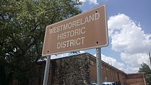

The Westmoreland Historic District is a neighborhood in Neartown Houston, Texas. It is west of Spur 527, between Westheimer Road and West Alabama Street.[1][2]
The community was created in 1902 and was home to many prominent families in Greater Houston.[1] The historic district's boundaries were established on July 23, 1997.[3] As of 2009 many of the original houses are still standing.[1]
Notable residents[]
- Governor of Texas James V. Allred - He lived in the James V. Allred House, 400 Emerson[4]
Government[]
The Harris Health System (formerly Harris County Hospital District) designated the Casa de Amigos Health Center in the Near Northside for the ZIP code 77006. The designated public hospital is Ben Taub General Hospital in the Texas Medical Center.[5]
Education[]
Residents are zoned to the Houston Independent School District.[3] Residents are zoned to Macgregor Elementary School,[6] Gregory-Lincoln Education Center (for middle school),[7] and Lamar High School.[8]
References[]
- ^ a b c Gonzales, J. R. "When a celebrity dies: Looking at a few front pages." Houston Chronicle. July 10, 2009. Retrieved on May 26, 2010.
- ^ Map of Neartown. Neartown Association. Retrieved October 20, 2008.
- ^ a b "Westmoreland Historic District." City of Houston. Retrieved on May 26, 2010.
- ^ Martin, Betty L. and Martha Peterson. "Westmoreland to host home tour." Houston Chronicle. Thursday October 31, 2002. ThisWeek 2. Retrieved on May 26, 2010.
- ^ "Clinic/Emergency/Registration Center Directory By ZIP Code". Harris County Hospital District. 2001-11-19. Archived from the original on 2001-11-19. Retrieved 2021-04-08. - See ZIP code 77006. See this map for relevant ZIP code.
- ^ "Macgregor Elementary Attendance Zone." Houston Independent School District. Retrieved on May 26, 2010.
- ^ "Gregory-Lincoln Middle Attendance Zone." Houston Independent School District. Retrieved on May 26, 2010.
- ^ "Lamar High School Attendance Zone." Houston Independent School District. Retrieved on May 26, 2010.
External links[]
| Wikimedia Commons has media related to Westmoreland, Houston. |
- Westmoreland Historic District Collection: An Inventory of Records at the Houston Metropolitan Research Center, Houston Public Library
- Westmoreland Preservation Alliance, a 501(c)(3) organization dedicated to the history and preservation of the Westmoreland neighborhood.


- Neighborhoods in Houston
- National Register of Historic Places in Houston
- Neartown, Houston