Meyerland, Houston
This article needs additional citations for verification. (December 2009) |


Meyerland is a 6,000-acre (9 sq mi) community in southwest Houston, Texas, outside of the 610 Loop and inside Beltway 8. The neighborhood is named after the Meyer family, who bought and owned 6,000 acres (24 km²) of land in southwest Houston.
Meyerland is the center of Houston's Jewish community; the Meyerland area is the home of Houston's Jewish Community Center, Congregation Beth Israel, Congregation Beth Yeshurun, and several smaller synagogues. The area is also home to Meyerland Plaza, a large outdoor shopping center.
Meyerland is almost entirely located within the 100-year floodplain, and houses are prone to flooding during heavy rain events.[1] Meyerland was inundated during Hurricane Harvey in 2017, and stories and images of the flooded community were prominent in media coverage of the natural disaster in Houston.[2][3][4][5]
Large scale flood mitigation projects are underway which will greatly benefit Meyerland. Chief amongst such projects is Project Brays, a $400m mega scale flood mitigation project which will remove several Meyerland homes from 100 year flood plain.
Circa 2018 several new homes are being built in Meyerland and the neighborhood is seeing strong new home construction. Luxury homes over $1m in value are being built several feet above the minimum base flood elevation.[6]
History[]
The subdivision was formerly rice fields.[7] Joseph F. Meyer Sr. originally acquired the land in sections beginning around 1885.[citation needed]
The land was unused for many years, although part of it was leased to farmers and cattlemen. Joseph Meyer was confident that one day his holdings would be within the Houston city limits.[citation needed]
After Joseph’s death in 1933, the land was divided among his three sons, George, Frank and Joseph Jr. It was not until 20 years after the father’s death that George Meyer decided to develop his share of the land.[citation needed]
George Meyer developed 1,200 acres (5 km2) of the fields into the Meyerland subdivision in 1955. Vice President Richard Nixon was at the subdivision's ribbon-cutting ceremony.[8] Meyerland was one of the first deed-restricted communities in the City of Houston.[9] Many white residents were moving away from the Third Ward area, so many houses in Meyerland were sold prior to construction.[10]
On Memorial Day, May 30, 1961, the "Hero Tree" was dedicated as a living memorial to Capt. Gary L. Herod for his heroism. The tree and a stone marker are located near Meyerland Plaza shopping center on Beechnut Street.[11]
On February 16, 1967, the Meyerland State Bank (now a BBVA Compass) was robbed. The bank initially believed it lost $62,211, which would have made it the most severe bank robbery in Houston at the time. The bank staff later realized that $13,000 of that was in the wrong location and was not in fact stolen, which meant it was Houston's second-most severe bank robbery.[7]
According to Chris Lane of the Houston Press, while many Houston neighborhoods that were considered desirable in 2014 had experienced a period of decline before being gentrified, Meyerland itself had never declined even though Meyerland Plaza had experienced turmoil in the 1980s.[12] In the mid to late 1980s families who began moving into Meyerland and Bellaire began to tear down older homes and build new ones.[13]
A string of over twelve robberies affected Meyerland from April 23, 1989 until June 19, 1989. On June 20, 1989 a suspect, Timothy Dion Morant, had been arrested, and confessed to the crime spree. The group of robbers targeted Meyerland since the houses had valuables, and the community was in proximity to the 610 Loop and other major thoroughfares, providing easy avenues for escape. Morant said that he committed half of the robberies, while his accomplices, many of whom were young men originating from the Hiram Clarke area, committed the other half.[14] Area residents used their funds to hire private patrols, causing crime rates to decrease. After families moved in, children who were caught speeding or with illegal substances told police that they were from Meyerland in an effort to get police to treat them more leniently. Stephen Klineberg, a Rice University sociology professor, stated that as Meyerland became wealthier, the class structure increasingly was "rigidified." At the same time, it was reported in 2006 in Texas Monthly that drugs were "plentiful" in Meyerland.[13]
On Memorial Day, 2015, water from the Brays Bayou flooded Meyerland. Meyerland resident Chris Bell called for an outside investigation on why anti-flooding infrastructure improvements were not completed on time; he argued that the Harris County Flood Control District had assisted with the ReBuild Houston infrastructure program, approved in 2010 in the wake of the 2001 Tropical Storm Allison flooding, and therefore should not be trusted to make a neutral report on the flooding.[15]
In 2017 the Israeli government stated it would spend $1 million to help pay for repairs for damages from Hurricane Harvey sustained by institutions of the Jewish community in Houston.[16] Out of every thirteen Jewish families in Meyerland, one had its house flooded during Harvey.[17]
Cityscape[]
In 2006 Mimi Swartz of the Texas Monthly said that the houses around Godwin Park are "cozy ranch houses from the fifties and sixties in Tudor, colonial, and contemporary variations, comfortable but never showy, with gardens lovingly tended."[13]
Demographics[]
In the City of Houston-defined Meyerland Super Neighborhood, there were 21,445 residents in 2015. 58% of them were non-Hispanic white, 16% were Hispanics, 13% were non-Hispanic Asians, 11% were non-Hispanic Blacks, and 2% were non-Hispanic others. In 2000 there were 19,841 residents of the super neighborhood. 77% were non-Hispanic White, 9% were Hispanic, 8% were non-Hispanic Asians, 4% were non-Hispanic Blacks, and 2% were non-Hispanic others.[18]
Government[]

Meyerland is in Houston City Council District C.[19] In the first 1991 Mayor of Houston election most Meyerland voters voted for Bob Lanier.[20][21] During the 1997 Mayor of Houston election, about 29% of Meyerland voters voted for Lee P. Brown.[22]
Meyerland is in Texas's 7th congressional district.[23]
Harris Health System (formerly Harris County Hospital District) designated Valbona Health Center (formerly People's Health Center) in Greater Sharpstown for ZIP code 77096. The nearest public hospital is Ben Taub General Hospital in the Texas Medical Center.[24]
Culture[]

The Evelyn Rubenstein Jewish Community Center,[25] Congregation Beth Israel, Congregation Beth Yeshurun, and several small synagogues are in the area.[9] Mimi Swartz of the Texas Monthly said "the neighborhood was a place where Jews could take care of their own and, they believed, could protect their children from negative influences while teaching them to follow religious tradition and embrace the values of family, education, achievement, and community."[13] Every year the Jewish Book and Arts Fair is held in Meyerland.[25]
Education[]
Primary and secondary education[]
Public schools[]


The neighborhood is served by several Houston Independent School District (HISD) schools.[26][27] Coldwell Banker United real estate agent Teresa Lewis stated in a 2010 Houston Chronicle article that "Meyerland has long been recognized for its exemplary and recognized magnet schools."[9]
The portion of the neighborhood north of the Brays Bayou is zoned to Lovett Elementary School;[28] Lovett is located in Section 2.[29][30] The portion of the neighborhood south of the Brays Bayou is zoned to Kolter Elementary School.[31] The portion of the neighborhood on the west (section 10, which has a western edge boundary of Hillcroft Avenue) is zoned to Herod Elementary School.[32] Herod is located on the edge of Section 10.[8] Lovett was named a National Blue Ribbon School in 2016.[33]
Almost all of the neighborhood is zoned to Meyerland Performing and Visual Arts Middle School (changed from Johnston Middle school in 2016[34]), also located in Meyerland.[35][36] A small portion is zoned to Pershing Middle School.[27][37] All students who are zoned to Pershing, Johnston, or Long have the option to apply for the regular program at Pin Oak Middle School in the city of Bellaire. Therefore Pin Oak Middle School serves most of Meyerland.[38] One section of Meyerland is zoned to Fondren Middle School.[39]
Meyerland residents are zoned to Bellaire High School, which is also in the city of Bellaire.[40] Meyerland is immediately south of Bellaire.[41] Yushang Chang, the author of Newcomer's Handbook Neighborhood Guide: Dallas-Fort Worth, Houston, and Austin, wrote that since Meyerland is zoned to Bellaire one could buy a house and guarantee that one's child could go the school without paying City of Bellaire housing prices and property taxes.[42]
History of public schools[]
From the opening of the subdivision in 1955 until 1958, Meyerland residents attended Horn Elementary School in Bellaire. Bellaire High School opened in 1955. Lovett opened in September 1958. Johnston Junior High School opened in 1959. Kolter opened in 1960. Herod Elementary School opened in 1961.[8]
In December 1991, before Christmas, an HISD document was given to an attendance boundary committee convened by the district. The document, labeled as a "draft", illustrated Meyerland being moved into the attendance zone of Westbury High School. This caused panic in Meyerland as the community feared that moving to Westbury, which was less prestigious than Bellaire High, would cause a decrease in property values.[41] On May 21, 1992, the HISD board adopted attendance boundary committee recommendations stating that the Bellaire High attendance zone would not be altered.[43]
Bellaire High School was remodeled in the 1992-1993 period.[8] The current Herod Elementary building opened in mid-January 2011. The current Lovett building opened in August 2011. The rebuilds of Herod, Lovett, and Horn Elementary of Bellaire together had a cost of $49 million and were a part of a $1 billion bond program approved by HISD voters in 2007.[44]
Due to the effect of Hurricane Harvey on the Kolter campus in 2017, it will be rebuilt.[45]
Gallery of public schools[]
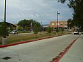
Lovett Elementary School serves portions of Meyerland north of the Brays Bayou
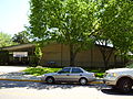
Kolter Elementary School serves portions of Meyerland south of the Brays Bayou


Private schools[]

Highlands Latin School, a private K-12 Christian School, is in Meyerland Section 3.[46][47] The campus previously housed Pilgrim Lutheran School, a private K-8 Christian School,[48] which later closed its K-8 section and now only has early childhood.[49]
Nearby Catholic schools, under the Roman Catholic Diocese of Galveston-Houston, include St. Vincent de Paul Catholic School (K-8),[50] and Corpus Christi Catholic School. Several other private schools, including St. Thomas' Episcopal School and Beth Yeshurun Day School, are located in the Meyerland area. The Robert M. Beren Academy, Episcopal High School (Bellaire), Westbury Christian School (grades K-12) and Emery/Weiner School are near Meyerland.[citation needed]
Public libraries[]

The Houston Public Library operated the George B. Meyer, Sr. Neighborhood Library, which was near Meyerland at 5005 West Bellfort.
The library opened in 1962. In 1994 the library received renovations to accommodate disabled people. By 2013 HPL planned to purchase land for a new Meyerland branch with $442,000. HPL spokesperson Sandra Fernandez stated that HPL wants to build a new facility in order to increase the size and parking capacity. There is a proposal to move the library to Westbury Square in Westbury, supported by the Westbury community but opposed by Meyerland residents.[51] In 2015 various proposals on where the replacement library should go were being debated.[52] Prior to Hurricane Harvey in 2017, the Houston community considered the Meyer Branch to be the Houston library in the poorest state of maintenance. Hurricane Harvey gave the library moderate damage, and the city government closed it afterwards, with demolition scheduled. The new library, which will also replace HPL Express Frank, will be at 5505 Belrose on a 2.5-acre (1.0 ha) plot of land in Westbury.[53]
Transportation[]
The Metropolitan Transit Authority of Harris County (METRO) operates public transportation.
Around 1988 METRO proposed having Beechnut Street widened. Residents of Meyerland, Maplewood, and Robindell appeared before the METRO board and protested the plans, stating that they would result in increased traffic. METRO dropped the plans.[54]
Police service[]
The neighborhood is within the Houston Police Department's Southwest Patrol Division [1]. The homeowners association maintains a contract with Harris County Precinct 5 Constable for improved local security.
Parks and recreation[]

Two city-operated parks are in Meyerland. Meyerland Park, located at 5151 Jason, is classified as a neighborhood park;[55] it is in Meyerland Section 2.[29][56]
Herbert Godwin Park,[57] located at 5101 Rutherglen, is classified as a community park.[58] The Godwin Community Center, on the same lot, has an outdoor pavilion, a playground, and a lighted sports field.[59] The sports facilities include a baseball diamond, a soccer field, and a covered basketball court. Godwin Park, adjacent to Kolter Elementary, is about one city block large. Many mothers and children gather at the park on weekends. Mimi Swartz of the Texas Monthly said "[t]he grass is shorn and green, the playground equipment freshly painted and sturdy. The park is shaded by benevolent oaks that are about the same age as the homes that surround it[...]"[13]
In the early years of Meyerland's existence, eight garden clubs formed. Little league baseball was first organized in Meyerland in 1957, with games occurring at Meyerland Park. By 1958 the Meyerland Teen Club and the Meyerland Civic Club opened. On May 24, 1958, the Meyerland Club officially opened; families gathered at the club, which hosted a swim team. The club closed in 1996 and was sold to the Jewish Community Center, which redeveloped the facility into the Merfish Teen Center.[8]
The Weekley YMCA in Houston includes Meyerland in its service area.[60] It opened in 1951 as the Southwest YMCA,[61] in West University Place. The current facility in Braeswood Place, Houston broke ground in 2001.[62]
Media[]
The Houston Chronicle is the area regional newspaper. On Thursdays, residents receive the Bellaire/West U/River Oaks/Meyerland [2] local section.
The Bellaire Examiner is a local newspaper distributed in the community.[63]
The Village News and Southwest News is also published in the community.
The Meyerland Journal is an alternative weekly political paper that covers the Meyerland and Bellaire regions.
The Bellaire Texan, which served the Meyerland area community in the mid-20th Century,[64] was headquartered in Bellaire and published by the Texan Publishing Corporation.[65] By 1975 it became known as the Bellaire & Southwestern Texan and was published by the Preston Publishing Company. It was then headquartered in Houston.[66]
Notable residents[]
- Chris Bell[15]
See also[]
- History of the Jews in Houston
References[]
- McAdams, Donald R. Fighting to Save Our Urban Schools-- and Winning!: Lessons from Houston. Teachers College Press, 2000. ISBN 0807770353, 9780807770351.
Notes[]
- ^ Jansen, Steve (2016-04-08). "100-Year Flood? Shoot, Houston Is in Trouble During a 10-Year Storm". Houston Press. Retrieved 2017-09-02.
- ^ "Photo of mother and baby's rescue becomes symbol of storm". Washington Post. Archived from the original on 2017-08-29. Retrieved 2017-09-02.
- ^ Haque, Michael Gold, Fahima; Tabrizy, Nilo (2017-08-31). "'No Amount of Planning Could Have Spared Us': How Texans Experienced Harvey". The New York Times. ISSN 0362-4331. Retrieved 2017-09-02.
- ^ Olson, Bradley; Frosch, Dan; Cook, Lynn (2017-09-02). "Flooded Again, a Houston Neighborhood Faces a Wrenching Choice". Wall Street Journal. ISSN 0099-9660. Retrieved 2017-09-02.
- ^ "Meyerland neighbors reeling from unprecedented damage after Harvey". mystatesman. Retrieved 2017-09-02.
- ^ "Meyerland sees strong rebuilding activity a year after Harvey - HoustonChronicle.com". www.houstonchronicle.com. 2018-08-10. Retrieved 2019-05-06.
- ^ Jump up to: a b Doster, Adam (2017-01-23). "How Did the Once-Largest Bank Heist in Houston History Happen?". Houstonia. Retrieved 2017-06-02.
- ^ Jump up to: a b c d e "History of Meyerland Archived 2011-03-14 at the Wayback Machine." Meyerland. Retrieved on December 15, 2009.
- ^ Jump up to: a b c Nicholson, Heather. "Meyerland's original appeal draws new residents." Houston Chronicle. March 11, 2010. Retrieved on July 16, 2010.
- ^ Kaplan, Barry J. (University of Houston). "Race, Income, and Ethnicity: Residential Change in a Houston Community, 1920-1970." . Winter 1981. pp. 178-202. CITED: p. 195.
- ^ J. R. Gonzales (15 March 2011), "The hero behind Herod Elementary", Houston Chronicle, retrieved 23 February 2016
- ^ Lane, Chris (2014-11-10). "The Changing Face of Houston - Meyerland". Houston Press. Retrieved 2017-04-20.
- ^ Jump up to: a b c d e Swartz, Mimi. "The Gangstas of Godwin Park." Texas Monthly. June 1, 2006. Jun2006, Vol. 34 Issue 6, p132. Retrieved on November 2, 2011. See profile at EBSCOHost
- ^ Piller, Ruth. "Man arrested in Meyerland burglaries." Houston Chronicle. Wednesday June 21, 1989. A21. Retrieved on October 26, 2011.
- ^ Jump up to: a b Nazerian, Tina. "Mayoral candidate calls for investigation of Meyerland flooding." Houston Chronicle. June 21, 2015. Retrieved on May 2, 2016.
- ^ "Israel to give $1M in aid to Houston Jewish community". Yahoo! News. 2017-09-04. Retrieved 2017-09-05.
- ^ Rendall, Autumn (2018-02-06). "Thrice-flooded Houston synagogue's search for higher ground continues". Houston Chronicle.
- ^ "Super Neighborhood Resource Assessment No. 31 Meyerland" (PDF). City of Houston. Retrieved 2019-08-14.
- ^ City of Houston, Council District Maps, District C Archived 2012-12-24 at the Wayback Machine." City of Houston. Retrieved on November 5, 2011.
- ^ Rodriguez, Lori. "Saying goodbye, with no regrets." Houston Chronicle. Saturday November 9, 1991. A31.
- ^ Bernstein, Alan and Jim Simmon. "Black vote went solidly for Turner/Whitmire failed to produce split." Houston Chronicle. Thursday November 7, 1991. A21.
- ^ Bernstein, Alan. "For Brown, ethnic medley with black chorus." Houston Chronicle. Monday December 8, 1997. A1. Retrieved on February 20, 2010.
- ^ "Congressional District 7 Archived 2006-04-17 at the Wayback Machine." National Atlas of the United States.
- ^ "Clinic/Emergency/Registration Center Directory By ZIP Code". Harris County Hospital District. 2001-11-19. Archived from the original on 2001-11-19. Retrieved 2021-04-08. - See ZIP code 77096. See this map for relevant ZIP code.
- ^ Jump up to: a b Stoeckert, Anthony. "Jewish book, art fair begins Sunday in Meyerland Archived 2012-04-24 at the Wayback Machine." Ultimate Bellaire (Houston Chronicle). October 26, 2011. Retrieved on December 2, 2011.
- ^ Meyerland Section Map Archived 2009-02-27 at the Wayback Machine. Meyerland. Accessed September 20, 2008.
- ^ Jump up to: a b "Map of Meyerland Sections." Meyerland. Retrieved on December 15, 2009.
- ^ "Lovett Elementary Attendance Zone Archived 2012-04-17 at the Wayback Machine." Houston Independent School District.
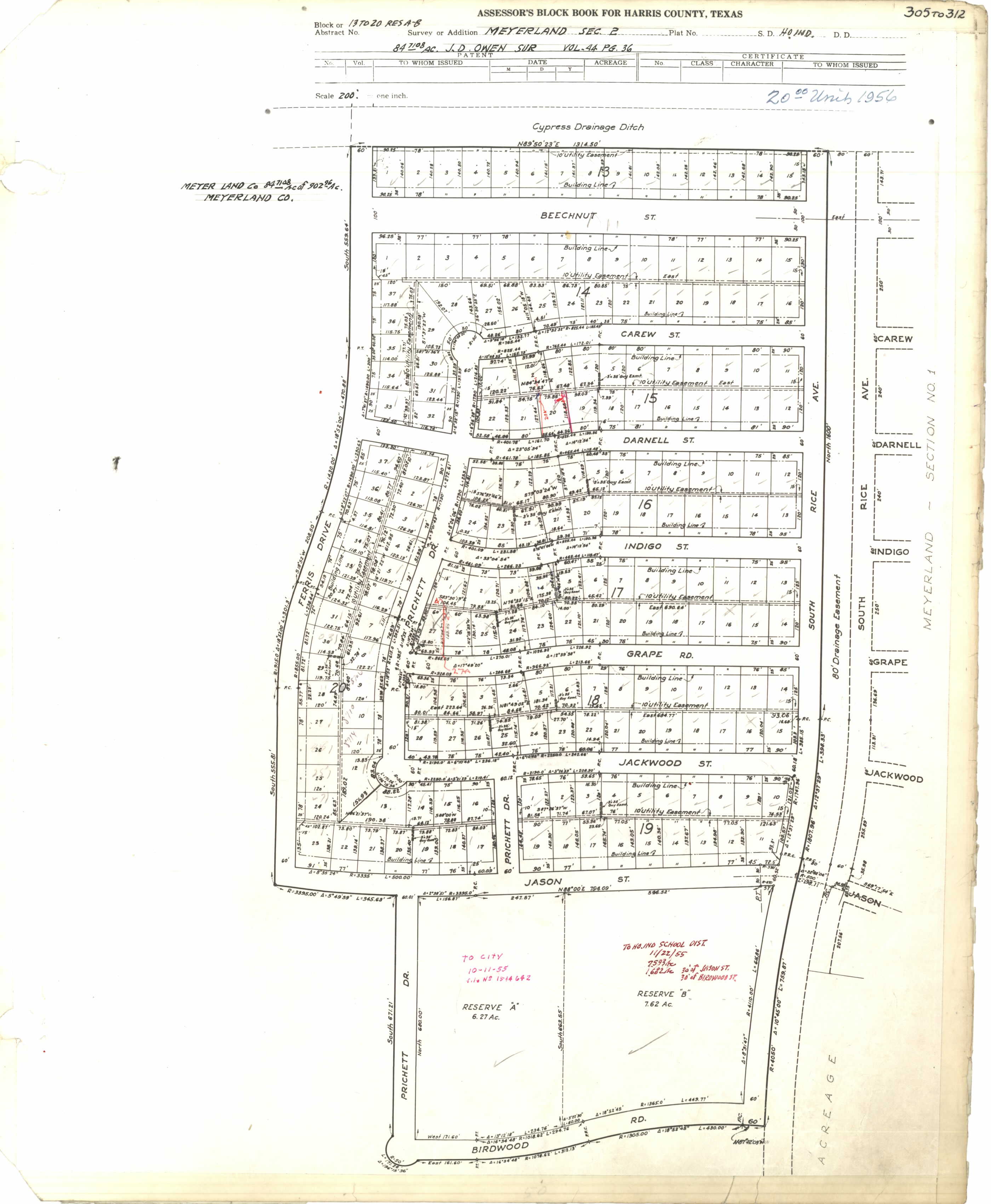
- ^ Jump up to: a b "Meyerland Sec. 2" (JPG, PDF). Harris County Block Book Map. Volume 84, Page 61. Retrieved on July 26, 2017. Reservation A has Meyerland Park and Reservation B has Lovett Elementary School.
- ^ Home. Lovett Elementary School. Retrieved on July 26, 2017. "8814 South Rice Ave. Houston, TX 77096-2622"
- ^ "Kolter Elementary Attendance Zone Archived 2008-04-11 at the Wayback Machine." Houston Independent School District.
- ^ "Herod Elementary Attendance Zone Archived 2012-02-14 at the Wayback Machine." Houston Independent School District.
- ^ "Lovett Elementary named National Blue Ribbon School". Bellaire Examiner at the Houston Chronicle. 2016-11-28. Retrieved 2017-01-19.
- ^ Clemons, Tracy. "HISD approves name changes for seven schools" (Archive). KTRK-TV. Thursday May 12, 2016. Retrieved on May 21, 2016.
- ^ "Johnston Middle Attendance Zone Archived 2008-04-11 at the Wayback Machine." Houston Independent School District. Retrieved on December 15, 2009.
- ^ Lassin, Arlene Nisson. "Celebration to mark 50 years for Johnston School." Houston Chronicle. Friday April 2, 2010. Retrieved on November 8, 2011.
- ^ "Pershing Middle Attendance Zone Archived 2008-04-11 at the Wayback Machine." Houston Independent School District. Retrieved on December 15, 2009.
- ^ "Pin Oak Middle School." The Southwest District. Houston Independent School District.
- ^ "Fondren Middle Attendance Zone Archived 2008-02-16 at the Wayback Machine." Houston Independent School District.
- ^ "Bellaire High School Attendance Zone Archived 2008-02-28 at the Wayback Machine." Houston Independent School District.
- ^ Jump up to: a b McAdams, p. 54.
- ^ Chang, Yushan. Newcomer's Handbook Neighborhood Guide: Dallas-Fort Worth, Houston, and Austin. , 2006. ISBN 0912301708, 9780912301709. p. 152.
- ^ McAdams, p. 55.
- ^ Foster, Robin. "Horn, Herod and Lovett schools benefit from upgrades Archived 2012-03-29 at the Wayback Machine." Houston Chronicle. August 16, 2011. Retrieved on August 19, 2011.
- ^ Kennedy, Megan; Cathy Hernandez (2017-12-14). "HISD approves plan to rebuild 4 Harvey-damaged elementary schools". KPRC-TV (Channel 2). Retrieved 2017-12-17.
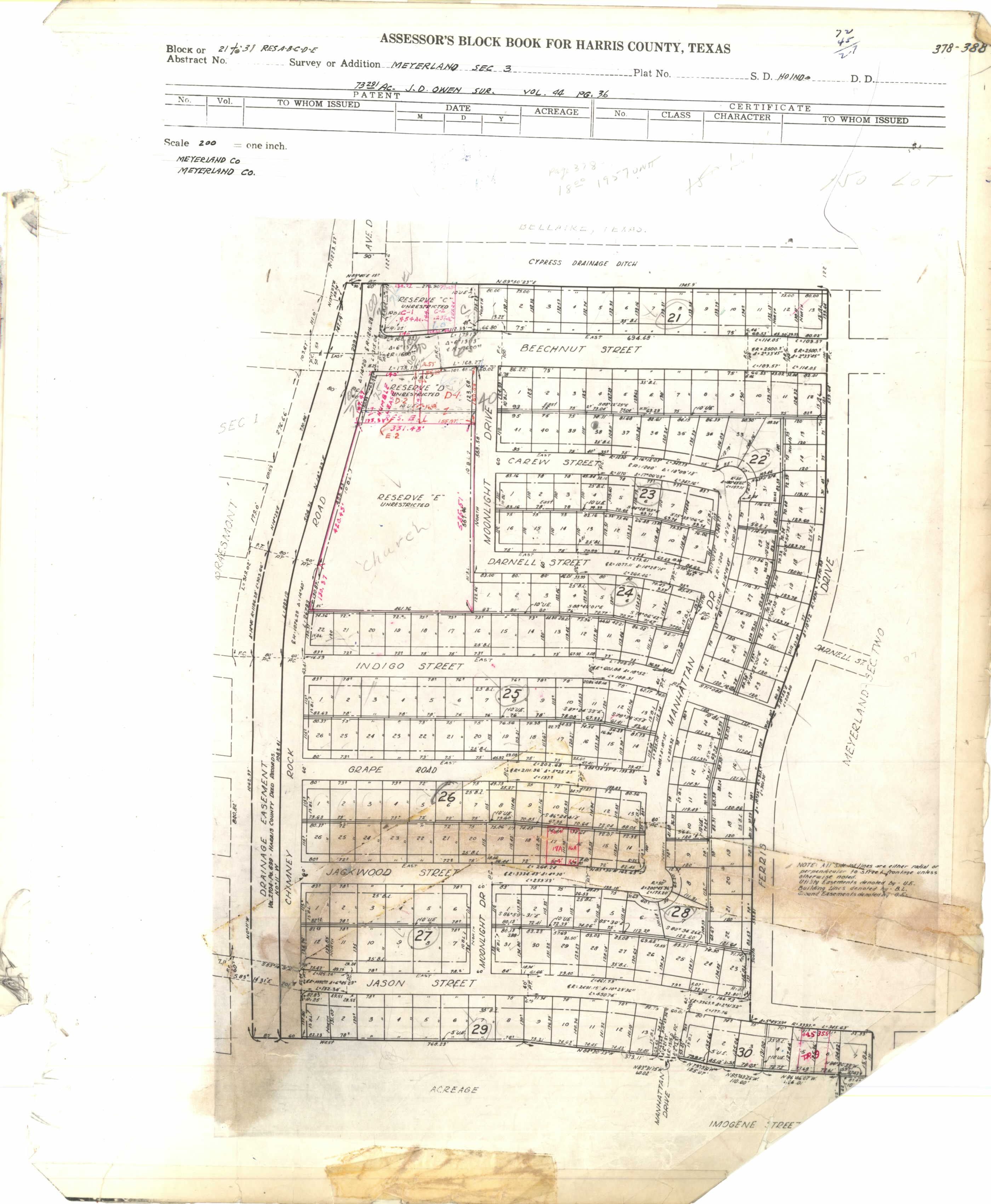
- ^ "Meyerland Sec. 3" (JPG, PDF). Harris County Block Book Map. Volume 85, Page 88. Retrieved on July 26, 2017. Reservation E has Highlands Latin School/Pilgrim Lutheran Church and School property.
- ^ "Houston". Highlands Latin School. Retrieved 2021-02-26.
Highlands Latin School (K-12) Bellaire/Meyerland Address: Pilgrim Lutheran Church – 8601 Chimney Rock Road, Houston, Texas, 77096
- ^ "Contact Us Archived 2017-06-04 at the Wayback Machine." Pilgrim Lutheran School. Retrieved on July 26, 2017. "Pilgrim Lutheran School 8601 Chimney Rock Rd. (corner of Beechnut) Houston, TX 77096"
- ^ "Home". Pilgrim Early Childhood School. Retrieved 2021-02-26. - See banner at top
- ^ "Home". St. Vincent de Paul Catholic School. 2001-07-22. Archived from the original on 2001-07-22.
Conveniently situated in the Southwest part of Houston, St. Vincent de Paul School is near [...]Meyerland,[...]
- ^ Peyton, Lindsay. "Residents divided on plans for Meyer Library." Houston Chronicle. Tuesday January 22, 2013. Retrieved on May 15, 2016.
- ^ Kerr, Jocelyn. "Ideas for new Meyer Neighborhood Library under consideration ." Examiner Newspaper Group. Sunday February 1, 2015. Retrieved on May 15, 2016.
- ^ Ward, Alyson (2018-07-19). "Nearly a year after Harvey's floods, six Houston libraries remain shuttered — some indefinitely". Houston Chronicle. Retrieved 2018-07-29.
- ^ Mintz, Bill. "Residents win fight on Beechnut plan." Houston Chronicle. Wednesday September 21, 1988. Retrieved on August 8, 2011.
- ^ NeighborRev2List2.gif. City of Houston. Retrieved on December 15, 2009.
- ^ "Our Parks G-N." City of Houston. Retrieved on July 26, 2017. "5151 Jason, 77096"
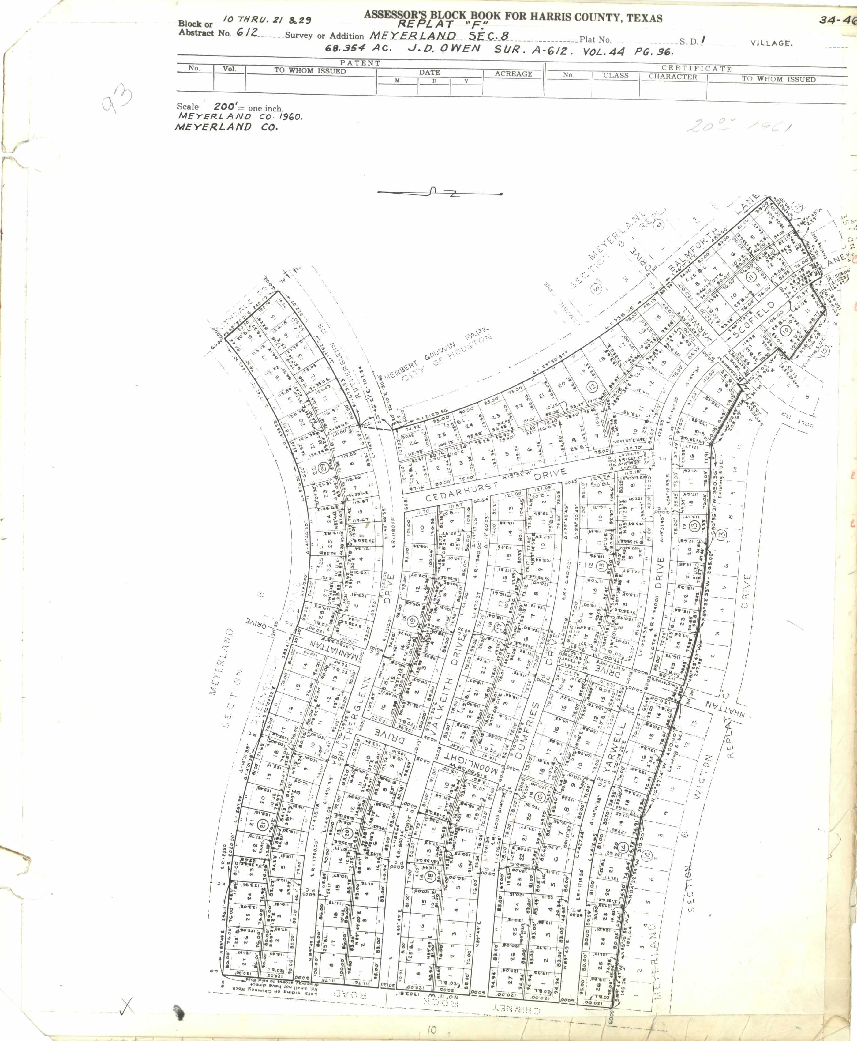
- ^ "Meyerland Sec. 8 Replat "F"" (PDF, JPG). Harris County Assessor's Block Book. Volume 93, Page 11. Retrieved on July 27, 2017. See text: "Herbert Godwin Park City of Houston"
- ^ communitylist1.gif Archived 2007-03-03 at the Wayback Machine." City of Houston. Retrieved on December 15, 2009.
- ^ "Godwin Community Center Archived 2010-05-28 at the Wayback Machine." City of Houston. Retrieved on December 15, 2009.
- ^ Lassin, Arlene Nisson (2006-01-26). "FACES IN THE CROWD: Weekley YMCA's top volunteer is full of spirit". Houston Chronicle. Retrieved 2020-05-04.
The Weekley Y serves the [...] Meyerland [...] communities.
- ^ "Southwest YMCA". YMCA Houston. 2001-07-11. Archived from the original on 2001-07-11. Retrieved 2020-05-04.
- ^ Stanton, Robert. "'Death Valley' coming back to life." Houston Chronicle. Thursday July 19, 2001. Retrieved on January 7, 2012.
- ^ "About Us[permanent dead link]." Examiner News.
- ^ The Bellaire & Southwestern Texan (Bellaire, Tex.), Vol. 24, No. 8, Ed. 1 Wednesday, June 25, 1975 Page: 1 of 47 (see page). At the Portal to Texas History, University of North Texas. Retrieved on March 2, 2017. "6622 Ferris St. Houston, Texas 77036"
- ^ The Bellaire Texan (Bellaire, Tex.), Vol. 2, No. 31, Ed. 1 Wednesday, September 14, 1955. p. 4 of 16 (see page). At the Portal to Texas History, University of North Texas. Retrieved on March 2, 2017. "215 N. 6th St., Bellaire, Texas"
- ^ The Bellaire & Southwestern Texan (Bellaire, Tex.), Vol. 24, No. 8, Ed. 1 Wednesday, June 25, 1975 Page: 2 of 47 (see page). At the Portal to Texas History, University of North Texas. Retrieved on March 2, 2017. "6622 Ferris St. Houston, Texas 77036"
External links[]
| Wikimedia Commons has media related to Meyerland, Houston. |
- Official Meyerland Community Improvement Association website
- Old Meyerland website at the Wayback Machine (archive index)
- Meyerland Plaza website
- Meyerland Middle School
- Elementary schools: Kolter and Lovett
| show |
|---|

| show |
|---|

- Jews and Judaism in Houston
- Neighborhoods in Houston