Winchester, Adams County, Ohio
Winchester, Ohio | |
|---|---|
 Dr. A.C. Lewis House, listed on the National Register of Historic Places, located at 103 E. South Street in Winchester | |
 Location in Adams County and the state of Ohio. | |
| Coordinates: 38°56′25″N 83°39′11″W / 38.94028°N 83.65306°WCoordinates: 38°56′25″N 83°39′11″W / 38.94028°N 83.65306°W | |
| Country | United States |
| State | Ohio |
| County | Adams |
| Area | |
| • Total | 2.63 sq mi (6.82 km2) |
| • Land | 2.62 sq mi (6.78 km2) |
| • Water | 0.02 sq mi (0.04 km2) |
| Elevation | 906 ft (276 m) |
| Population | |
| • Total | 1,051 |
| • Estimate (2019)[4] | 1,006 |
| • Density | 384.56/sq mi (148.48/km2) |
| Time zone | UTC-5 (Eastern (EST)) |
| • Summer (DST) | UTC-4 (EDT) |
| ZIP code | 45697 |
| Area code(s) | 937, 326 |
| FIPS code | 39-85876 |

Winchester is a village in Adams County, Ohio, United States. The population was 1,051 at the 2010 census. The name of the surrounding township is also named Winchester.
State Route 136 passes through Winchester. Winchester is adjacent to Ohio State Route 32, a four lane divided highway known as the Appalachian Highway. The Appalachian Highway links Winchester to Cincinnati. A traffic signal is located at the intersection of Routes 32 and 136.
History[]
Winchester was laid out in 1815 by Joseph Darlinton. It was named for Darlinton's former hometown of Winchester, Virginia.[5]
There is also an Ohio Historic Site in Winchester, the . The Dr. A. C. Lewis home was built between 1845 and 1848. Dr. Lewis is considered the first resident physician of Winchester. He was a known abolitionist and used the house as a station on the underground railroad.
Geography[]
Winchester is located at 38°56′25″N 83°39′11″W / 38.940248°N 83.653174°W (38.940248, -83.653174).[6]
According to the United States Census Bureau, the village has a total area of 2.63 square miles (6.81 km2), of which 2.61 square miles (6.76 km2) is land and 0.02 square miles (0.05 km2) is water.[7]
Demographics[]
| Historical population | |||
|---|---|---|---|
| Census | Pop. | %± | |
| 1870 | 416 | — | |
| 1880 | 550 | 32.2% | |
| 1900 | 796 | — | |
| 1910 | 927 | 16.5% | |
| 1920 | 913 | −1.5% | |
| 1930 | 821 | −10.1% | |
| 1940 | 798 | −2.8% | |
| 1950 | 690 | −13.5% | |
| 1960 | 788 | 14.2% | |
| 1970 | 760 | −3.6% | |
| 1980 | 1,080 | 42.1% | |
| 1990 | 978 | −9.4% | |
| 2000 | 1,025 | 4.8% | |
| 2010 | 1,051 | 2.5% | |
| 2019 (est.) | 1,006 | [4] | −4.3% |
| U.S. Decennial Census[8] | |||
2010 census[]
As of the census[3] of 2010, there were 1,051 people, 420 households, and 273 families living in the village. The population density was 402.7 inhabitants per square mile (155.5/km2). There were 462 housing units at an average density of 177.0 per square mile (68.3/km2). The racial makeup of the village was 98.4% White, 0.2% African American, 0.5% Native American, 0.3% from other races, and 0.7% from two or more races. Hispanic or Latino of any race were 1.0% of the population.
There were 420 households, of which 34.0% had children under the age of 18 living with them, 45.7% were married couples living together, 13.1% had a female householder with no husband present, 6.2% had a male householder with no wife present, and 35.0% were non-families. 31.2% of all households were made up of individuals, and 13.3% had someone living alone who was 65 years of age or older. The average household size was 2.48 and the average family size was 3.05.
The median age in the village was 35.9 years. 27.3% of residents were under the age of 18; 9.3% were between the ages of 18 and 24; 25.9% were from 25 to 44; 22% were from 45 to 64; and 15.6% were 65 years of age or older. The gender makeup of the village was 49.0% male and 51.0% female.
2000 census[]
As of the census[9] of 2000, there were 1,025 people, 410 households, and 280 families living in the village. The population density was 381.8 people per square mile (147.7/km2). There were 448 housing units at an average density of 166.9 per square mile (64.5/km2). The racial makeup of the village was 99.02% White, 0.20% Native American, 0.39% Asian, and 0.39% from two or more races. Hispanic or Latino of any race were 0.49% of the population.
There were 410 households, out of which 34.9% had children under the age of 18 living with them, 52.4% were married couples living together, 11.0% had a female householder with no husband present, and 31.5% were non-families. 27.6% of all households were made up of individuals, and 13.7% had someone living alone who was 65 years of age or older. The average household size was 2.50 and the average family size was 3.06.
In the village, the population was spread out, with 28.4% under the age of 18, 8.7% from 18 to 24, 28.4% from 25 to 44, 20.3% from 45 to 64, and 14.2% who were 65 years of age or older. The median age was 34 years. For every 100 females, there were 89.1 males. For every 100 females age 18 and over, there were 85.4 males.
The median income for a household in the village was $32,344, and the median income for a family was $36,750. Males had a median income of $33,036 versus $19,028 for females. The per capita income for the village was $16,711. About 9.5% of families and 14.2% of the population were below the poverty line, including 15.2% of those under age 18 and 18.4% of those age 65 or over.
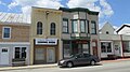
Gallery[]

Winchester corporation limit sign
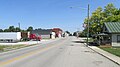
Looking north on Main Street (Ohio Highway 136) in Winchester

Winchester water tower
Fancy's Famous Pizza
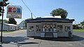
Reid's Dairy Bar

Subway store (now closed.)

Budget Host Inn
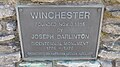
Joseph Darlinton Bicentennial Marker
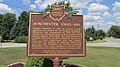
Winchester Ohio Historical Marker
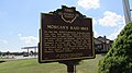
Morgan's Raid 1863 (reverse side)
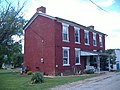
Dr. A. C. Lewis House


References[]
- ^ "2019 U.S. Gazetteer Files". United States Census Bureau. Retrieved July 28, 2020.
- ^ "US Board on Geographic Names". United States Geological Survey. 2007-10-25. Retrieved 2008-01-31.
- ^ a b "U.S. Census website". United States Census Bureau. Retrieved 2013-01-06.
- ^ a b "Population and Housing Unit Estimates". Retrieved May 21, 2020.
- ^ Evans, Nelson Wiley (1900). A History of Adams County, Ohio: From Its Earliest Settlement to the Present Time. E B. Stivers. p. 498.
- ^ "US Gazetteer files: 2010, 2000, and 1990". United States Census Bureau. 2011-02-12. Retrieved 2011-04-23.
- ^ "US Gazetteer files 2010". United States Census Bureau. Retrieved 2013-01-06.
- ^ "Census of Population and Housing". Census.gov. Retrieved June 4, 2015.
- ^ "U.S. Census website". United States Census Bureau. Retrieved 2008-01-31.
Municipalities and communities of Adams County, Ohio, United States | ||
|---|---|---|
| Villages |  | |
| Townships | ||
| CDPs | ||
| Other communities | ||
| ||
Authority control | |
|---|---|
| General |
|
| National libraries | |
- Villages in Ohio
- Villages in Adams County, Ohio
- Populated places on the Underground Railroad
- 1815 establishments in Ohio
- Populated places established in 1815