Woodend, Queensland
| Woodend Ipswich, Queensland | |||||||||||||||
|---|---|---|---|---|---|---|---|---|---|---|---|---|---|---|---|
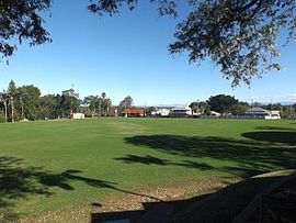 Ipswich Grammar School sports oval, 2016 | |||||||||||||||
| Population | 1,302 (2016 census)[1] | ||||||||||||||
| • Density | 1,000/km2 (2,590/sq mi) | ||||||||||||||
| Postcode(s) | 4305 | ||||||||||||||
| Area | 1.3 km2 (0.5 sq mi) | ||||||||||||||
| Location | |||||||||||||||
| LGA(s) | City of Ipswich | ||||||||||||||
| State electorate(s) | Ipswich | ||||||||||||||
| Federal division(s) | Blair | ||||||||||||||
| |||||||||||||||
Woodend is an inner suburb of Ipswich in the City of Ipswich, Queensland, Australia.[2] At the 2016 census the population of Woodend was 1,302 people.[3]
Geography[]
Woodend's northern and eastern border is defined by the meandering course of the Bremer River.
History[]
The origin of the suburb name is from the name given to the residence of Arthur Macalister, a Scottish migrant who became the second Premier of Queensland.[2]
Woodend claims a few firsts for the Ipswich area:
- In 1848 Woodend Pocket was the first coal-bearing crown land in the Ipswich area to be subdivided into small 'coal allotments
- In 1854 Englishman John Ferrett opened the first successful Ipswich coal mine in the Woodend area (The Radstock Pit)
- In 1862 John Panton grew the first cotton in Ipswich in the Woodend area
- One of Ipswich's first schools was opened by Daniel McGrath, 1847 in the Woodend area.[4]
Following its early days as coal lots, the Woodend area was mostly cleared of bush by the 1860s. Woodend became a middle class suburb with a residential heritage. Woodend became home to:
- Ipswich Grammar School, 1863
- St Mary's Convent School, established in 1863
- Saint Mary's College in 1946.[4]

At the 2016 census the population of Woodend was 1,302 people.[3]
Transport[]
Woodend has no train station, however it is serviced by the nearby Ipswich Station.
Education[]
- Saint Edmund's College
- Saint Mary's College
- St Mary's Primary
- Ipswich Grammar School, established in 1863, first school to open as a result of the Grammar Schools Act of 1860
Parks and Sports Facilities[]
- Woodend Park
- Smith Park
- Timothy Molony Park (Owned by Saint Mary's Catholic Parish)
Places of worship[]
- St Mary's Catholic Church, cnr Roseberry and Elizabeth Streets
References[]
- ^ Australian Bureau of Statistics (27 June 2017). "Woodend (QLD) (State Suburb)". 2016 Census QuickStats. Retrieved 29 March 2018.

- ^ a b "Woodend – suburb (entry 45090)". Queensland Place Names. Queensland Government. Retrieved 23 June 2017.
- ^ a b "2016 Census quick stats". Australia Bureau of Statistics. Retrieved 20 April 2018.
- ^ a b "About Ipswich suburb place names". Ipswich City Council. Retrieved 20 September 2017.
External links[]

- Suburbs of Ipswich, Queensland