Mount Walker West, Queensland
| Mount Walker West Queensland | |||||||||||||||
|---|---|---|---|---|---|---|---|---|---|---|---|---|---|---|---|
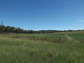 Fields along Mount Walker West Road, 2015 | |||||||||||||||
 Mount Walker West | |||||||||||||||
| Coordinates | 27°46′55″S 152°30′47″E / 27.7819°S 152.5130°ECoordinates: 27°46′55″S 152°30′47″E / 27.7819°S 152.5130°E | ||||||||||||||
| Population | 19 (2016 census)[1] | ||||||||||||||
| • Density | 1.027/km2 (2.66/sq mi) | ||||||||||||||
| Postcode(s) | 4340 | ||||||||||||||
| Area | 18.5 km2 (7.1 sq mi) | ||||||||||||||
| Time zone | AEST (UTC+10:00) | ||||||||||||||
| LGA(s) |
| ||||||||||||||
| State electorate(s) | Scenic Rim | ||||||||||||||
| Federal division(s) | |||||||||||||||
| |||||||||||||||

Mount Walker West is a locality split between the Scenic Rim Region and City of Ipswich local government areas of Queensland, Australia.[2][3] In the 2016 census, Mount Walker West had a population of 19 people.[1]
Geography[]
Mount Walker West is in South East Queensland.
Along the eastern extent of Mount Walker West the Bremer River marks the boundary. In the west elevations rise to around 250 metres (820 ft) above sea level.
History[]
The locality takes its name from the mountain Mount Walker, which was originally named Mount Forbes by John Oxley on 22 September 1824 after Sir Francis Forbes, the Chief Justice of New South Wales. The name was subsequently altered to Mount Walker, a shepherd called Walker on the Franklyn Vale pastoral run.[2][3]
At the 2011 census the locality and surrounds recorded a population of 392.[4]
References[]
| Wikimedia Commons has media related to Mount Walker West, Queensland. |
- ^ a b Australian Bureau of Statistics (27 June 2017). "Mount Walker West (SSC)". 2016 Census QuickStats. Retrieved 20 October 2018.

- ^ a b "Mount Walker West – locality in Scenic Rim Region (entry 45217)". Queensland Place Names. Queensland Government. Retrieved 17 November 2019.
- ^ a b "Mount Walker West – locality in City of Ipswich (entry 45099)". Queensland Place Names. Queensland Government. Retrieved 16 November 2019.
- ^ Australian Bureau of Statistics (31 October 2012). "Coleyville (State Suburb)". 2011 Census QuickStats. Retrieved 27 March 2015.
- Scenic Rim Region
- City of Ipswich
- Localities in Queensland