Woodhill, New South Wales
| Woodhill New South Wales | |||||||||||||||
|---|---|---|---|---|---|---|---|---|---|---|---|---|---|---|---|
 | |||||||||||||||
 Woodhill Location in New South Wales | |||||||||||||||
| Coordinates | 34°43′57″S 150°41′02″E / 34.73250°S 150.68389°ECoordinates: 34°43′57″S 150°41′02″E / 34.73250°S 150.68389°E | ||||||||||||||
| Population | 72 (2016 census)[1] | ||||||||||||||
| Postcode(s) | 2535 | ||||||||||||||
| Location | |||||||||||||||
| LGA(s) | City of Shoalhaven | ||||||||||||||
| Region | South Coast | ||||||||||||||
| County | Camden | ||||||||||||||
| Parish | |||||||||||||||
| State electorate(s) | Kiama | ||||||||||||||
| Federal division(s) | Gilmore | ||||||||||||||
| |||||||||||||||

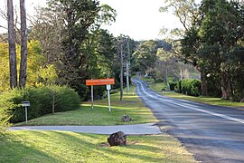
Woodhill is a locality in the City of Shoalhaven in New South Wales, Australia.[2][3] It lies in the hills about 10 km northwest of Berry. It is home to the Rodway Nature Reserve, a 83ha park created in May 1970 and managed by the NSW National Parks and Wildlife Service.[4]
Demographics[]
At the 2016 census, it had a population of 72. 45.6% of the population was male, and 54.4% was female. The median age of residents was 62.[1]
References[]
| Wikimedia Commons has media related to Woodhill. |
- ^ a b Australian Bureau of Statistics (27 June 2017). "Woodhill (NSW)". 2016 Census QuickStats. Retrieved 12 August 2017.

- ^ "Woodhill". Geographical Names Register (GNR) of NSW. Geographical Names Board of New South Wales. Retrieved 12 August 2017.
- ^ "Woodhill". OpenStreetMap. Retrieved 12 August 2017.
- ^ "Rodway Nature Reserve". NSW National Parks and Wildlife Service. Retrieved 28 November 2021.
| Cities | |
|---|---|
| Towns & Townships |
|
| Local government areas | |
| National parks | |
| Rivers and other waterbodies | |
This South Coast geography article is a stub. You can help Wikipedia by . |
Categories:
- Towns in New South Wales
- City of Shoalhaven
- Localities in New South Wales
- South Coast, New South Wales geography stubs