Étais-la-Sauvin
Étais-la-Sauvin | |
|---|---|
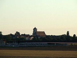 View from the East | |
 Coat of arms | |
show Location of Étais-la-Sauvin | |
 Étais-la-Sauvin | |
| Coordinates: 47°30′14″N 3°20���47″E / 47.5039°N 3.3464°ECoordinates: 47°30′14″N 3°20′47″E / 47.5039°N 3.3464°E | |
| Country | France |
| Region | Bourgogne-Franche-Comté |
| Department | Yonne |
| Arrondissement | Auxerre |
| Canton | Vincelles |
| Government | |
| • Mayor (2020–2026) | Claude Macchia |
| Area 1 | 44.79 km2 (17.29 sq mi) |
| Population (Jan. 2018)[1] | 627 |
| • Density | 14/km2 (36/sq mi) |
| Time zone | UTC+01:00 (CET) |
| • Summer (DST) | UTC+02:00 (CEST) |
| INSEE/Postal code | 89158 /89480 |
| Elevation | 178–365 m (584–1,198 ft) |
| 1 French Land Register data, which excludes lakes, ponds, glaciers > 1 km2 (0.386 sq mi or 247 acres) and river estuaries. | |


Étais-la-Sauvin is a commune in the Yonne department in Bourgogne-Franche-Comté in north-central France, in the natural region of Forterre.
See also[]
References[]
- ^ "Populations légales 2018". INSEE. 28 December 2020.
| Wikimedia Commons has media related to Étais-la-Sauvin. |
| show Authority control |
|---|
This Yonne geographical article is a stub. You can help Wikipedia by . |
Categories:
- Communes of Yonne
- Orléanais
- Yonne geography stubs