Treigny-Perreuse-Sainte-Colombe
Treigny-Perreuse-Sainte-Colombe | |
|---|---|
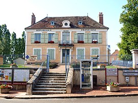 The town hall in Treigny | |
Location of Treigny-Perreuse-Sainte-Colombe  | |
 Treigny-Perreuse-Sainte-Colombe | |
| Coordinates: 47°33′05″N 3°11′05″E / 47.5514°N 3.1847°ECoordinates: 47°33′05″N 3°11′05″E / 47.5514°N 3.1847°E | |
| Country | France |
| Region | Bourgogne-Franche-Comté |
| Department | Yonne |
| Arrondissement | Auxerre |
| Canton | Vincelles |
| Intercommunality | Puisaye-Forterre |
| Area 1 | 67.46 km2 (26.05 sq mi) |
| Population (Jan. 2018)[1] | 982 |
| • Density | 15/km2 (38/sq mi) |
| Time zone | UTC+01:00 (CET) |
| • Summer (DST) | UTC+02:00 (CEST) |
| INSEE/Postal code | 89420 /89520 |
| Elevation | 187–367 m (614–1,204 ft) |
| 1 French Land Register data, which excludes lakes, ponds, glaciers > 1 km2 (0.386 sq mi or 247 acres) and river estuaries. | |


Treigny-Perreuse-Sainte-Colombe is a commune in the Yonne department in Bourgogne-Franche-Comté in north-central France. It was established on 1 January 2019 by merger of the former communes of Treigny (the seat) and Sainte-Colombe-sur-Loing.[2]
Its territory straddles the natural regions of Puisaye (Treigny) and Forterre (Perreuse and Sainte-Colombe).
See also[]
References[]
- ^ "Populations légales 2018". The National Institute of Statistics and Economic Studies. 28 December 2020.
- ^ Arrêté préfectoral 29 November 2018, modified 17 December 2018 (in French)
| Wikimedia Commons has media related to Treigny-Perreuse-Sainte-Colombe. |
This Yonne geographical article is a stub. You can help Wikipedia by . |
Categories:
- Communes of Yonne
- Yonne geography stubs