Turny
Turny | |
|---|---|
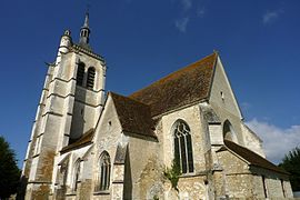 The church in Turny | |
 Coat of arms | |
show Location of Turny | |
 Turny | |
| Coordinates: 48°02′09″N 3°44′50″E / 48.0358°N 3.7472°ECoordinates: 48°02′09″N 3°44′50″E / 48.0358°N 3.7472°E | |
| Country | France |
| Region | Bourgogne-Franche-Comté |
| Department | Yonne |
| Arrondissement | Auxerre |
| Canton | Saint-Florentin |
| Area 1 | 24.87 km2 (9.60 sq mi) |
| Population (Jan. 2018)[1] | 679 |
| • Density | 27/km2 (71/sq mi) |
| Time zone | UTC+01:00 (CET) |
| • Summer (DST) | UTC+02:00 (CEST) |
| INSEE/Postal code | 89425 /89570 |
| Elevation | 111–297 m (364–974 ft) |
| 1 French Land Register data, which excludes lakes, ponds, glaciers > 1 km2 (0.386 sq mi or 247 acres) and river estuaries. | |


Turny is a commune in the Yonne department in Bourgogne-Franche-Comté in north-central France.
See also[]
References[]
- ^ "Populations légales 2018". INSEE. 28 December 2020.
| Wikimedia Commons has media related to Turny. |
This Yonne geographical article is a stub. You can help Wikipedia by . |
Categories:
- Communes of Yonne
- Yonne geography stubs