Ōtoyo, Kōchi
Ōtoyo
大豊町 | |
|---|---|
Town | |
 Otoyo town hall | |
 Flag  Seal | |
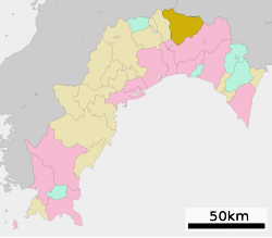 Location of Ōtoyo in Kōchi Prefecture | |
 Ōtoyo Location in Japan | |
| Coordinates: 33°46′N 133°40′E / 33.767°N 133.667°ECoordinates: 33°46′N 133°40′E / 33.767°N 133.667°E | |
| Country | Japan |
| Region | Shikoku |
| Prefecture | Kōchi Prefecture |
| District | Nagaoka |
| Area | |
| • Total | 314.94 km2 (121.60 sq mi) |
| Population (2010) | |
| • Total | 4,950 |
| • Density | 15.7/km2 (41/sq mi) |
| Time zone | UTC+09:00 (JST) |
| Website | Town of Ōtoyo |
| Symbols | |
| Bird | Varied tit |
| Flower | Adonis |
| Tree | Japanese cedar |

Ōtoyo (大豊町, Ōtoyo-chō) is a town located in Nagaoka District, Kōchi Prefecture, Japan in the mountainous district of central Shikoku. The Yoshino River (吉野川) and Ananai River (穴内川) both flow through Ōtoyo. It is the only municipality in Shikoku where over 50% of the population is aged over 65.
History[]
On March 31, 1955 the villages of Higashitoyonaga, Nishitoyonaga, Ōsugi, and Tentsubo joined to form the village of Ōtoyo. The name Ōtoyo came from taking the Ō (大) in Ōsugi (大杉, Ōsugi) and the Toyo (豊, Toyo) in Toyonaga (豊永, Toyonaga). Following this, a section of Ōtoyo was absorbed into the town of Tosayamada (present day Kami, Kōchi). On the April 1, 1972, the village became a town.
The town has two buildings that are recorded on Japan's National Cultural Properties list, and the former .
Population and demographics[]
As of 2010, the town has an estimated population of 4,962 and a density of 15.75 persons per km2. The total area is 314.94 km2.[1]
Events[]
- Osugi Summer Festival
- Otaguchi Summer Festival
- Wild Game Festival
- Fukujuso Flower Festival
Tourist sites[]
- Sugi no Osugi (杉の大スギ, Sugi-no-Osugi)
- Yutoristo Park (ゆとりすとパークおおとよ, Yutorisuto Koen)
- Whitewater Rafting - Due to its prime location on the Yoshino River and its proximity to Otoyo is the location of a large number of rafting companies.
 |
 |
 |
| Ryuo Waterfall (龍王の滝, Ryuonotaki) | Mount Kajigamori (ja:梶ヶ森, Kajigamori) | Hibari Restaurant (ひばり食堂, Hibari Shokudo) |
Local products[]
Transportation[]
Train
- Tosa-Iwahara Station
- Toyonaga Station
- Ōtaguchi Station
- Tosa-Ananai Station
- Osugi Station (Express Train)
- Tosa-Kitagawa Station
- Kakumodani Station
Road
References[]
- ^ ゆとりすと 通巻187号 2010年11月号 (大豊町広報雑誌)
External links[]
![]() Media related to Ōtoyo, Kōchi at Wikimedia Commons
Media related to Ōtoyo, Kōchi at Wikimedia Commons
- Ōtoyo official website (in Japanese)
| show Authority control |
|---|
This Kōchi Prefecture location article is a stub. You can help Wikipedia by . |
- Towns in Kōchi Prefecture
- Kōchi geography stubs