Řepeč
Řepeč | |
|---|---|
Municipality | |
 | |
 Řepeč | |
| Coordinates: 49°24′11″N 14°31′0″E / 49.40306°N 14.51667°ECoordinates: 49°24′11″N 14°31′0″E / 49.40306°N 14.51667°E | |
| Country | |
| Region | South Bohemian |
| District | Tábor |
| Area | |
| • Total | 12.78 km2 (4.93 sq mi) |
| Elevation | 475 m (1,558 ft) |
| Population (2006) | |
| • Total | 267 |
| • Density | 21/km2 (54/sq mi) |
| Postal code | 391 61 |

Řepeč is a village and municipality (obec) in Tábor District in the South Bohemian Region of the Czech Republic.
The municipality covers an area of 12.78 square kilometres (4.93 sq mi), and has a population of 267 (as at 28 August 2006).
Řepeč lies approximately 11 kilometres (7 mi) west of Tábor, 48 km (30 mi) north of České Budějovice, and 77 km (48 mi) south of Prague.
Gallery[]
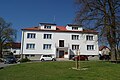
House

Memorial to deceased in both world wars

Village chapel


References[]
| Wikimedia Commons has media related to Řepeč. |
| Wikimedia Commons has media related to Řepeč. |
| Authority control: National libraries |
|---|
This South Bohemian Region location article is a stub. You can help Wikipedia by . |
Categories:
- Villages in Tábor District
- South Bohemian Region geography stubs