Haškovcova Lhota
Haškovcova Lhota | |
|---|---|
Municipality | |
 Chapel in the village | |
 Haškovcova Lhota | |
| Coordinates: 49°19′47″N 14°27′57″E / 49.32972°N 14.46583°ECoordinates: 49°19′47″N 14°27′57″E / 49.32972°N 14.46583°E | |
| Country | |
| Region | South Bohemian |
| District | Tábor |
| Area | |
| • Total | 3.03 km2 (1.17 sq mi) |
| Elevation | 417 m (1,368 ft) |
| Population (2006) | |
| • Total | 74 |
| • Density | 24/km2 (63/sq mi) |
| Postal code | 391 65 |

Haškovcova Lhota is a village and municipality (obec) in Tábor District in the South Bohemian Region of the Czech Republic.
| Wikimedia Commons has media related to Haškovcova Lhota. |
The municipality covers an area of 3.03 square kilometres (1.17 sq mi), and has a population of 73 (as 2017).
Haškovcova Lhota lies approximately 17 kilometres (11 mi) south-west of Tábor, 40 km (25 mi) north of České Budějovice, and 85 km (53 mi) south of Prague.
Gallery[]
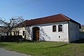
House
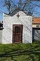
Chapel

Village square (spring 2019)


References[]
| Authority control: National libraries |
|---|
This South Bohemian Region location article is a stub. You can help Wikipedia by . |
Categories:
- Villages in Tábor District
- South Bohemian Region geography stubs