Pohnání
Pohnání | |
|---|---|
Municipality | |
 | |
 Coat of arms | |
 Pohnání | |
| Coordinates: 49°28′25″N 14°49′10″E / 49.47361°N 14.81944°ECoordinates: 49°28′25″N 14°49′10″E / 49.47361°N 14.81944°E | |
| Country | |
| Region | South Bohemian |
| District | Tábor |
| Area | |
| • Total | 3.57 km2 (1.38 sq mi) |
| Elevation | 627 m (2,057 ft) |
| Population (2011) | |
| • Total | 79 |
| • Density | 22/km2 (57/sq mi) |
| Postal code | 391 42 |

Pohnání is a village and municipality (obec) in Tábor District in the South Bohemian Region of the Czech Republic.
The municipality covers an area of 3.57 square kilometres (1.38 sq mi), and has a population of 80 (as at 3 July 2006).
Pohnání lies approximately 14 kilometres (9 mi) north-east of Tábor, 61 km (38 mi) north-east of České Budějovice, and 74 km (46 mi) south-east of Prague.
Gallery[]
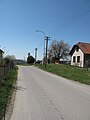
Road

Cottage

Neighbouring countryside


References[]
| Wikimedia Commons has media related to Pohnání. |
| Authority control: National libraries |
|---|
This South Bohemian Region location article is a stub. You can help Wikipedia by . |
Categories:
- Villages in Tábor District
- South Bohemian Region geography stubs