Chrbonín
Chrbonín | |
|---|---|
Municipality | |
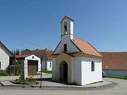 Chapel of the Assumption | |
 Flag  Coat of arms | |
 Chrbonín | |
| Coordinates: 49°21′35″N 14°52′19″E / 49.35972°N 14.87194°ECoordinates: 49°21′35″N 14°52′19″E / 49.35972°N 14.87194°E | |
| Country | |
| Region | South Bohemian |
| District | Tábor |
| Area | |
| • Total | 7.08 km2 (2.73 sq mi) |
| Elevation | 588 m (1,929 ft) |
| Population (2006) | |
| • Total | 140 |
| • Density | 20/km2 (51/sq mi) |
| Postal code | 391 55 |

Chrbonín is a village and municipality (obec) in Tábor District in the South Bohemian Region of the Czech Republic.
The municipality covers an area of 7.08 square kilometres (2.73 sq mi), and has a population of 140 (as at 3 July 2006).
Chrbonín lies approximately 17 kilometres (11 mi) east of Tábor, 52 km (32 mi) north-east of České Budějovice, and 87 km (54 mi) south of Prague.
References[]
| Wikimedia Commons has media related to Chrbonín. |
| Authority control: National libraries |
|---|
This South Bohemian Region location article is a stub. You can help Wikipedia by . |
Categories:
- Villages in Tábor District
- South Bohemian Region geography stubs