Nadějkov
Nadějkov | |
|---|---|
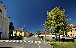 The square in Nadějkov | |
 Nadějkov Location in the Czech Republic | |
| Coordinates: 49°30′10″N 14°28′45″E / 49.50278°N 14.47917°ECoordinates: 49°30′10″N 14°28′45″E / 49.50278°N 14.47917°E | |
| Country | |
| Region | South Bohemian |
| District | Tábor |
| First mentioned | 1373 |
| Area | |
| • Total | 24.22 km2 (9.35 sq mi) |
| Elevation | 535 m (1,755 ft) |
| Population (2021-01-01)[1] | |
| • Total | 737 |
| • Density | 30/km2 (79/sq mi) |
| Time zone | UTC+1 (CET) |
| • Summer (DST) | UTC+2 (CEST) |
| Postal codes | 398 52, 399 01 |
| Website | www |

Nadějkov is a municipality and village in Tábor District in the South Bohemian Region of the Czech Republic. It has about 700 inhabitants.
Nadějkov lies approximately 17 kilometres (11 mi) north-west of Tábor, 60 km (37 mi) north of České Budějovice, and 65 km (40 mi) south of Prague.
Administrative parts[]
Villages and hamlets of Bezděkov, Brtec, Chlístov, Číčovice, Hronova Vesec, Hubov, Kaliště, Křenovy Dvory, Modlíkov, Mozolov, Nepřejov, Petříkovice, Pohořelice, Šichova Vesec, Starcova Lhota, Větrov and Vratišov are administrative parts of Nadějkov.
History[]
The first written mention of Nadějkov is from 1373.[2]
References[]
- ^ "Population of Municipalities – 1 January 2021". Czech Statistical Office. 2021-04-30.
- ^ "Historie Nadějkova" (in Czech). Obec Nadějkov. Retrieved 2021-09-11.
| Wikimedia Commons has media related to Nadějkov. |
| Authority control: National libraries |
|---|
This South Bohemian Region location article is a stub. You can help Wikipedia by . |
Categories:
- Villages in Tábor District
- South Bohemian Region geography stubs