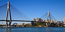
A4/M4 (Sydney)
This article needs additional citations for verification. (December 2013) |
A4/M4 | |
|---|---|
 | |
| M4 Motorway crossing the Nepean River, shortly east of the Russel Street intersection | |
| General information | |
| Type | Motorway |
| Route number(s) |
|
| Former route number |
|
| Major junctions | |
| East end | Bradfield Highway Sydney CBD |
| |
| West end | Glenbrook, Sydney |
| Highway system | |
The A4 and M4 is an arterial route in Sydney, Australia. It connects the Inner West of Sydney with the outer western suburbs. It used to be Metroad 4, which was a Metroad in Sydney.
The A4/M4 mostly follows what was previously National Route 32 from the Western Distributor in the CBD, west to the Great Western Highway (Route 32) at Lapstone. Both the A4 and M4 sections were known as Metroad 4 until 2013, which in turn replaced the previous Sydney stretch of National Route 32 in September 1992.
The names "M4" and "A4" are just the route allocations for the route as a whole. In fact, the A4/M4 route runs along a whole series of roads. The roads from east to west are:
- A4 section:
- Western Distributor
- Victoria Road
- The Crescent
- City West Link
- Dobroyd Parade
- Wattle Street
- M4 section:
- M4 East
- M4 Western Motorway
History[]

The earliest route allocation of M4/A4 is National Route 32. It was introduced in 1954 with other National Routes. Most of the 1954 alignment of National Route 32 in Sydney is very different from the current M4/A4 alignment in Sydney. Back then National Route 32 ran along the entire Great Western Highway from Bathurst via the Blue Mountains to Broadway, Sydney.
With the opening of the M4 Motorway in 1992, National Route 32 was truncated and terminated at Lapstone in Blue Mountains instead. Metroad 4 was introduced to replace the Sydney section of National Route 32, but went along the motorway instead of Great Western Highway from Lapstone to North Strathfield. This was the first Metroad to be introduced in Sydney. The section of Great Western Highway that was formerly National Route 32 was allocated State Route 44 which is now A44.
In 2000, when the City West Link opened, Metroad 4 was realigned to Wattle Street, Dobroyd Parade, City West Link, Victoria Road and Western Distributor and terminated at the junction of Cahill Expressway, Western Distributor and Bradfield Highway in Millers Point.[1]
In 2013, as part of the statewide alpha numeric route conversion, the Metroad 4 was replaced by M4 for the motorway and A4 for the non-motorway section.
In July 2019, the A4 between Strathfield and Haberfield was realigned onto the new M4 East tunnels and was redesignated M4.[2][3] This meant that A4 no longer runs along any section of Parramatta Road or Great Western Highway.
See also[]
![]() Australian Roads portal
Australian Roads portal
References[]
- ^ Metroad 4, Ozroads, Retrieved on 8 August 2013.
- ^ "WestConnex". NSW Government. Archived from the original on 10 July 2019. Retrieved 10 July 2019.
- ^ "New M4 tunnels to open this weekend". WestConnex. 10 July 2019. Retrieved 10 July 2019.
- Sydney Metroads