Eastern Distributor
Eastern Distributor | |
|---|---|
 | |
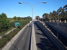
Tunnel entrance at Woolloomooloo | |
 | |
 North end South end Location in greater Sydney | |
| Coordinates | |
| General information | |
| Type | Motorway |
| Length | 4.7 km (2.9 mi) |
| Opened | 19 December 1999 (Completed in July 2000) |
| Route number(s) |
|
| Former route number |
|
| Major junctions | |
| North end | Woolloomooloo |
| William Street Anzac Parade Cross City Tunnel | |
| South end | Kensington |
| Location(s) | |
| LGA(s) | City of Sydney |
| Highway system | |

The Eastern Distributor is a 4.7-kilometre-long (2.9 mi)[1] motorway in Sydney, New South Wales, Australia. Part of the M1, the motorway links the Sydney central business district with Sydney Airport. The centre-piece is a 1.7 km (1.1 mi) tunnel running from Woolloomooloo to Surry Hills. Built as a build-own-operate-transfer project, it is 75.1% owned by Transurban.
The motorway opened to traffic in December 1999 with the project completed in July 2000. It is tolled in the northbound direction with no toll applied southbound.
Transurban considers a section of the Cahill Expressway to be part of the Eastern Distributor, and denotes the latter to have a length of 6 kilometres (4 mi).[2] The length of 4.7 kilometres (2.9 mi) used in this article refers to the length of the motorway constructed in the 1990s between the southern end of Cahill Expressway (Cowper Wharf Road) and the northern end of Southern Cross Drive (Link Road).
Design[]
This motorway is part of the 110-kilometre (68 mi) Sydney Orbital Network. For about half its length, it is in a trench inside South Dowling Street. The motorway provides a southbound exit for Lachlan Street/Dacey Avenue, a northbound exit to South Dowling Street (south of Cleveland Street), a northbound entrance ramp from South Dowling Street (north of Cleveland Street), connections from William Street (heading south), and to William Street (heading north). There are also connection to the Cross City Tunnel, giving motorists direct connections under the city to the Western Distributor. There are also northbound/southbound entry/exits to Moore Park Road and Anzac Parade. Southbound motorists were later found to be entering the Eastern Distributor from the Cross City Tunnel access point and immediately attempting to cross three lanes for the Anzac Parade off-ramp. Permanent traffic obstacles have subsequently been installed and users are now referred to the Lachlan Street/Dacey Avenue exit, or as through traffic towards Sydney Airport.
The project's centrepiece is the 1.7-kilometre (1.1 mi) piggyback tunnel under one of Australia's most densely populated urban areas, necessitated due to the requirement of three lanes in each direction within the existing roadway corridor.[3] The unique double-deck, three lanes per direction design comprises a large, single tunnel excavation. At mid-height through the excavation, a precast concrete ledge forms the base of the northbound tunnel, with the southbound tunnel slotting below. As a result, only one tunnel roof was created with the lower southbound carriageway built in a slot. According to the Australasian Tunnelling Society, no records are available of any piggyback tunnel (rail or road) where the upper carriageway has been carried on prestressed concrete planks resting on sidewall ledges. In the main tunnel there is a central length of 0.5 kilometres (0.3 mi) where the span is typically greater than 17 metres (56 ft), and of note, there is no record of any road tunnel with spans greater than this where permanent roof support comprises rockbolts and shotcrete only and with vertical unsupported sidewalls of rock.[4]
The tunnel's claim to fame at the time it was built was that at 24.5 metres (80 ft) across at its widest point, it was the widest tunnel in the world.[5] This point occurs where the William Street on ramp tunnel merges with the main tunnel.[4] At 14 metres (46 ft), the tunnel is also notably large from the ceiling to the floor.[6][5]
The tunnels of the Eastern Distributor are fully equipped with lighting, ventilation, drainage, CCTV surveillance, fire fighting and emergency control systems.[4]
History[]
County of Cumberland planning scheme[]
The need for an Eastern Distributor was first discussed in the early 1950s in the County of Cumberland planning scheme.[7]
Underpasses of the Eastern Distributor beneath William Street and Taylor Street were proposed to commence construction in 1974.[8]
1984 scheme[]
In 1984, the Department of Main Roads proposed construction of the Eastern Distributor as a surface freeway with underpasses at William Street and Oxford Street. It was later redesigned into a tunnel from north of William Street to the intersections of South Dowling, Moore Park Road and Anzac Parade. An Environmental Impact Statement (EIS) was prepared on 1985 to be built in three stages:[9][10][11][12]
- Stage 1: A southbound tunnel underpass under William Street (William Street underpass) and a roundabout at the Riley Street / Sir John Young Crescent intersection, scheduled for completion in 1988
- Stage 2: Southbound tunnel for the full length and a reconfigured Cahill Expressway intersection with Sir John Young Crescent. Bourke Street and Palmer Street including the William Street underpass would also be reversed for northbound travel. Stage 2 was scheduled for completion in 1990
- Stage 3: Northbound tunnel from Flinders Street connecting directly to the William Street underpass, scheduled for completion in 1992
The William Street underpass (Stage 1) opened in November 1987 and connected Cahill Expressway and Palmer Street to Bourke Street. The underpass allowed southbound traffic from the Cahill Expressway to avoid intersecting William Street.[13] The rest of the 1984 scheme was abandoned and not constructed due to escalating costs. The William Street underpass would eventually be closed twelve years later after the main Eastern Distributor tunnels opened to traffic in December 1999, and was reconstructed to form part of the Bourke Street on-ramp which opened seven months later.
1994 scheme[]
The completion of the Sydney Harbour Tunnel in 1992 resulted in an increase in volumes on Cahill Expressway and an increased need for an inner-city bypass south and south-east of the expressway. Roads & Traffic Authority (RTA) undertook community consultation to gauge the level of community acceptance of construction of an Eastern Distributor as a toll road. With indications of a high level of community support, the Eastern Distributor project was revived by the New South Wales state government in 1994, based on the 1984 scheme. The Eastern Distributor would link the Sydney central business district with Sydney Airport via the already existing Southern Cross Drive (freeway), which would be widened.[6] It was designed to ease congestion and to reduce the time to travel from the city to the airport by bypassing 19 traffic lights.[6][14] A study commissioned by the State Chamber of Commerce in 1997 found that the "Eastern Distributor would prevent 330 accidents a year and cut fuel consumption by 1.2 million litres annually".[5]
Tender process[]
In May 1994, the state government gave approval for RTA to invite the private sector to tender to construct and operate the tollway under a build-own-operate-transfer arrangement. In February abd March 1995, three proponents were invited to develop detailed proposals. RTA later requested the proponents to submit revised offers based on a concession term of 38 years, as "a term of 45 years would be unacceptable to the community" and the 38 year term had already been set as a precedent by the M2 Motorway.[9]
The Labor state opposition promised that if elected, the Eastern Distributor would be toll-free.[10] When Labor was elected as government in March 1995, the formal tender process had already commenced, and the new government had to proceed with constructing the Eastern Distributor as a tollway.[9] In November 1995, the government agreed with RTA's recommendation to appoint Airport Motorway Limited (AML) as the successful proponent, with the government providing planning, support and management during construction.[9] The other two unsuccessful proponents were Baulderstone Hornibrook and Transfield.[9]
The Keating federal government announced on 15 December 1995 that it intended to withdraw taxation concessions on infrastructure bonds for urban road projects, "effective immediately".[15] In a response letter written to the federal treasurer Ralph Willis in January 1996, the state treasurer Michael Egan highlighted that the policy would impact the M5 East and Eastern Distributor projects, and estimated that the policy would result in an "increase the cost of the Eastern Distributor project by between $70 million and $90 million".[9] As a result, the announcement was "sufficient to halt the progress of the Eastern Distributor project" and the appointment of AML as the successful proponent was not formally endorsed. The policy was not enacted into legislation by the Keating government prior to the March 1996 federal election. The newly-elected Howard government reversed the policy in June 1996 and confirmed that the Eastern Distributor has been certified as "an urban road project which may utilise infrastructure bonds for financing purposes".[9][15]
Following the reversal of the federal government policy, the appointment of AML as the successful proponent and the decision to proceed with the project was formally announced on 13 August 1996.[14][16][6] The agreement was signed in 1997, and under the concession agreement, AML would own and operate the tollway for 38 years after full opening.[17][9]
Planning[]
In 1994, RTA decided to delay the EIS until after the selection of the preferred proponent, explaining that if an EIS was prepared then (1994), then "it is unlikely to contain the most innovative solutions to construction and environmental issues and could require a further EIS being required before work could commence". However, there would be a risk that substantial changes to the EIS would risk a new tender.[9]
The EIS for the Eastern Distributor was eventually exhibited in November to December 1996. 2,762 submissions were received during the exhibition period. RTA proposed significant modifications in April 1997, which included:[18]
- a landscaped canopy over the motorway near the Art Gallery
- relocation of the northern tunnel portal north of Cathedral Street
- lowering of the motorway in a trench between South Dowling Street (known as the "Parkway scheme")
Due to the substantial modifications, RTA sought advice from the Independent Commission Against Corruption (ICAC) on whether a new tender was required; ICAC later advised that it was not required. The proposed modifications increased project costs by A$132 million. As a result, the concession period was increased from 38 to 48 years, and the opening toll price was also increased from A$2.50 to A$3.00.[9][5]
The New South Wales Audit Office undertook a performance audit of the proposed tollway and tabled its report in Parliament on 28 May 1997, with the report finalised in July 1997.[9] A planning assessment report by the Director-General of Department of Urban Affairs and Planning was published on 2 June 1997,[18] and the project was approved by the Minister for Urban Affairs and Planning on 26 June 1997, subject to 151 conditions.[10][17][19] Actual construction started soon after in August 1997.
Construction[]
Construction involved 5,000 workers was undertaken by Leighton Contractors, who was a shareholder of Airport Motorway Limited.[6] Two separate tunnel subcontractors began excavating the northbound tunnel in January 1998, working at either end of the tunnel at Surry Hills and Woolloomooloo.[5] Seven roadheaders were utilised for the tunnel boring, with the rock ceiling then reinforced with rock bolts and shotcrete.[4] On 4 December 1998 the two teams were shaking hands in the middle–30 metres (100 ft) beneath Taylor Square. By March 1999 all digging was complete, after 400,000 cubic metres (520,000 cu yd) of soil, largely Sydney sandstone was removed–equal to 40,000 truckloads.[5]
At a cost of $730 million,[6] the motorway was opened on 19 December 1999, except for the William Street on and off ramps which were opened on 23 July 2000, just in time for the 2000 Summer Olympics.[20] As part of the agreement which defined the 48 years of concession period, the motorway will revert to government ownership on 23 July 2048.[21]
After opening, a number of changes were made to surface streets:[10]
- Crown Street was converted from one-way northbound to two-way
- Bourke St was converted from one-way southbound to two-way traffic (south of William Street), closed off at Taylor Square, and closed off to northbound traffic just north of the southbound Eastern Distributor on-ramp
- Palmer St was converted from one-way southbound to two-way traffic (north of William Street)
- Campbell Street was closed off at Taylor Square
Post-opening[]
Toll booths operated at toll points along the Eastern Distributor. With the introduction of electronic tolls, these were replaced by readers on a gantry and demolished.[when?][22]
In July 2017, the northbound off-ramp exit onto South Dowling Street towards Cleveland Street was closed off for 24 hours per day, 7 days a week, on a six-month trial (initially three months).[23] Prior to the closure, the exit was the last northbound exit before toll and was closed during morning and afternoon peaks. Vehicles would regularly queue at the South Dowling Street/Cleveland Street intersection and spill back onto the motorway via the exit. The trial closure saw significant improvements to traffic congestion along both South Dowling Street and the Eastern Distributor, and increase in speeds on both roads.[24][25] Following the successful trial, the exit was permanently closed in February 2018.[26]
Tolls[]
Ownership[]
The Eastern Distributor is owned and operated by Airport Motorway Limited (AML), which is 75.1% owned by Transurban.[27]
When AML was incorporated, Leighton Group held 11% of AML, with Macquarie Infrastructure Group being the holder of the balance.[28][29] Leighton sold its stake to Macquarie Infrastructure in 2000. By 2005, Macquarie Infrastructure Group held 71.35% of AML.[30] Macquarie Infrastructure Group spun off Sydney Roads Group including its stake in AML in July 2006.[31] Sydney Roads Group was sold to Transurban in April 2007.[32]
Toll prices[]
The Eastern Distributor is tolled in the northbound direction only for all traffic that use the main tunnel (Surry Hills/Moore Park to Woolloomooloo). There are two toll points on the Eastern Distributor: one at the northern end of the motorway and one at the William Street/Cross City Tunnel exit. Northbound vehicles along Eastern Distributor are charged the same toll price in either toll point.
At the time of opening, the toll price for light vehicles (cars and motorcycles) was A$3.00.[33] In April 2003, the toll price for heavy vehicles (trucks and buses) was A$7.50.[34]
| Toll road | Toll type | Class A flagfall[a] | Class A charge per km[a] | Class A maximum toll or cap[a] | Class B toll prices[a] | Toll increase[37] | Toll concessionaire | Expiry of toll concession[38]
|
|---|---|---|---|---|---|---|---|---|
| Eastern Distributor (northbound) | Fixed | – | – | $8.37 | 2 x of Class A prices | Quarterly on 1 January, 1 April, 1 July, and 1 October, by the greater of the weighted sum of quarterly AWE and quarterly CPI or 1% | Airport Motorway Limited (75.1% owned by Transurban) | July 2048
|
- ^ Jump up to: a b c d Class A vehicles are typically cars and motorcycles; Class B vehicles are all other vehicles including trucks and heavy vehicles[36]
Exits and interchanges[]
| LGA | Location | km[1] | mi | Destinations | Notes |
|---|---|---|---|---|---|
| Sydney | Sydney CBD | 0 | 0.0 | Northern terminus: continues as Cahill Expressway | |
| Toll point for northbound traffic | |||||
| Woolloomooloo | 0.26 | 0.16 | Cathedral Street / to William Street, Paddington, Sydney CBD | Southbound exit only | |
| 0.4 | 0.25 | Northern end of tunnel | |||
| Darlinghurst | 1.2 | 0.75 | Anzac Parade / Moore Park Road – Randwick, La Perouse | Southbound exit only | |
| 1.3 | 0.81 | Cross City Tunnel / Bourke Street – no exit | Southbound entrance only | ||
| 1.6 | 0.99 | Anzac Parade / Moore Park Road – no exit | Northbound entrance only | ||
| 1.65 | 1.03 | William Street / Cross City Tunnel – Paddington, Sydney CBD | Northbound exit only; toll point at exit | ||
| Surry Hills–Moore Park boundary | 2.1 | 1.3 | Southern end of tunnel | ||
| 2.2 | 1.4 | South Dowling Street northbound – no exit | Northbound entrance only | ||
| Moore Park | 2.5– 2.8 | 1.6– 1.7 | Tunnel (under Cleveland Street) | ||
| Moore Park–Redfern boundary | 3.2 | 2.0 | South Dowling Street southbound to Dacey Avenue & Lachlan Street – Randwick, Alexandria, Rosebery | Southbound exit only | |
| Waterloo | 3.5– 4.1 | 2.2– 2.5 | Tunnel | ||
| Sydney–Randwick boundary | Zetland–Kensington boundary | 4.4 | 2.7 | South Dowling Street / to Todman Avenue – Randwick, Kensington | Northbound exit and southbound entrance only |
| 4.7 | 2.9 | Link Road – Rosebery | Northbound exit and entrance only | ||
| Southern terminus: continues as Southern Cross Drive | |||||
1.000 mi = 1.609 km; 1.000 km = 0.621 mi
| |||||
See also[]
- Freeways in Sydney
- List of tunnels in Australia
References[]
- ^ Jump up to: a b Eastern Distributor, Woolloomooloo NSW 2011 to Eastern Distributor, Zetland NSW 2017 (Map). Google Maps. 2021. Retrieved 25 August 2021.
- ^ "Eastern Distributor". Linkt. Retrieved 25 August 2018.
- ^ Lai, Steven; Wong, Dee; Wu, Dicken (9 April 2009). "Fire and life safety designs for road tunnels in Asia" (PDF). Fire Division, Hong Kong Institution of Engineers. pp. 23–24. Archived from the original (PDF) on 29 January 2016.
- ^ Jump up to: a b c d "Eastern Distributor, Sydney". Australasian Tunnelling Society. Archived from the original on 16 February 2011.
- ^ Jump up to: a b c d e f "History". Eastern Distributor. Archived from the original on 25 April 2002.
- ^ Jump up to: a b c d e f Jewell, Chris; Merrick, Noel (2003). "Modelling of the groundwater impact of a sunken urban motorway in Sydney, Australia" (PDF). RMZ – Materials and Geoenvironment. 50 (1): 229. Archived from the original (PDF) on 24 September 2015.
- ^ £10 mil road plan to speed Sydney traffic The Sun 19 July 1950 page 12
- ^ "Annual Report 1972–73" (PDF). OpenGov NSW. Department of Main Roads New South Wales. 1973. p. 11. Retrieved 27 August 2021.
- ^ Jump up to: a b c d e f g h i j k "NSW Audit Office - Performance Reports – 1997 – Review of Eastern Distributor" (PDF). NSW Audit Office. July 1997. Retrieved 24 August 2021.
- ^ Jump up to: a b c d "Cahill Expressway/Eastern Distributor/Eastern Freeway: History and Development". Ozroads. Retrieved 24 August 2021.
- ^ "The Eastern Distributor – Preferred Scheme" (PDF). OpenGov NSW. New South Wales Department of Main Roads. 1985. Retrieved 24 August 2021.
- ^ "Eastern Distributor – Environmental Impact Statement Report" (PDF). New South Wales Department of Main Roads. November 1985. Retrieved 24 August 2021.
- ^ "The Eastern Distributor Stage 1 – William Street Underpass" (PDF). Expressway.online. New South Wales Department of Main Roads. Retrieved 24 August 2021.
- ^ Jump up to: a b Ries, Ivor (14 August 1996). "Carr's tollway turnaround". Australian Financial Review. Retrieved 26 August 2021.
- ^ Jump up to: a b "Annual Report 1996" (PDF). OpenGov NSW. Roads and Traffic Authority New South Wales. October 1996. p. 56. Retrieved 26 August 2021.
- ^ City Tollway Fleetline issue 244 September 1996 page 163
- ^ Jump up to: a b "Roads and Traffic Authority Annual Report 1996-97" (PDF). OpenGov NSW. Roads and Traffic Authority. 30 October 1997. p. 79,92. Retrieved 24 August 2021.
- ^ Jump up to: a b "Proposed Eastern Distributor: Cahill Expressway to Mill Pond Road: volume 1: environmental impact assessment" (PDF). OpenGov NSW. Department of Urban Affairs and Planning. 2 June 1997. Retrieved 24 August 2021.
- ^ "East link go-ahead". Daily Telegraph. 28 June 1997. p. 4.
- ^ "Eastern Distributor Construction Homes Damage". Parliament of New South Wales. 11 September 2001. Archived from the original on 24 September 2015.
- ^ "Eastern Distributor". Roads and Maritime Services. Archived from the original on 25 June 2012.
- ^ "Eastern Distributor Toll Plaza". Ford Civil. Retrieved 25 August 2021.
- ^ "Trial full closure of Eastern Distributor off ramp at Cleveland Street". Transport for NSW - Roads and Waterways. 3 July 2017. Retrieved 25 August 2021.
- ^ "Cleveland Street Off Ramp Closure Trial - An interim update of the trial closure 24 hours a day 7 days per week" (PDF). Linkt. Retrieved 25 August 2021.
- ^ "Saving travel times in the heart of Sydney". Transurban. 5 February 2018. Retrieved 25 August 2021.
- ^ "Inquiry into progress under the National Road Safety Strategy 2011-2020 - Transurban submission" (PDF). National Road Safety Strategy. Transurban. March 2018. p. 9. Retrieved 25 August 2021.
- ^ "Transurban turnover rises as traffic grows". The Sydney Morning Herald. 12 January 2012. Archived from the original on 13 January 2012.
- ^ "Eastern Distributor to ease Sydney city congestion". TunnelTalk. February 1999. Retrieved 24 August 2021.
- ^ "Leighton Group Concise Annual Report" (PDF). Leighton Group. 2000.
- ^ "Macquarie hits the road running". Sydney Morning Herald. 8 February 2005.
- ^ "Transurban takeover gets green light". Sydney Morning Herald. 8 March 2007.
- ^ "Transurban finalises Sydney Roads takover". The Australian. 27 April 2007. Retrieved 5 November 2020.
- ^ "Sydney's great toll rort". The Daily Telegraph. 17 October 2009.
- ^ "Eastern Distributor toll to rise". Sydney Morning Herald. 17 April 2003.
- ^ "Toll charges – costs by toll road". Transport for NSW - Roads and Waterways. Retrieved 5 July 2021.
- ^ "What is my vehicle class?". Linkt. Retrieved 5 November 2020.
- ^ "When and how do toll prices increase". Linkt. Retrieved 5 November 2020.
- ^ "Road tolling in New South Wales" (PDF). New South Wales Parliament. Portfolio Committee No.2 – Health and Community Services. October 2017. Retrieved 30 October 2020.
External links[]
| Wikimedia Commons has media related to Eastern Distributor. |
- Highways in Sydney
- Tunnels in Sydney
- Toll roads in Australia
- Tunnels completed in 2000
- Highway 1 (Australia)
- Road tunnels in Australia
- Surry Hills, New South Wales
- Moore Park, New South Wales
- Kensington, New South Wales
- Woolloomooloo
- Darlinghurst, New South Wales
- Redfern, New South Wales